Quiet end to the week before severe storms move in for Easter Sunday
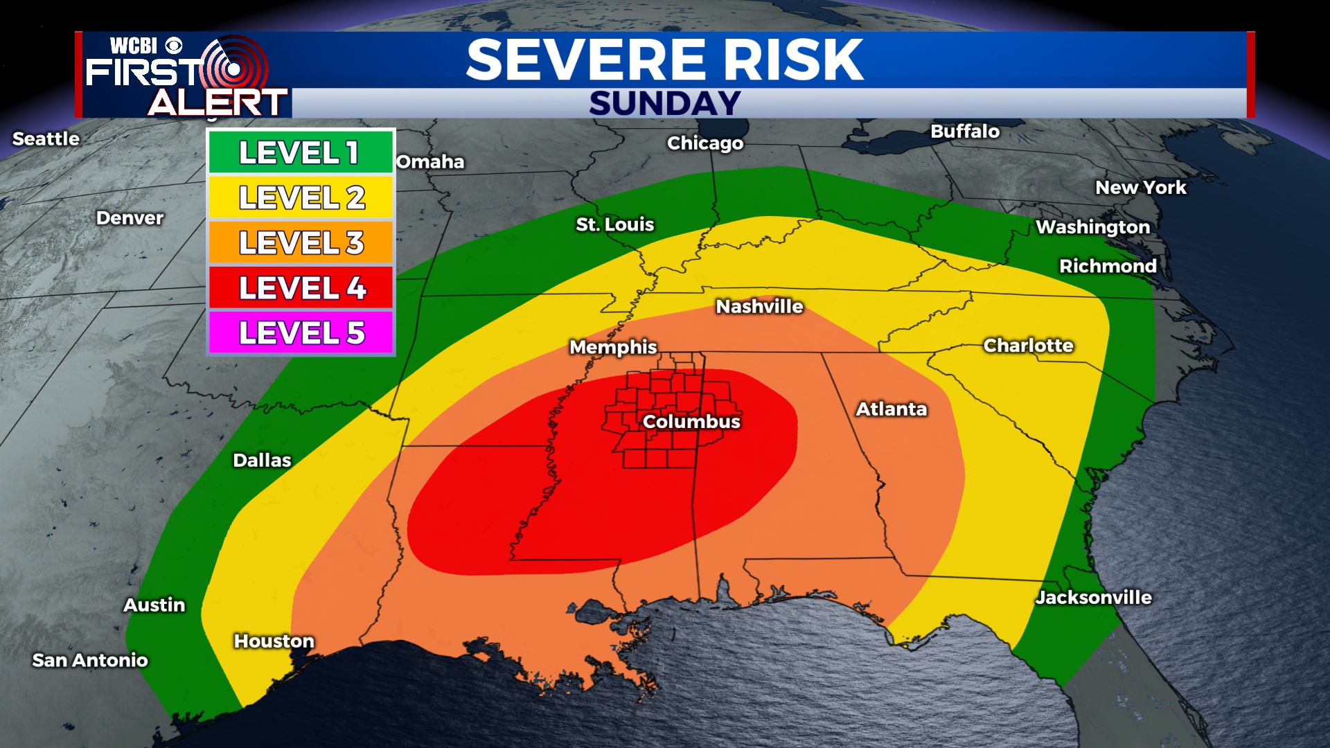
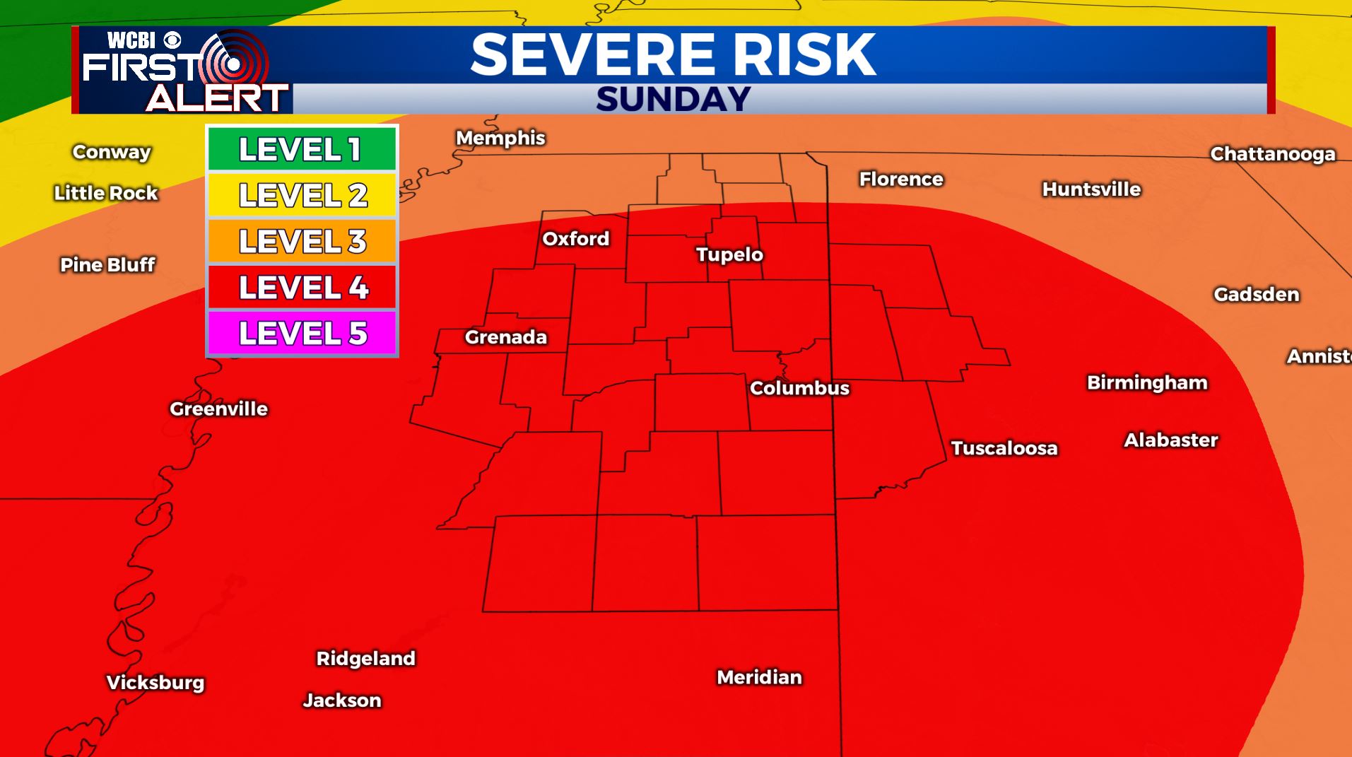
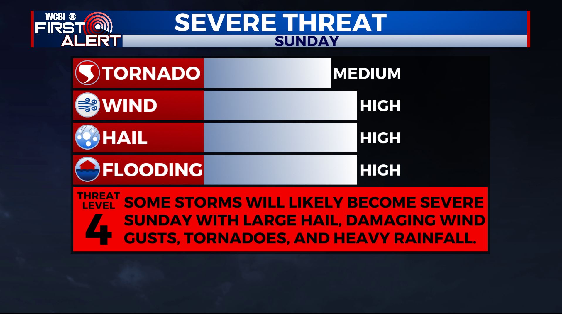
SUMMARY: Pretty quiet, cooler and nice weather stays in place for Friday and Saturday but that will all change on Sunday. A big storm system will move through the region on Easter Sunday and it could spark a severe weather outbreak across the Deep South. We’re right now as of Friday morning under a Level 3-4 risk of severe weather. All modes of severe weather remain on the table including damaging winds, large hail, tornadoes and flooding.
FRIDAY: Partly to mostly cloudy. Much cooler with lows in the mid 40s this morning. Turning sunny by the afternoon. Below normal highs in the low 60s. Breezy northerly winds 10-20 mph.

FRIDAY NIGHT: Mainly clear and chilly. Lows in the upper 30s to around 40.
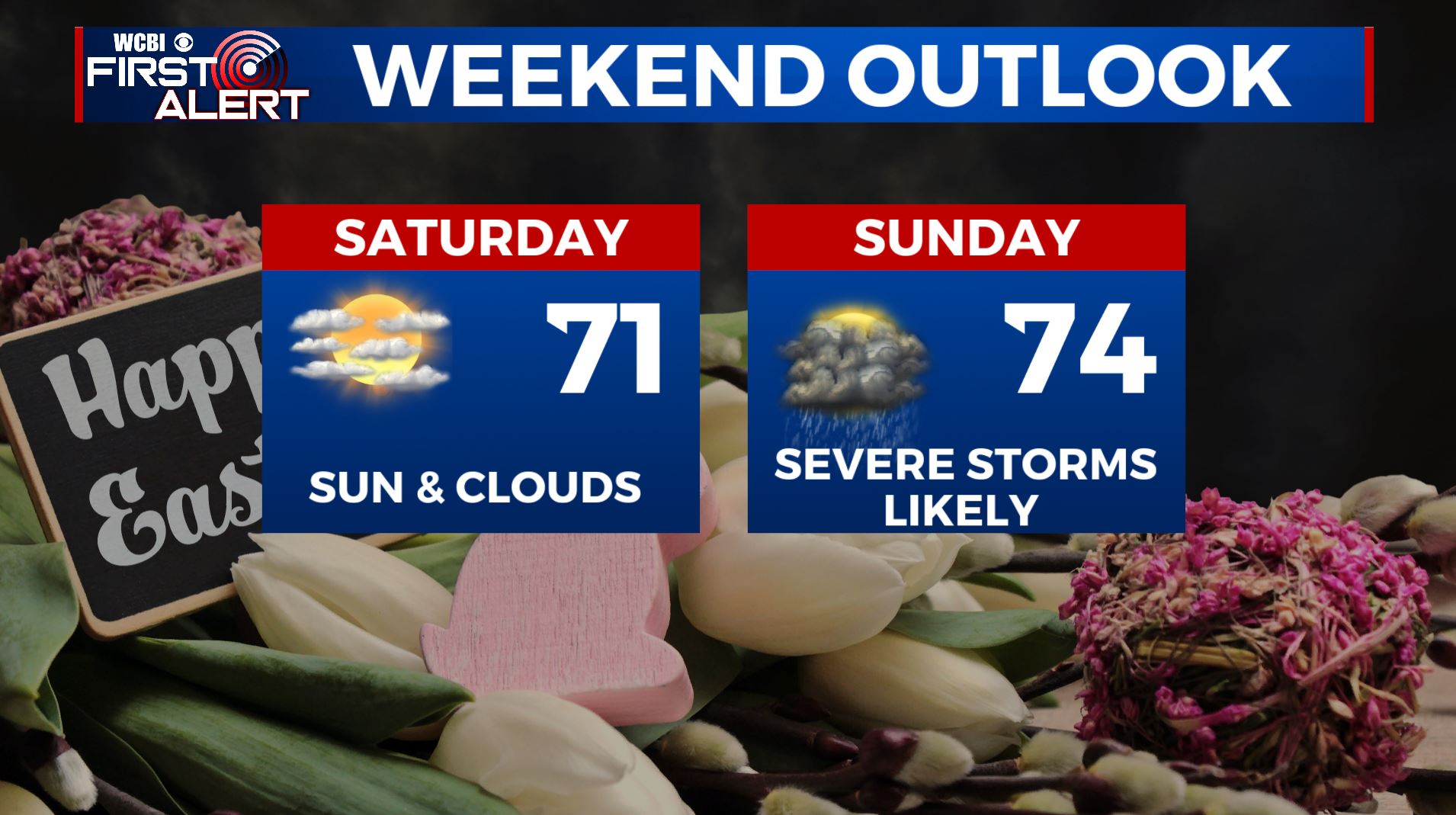
SATURDAY: A mix of sun & clouds. Highs in the lower 70s.
SATURDAY NIGHT: Becoming cloudy with rain and thunder developing after midnight. Lows in the 50s.
EASTER SUNDAY: Areas of rain and thunderstorms. Some storms could become severe with large hail, damaging wind gusts, tornadoes, and heavy rainfall. Between 1 to 4 inches of rain may fall and that could lead to some flooding. Mild highs in the mid 70s are expected.
NEXT WEEK: Below average conditions are likely overall with highs mainly in the 60s and lows in the 40s and upper 30s. The week looks quiet with mostly sunny skies.
Stay connected with @WCBIWEATHER on Facebook, Twitter, Instagram, and the WCBI News App


Leave a Reply