Rain chances & cooler temperatures return this week
SUMMARY: A warm front will be lifting to our north on Monday, which could produce some isolated showers, especially north of I-22. A few more showers & storms storms will be possible on Tuesday as a cold front pushes through the area, setting us up for a drier Wednesday and Thursday along with a bit of a cool down as we go from the 80s to the 70s. Another round of storms are likely on Friday as a second cold front is set to push through. The weekend is looking fairly nice but cooler with below average temperatures.
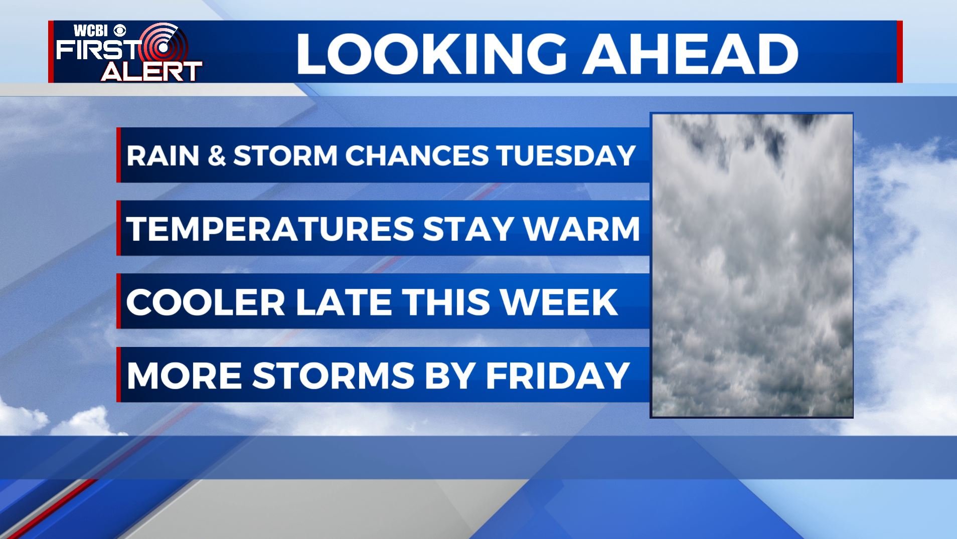
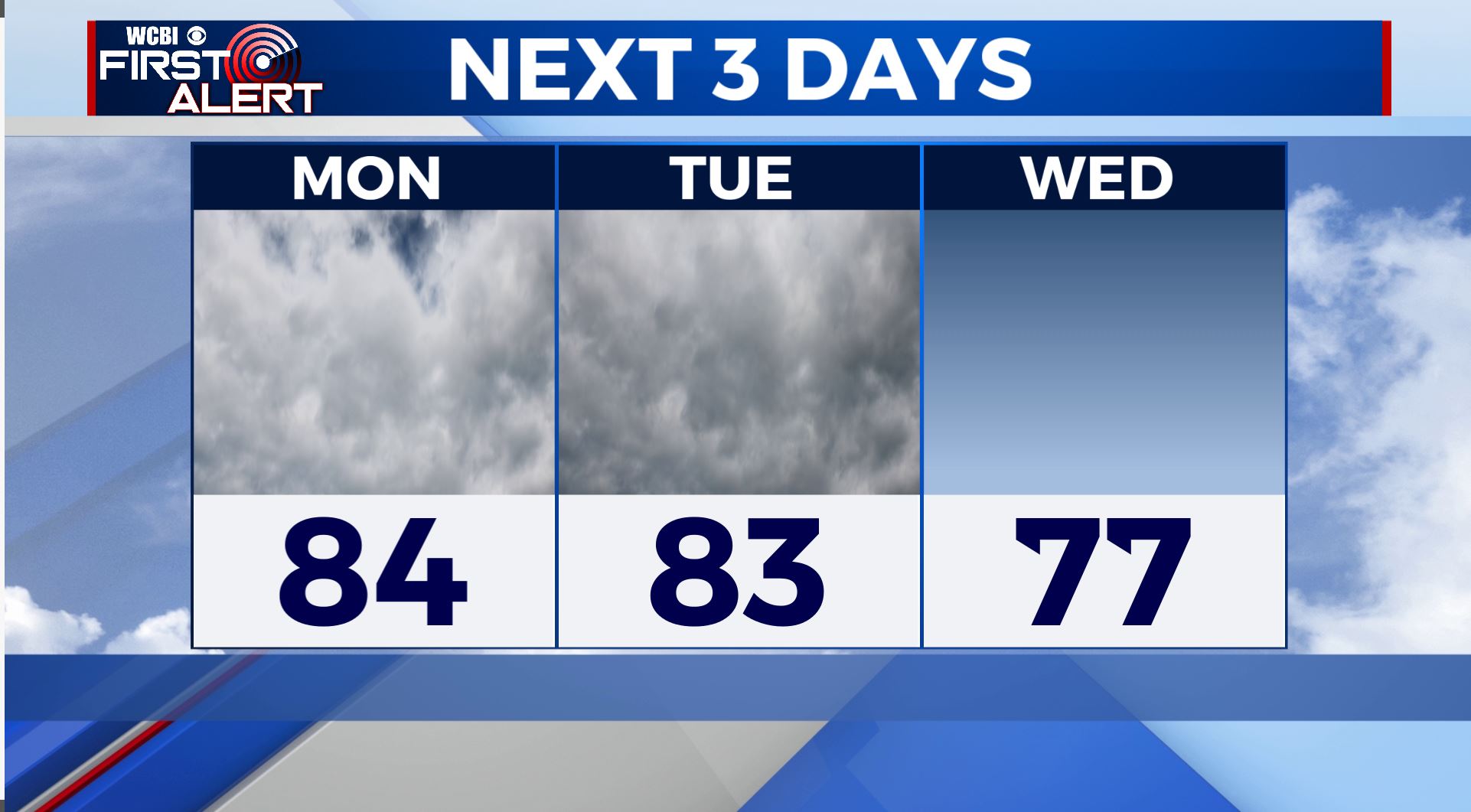
MONDAY: We’ll seen an increase in clouds for your Monday as a warm front lifts north. An isolated shower or storm will be possible in our northern counties, but most of us will stay dry. Temperatures climbing into the mid 80s by the afternoon thanks to a SW wind at 5-10 mph.
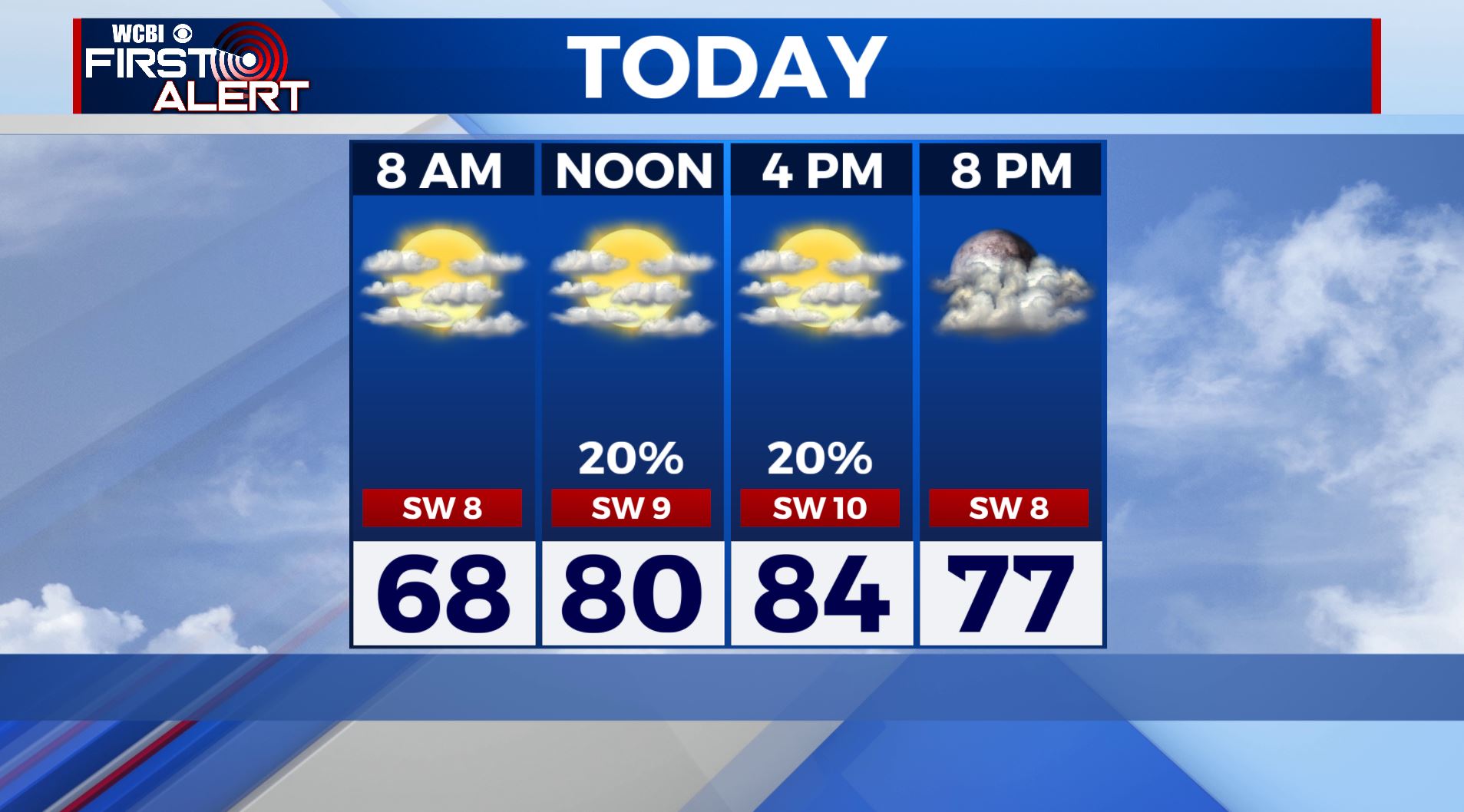
TUESDAY: As a cold front moves through the area, everyone will have the chance to see scattered showers or storms, especially in the afternoon and evening. Otherwise, we’ll see mostly cloudy skies through the day. Temperatures will start out in the 60s with highs in the mid 80s. A few storms could produce gusty winds or some small hail, but severe weather remains unlikely.
WEDNESDAY-THURSDAY: Mostly sunny skies & dry conditions will return to the area midweek. Temperatures behind the cold front cooling back down to near normal. Highs will be in the mid 70s with overnight lows in the 40s and 50s.
FRIDAY: Another round of showers and storms will move through the area on Friday with highs near 70.
SATURDAY-SUNDAY: For now, Mother’s Day weekend is looking nice & cooler with mostly sunny skies for Saturday and Sunday. Highs only in the upper 60s to lower 70s.
Stay connected with @WCBIWEATHER on Facebook, Twitter, Instagram, and the WCBI News App


Leave a Reply