Still cool & cloudy with some light rain chances for Tuesday
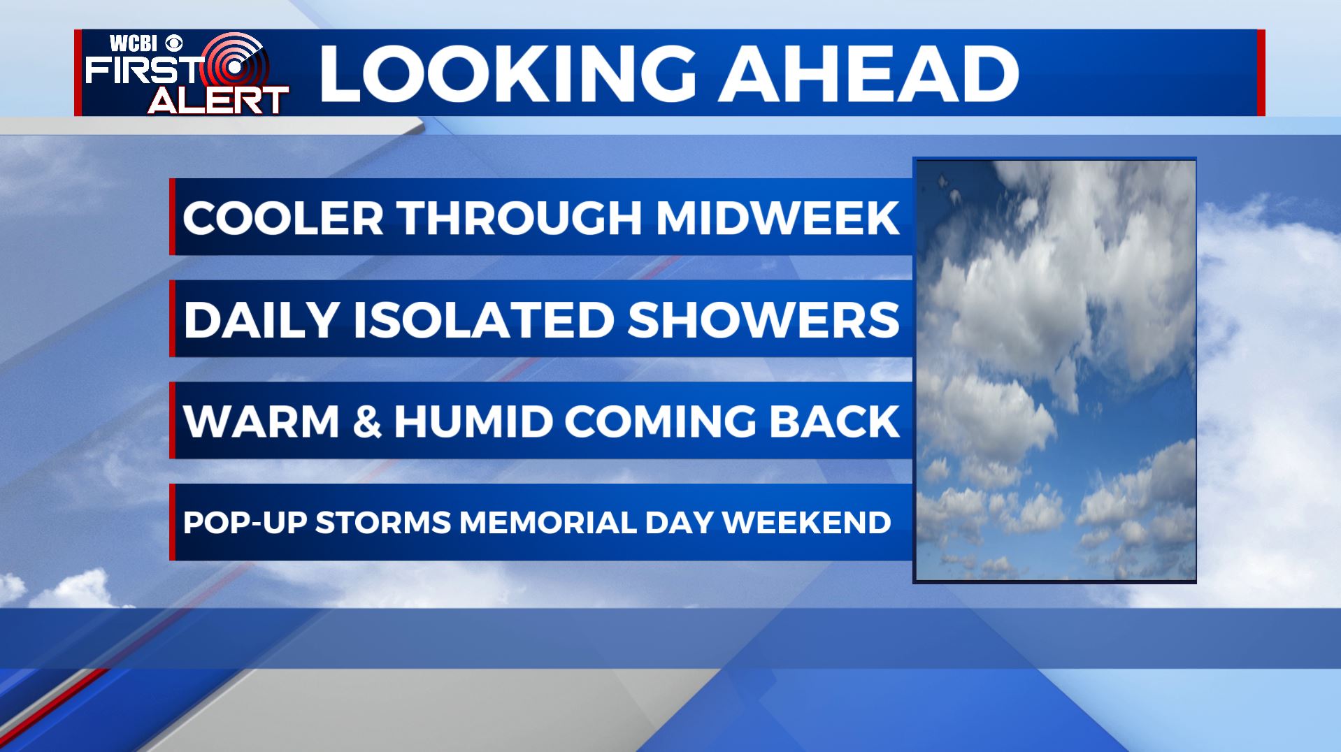
SUMMARY: Below average & cooler temperatures expected through midweek with highs in the 70s. A mix of sun & clouds and a few daily isolated showers remain possible as a cutoff low stays put in the Southeast. Warmer temperatures will make a comeback just in time for the coming Memorial Day holiday weekend with on & off again chances for showers & storms.
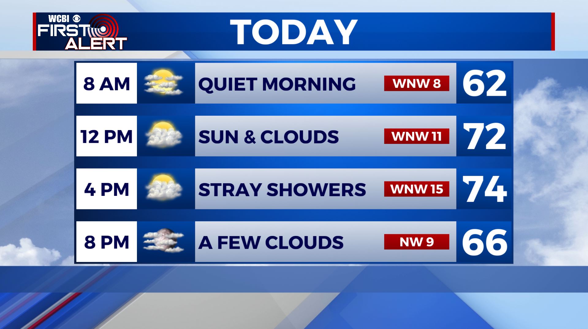
TUESDAY: Waking up this Tuesday morning to some clouds and temperatures in the 50s. We’ll have mostly cloudy skies with some isolated showers due to the daytime heating this afternoon, but not looking to be a big deal. Highs still cool in the lower to mid 70s.Winds WNW 5-15 mph.
TUESDAY NIGHT: A few clouds, cool and quiet. Overnight lows in the mid 50s.
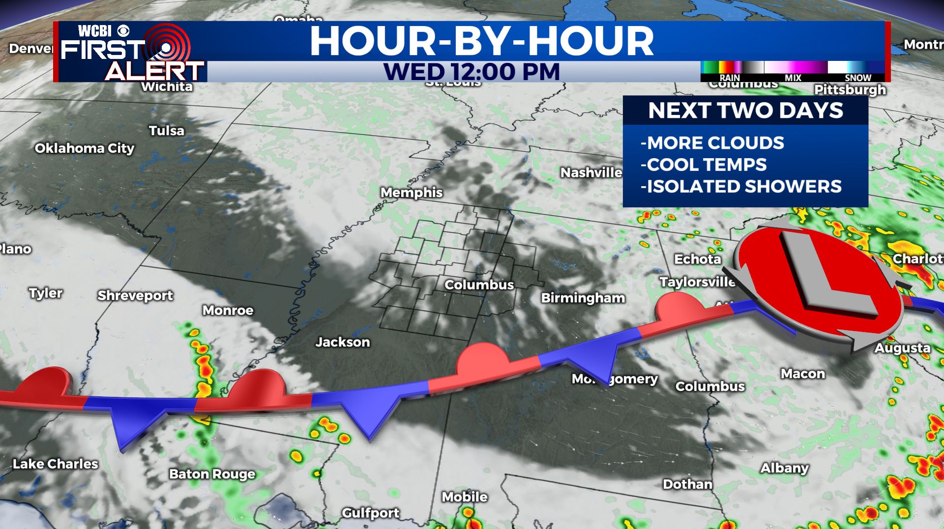
WEDNESDAY: A mix of sun & clouds with an isolated chance of an afternoon shower or two. Highs warming up a bit in the upper 70s.
WEDNESDAY NIGHT: Partly cloudy skies. Overnight lows in the upper 50s to near 60.
THURSDAY: Partly sunny and warmer with highs in the lower to mid 80s. Still expecting a slight chance of an afternoon shower.
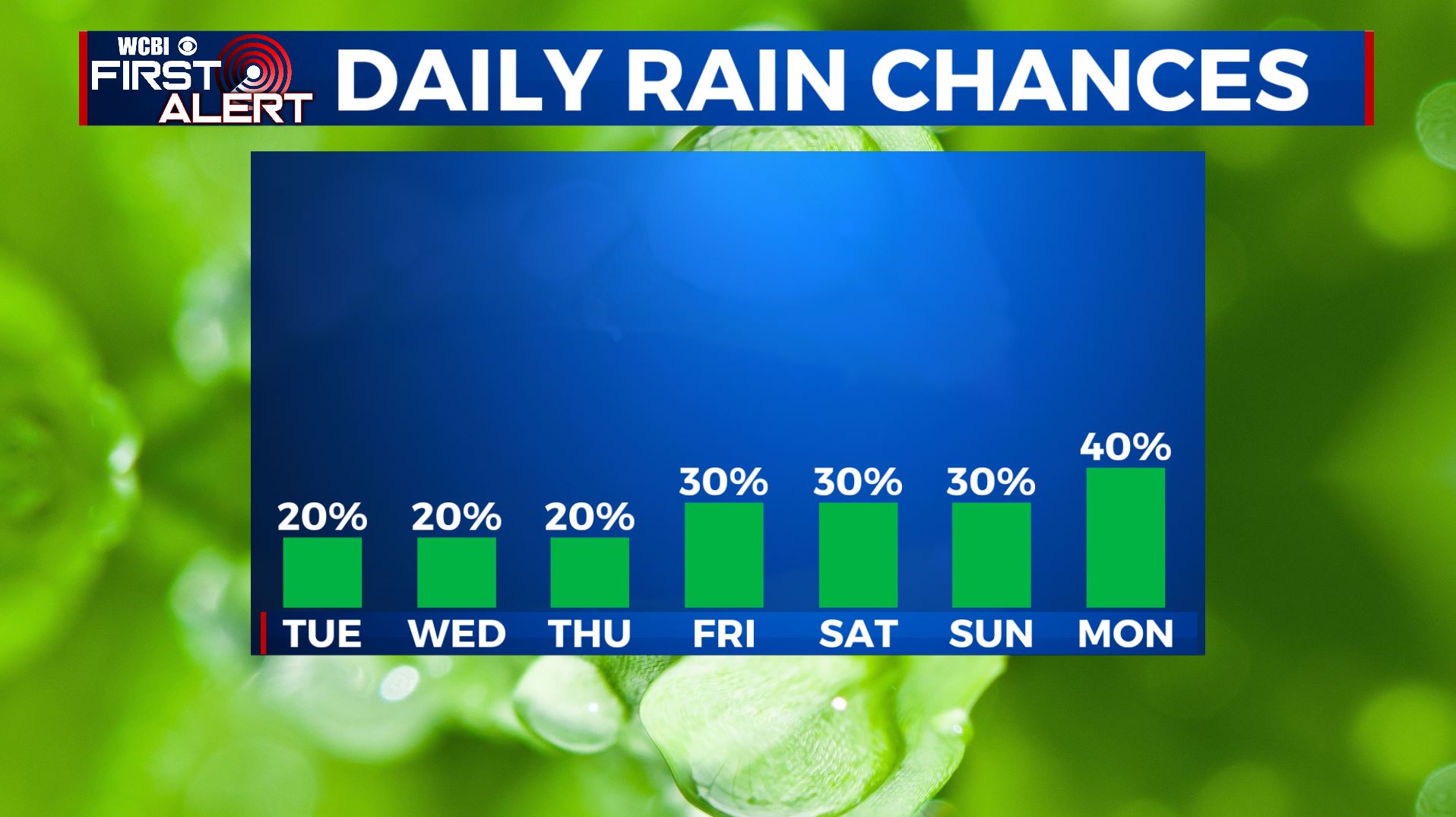
FRIDAY: Partly sunny with a chance of a pop-up shower once again. Highs getting back up to above average in the mid to upper 80s.
MEMORIAL DAY WEEKEND: Partly sunny and feeling like summer with the return of the warm and humid conditions. A daily chance of scattered rain and storms, but not looking to be a complete washout or no severe weather expected for now. Highs in the upper 80s to near 90 degrees.
Stay connected with @WCBIWEATHER on Facebook, Twitter, Instagram, and the WCBI News App


Leave a Reply