One more cool day for Wednesday before summer returns
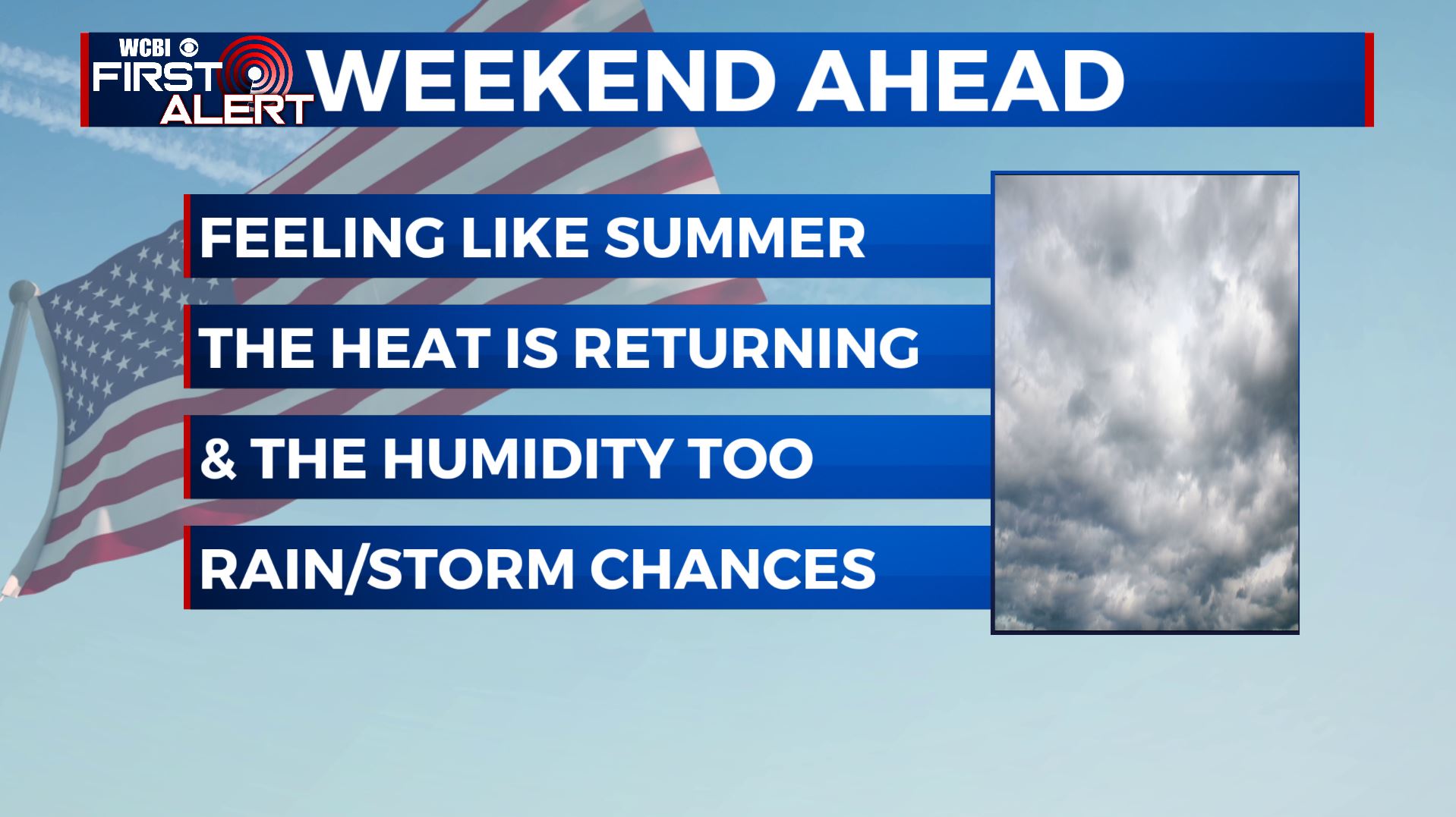
SUMMARY: One more less humid and cool day for your Wednesday before we start warming back up to the 80s as we end the week. We’ll stay partly sunny to mostly cloudy with a slight chance of a stray shower in the afternoon. The humidity will increase along with the return of the summer heat and daily rain & pop-up storm chances for the long Memorial Day holiday weekend.
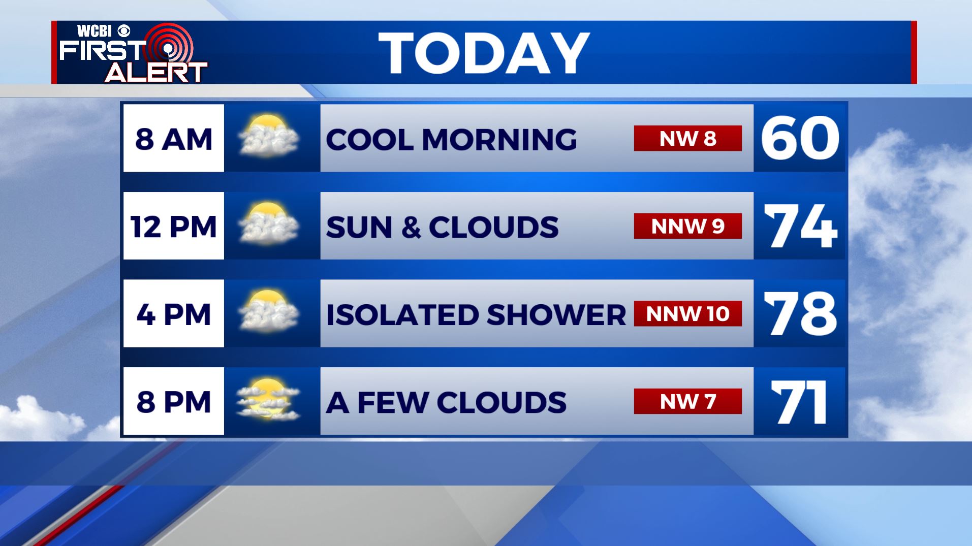
WEDNESDAY: We are once again waking up on a cool note note this morning with temperatures in the 50s. Expect once again a mix of sun & clouds with an isolated chance of an afternoon shower or two for your Wednesday. Still below average & cool, but less humid and a few degrees warmer from Tuesday with highs in the mid to upper 70s.
WEDNESDAY NIGHT: Partly cloudy skies. Overnight lows in the upper 50s to near 60.
THURSDAY: A mix of sun & clouds and warmer with highs in the lower to mid 80s. Still expecting a very slight chance of an afternoon shower, but looks to be the driest day of the week.
THURSDAY NIGHT: Mostly cloudy and milder. Overnight lows in the 60s.
FRIDAY: Partly sunny with chances of a pop-up shower or storm. Highs getting back up to above average in the mid to upper 80s.
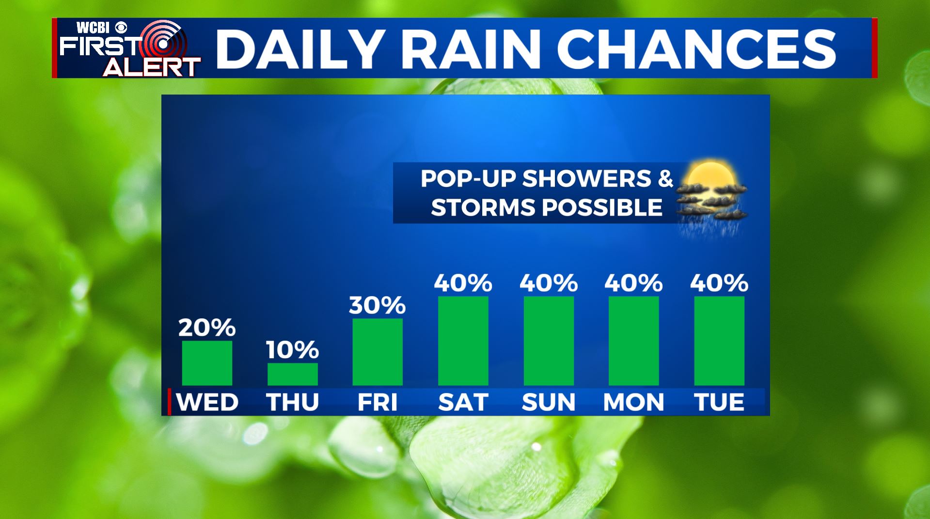
MEMORIAL DAY WEEKEND: Partly sunny to mostly cloudy skies and feeling like summer with the return of the heat and humid conditions. A daily chance of scattered rain and storms, but not looking to be a complete washout or no severe weather expected for now. Highs in the upper 80s to near 90 degrees.
TUESDAY: Still warm & above average with highs in the mid to upper 80s. A mix of sun and clouds with chances for a few scattered showers & storms.
Stay connected with @WCBIWEATHER on Facebook, Twitter, Instagram, and the WCBI News App


Leave a Reply