Rain & storm chances are here to stay
SUMMARY: Summer is here to stay! Expect the warm and humid conditions with highs in the 80s, along with chances of showers and storms heading into the rest of the week as a couple of disturbances push through the region. Some spots may get some heavy rainfall over the coming days while other spots miss out. More sunshine returns to the forecast by the weekend.
TUESDAY: Expect to hit the repeat button with our weather for our Tuesday. Waking up to a mix of sun & clouds this morning. Expect showers and a few thunderstorms as moisture from a disturbance in the Gulf of Mexico moves into the area. Highs in the lower to mid 80s with a breezy SE wind 10-20 mph.
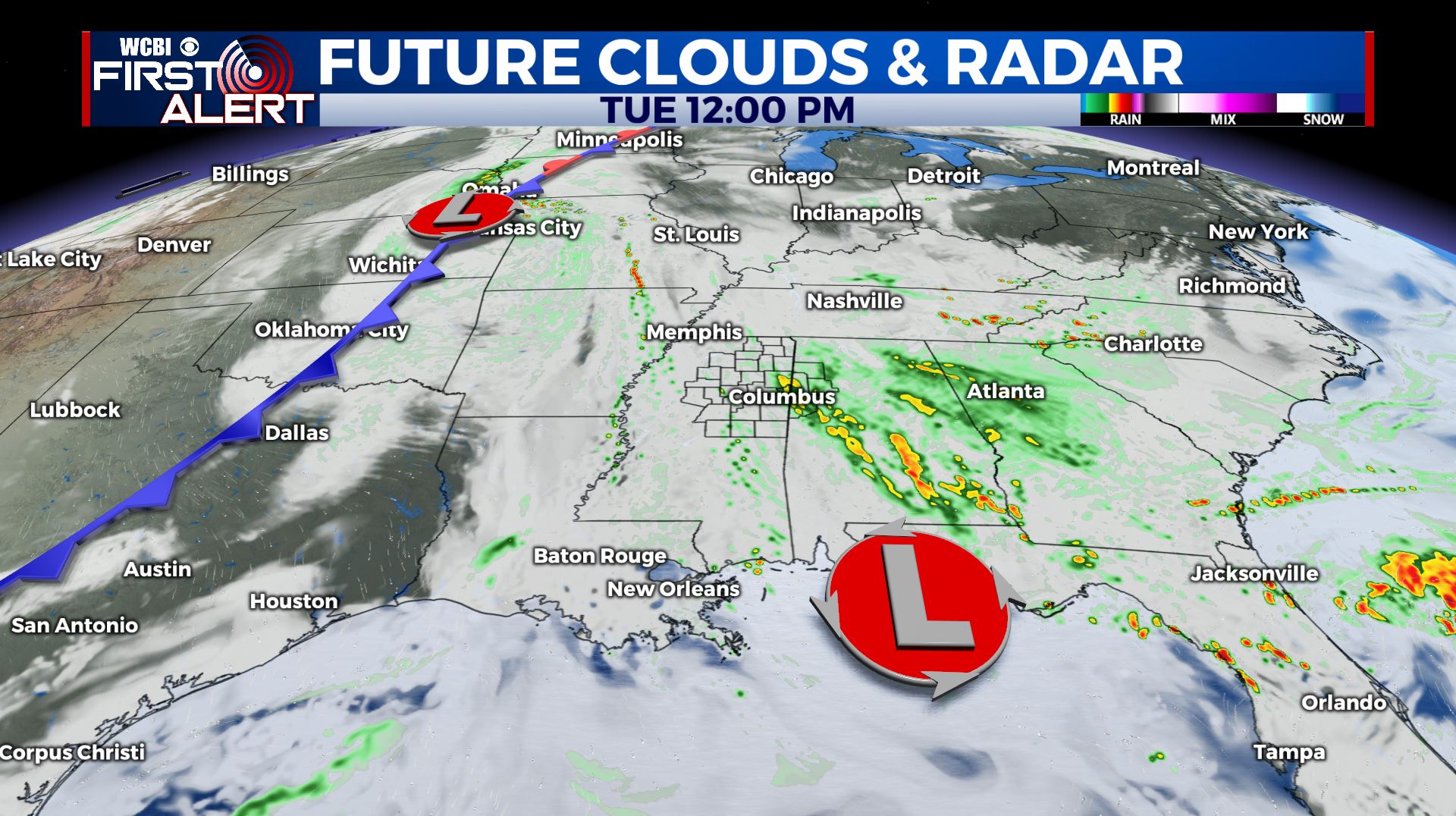
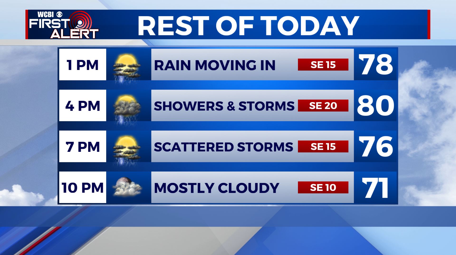
TUESDAY NIGHT: Showers and storms will come to an end early evening. Mostly cloudy skies overnight. Lows in the upper 60s.
WEDNESDAY: Scattered showers and storms are likely as an area of low pressure continues to meander around Central Plains & Deep South. No severe weather is expected, but some storms could have some gusty winds, heavy downpours and maybe some small hail. Highs from the upper 70s to lower 80s.
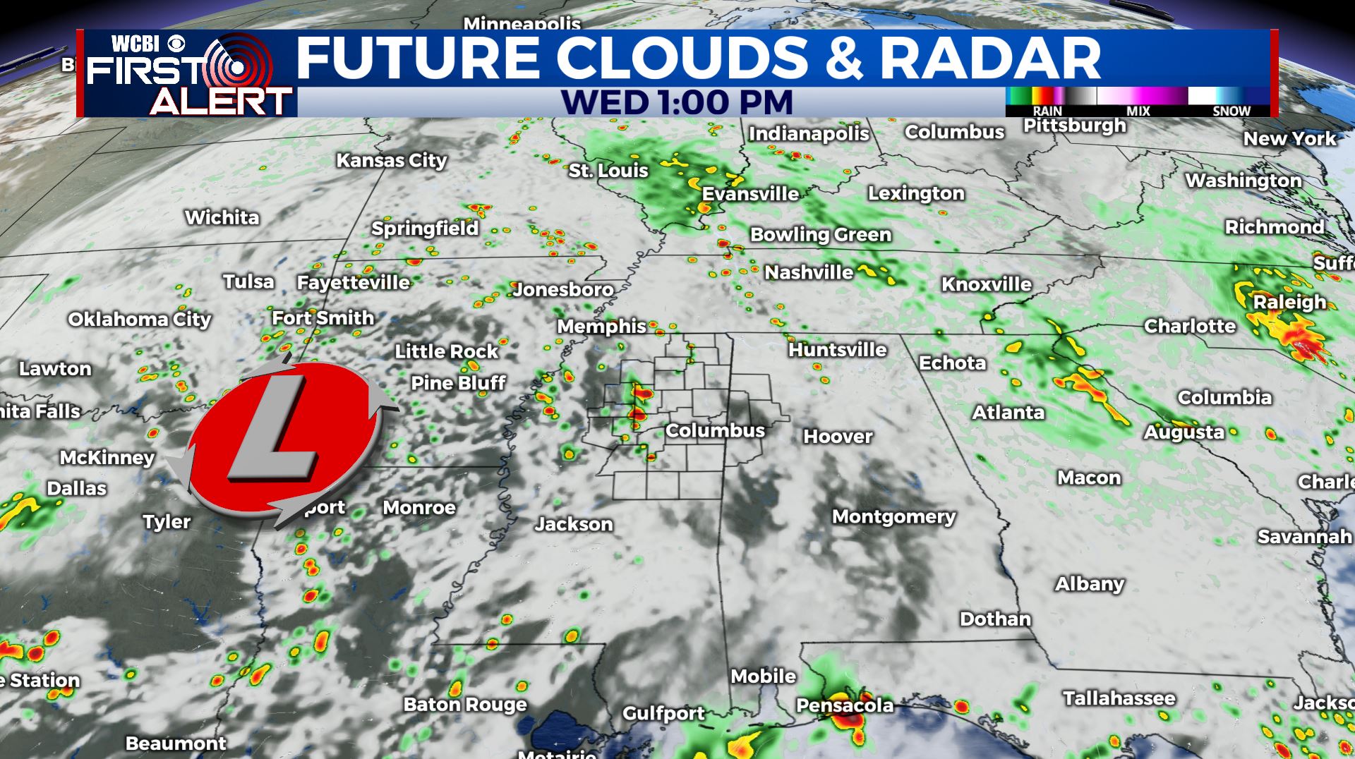
WEDNESDAY NIGHT: Mostly cloudy. A few showers or storms may linger. Overnight lows in the mid 60s.
THURSDAY-FRIDAY: Partly sunny to mostly cloudy skies with showers and storms still likely. Highs in the lower to mid 80s with overnight lows in the 60s.
SATURDAY: Chances for showers and storms will continue, but will be scaling back as that cutoff low finally moves away from us. Highs staying warm & humid in the mid to upper 80s.
SUNDAY-MONDAY: More sunshine and drier weather returns. Highs remain in the lower to mid 80s. Overnight lows may dip down into the upper 50s to near 60 Sunday morning.
Stay connected with @WCBIWEATHER on Facebook, Twitter, Instagram, and the WCBI News App


Leave a Reply