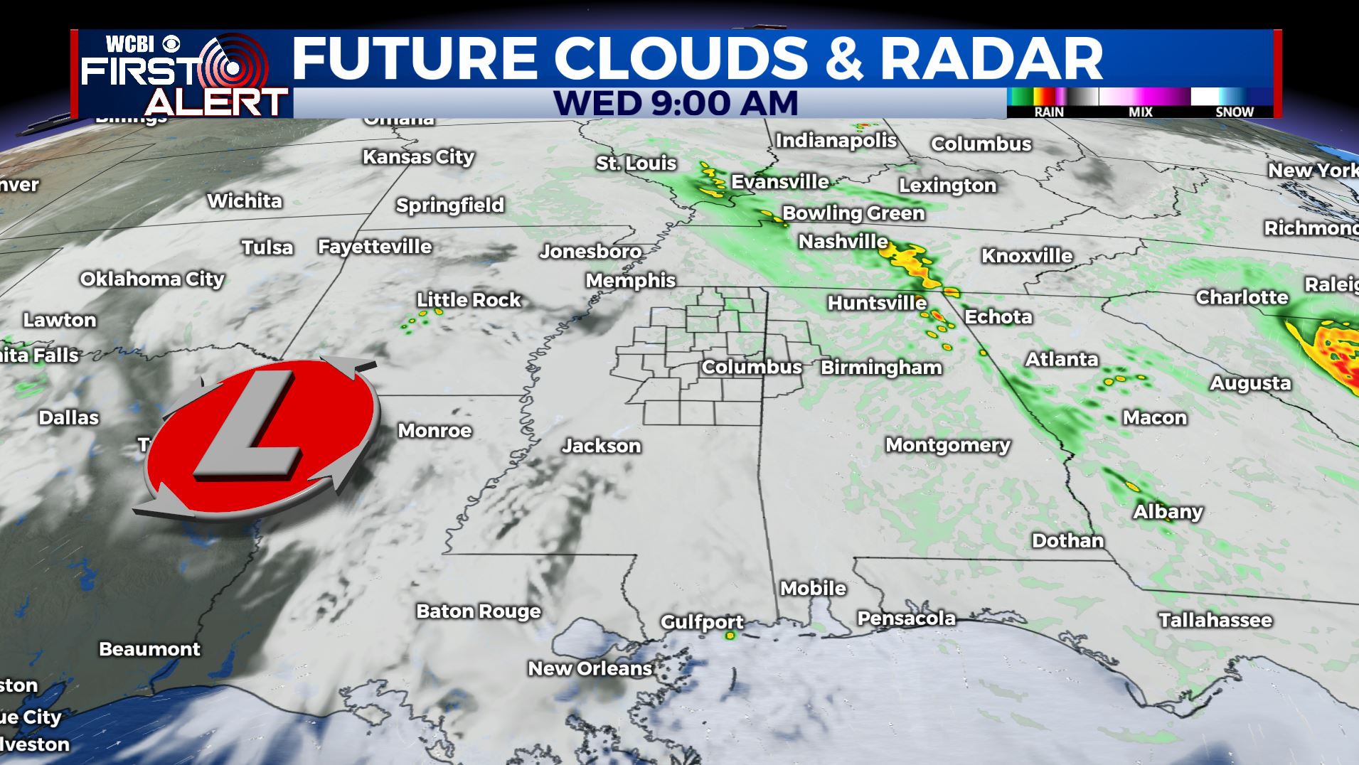
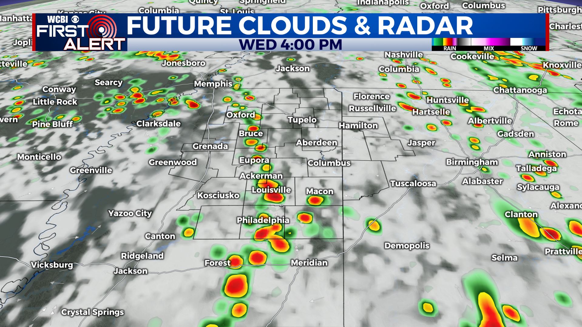
Another cloudy & rainy day for Wednesday
SUMMARY: Our unsettled weather pattern of daily shower and thunderstorm chances will continue through the end of the workweek. Temperatures will stay in the upper 70s to lower 80s thanks to the cloud cover and the rain cooled air. More sunshine returns to the forecast by the weekend.
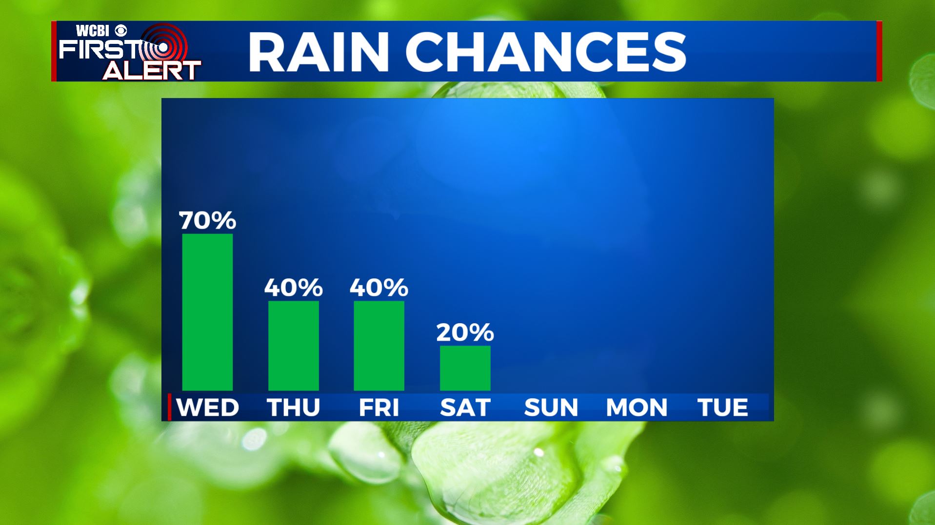
WEDNESDAY: Showers and storms are likely as an area of low pressure continues to meander around the Deep South. No severe weather is expected, but some storms could have some gusty winds, heavy downpours and maybe some small hail. Highs in the upper 70s to around 80 degrees.SE winds 5 to 10 mph.
WEDNESDAY NIGHT: Mostly cloudy with a continuing chance of a few showers with a few rumbles of thunder. Lows in the mid 60s.
THURSDAY-FRIDAY: Partly sunny to mostly cloudy skies with chances of scattered showers and storms. Highs in the lower to mid 80s with overnight lows in the 60s.
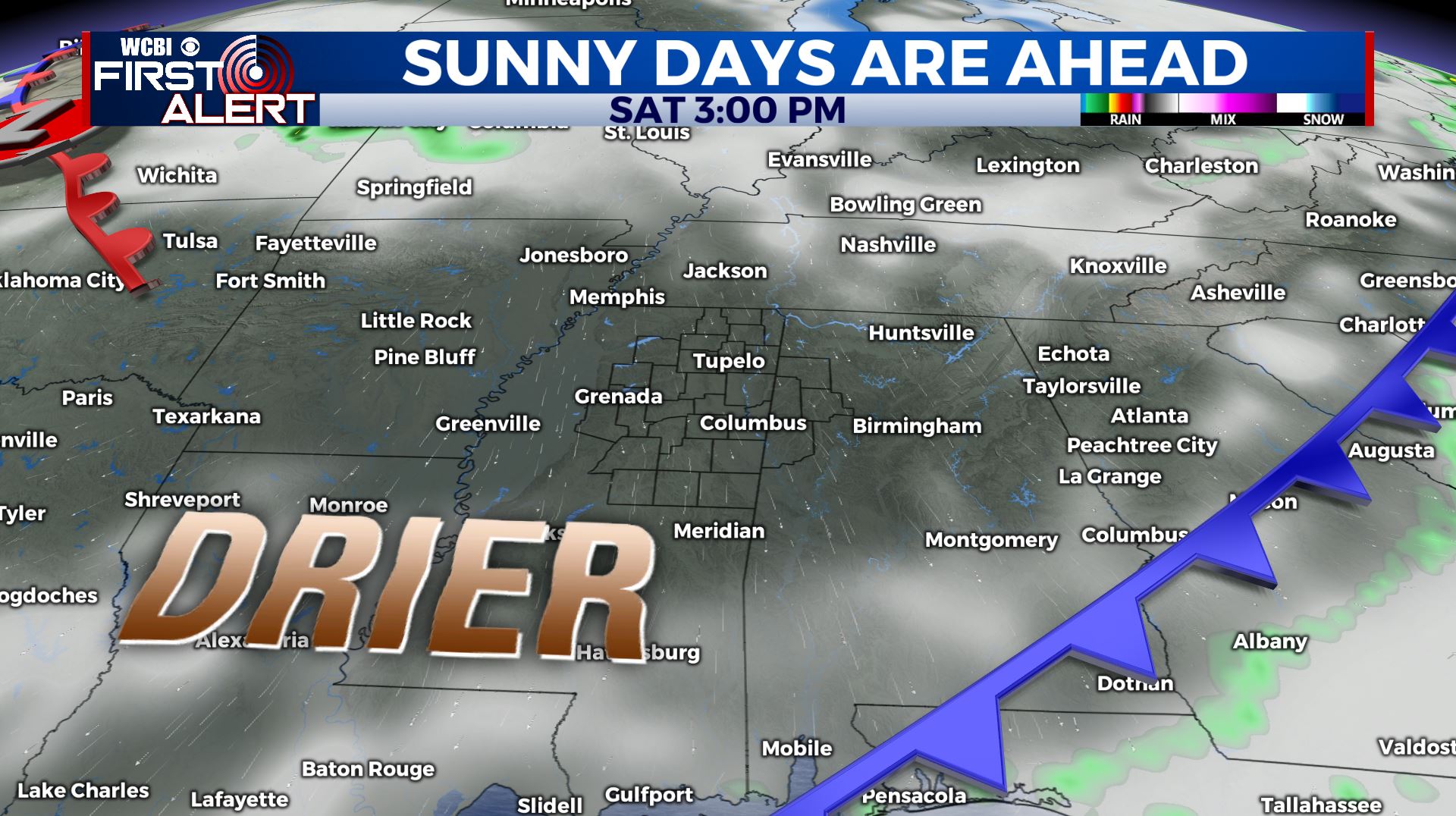
THIS WEEKEND: Just a slight chance of a few isolated showers on Saturday, but we’ll be finally drying out as the sunshine makes a return. Highs remain in the lower to mid 80s. Overnight lows may dip down into the upper 50s to near 60 Saturday and Sunday night.
EARLY NEXT WEEK: Staying quiet with more sunshine and drier weather. Highs in the lower to mid 80s with overnight lows in the 60s.


Leave a Reply