Another chance for afternoon storms on Thursday
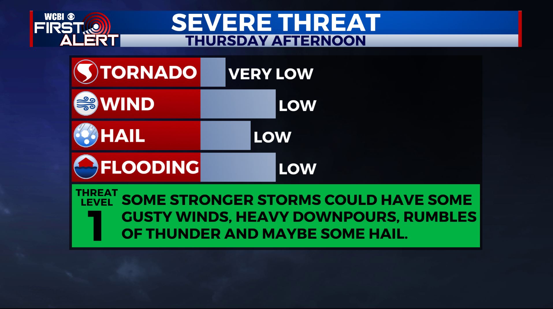
SUMMARY: Scattered showers and storms are once again in the forecast for Thursday. A few strong storms can’t be ruled out with some heavy downpours, hail and gusty winds. A cold front will be pushing through on Friday, allowing for the sunshine and less humid conditions to return for the weekend. The drier weather pattern is looking to stick around through the first half of next week.
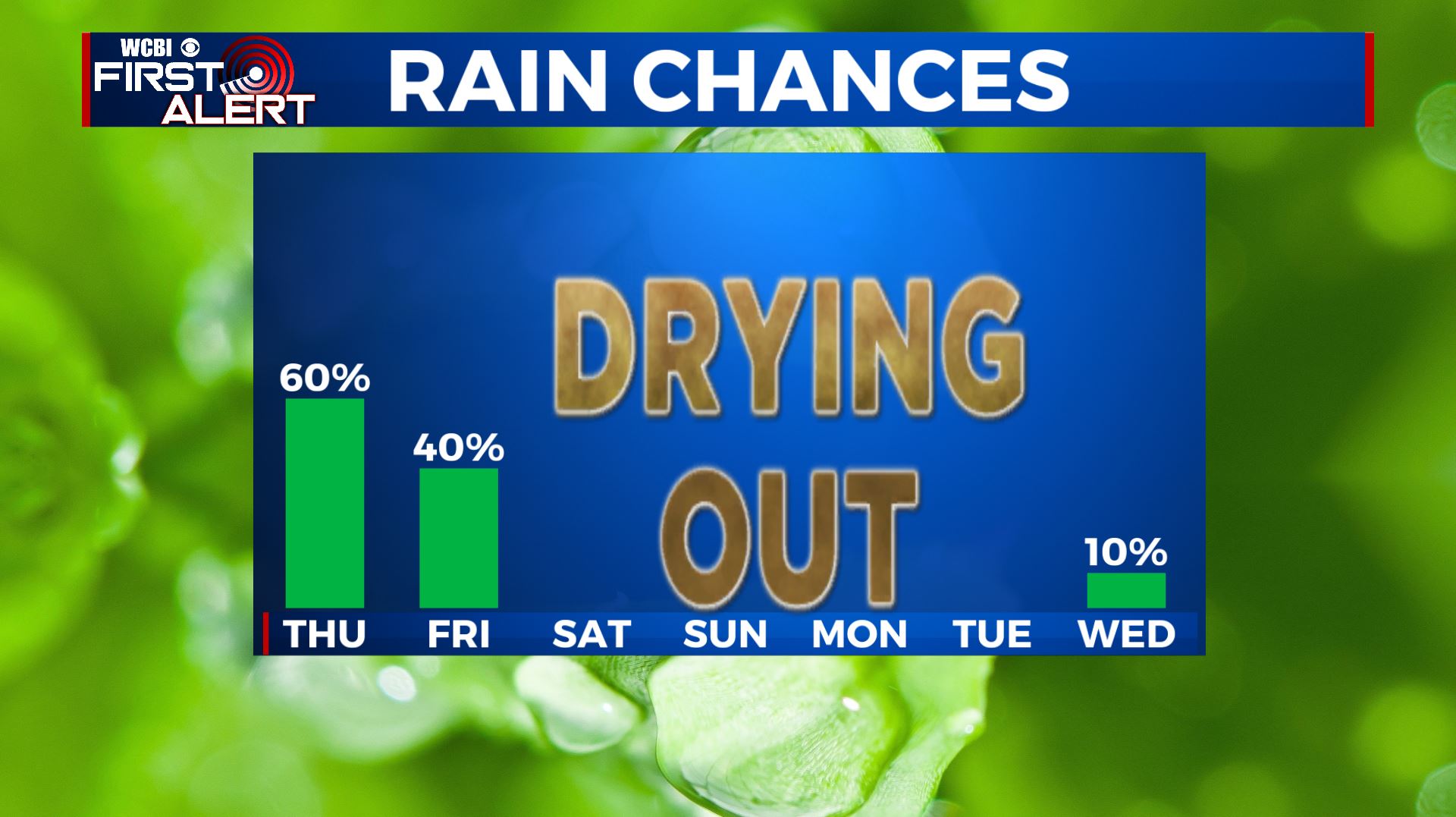
THURSDAY: A mix of sun & clouds with anther chance of scattered pop up showers and thunderstorms in the afternoon as an area of low pressure continues to meander around the Deep South. A few strong storms can’t be ruled out, depending on how much daytime heating of the sun we’ll get. Highs will be in the lower 80s. A breezy SW wind at 10-20 mph.
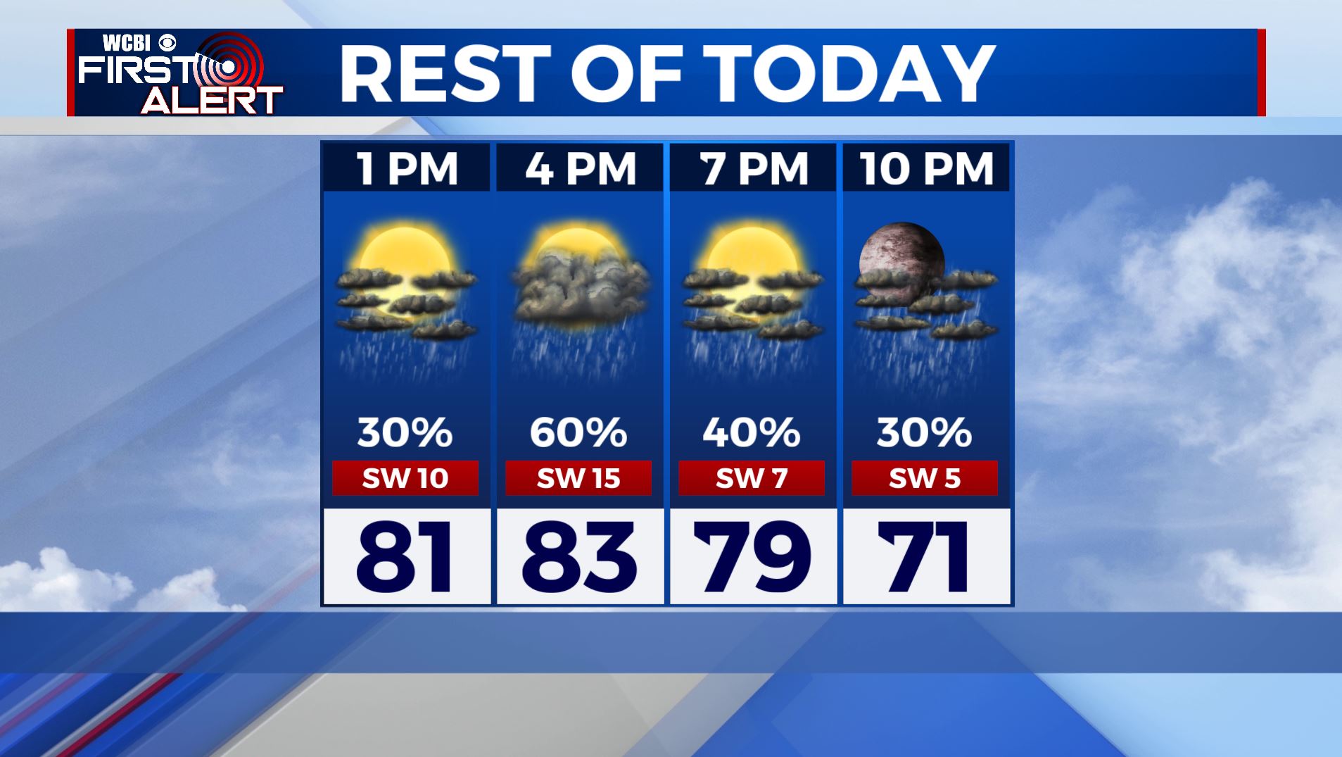
THURSDAY NIGHT: Mostly cloudy with a continuing chance of a few showers and storms. Lows in the mid 60s.
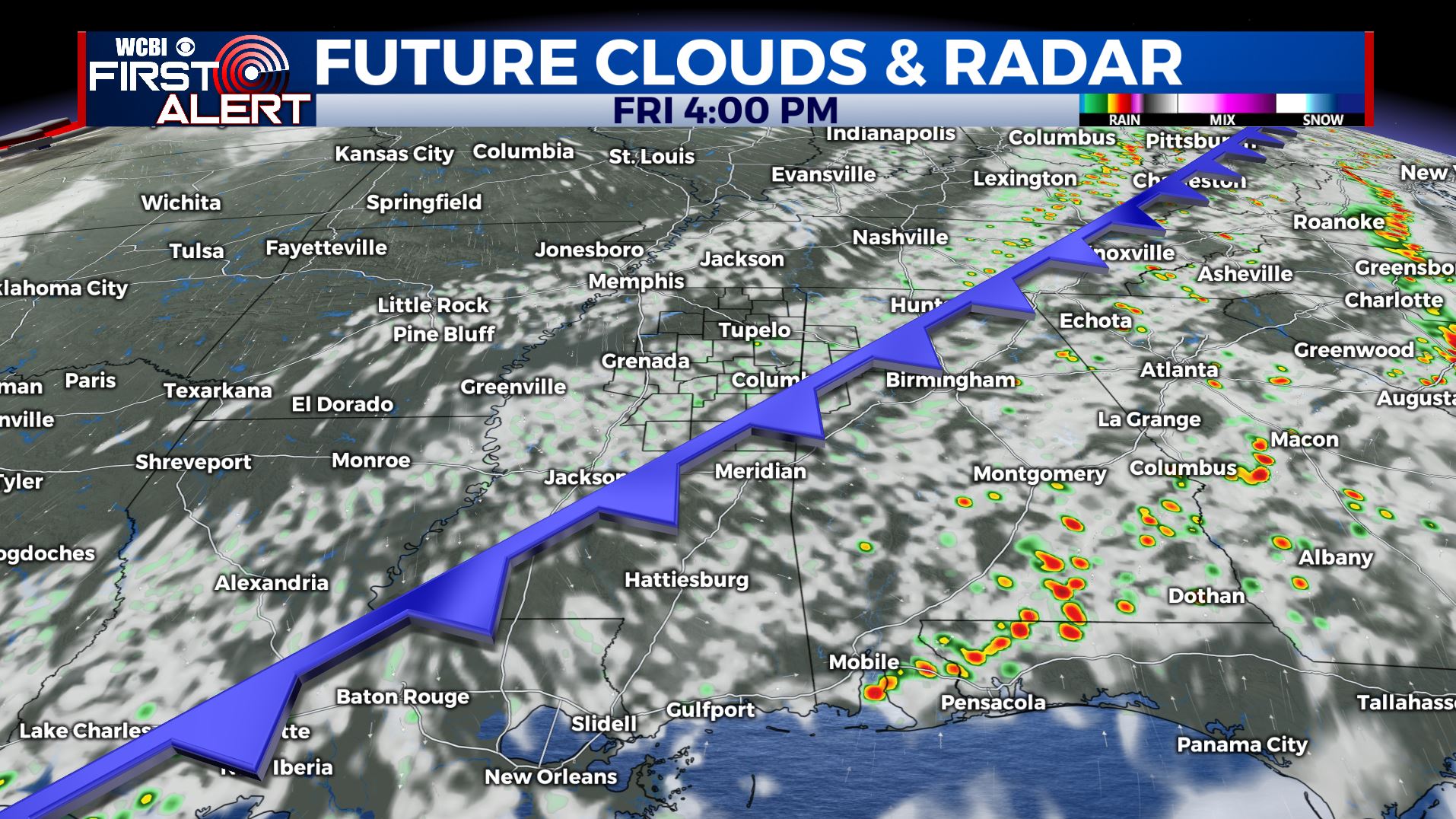
FRIDAY: Partly sunny to mostly cloudy skies with chances of scattered showers and storms as a cold front moves through the region. Highs in the lower to mid 80s.
FRIDAY NIGHT: Skies will finally begin to clear as drier air moves in behind the front. Overnight lows in the lower 60s.
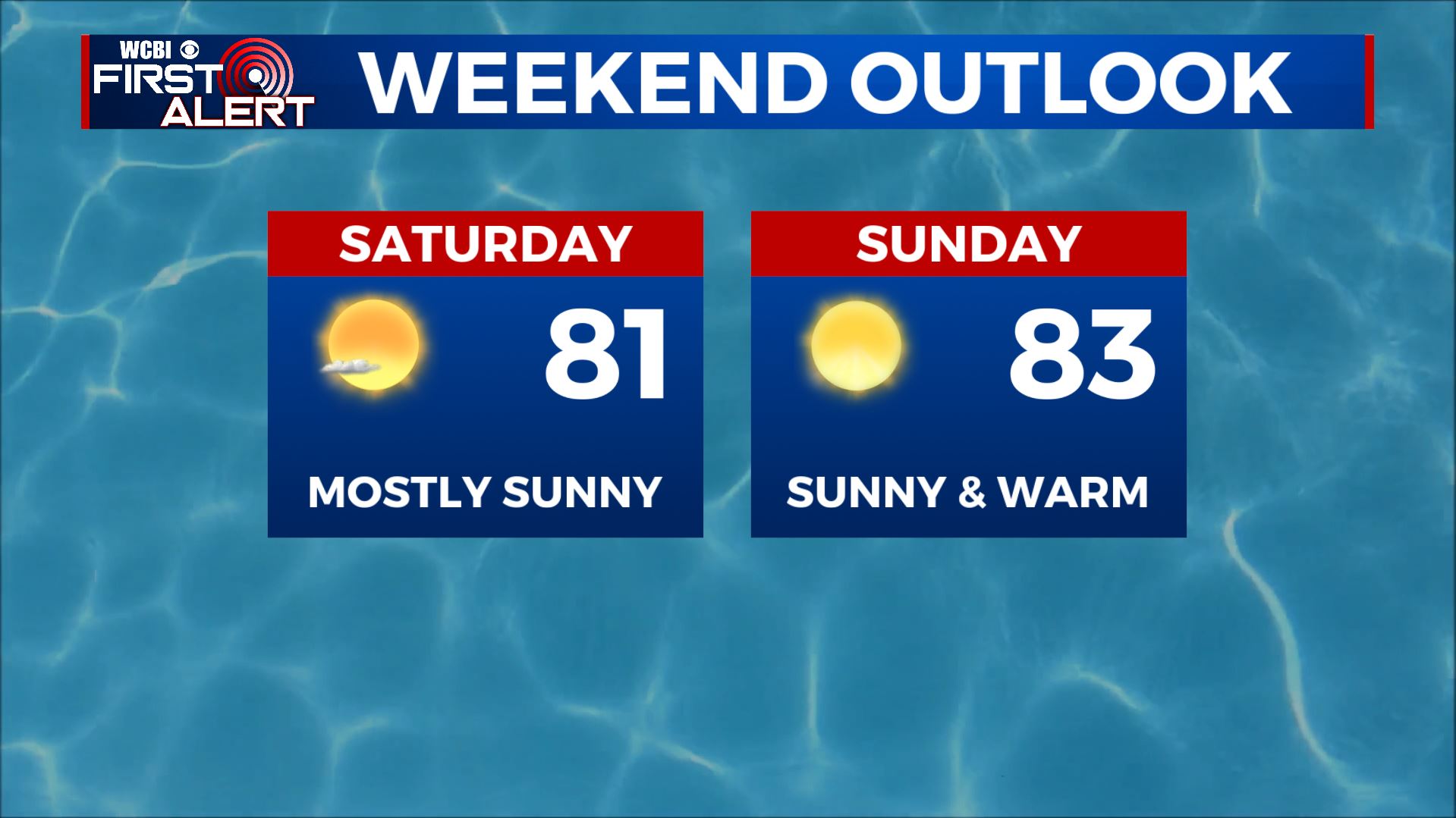
THIS WEEKEND: We’ll be finally drying out as the sunshine makes a return. Highs remain in the lower to mid 80s. Overnight lows may dip down into the upper 50s to near 60 Saturday and Sunday night.
NEXT WEEK: Our drying trend continues as an area of high pressure moves in. Expect warm highs temperatures in the mid to upper 80s under sunny skies through at least Wednesday.
Stay connected with @WCBIWEATHER on Facebook, Twitter, Instagram, and the WCBI News App


Leave a Reply