Storms Tue PM – Wed AM, sunny & cool end to the week
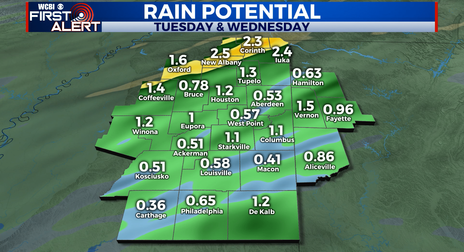
SUMMARY: A cold front will swing across the Twin States Tuesday night and Wednesday. More rain and storms are likely and some strong to severe storms are possible once again. This system looks more like a rain, wind, and perhaps hail producer more so than a tornado producer. Sunny, cool, and dry weather returns Thursday. Nice weather is on tap for the upcoming Easter weekend.
MONDAY NIGHT: Clear and chilly. Lows around 40. Light SE winds.
TUESDAY: Sunny skies early with increasing clouds during the afternoon. Rain and thunder showers are possible during the 2nd part of the day into the evening. Highs in the low to mid 70s. Southerly winds around 10 mph.
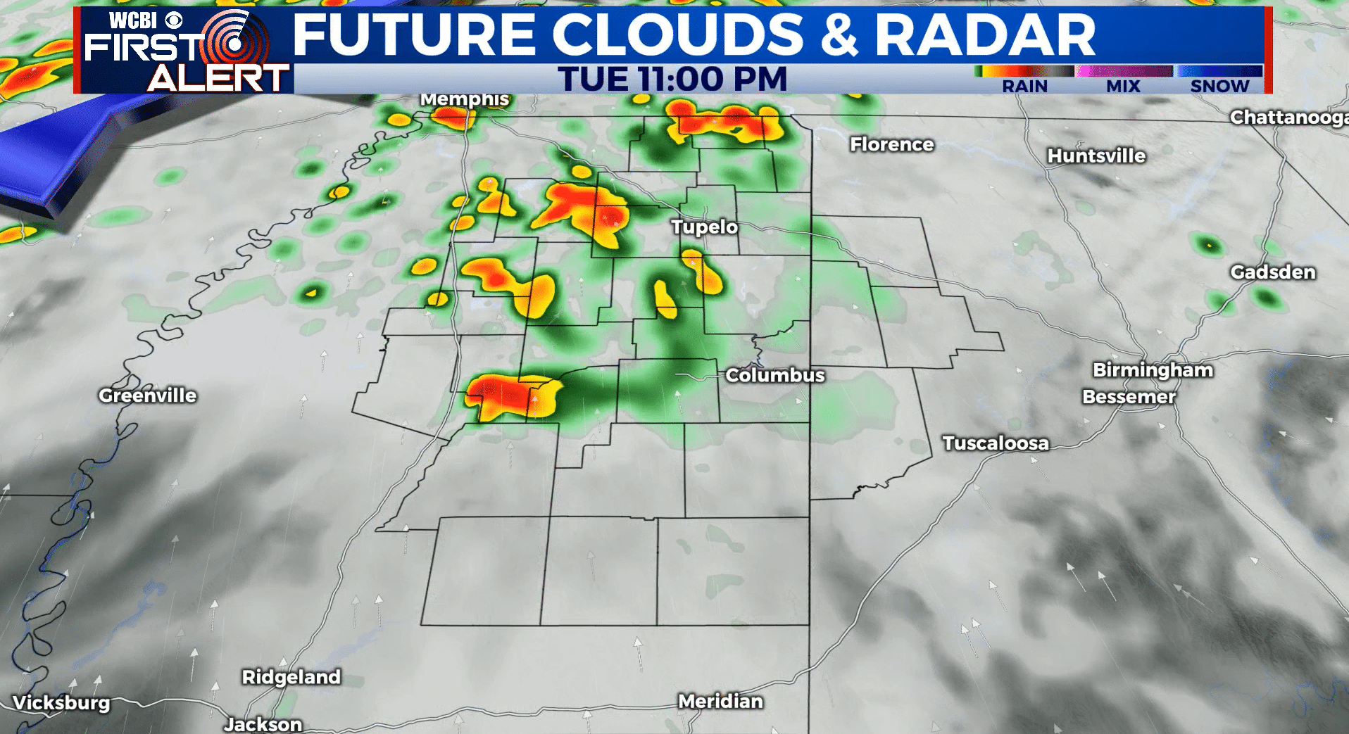
TUESDAY NIGHT/WEDNESDAY MORNING: Areas of rain and storms. Some could be strong to severe with wind and hail. Another 1-3” of rain is also possible. The tornado threat is low with this setup (compared to recent systems) but we’ll continue to monitor. Lows in the 60s.
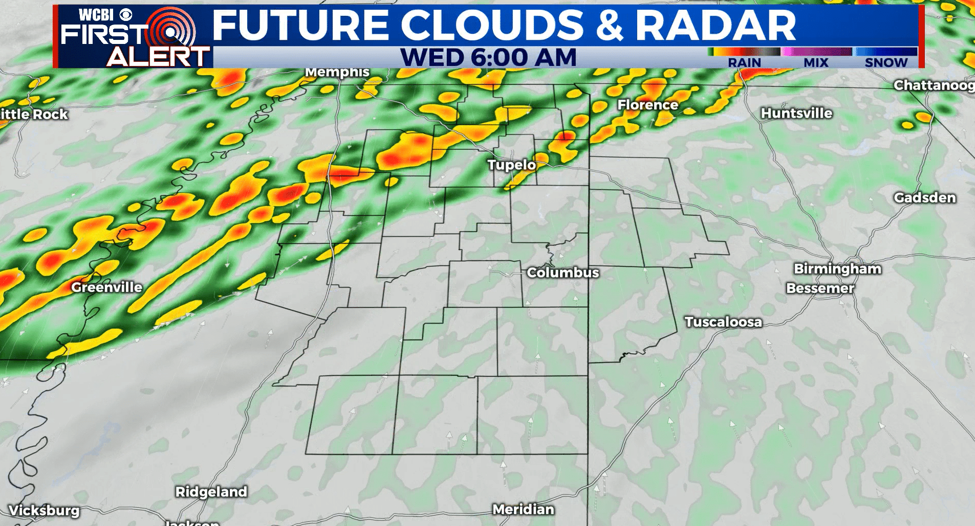
WEDNESDAY: Rain and storms in the morning with activity tapering off during the afternoon. Highs in the 60s early with more in the way of 50s (and perhaps 40s) during the 2nd half of the day. Gusty NW winds 10-25 mph develop.
WEDNESDAY NIGHT: Clear and chilly. Lows in the mid to low 30s. Some frost is possible, especially in low lying and sheltered spots.
THURSDAY: Sunny and cool. Highs in the mid 50s.
THURSDAY NIGHT: Clear and cold. Lows in the low 30s and even upper 20s. A widespread freeze is possible so you will want to protect any tender vegetation.
FRIDAY: Staying sunny and cool. Highs in the 50s to around 60.
FRIDAY NIGHT: Clear and chilly. Lows in the mid 30s. Some patchy frost can’t be ruled out.
SATURDAY: Partly cloudy. Highs in the low to mid 60s.
EASTER SUNDAY: Partly cloudy. Highs in the low 70s.
Follow @WCBIWEATHER on Facebook, Twitter, Instagram, and the WCBI News App


Leave a Reply