Warm & humid with some rain chances this weekend
SUMMARY: The summer like weather will continue through the weekend with highs in the mid to upper 80s. Daily chances of on & off again showers and storms continues, especially Friday and Sunday. Not a washout though and no severe weather is expected. The region will get a little bit of a cool down early to mid next week with drier weather returning as of right now.
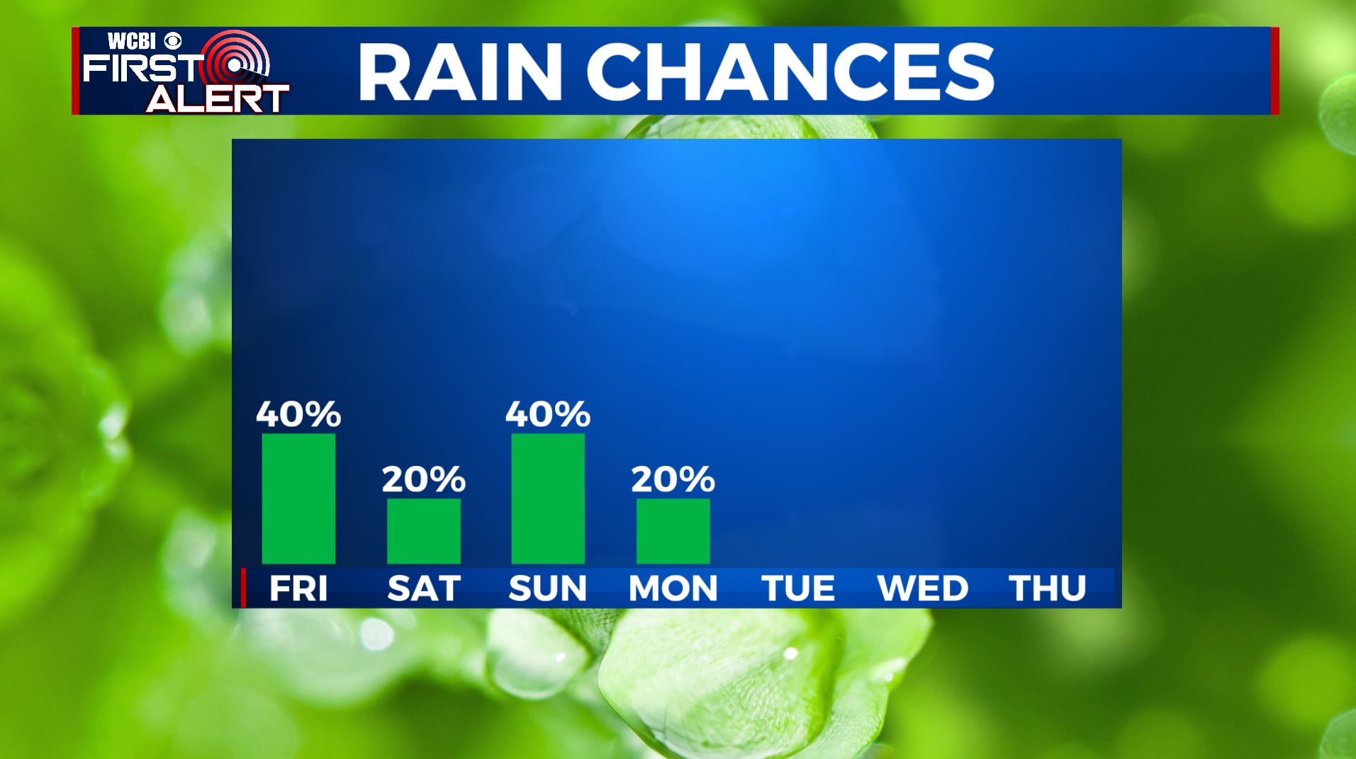
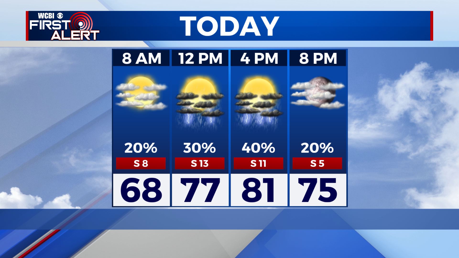
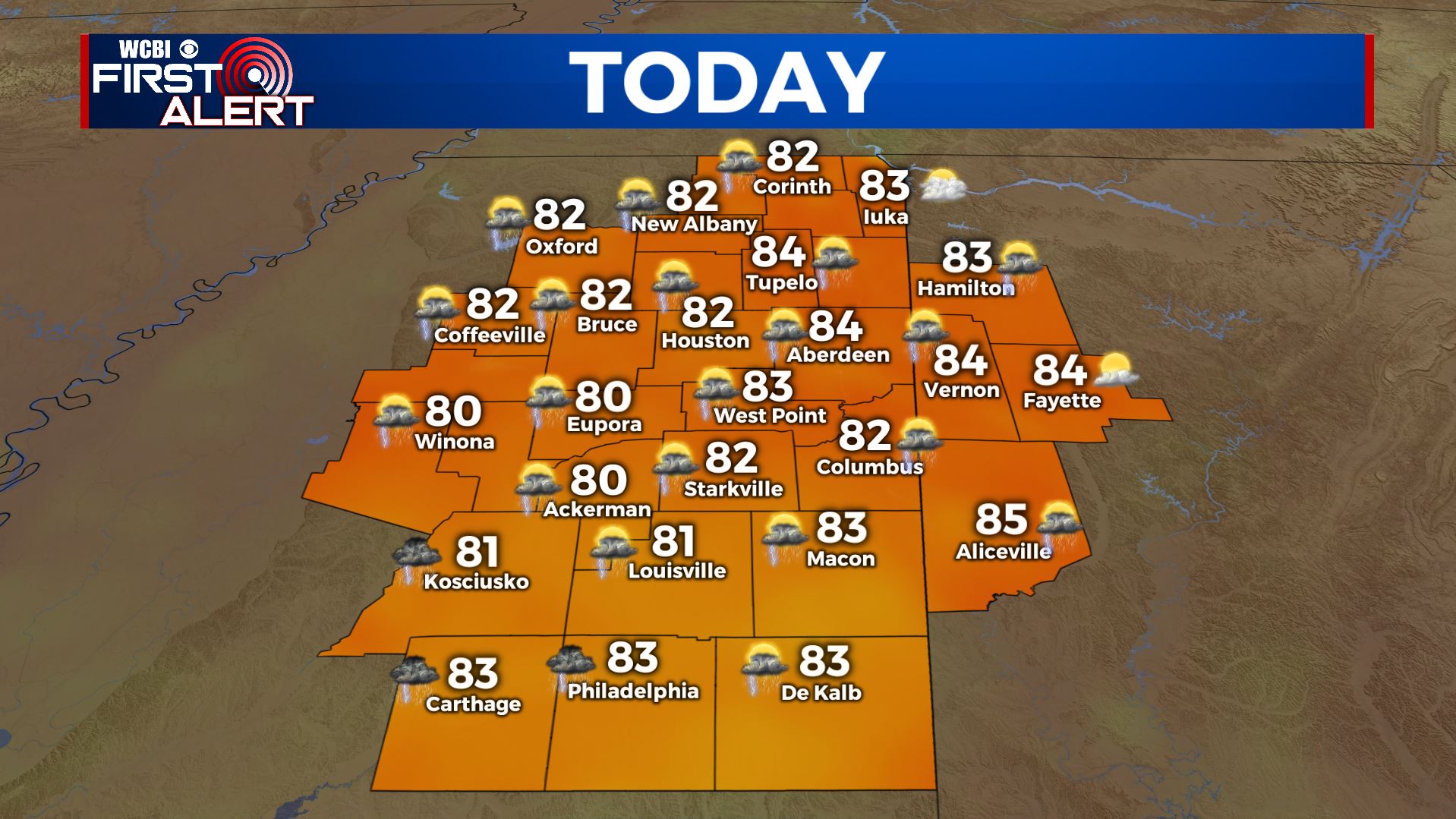
FRIDAY: It’s already a mild start to our Friday with a mix of sun & clouds and temperatures in the mid/upper 60s to near 70. Expect a “carbon copy” of Thursday’s weather for today with scattered showers & storms this afternoon. Warm & humid once again with highs in the lower to mid 80s. Some storms could produce locally heavy downpours. Winds S 5-15 mph.
FRIDAY NIGHT: Turning mostly to partly cloudy. Mild overnight lows in the mid 60s.
SATURDAY: A mix of sun & clouds and warm. Highs in the mid to upper 80s. A small chance of a stray shower or storm.
SATURDAY NIGHT: Partly cloudy. Another mild night with overnight lows in the mid 60s.
SUNDAY: Partly to mostly cloudy with better chances of scattered showers and storms as a cold front is pushing through. Highs once again top out in the mid 80s.
MONDAY: A stray shower and storms remain possible with a mix of sun & clouds. Temperatures behind our cold front cooler with highs only in the upper 70s.
TUESDAY-THURSDAY: Sunny to mostly sunny skies right now with highs in the upper 70s to lower 80s. Recent models suggest a cutoff low in the atmosphere may develop across the Deep South that could change this forecast so we’ll continue to keep you updated as we fine tune this.
Stay connected with @WCBIWEATHER on Facebook, Twitter, Instagram, and the WCBI News App


Leave a Reply