A dreary Wednesday is ahead thanks to rain chances & cooler temperatures
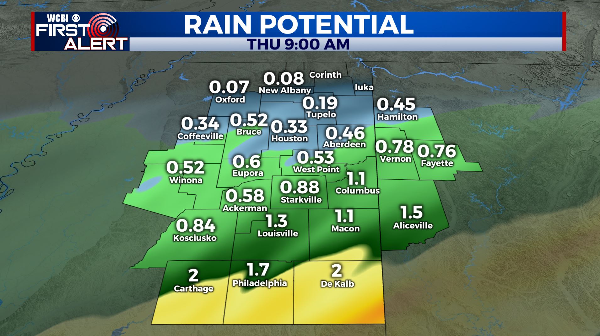
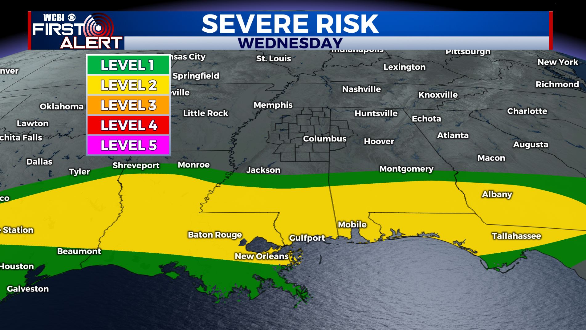
SUMMARY: More rain will move through the region Wednesday into early Thursday. Anywhere from a quarter to 2″ of additional rain will fall. The heavier amounts could lead to more flooding, especially in our southern counties. Some thunder is also possible but odds of severe weather north of I-20 are pretty slim. Lots of sunshine returns Friday and it’ll stick around through the weekend before more rain & storm chances move back in early next week.
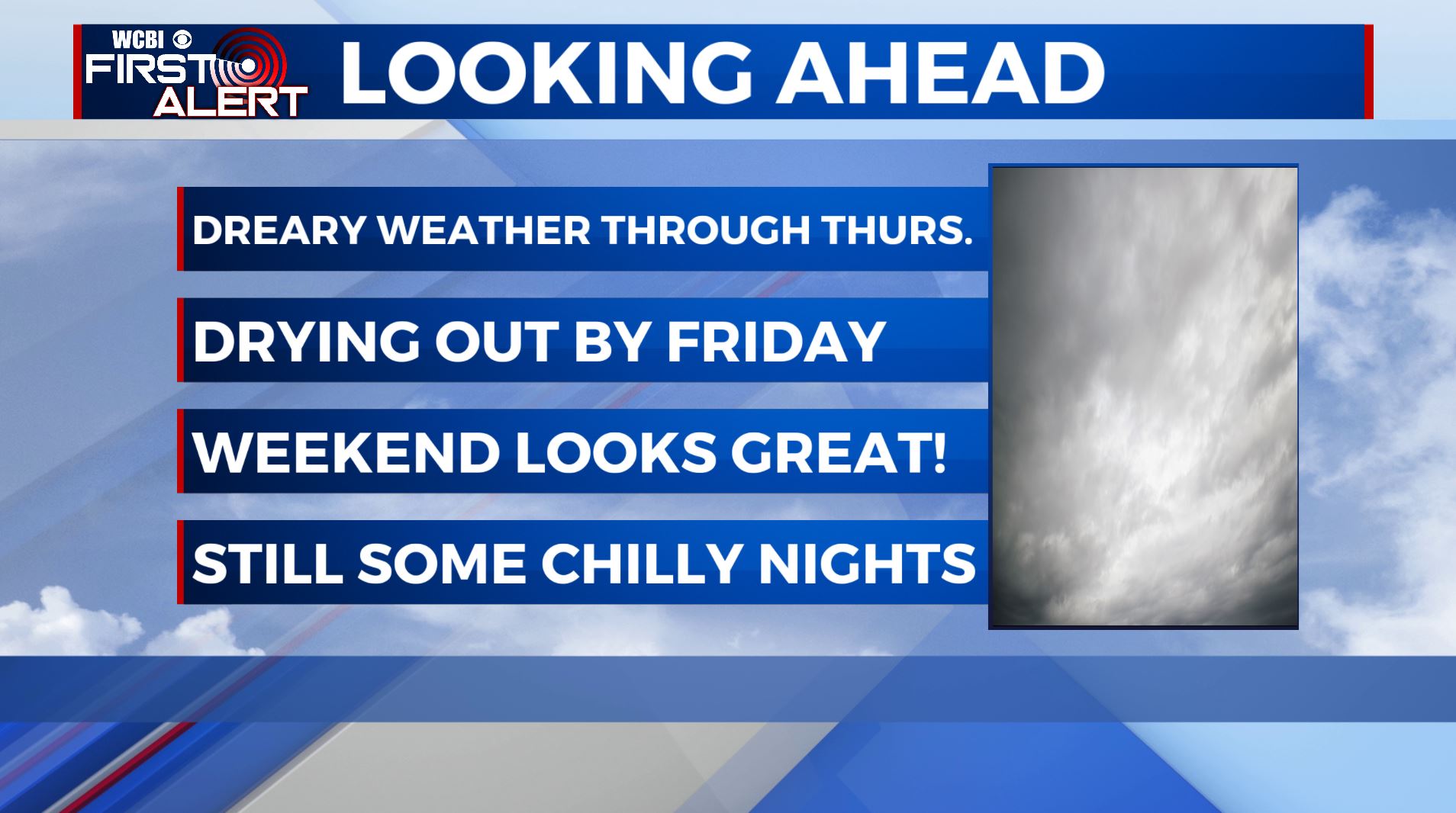
WEDNESDAY: We’ll continue to see widespread chances of rain & thundershowers push through the region as our stationary front settles south of us. Severe weather threat will stay in areas south of I-20 and along the Gulf Coast. Look for temps much cooler in the upper 50s for highs.
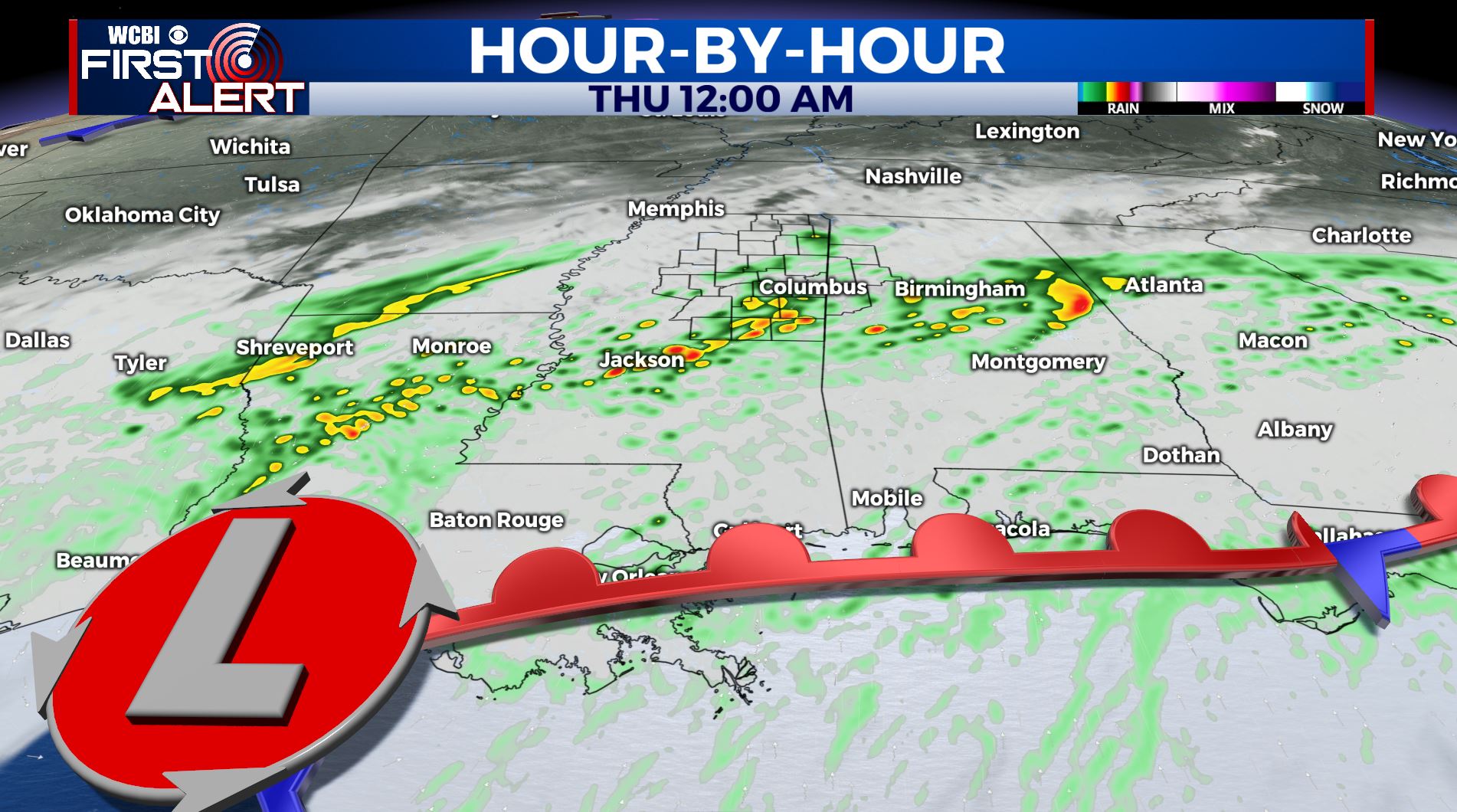
WEDNESDAY NIGHT: Additional rain is likely as an area of low pressure pushes through to our south. Lows in the upper 40s.
THURSDAY: Morning clouds and rain with some clearing during the afternoon. Highs may top out in the low 60s if we skies clear out.
THURSDAY NIGHT: Clear and much cooler as a cold front pushes through. Lows around 40.
FRIDAY: Sunny skies make a return. Highs near 60. Lows in the low 30s Friday night under clear skies.
SATURDAY: A beautiful weekend ahead with lots of sunshine. Highs in the low 60s. Staying clear Saturday night with lows in the mid 30s.
SUNDAY: Mostly sunny skies. Highs in the mid to upper 60s.
MONDAY & TUESDAY: Another round of rain and thunder return to the region. Temperatures moderate back to the upper 60s Monday to near 70 by Tuesday.
Stay connected with @WCBIWEATHER on Facebook, Twitter, Instagram, and the WCBI News App


Leave a Reply