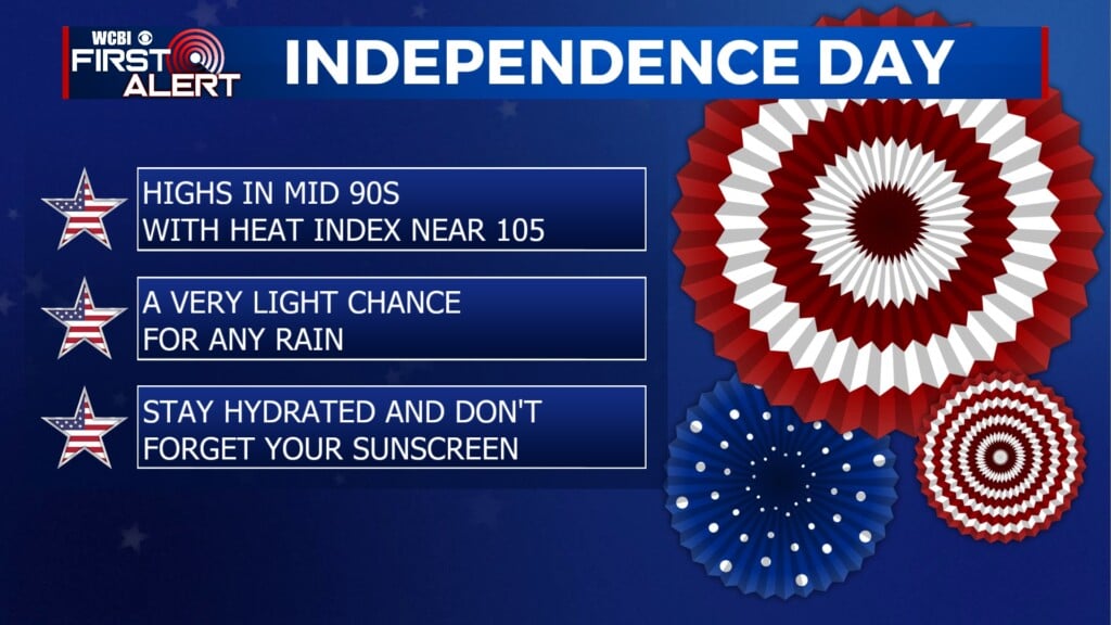
More storms on the horizon
COLUMBUS, Mississippi (WCBI)- Coming off of the weekend with overnight showers and storms Sunday, more are on the way. This is going to be a wet week, so get that rain gear ready!
MONDAY NIGHT: Cloud coverage will clear out but quickly fill back in through the overnight hours. Temperatures tonight are going to be very mild and comfortable. The overnight temperatures will only fall into the middle 40s.
TUESDAY: Heavy cloud coverage is going to be maintaining through our Tuesday. Some may see a few light showers across northern Mississippi, with strong severe showers staying off to the West and NW. Most will stay dry. High temperatures will be warm (others may call it hot), heading into the low to middle 80s. Low temperatures overnight will be mild again in the upper 60s.
REST OF THE WEEK: Rain showers and storms are going to be moving back in. The system with severe showers Tuesday will be moving into northern Mississippi on Wednesday. This is expected to be an all day event. Gusty winds and heavy rain are likely. Hail is possible. There is a low chance for tornadoes, but not zero. High temperatures Wednesday will continue in the in lower 80s. Rain showers and thunderstorms will maintain throughout the end of the week, as temperatures fall back into the 60s. Some sunshine will return again on Sunday, with the temperatures back in the 70s.