Cold Air and Wintry Mix On The Way!
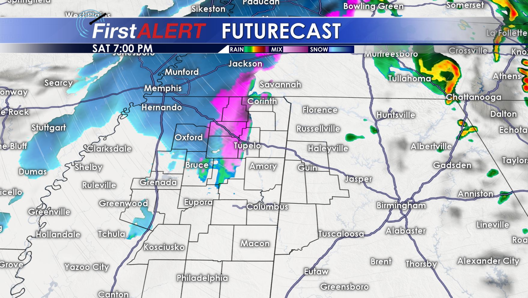
There is the potential for a little wintry mix in our area this evening into tonight. NO accumulation is expected and NO impacts will occur.
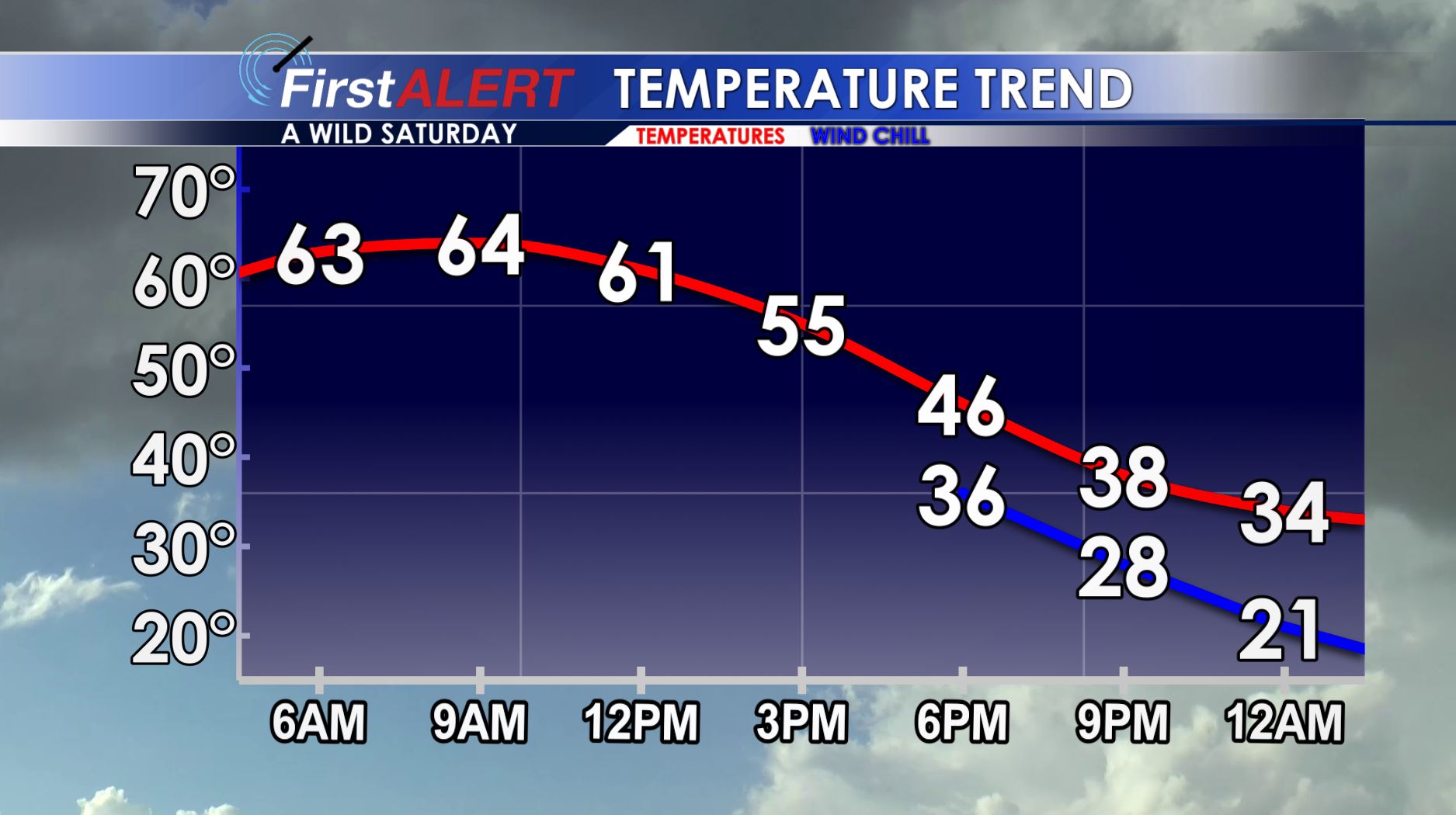
SATURDAY: Saturday Evening into the overnight, bitter cold air and the presence of a bit of leftover moisture may in fact allow for some very light wintry mix to fall, including snow flurries. Right now we do not expect any impacts, but if more moisture is present, there could be some light impacts towards Memphis and in the Mississippi Delta. We also do not expect to see any accumulation. Given the wind, warm temperatures earlier Saturday and drier air pushing in, confidence is high that things will stay tame as far as wintry weather is concerned. Temperatures will fall into the 30s and even 20s in a few spots Saturday Night.
SUNDAY: Decreasing clouds and cold through the day with highs in the mid to upper 30s. Northwest winds at 10-20 mph with gusts as high as 30 mph will keep wind chills in the teens and 20s through the day. Winds calm somewhat overnight under clear skies, allowing temperatures to drop into the teens and 20s.
MLK DAY: Sunny and a bit warmer than Sunday with highs in the mid to upper 40s. Overnight lows in the low to mid 30s.
MID NEXT WEEK: High temperatures into the 40s and 50s Tuesday and Wednesday with another front approaching. Isolated showers possible Tuesday, with more widespread precipitation Wednesday. Temperatures will likely drop through the day Wednesday, with the high temperature coming in the morning hours. Thursday, look for another round of arctic air to come into the region.
FOLLOW @WCBIWEATHER ON FACEBOOK, TWITTER AND INSTAGRAM.


Leave a Reply