Soggy Weekend
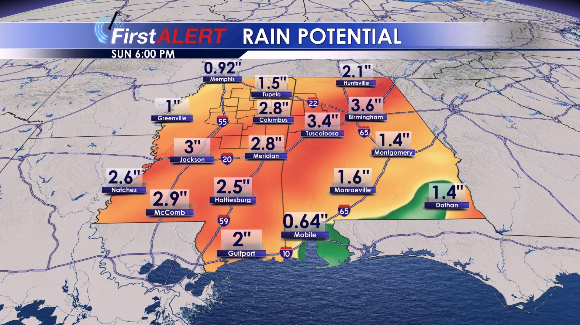
Weekend Rain Potential
FRIDAY NIGHT: Areas of showers and clouds are likely along with much milder lows in the 50s. Southerly winds between 5 and 10 mph continue.
SATURDAY: Widespread rain with a few embedded storms can be expected. Some rain may be heavy and the chance of precipitation is 100%. While we can’t totally rule out a stray strong storm in our neck of the woods the moist unstable air should remain across central and southern Mississippi. That’s where the best risk of any severe weather will likely be but it bears watching. Highs are going to be in the mid 60s.
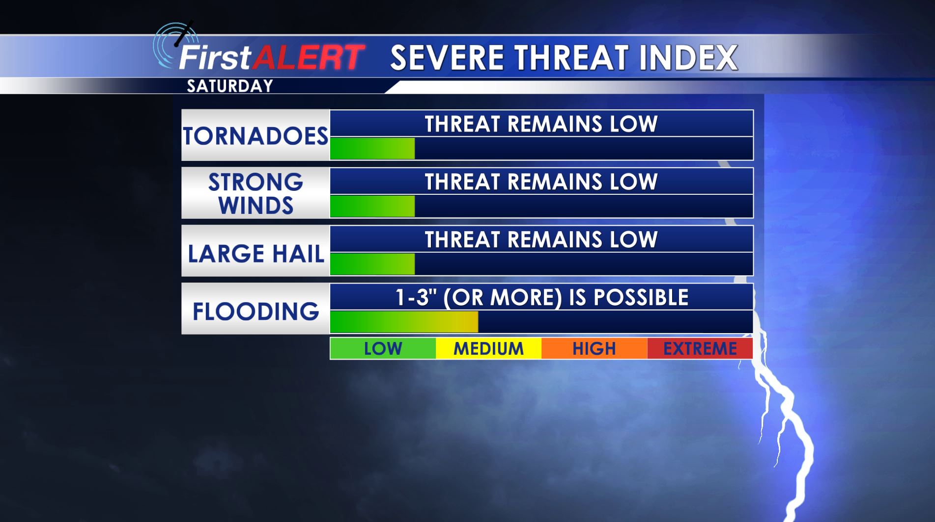
Saturday’s Severe Threat
SUNDAY: Additional rain is on tap along with highs in the 60s. The chance of rain is 70%. Total weekend rainfall between 1″ and 3″+ is possible. A cold front is slated to push through during the afternoon and evening. Out ahead of it there may be just enough unstable air to support a strong storm or two but it’s not a sure bet. It will usher in cooler air for Sunday night and temperatures may fall into the lower 40s. Some spots may even dip into the upper 30s.
MONDAY: A fairly cloudy day is likely along with cooler highs in the lower 50s. Some lingering showers are possible the chance of rain is 20% or less.
TUESDAY: More sun develops and that should boost high temperatures back into the mid 60s.
WEDNESDAY: Highs push back up into the upper 60s under variably cloudy skies. The chance of rain is low at 20%.
THURSDAY: Even milder conditions are possible with forecast highs in the low to mid 70s. Some showers can’t be ruled out but we’re going to keep the rain chance at just 20% for now.
Follow @WCBIWEATHER on Facebook, Twitter, Instagram, and Snapchat


Leave a Reply