A chilly start but a beautiful Thursday is ahead
SUMMARY: It’s a cold start to our Thursday with temperatures in the 20s to the 30s. A sunny and clear blue sky day is ahead for us. A few weak disturbances will pass through the region Thursday night into Friday night but not expecting much. Our next best chance of rain and storms will come Monday through Wednesday. There could be some strong to severe storms Tuesday evening/night into Wednesday.
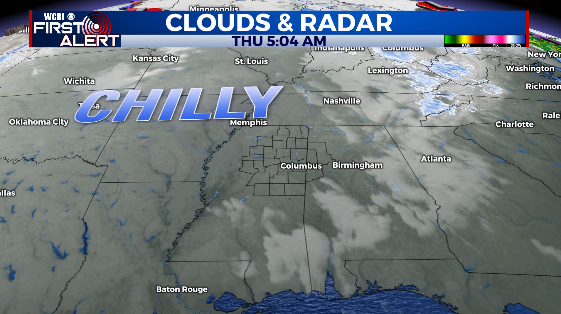
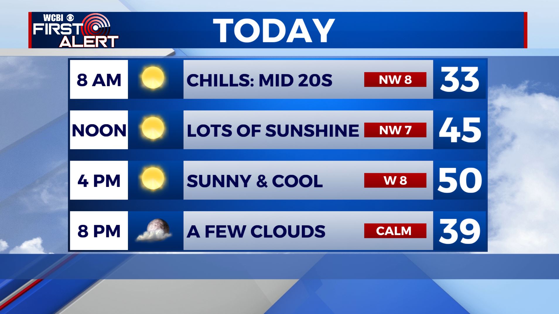
THURSDAY: After a cold start, expect a sunny and cool day. Highs in the upper 40s to near 50. NW Wind 5-10 mph.
THURSDAY NIGHT: Partly cloudy skies as a weak disturbance pushes east of us. Lows near freezing in lower 30s.
FRIDAY: Mostly sunny. Highs in the mid 50s.
FRIDAY NIGHT: Partly to mostly cloudy. A weak system could produce a stray shower or two. Lows in the mid 30s.
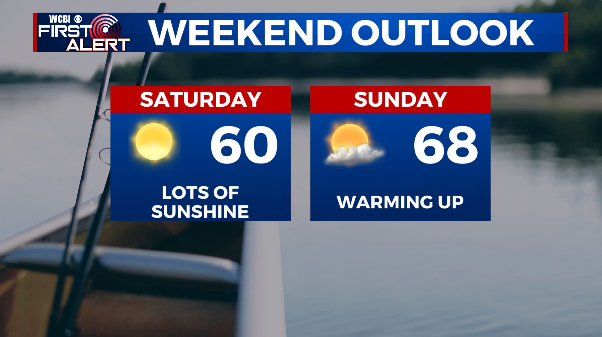
SATURDAY: Lots of sunshine. Highs in the upper 50s to lower 60s.
SATURDAY NIGHT: Mainly clear. Lows near 40.
SUNDAY: A mix of sun & clouds. Highs in the mid to upper 60s.
MONDAY: Mostly cloudy and milder. Highs in the upper 60s to around 70. Areas of showers are possible with the chance of rain.
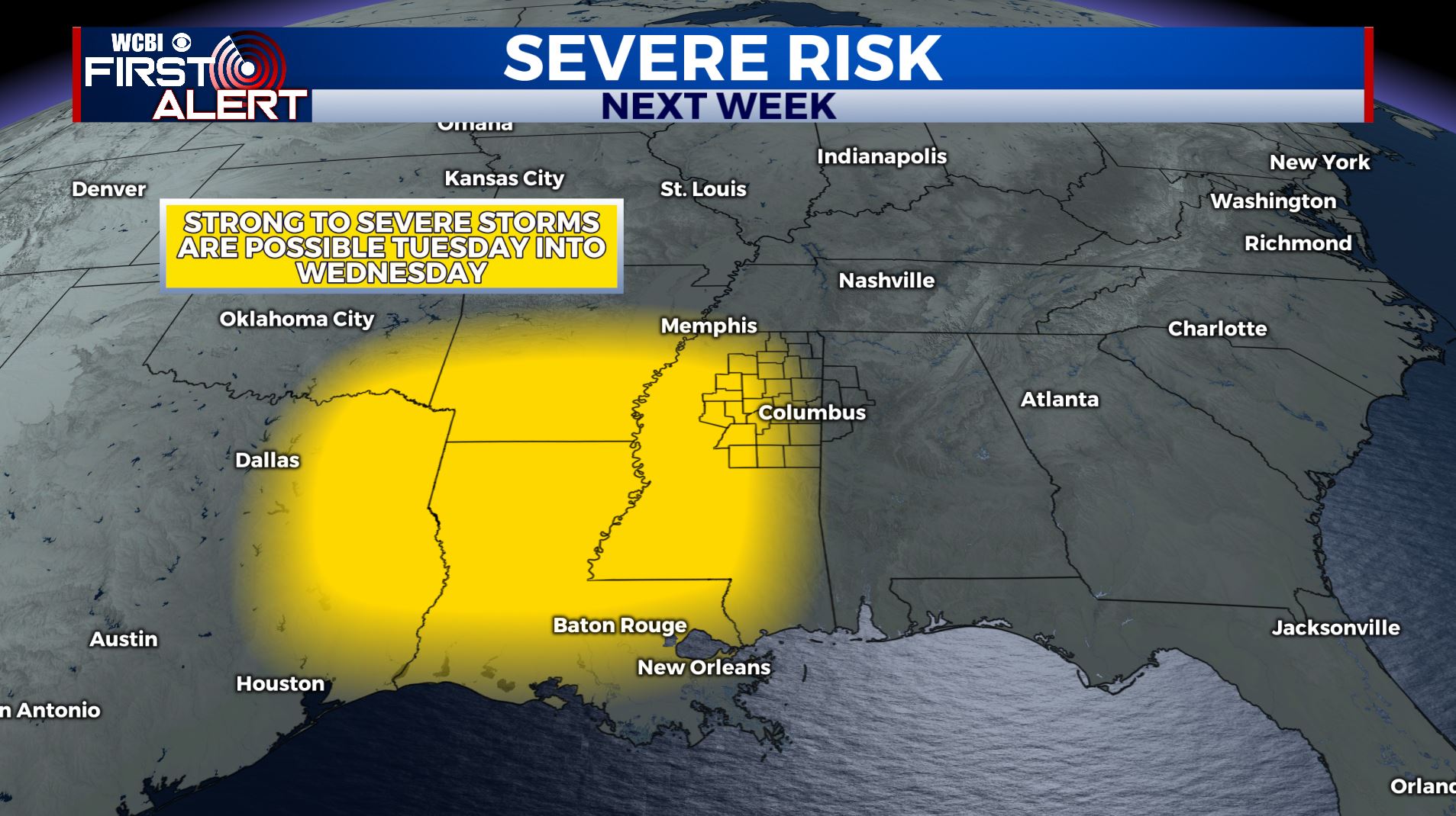
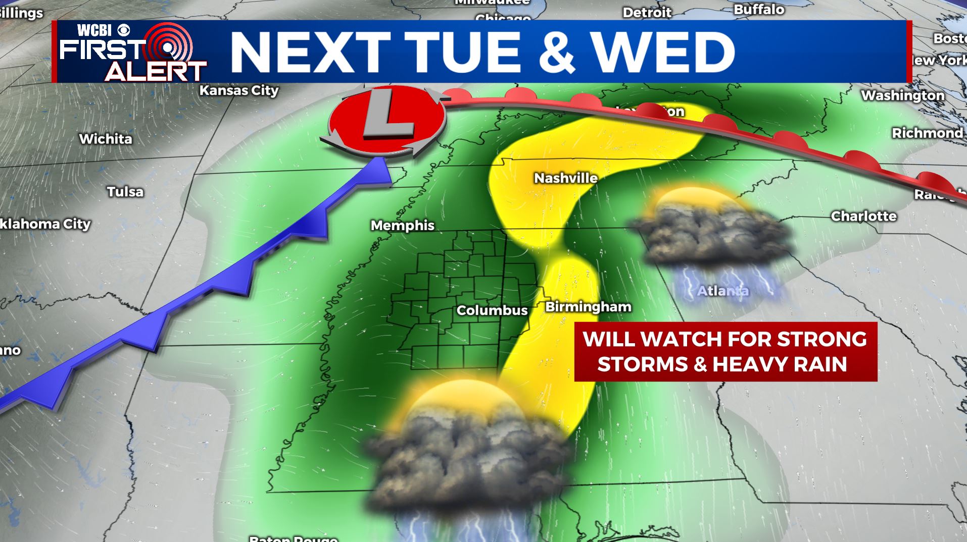
TUESDAY-WEDNESDAY: Rain and storms are possible Tuesday into Wednesday with an upper area of low pressure and cold front passing through. Some strong to severe weather may occur Tuesday evening and night. Stay with us over the coming days as we fine tune timing, and any potential impacts.
Follow @WCBIWEATHER on Facebook, Twitter, Instagram, and the WCBI News App


Leave a Reply