A cloudy & chilly Monday ahead
SUMMARY: It will be a chilly start to the new workweek, but sunshine and the 50s will return by Tuesday and Wednesday. We are going to see another round of rain for late Thursday into Friday followed by another blast of cold air for the weekend.
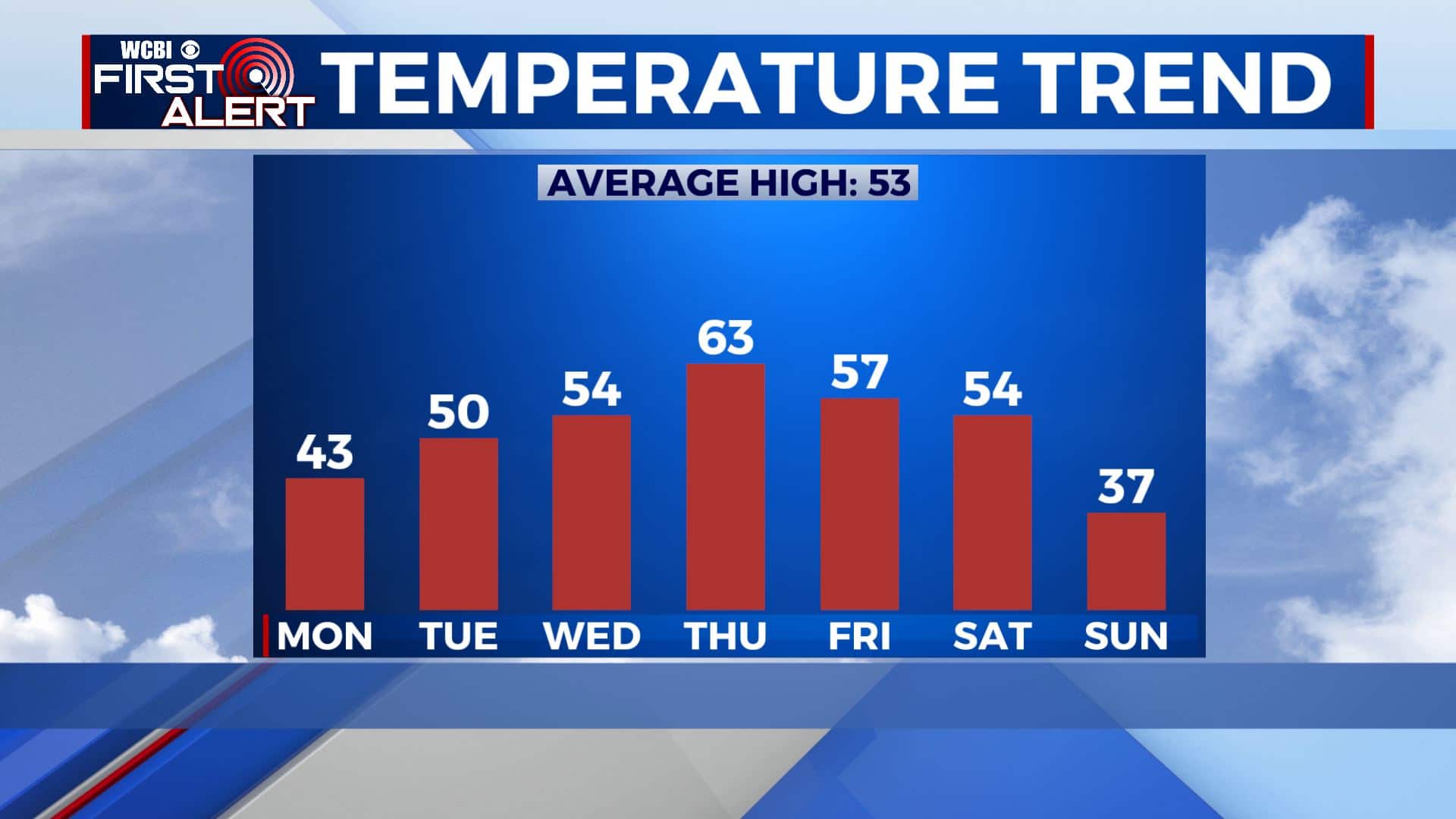
MONDAY: BRRRRRR!!! It’s going to be a gloomy & chilly Monday for us thanks to the cloudy skies and breezy conditions. Winds will be coming out of the NW 10-20, gusting up to 25 mph. Wind chills will make it feel like the 30s, even the 20s out there at times. Highs in the lower 40s.
MONDAY NIGHT: Partly cloudy skies and cold. Overnight lows in the mid to upper 20s. Still a bit breezy with a NW wind 10-15 mph.
TUESDAY: The sunshine returns for mid week allowing temperatures to climb back up to near 50 degrees. NW winds 5-10 mph.
TUESDAY NIGHT: Mostly clear skies and cold. Lows in the upper 20s.
WEDNESDAY: Mostly sunny skies. Highs in the mid 50s.
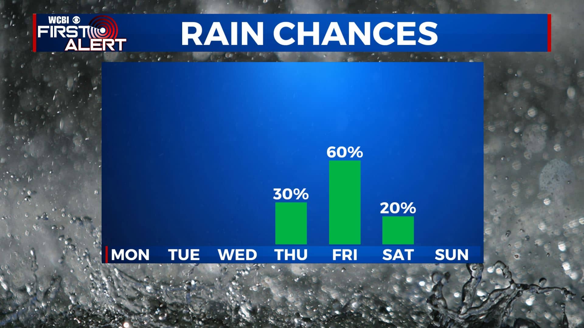
THURSDAY: Clouds will start building back in ahead our next storm system that will start bringing in rain chances by late Thursday. Temperatures mild once again in the lower 60s.
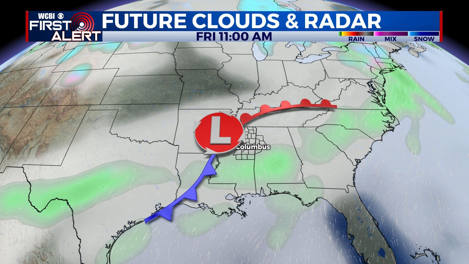
FRIDAY-SATURDAY: Rain is like for our Friday. Rain will be heavy at times. Should be out of the region by early Saturday, leaving us dry going into the weekend. Highs will be back down into the 50s both days.
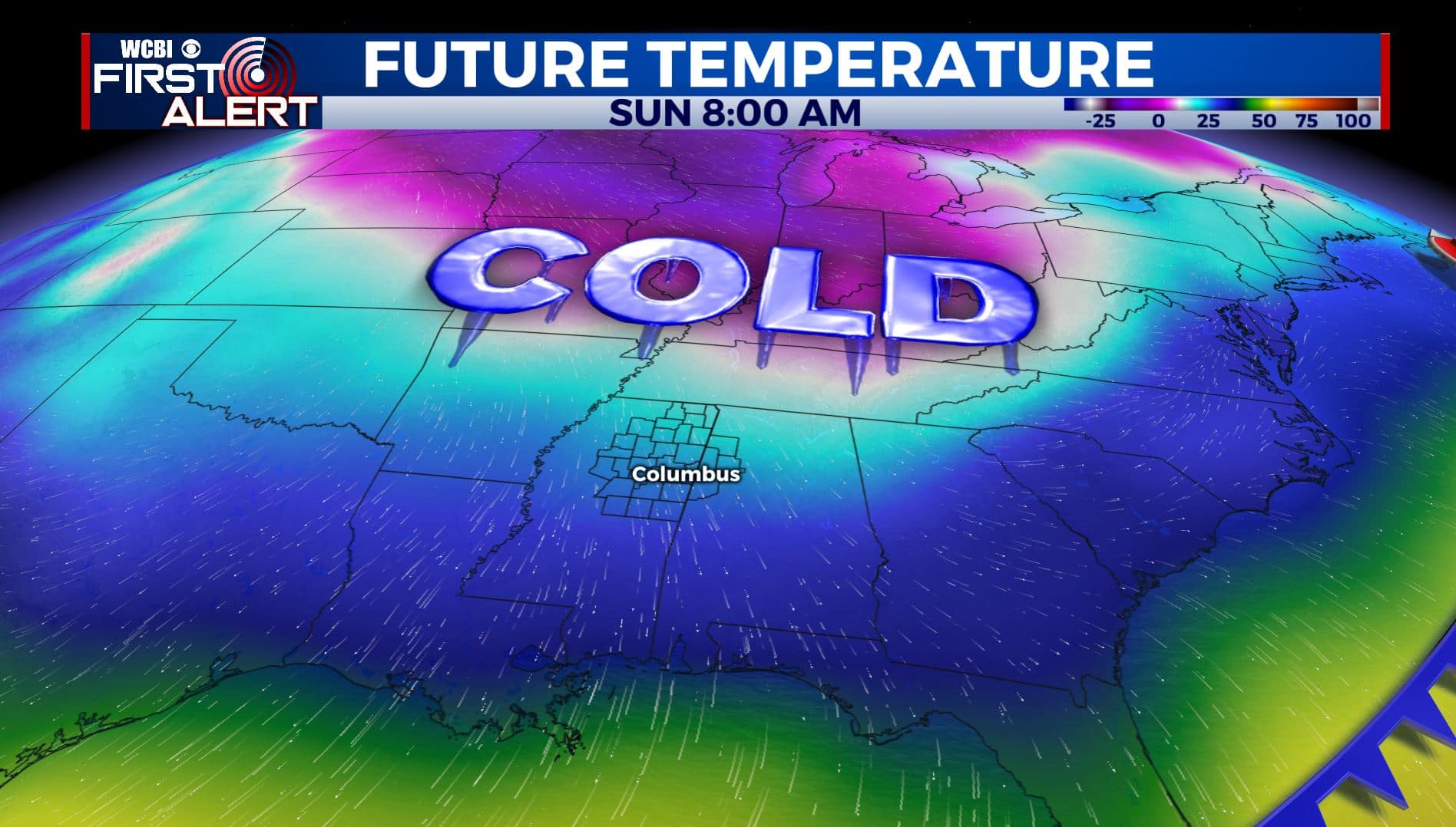
SUNDAY: Another blast of cold air will arrive by Sunday and could last into early next week. High temperatures will likely be in the 30s on Sunday. Stay tuned!
Stay connected with @WCBIWEATHER on Facebook, Twitter, Instagram, and the WCBI News App


Leave a Reply