A cooler but rainy day for Tuesday
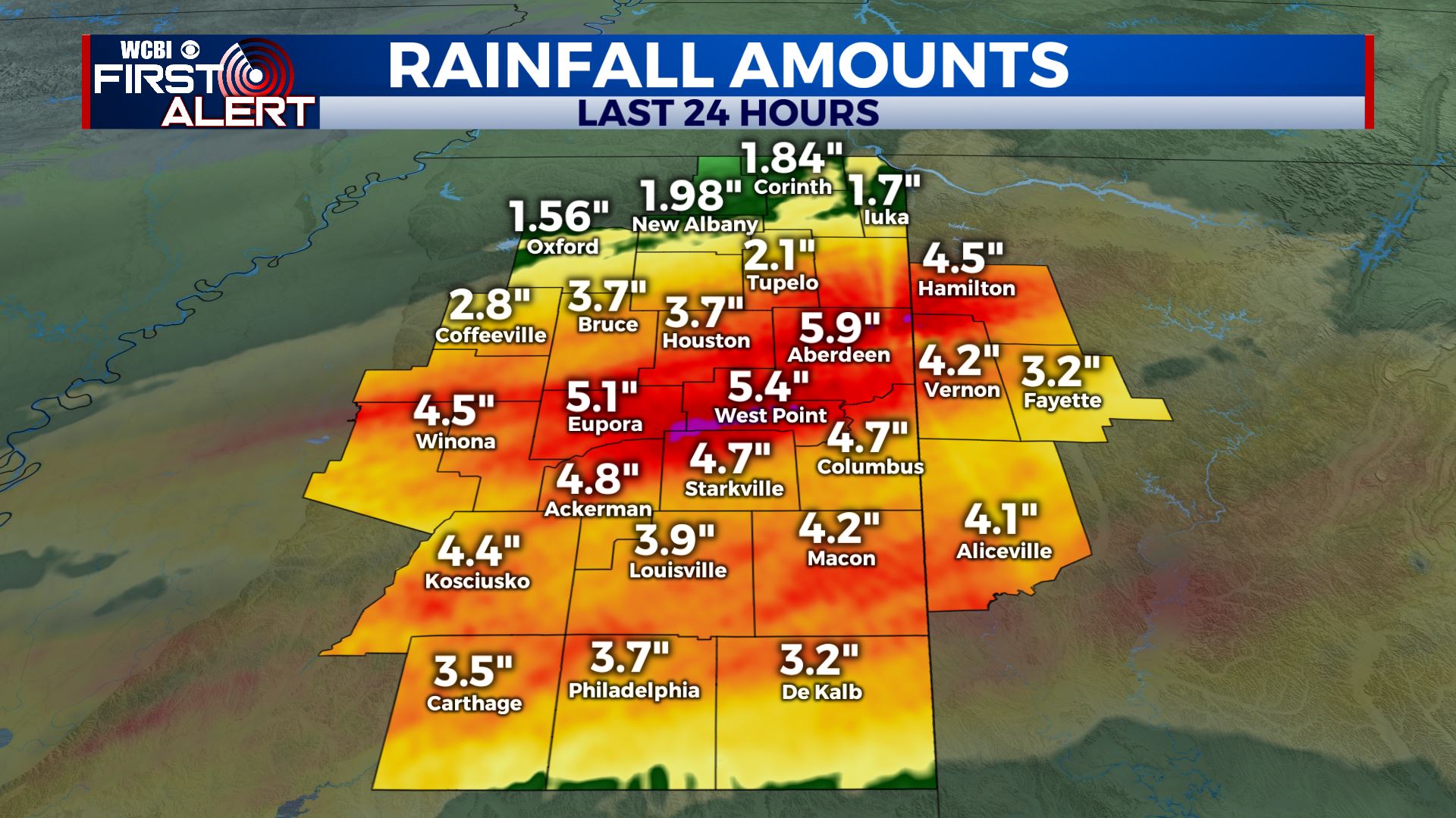
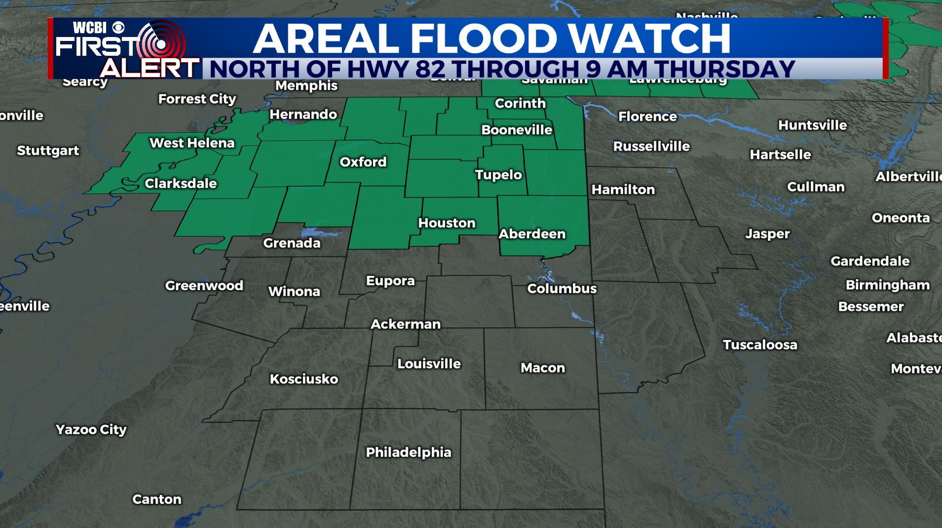
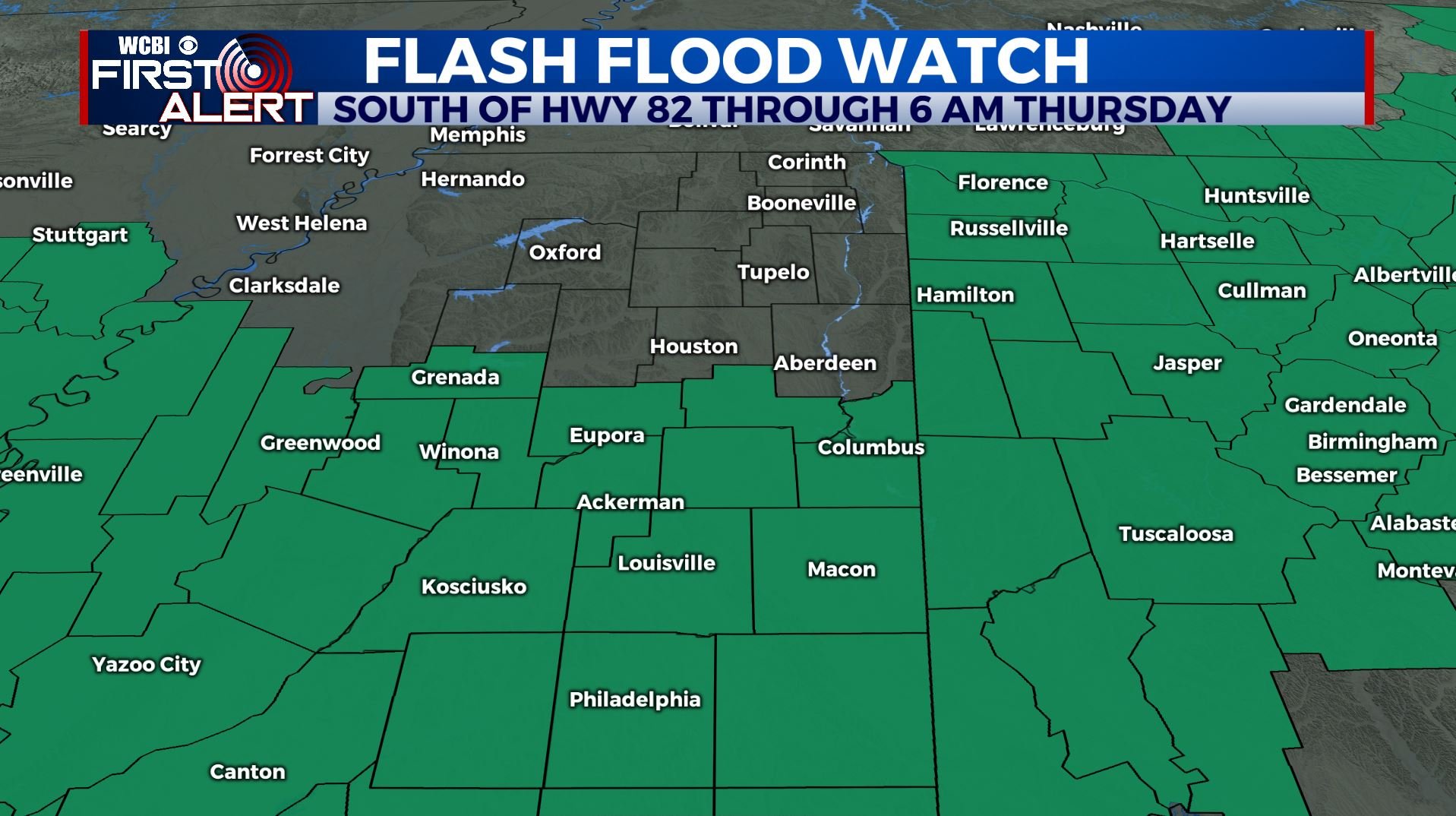
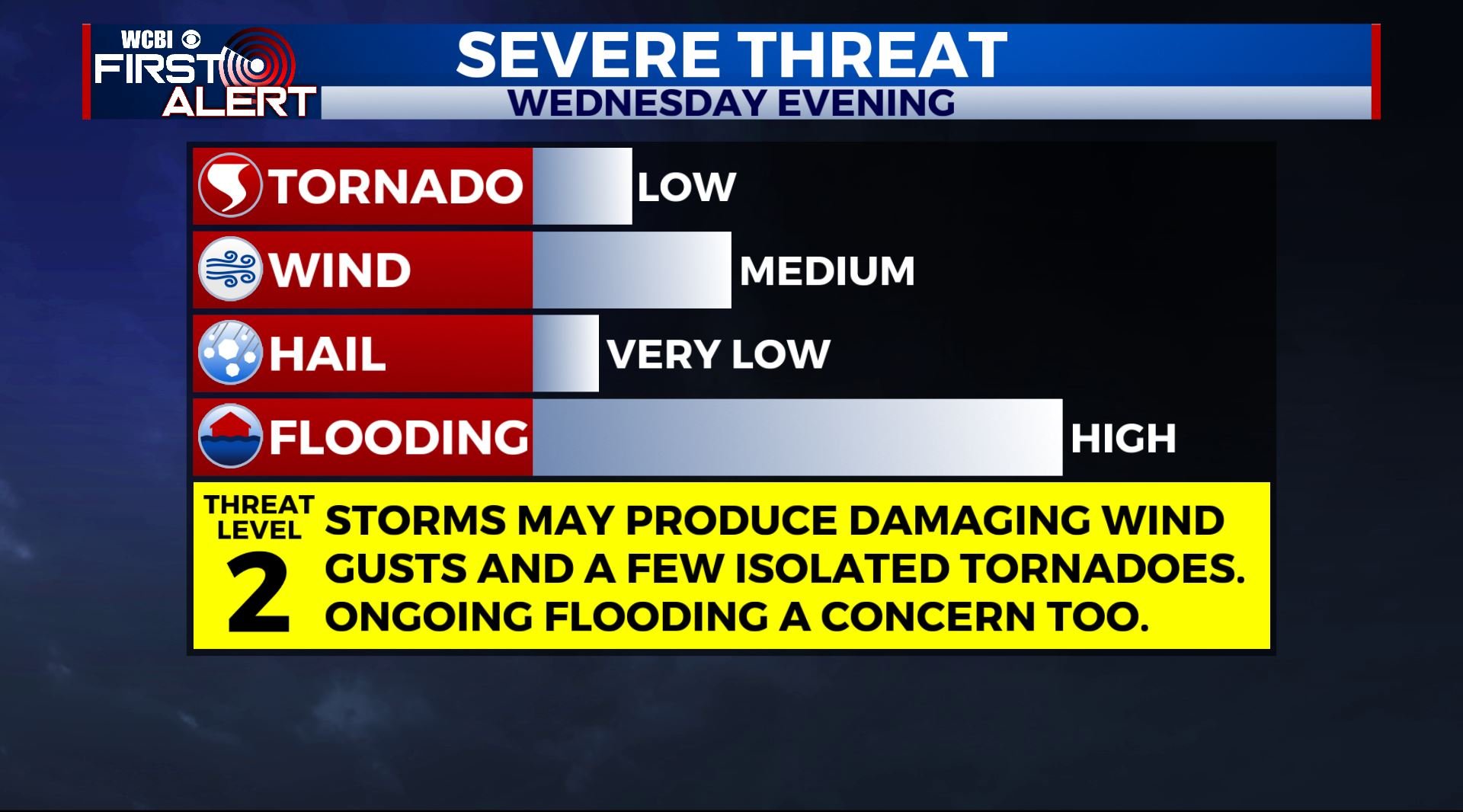
SUMMARY: 3 to almost 6″ of rain has fallen across northern Mississippi & Western Alabama in the last 24 hours and more rain & more flooding concerns are in the forecast. Flash Flood & Areal Flood Watches remain in effect through Thursday morning. An additional 1-2 inches is expected over the next 48 hours. Heavy rain will continue to pose a flooding threat through Wednesday night. Strong to severe storms are possible Wednesday afternoon and evening. Cooler and drier air is slated to return for the end of the week before wet weather returns by Saturday night and Sunday.
TUESDAY: Cloudy and cool with areas of showers and rain as a cold front sinks to our south. The intensity of rain won’t be as high as it was on Monday. Plan on highs mainly in the 50s with NW winds around 10-20 mph.
TUESDAY NIGHT: Cloudy with areas of showers and rain. Lows in the upper 40s to around 50.
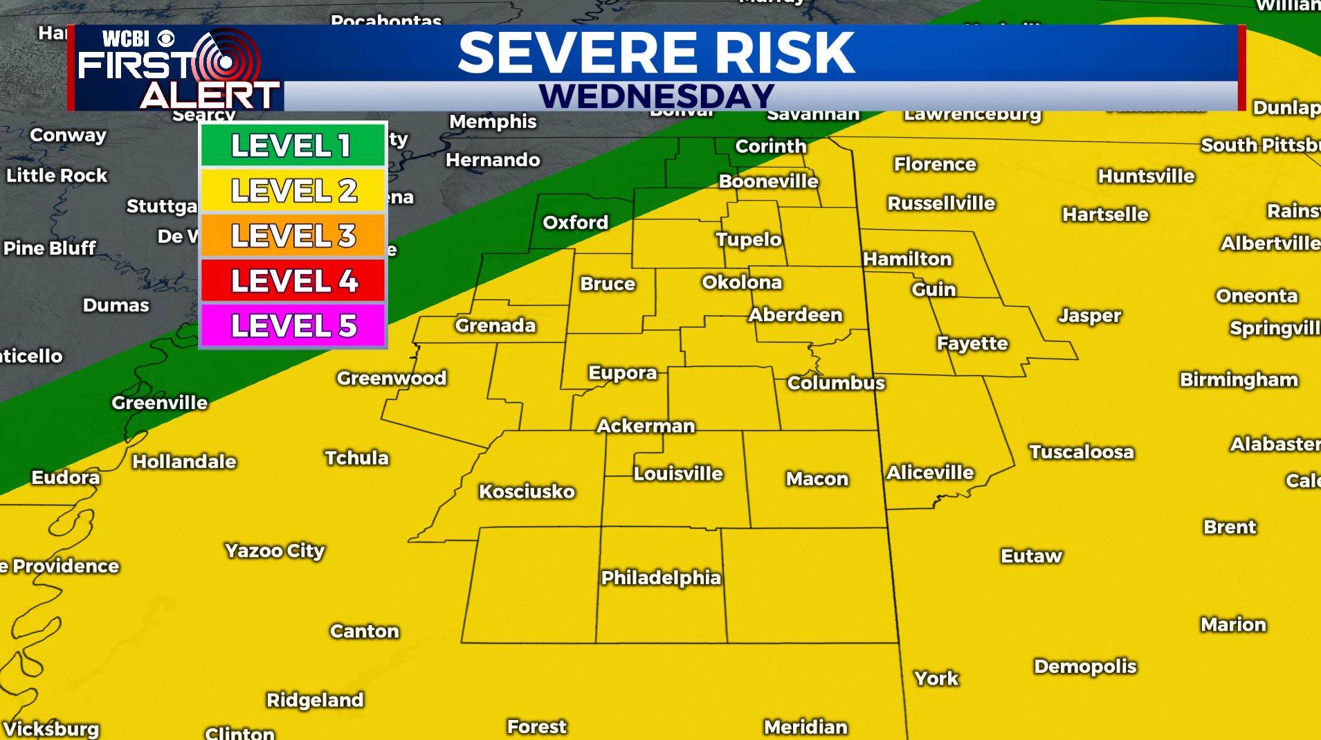
WEDNESDAY: Warmer highs in the 60s to low 70s. The trade off will be a risk for strong to severe storms during the afternoon and evening, including strong wind gusts and even an isolated tornado or two. We’re right now under a Level 2 Risk. We’ll keep monitoring things going forward. SE winds 10-20 mph.
WEDNESDAY NIGHT: Areas of rain and storms. More heavy rain is likely. Lows near 50.
THURSDAY: Morning rain followed by drying. Highs cooler in the low to mid 50s.
THURSDAY NIGHT: Clearing. Much colder lows around 30.
FRIDAY: Sunny and cool. Highs in the upper 40s to around 50.
FRIDAY NIGHT: Clear and chilly. Lows around freezing.
SATURDAY: A nice start with clouds increasing during the afternoon. A few showers are possible late in the evening but most of the day looks dry. Highs in the mid to upper 50.
SUNDAY-MONDAY: Areas of rain and thunder. Highs in the 60s.
Follow @WCBIWEATHER on Facebook, Twitter, Instagram, and the WCBI News App.


Leave a Reply