A few spotty showers & storms still possible for our Thursday
SUMMARY: Thursday looks to have lower rain chances, but scattered afternoon storms still possible. We’ll have drier conditions for your Friday and Saturday, but another disturbance will bring the return of higher rain & storm chances for Sunday into early next week. Highs fairly seasonable in the mid to upper 80s.
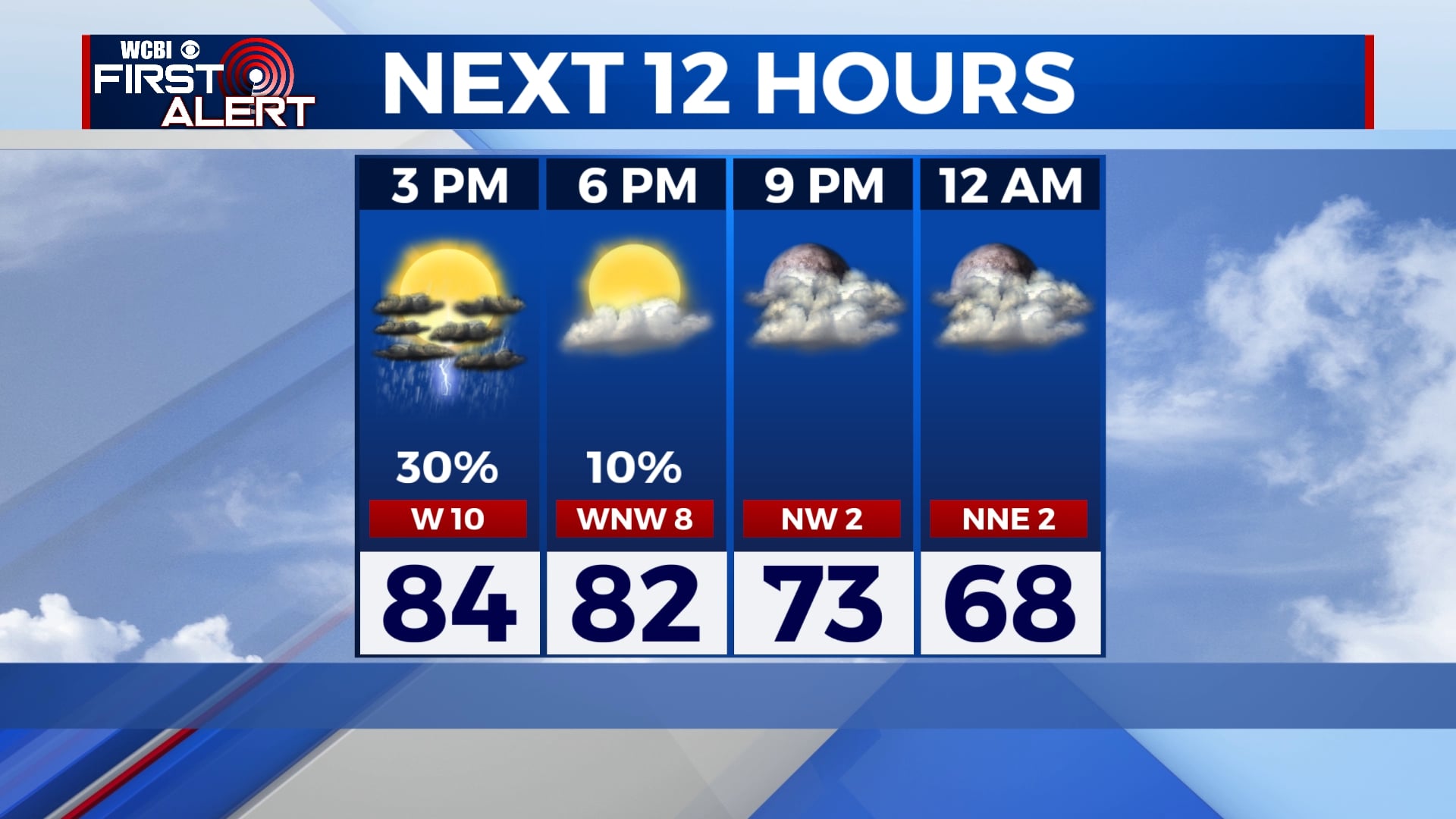
THURSDAY: Expect mostly dry conditions with a mix of sun & clouds this afternoon. Still can’t rule out the chance for a stray shower or storm if we can get enough daytime heating. Highs in the mid-80s.
THURSDAY NIGHT: Storm chances drop off again as we lose the heat of the day. A mild and muggy night in store, with lows in the mid 60s once again.
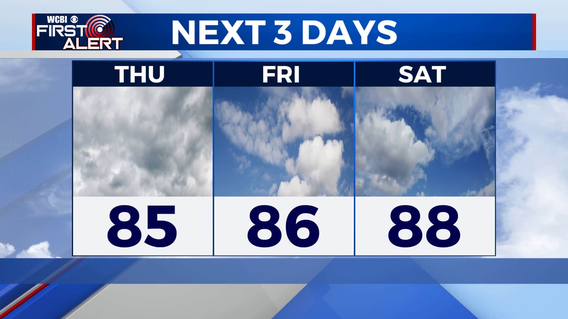
FRIDAY: Much lower rain chances for Friday, most of us should stay dry throughout the day. Expect partly cloudy skies and a high in the upper 80s to around 90. A stray shower or storm is still possible.
WEEKEND: A few storms possible for our Saturday, but another storm system moving in from the southwest will increase our shower and storm chances by Sunday. Highs look to stay in the upper 80s to near 90 degrees.
NEXT WEEK: Lower 80s likely as we start next workweek with widespread showers and storms Monday. Rain chances diminish a bit as we head into the midweek. Temperatures warm back into the mid to upper 80s by Wednesday. Lows remaining steady in the upper 60s.
Stay connected with @WCBIWEATHER on Facebook, Twitter, Instagram, and the WCBI News App.


Leave a Reply