A rainy start but drier & colder weather moving in for Thursday
SUMMARY: We’re dealing with another round of unwelcomed rain this Thursday. Colder and drier air settles in by Thursday afternoon and for the end of the work week. Temperatures will be in the 20s Friday and Saturday morning. The sunshine makes a return for Friday into the start of the weekend. More rain chances do move back in Sunday into early next week.
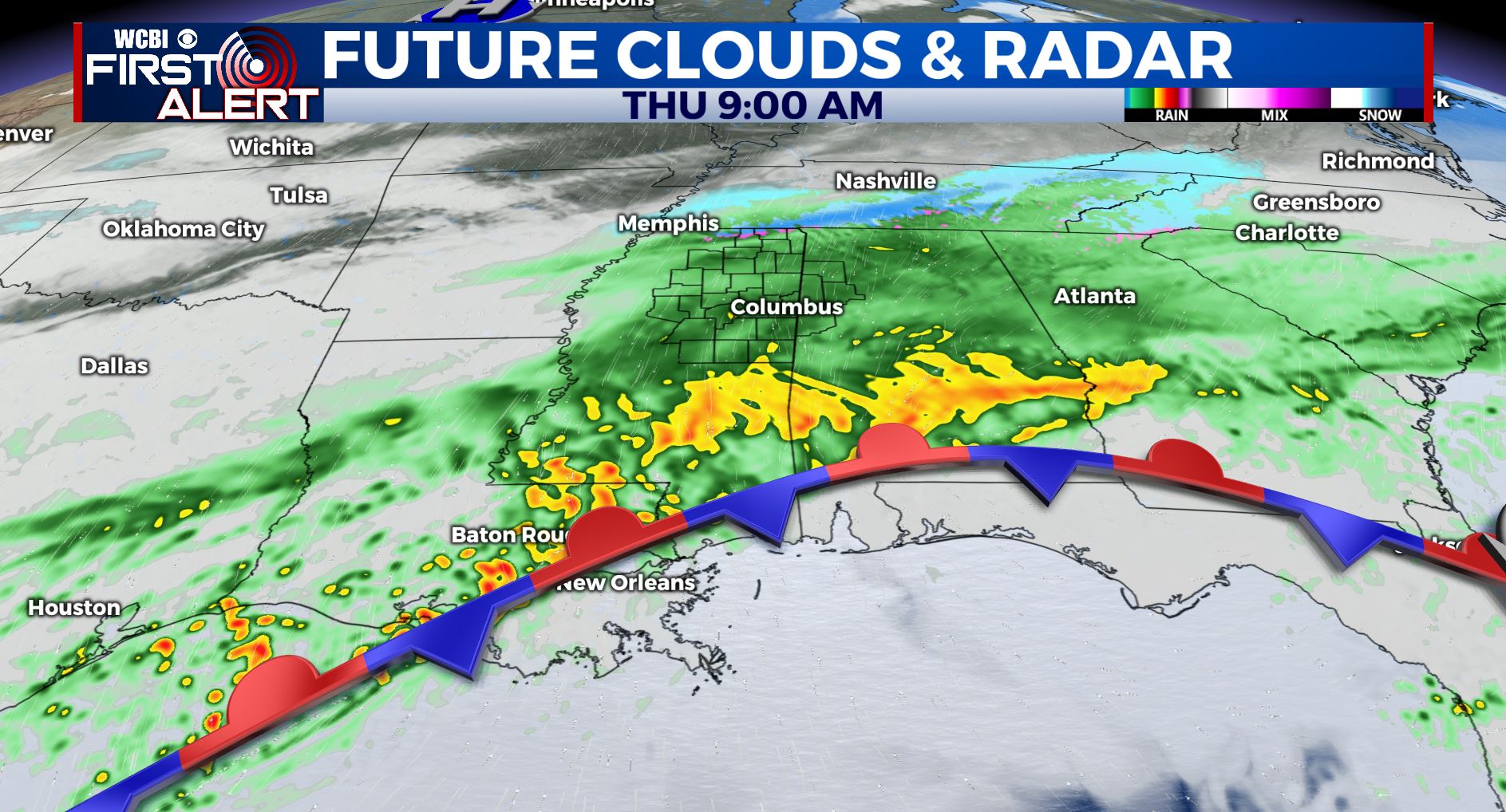
THURSDAY: We are waking up once again to another round of rain this Thursday morning. A few flakes may mix in near the TN border but warm ground temperatures will limit impacts. Highs should top out in the 40s this afternoon with a breezy N wind at 10-20 mph, gusting up to 25 as colder & drier air moves in.
THURSDAY NIGHT: Skies clear up. Breezy as much colder air pushes in. Actual temperatures fall into the mid to upper 20s with wind chill values tumbling into the teens and low 20s. Winter gear will be a must once again by Friday morning.
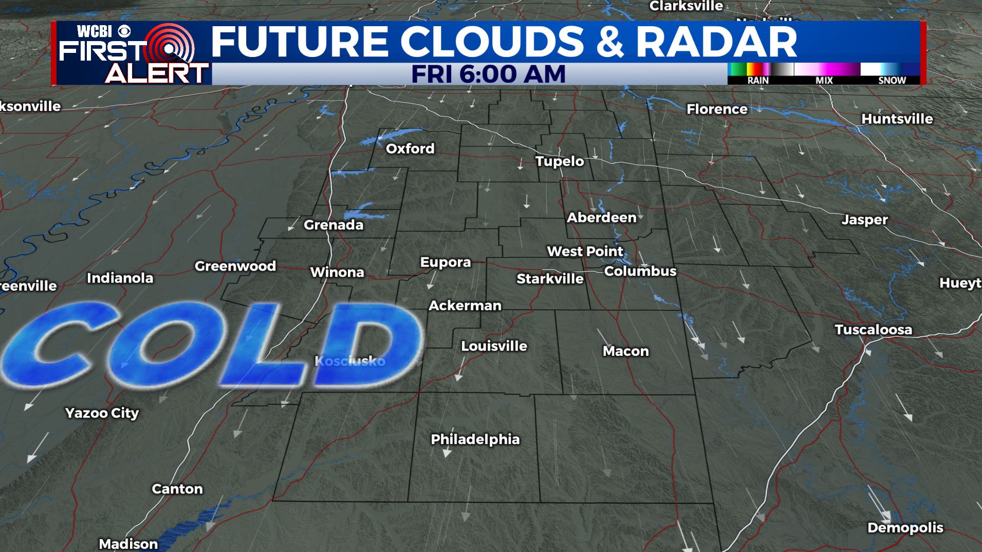
FRIDAY: Sunshine returns and drier weather. Highs below average & cool in the mid to upper 40s. A northerly breeze will keep a winter chill going all day long.
FRIDAY NIGHT: Clear and cold. Lows in the lower mid 20s.
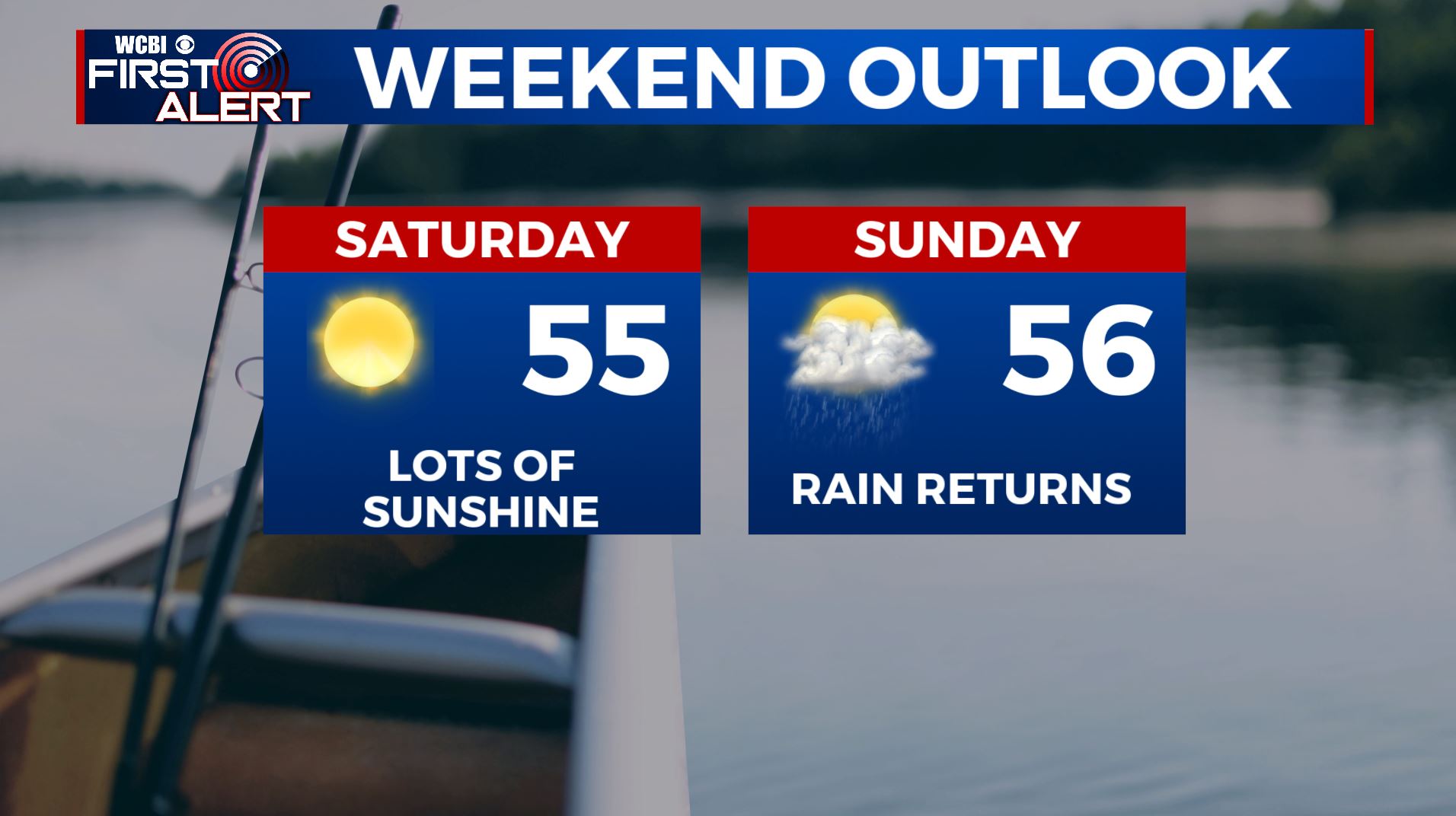
SATURDAY: Sunny. Highs in the mid 50s.
SATURDAY NIGHT: Partly cloudy. Lows in the mid 30s.
SUNDAY: Clouds increase. Afternoon and evening showers are possible. Highs in the low 50s.
SUNDAY NIGHT: Areas of showers. Lows in the mid to upper 40s.
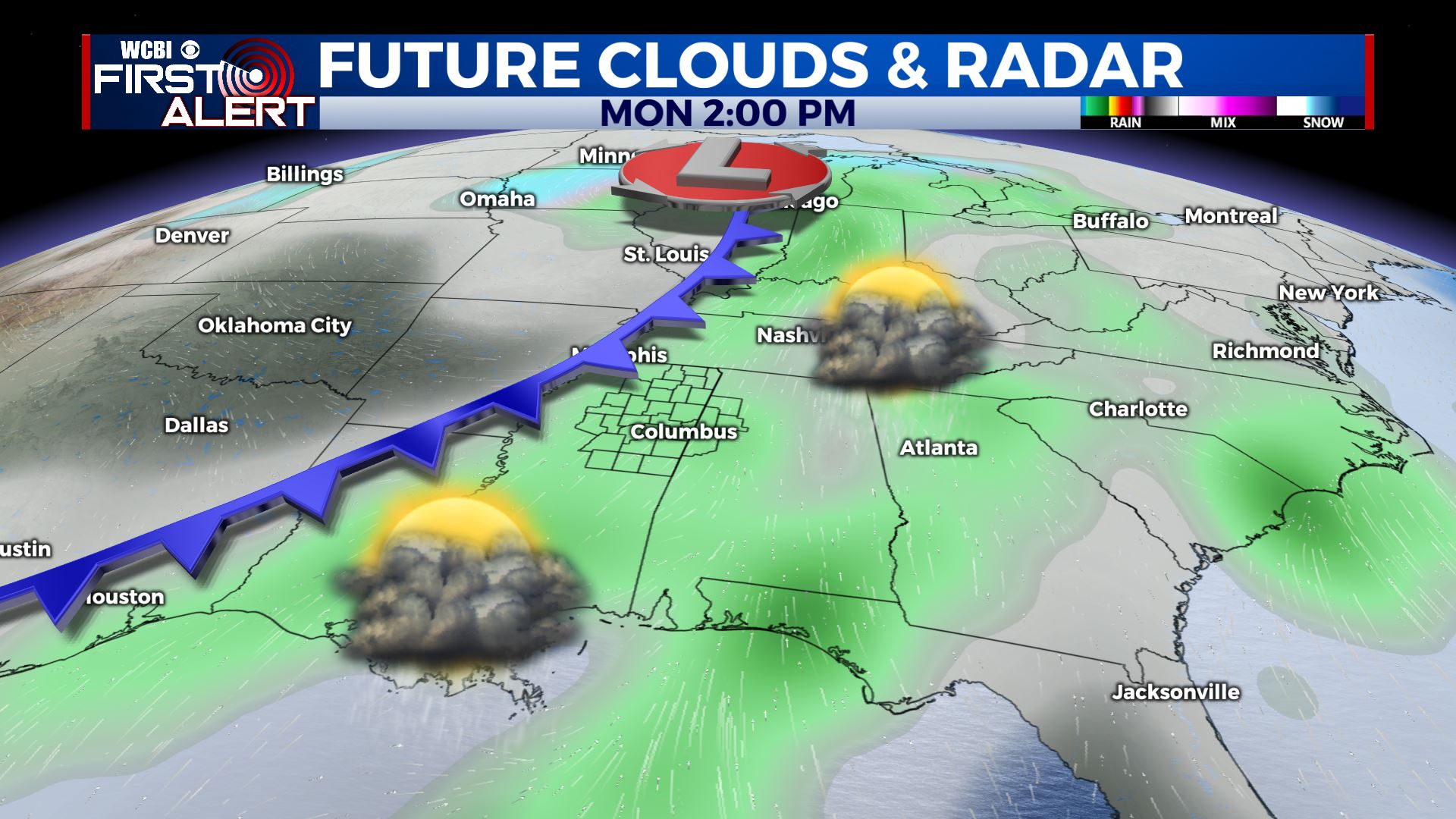
MONDAY: Rain & storms likely. It’s still uncertain if there will be any strong to severe storm activity but we’re going to closely watch the setup since it can’t be ruled out just yet. Highs in the upper 60s to around 70.
TUESDAY: Sun & clouds. Highs around 60.
WEDNESDAY: Mostly cloudy and colder. Highs in the 40s.
Follow @WCBIWEATHER on Facebook, Twitter, Instagram, and the WCBI News App


Leave a Reply