A really nice & pleasant day ahead for your Wednesday
SUMMARY: The middle part of the workweek will be amazing for early August with mostly sunny skies and cooler, less humid conditions. The summer heat and humidity will make a comeback by the weekend. We’ll be staying pretty dry over the next week or so, still can’t rule out the chance of an afternoon stray summertime shower or storm. 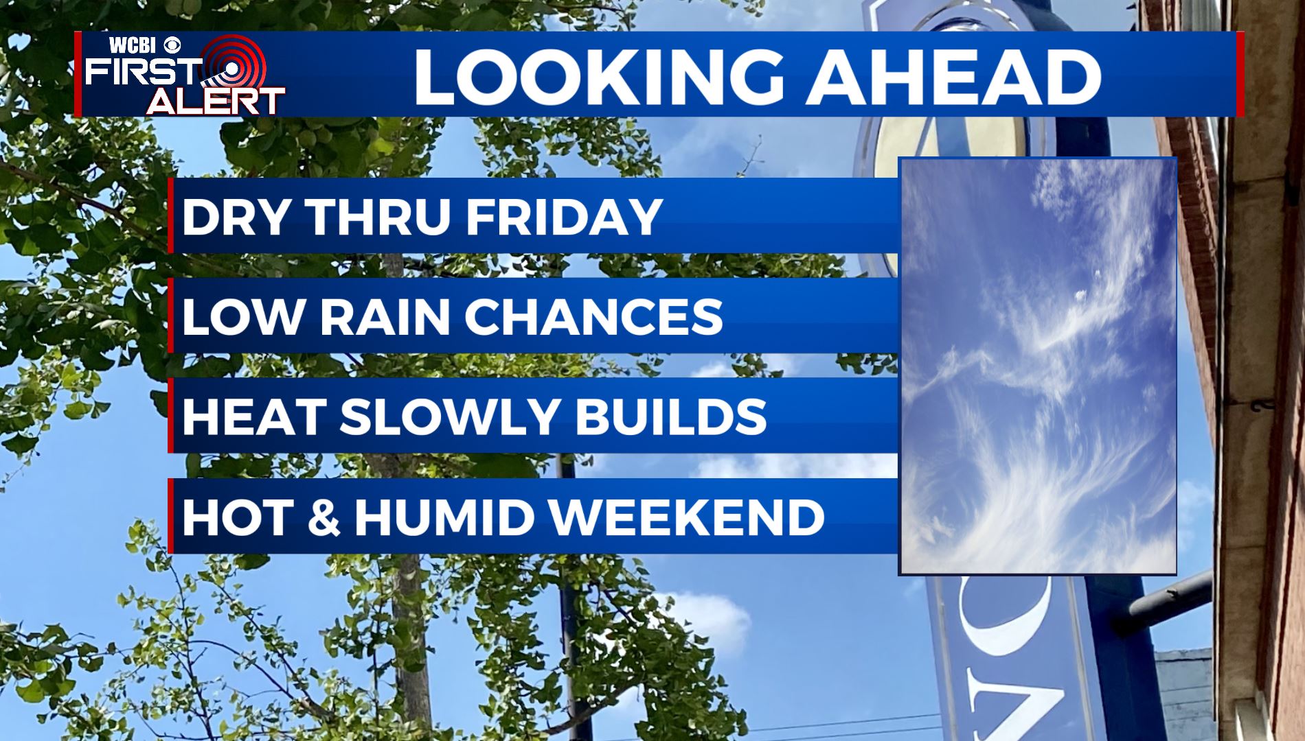 WEDNESDAY: After a quiet, comfortable start in the 60s, we’ll have mostly sunny skies for your Wednesday. We’ll have some haze in the sky due to western wildfires that will bring us beautiful colorful sunrises & sunsets. North winds 5-10 mph will keep us nice & pleasant in the mid to upper 80s. Enjoy!
 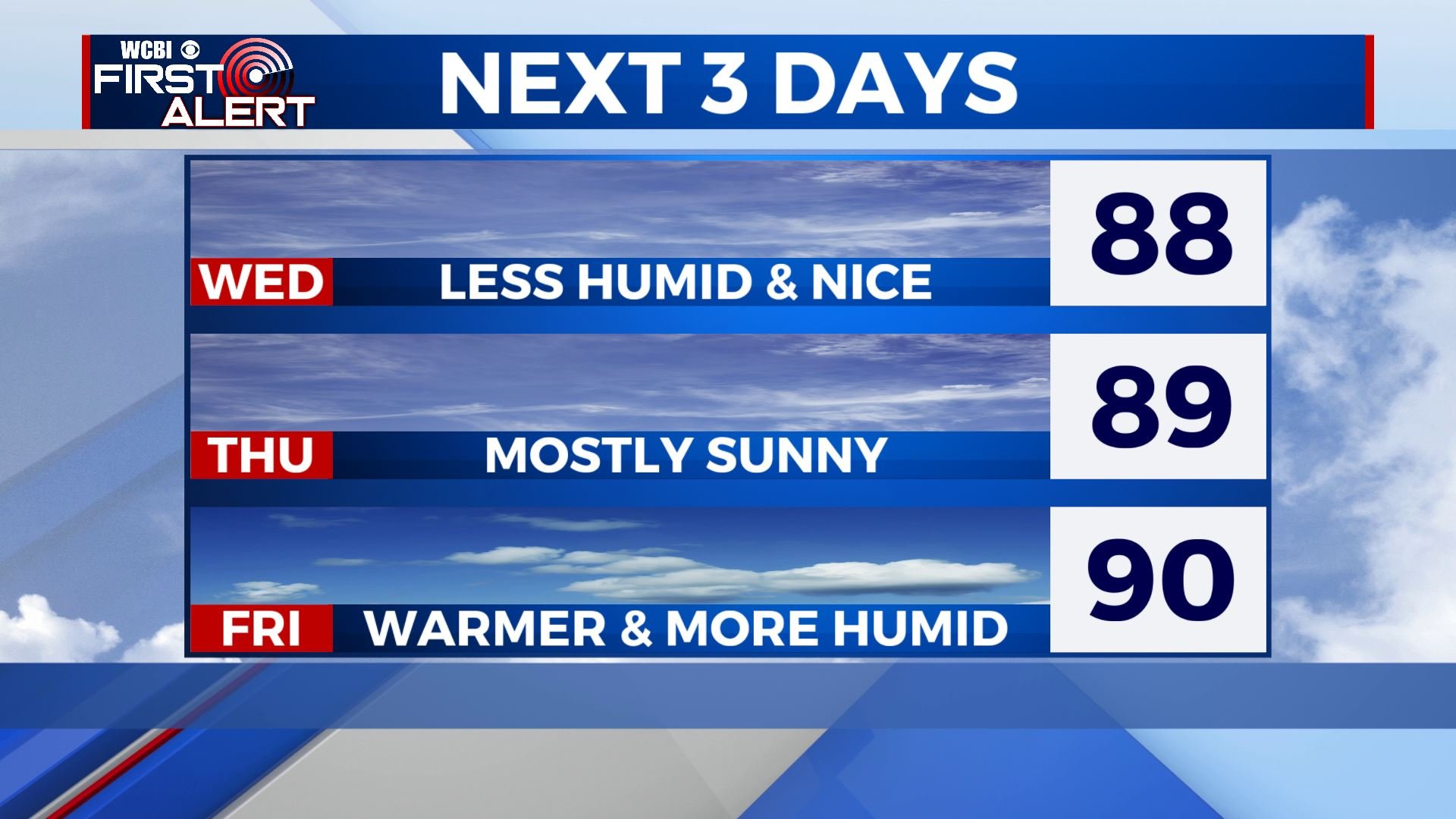 WEDNESDAY NIGHT: Another very pleasant and comfortable night in store, with overnight lows in the mid 60s under mostly clear skies once again. Calm winds. THURSDAY: A bit warmer for Thursday, highs top out in the upper 80s to near 90. Skies remain mostly sunny with dry air in place. FRIDAY – WEEKEND: A mix of sun and clouds with a stray shower or pop-up storm possible in the afternoon. The summer heat and the humidity makes a comeback. Highs in the lower to mid 90s. Overnight lows in the 70s. EARLY NEXT WEEK: Monday and Tuesday continue to heat up with highs in the mid 90s. A mix of sun and clouds. Stray storms are again possible in the afternoon. Overnight lows mild & muggy in the mid 70s . TROPICS: NOAA just released their mid-season Hurricane Outlook and they are still calling for an above-average Atlantic season as we are now heading into the more active months of it.
 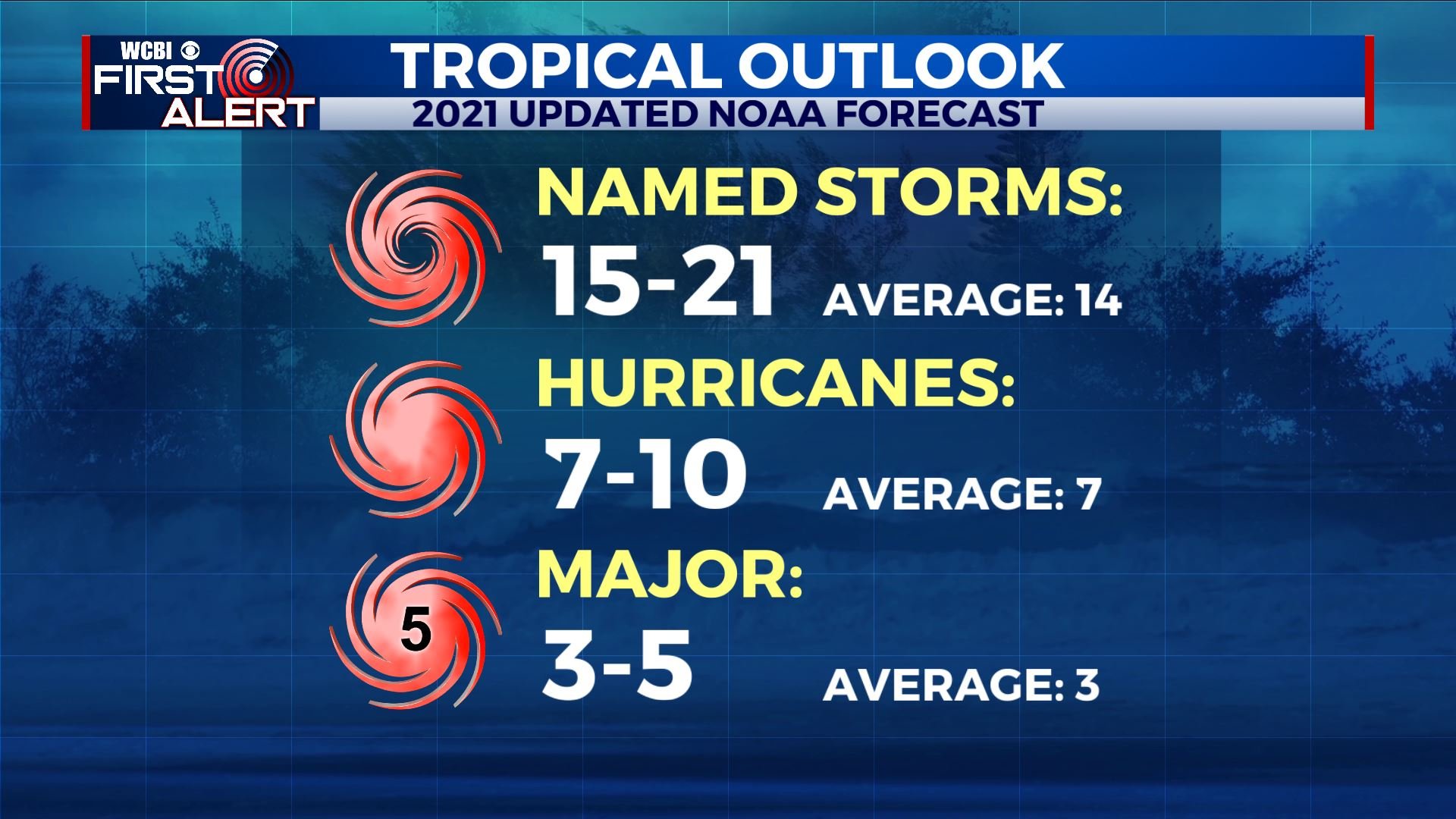 Stay connected with @WCBIWEATHER on Facebook, Twitter, Instagram, and the WCBI News App


Leave a Reply