A very warm end to the workweek
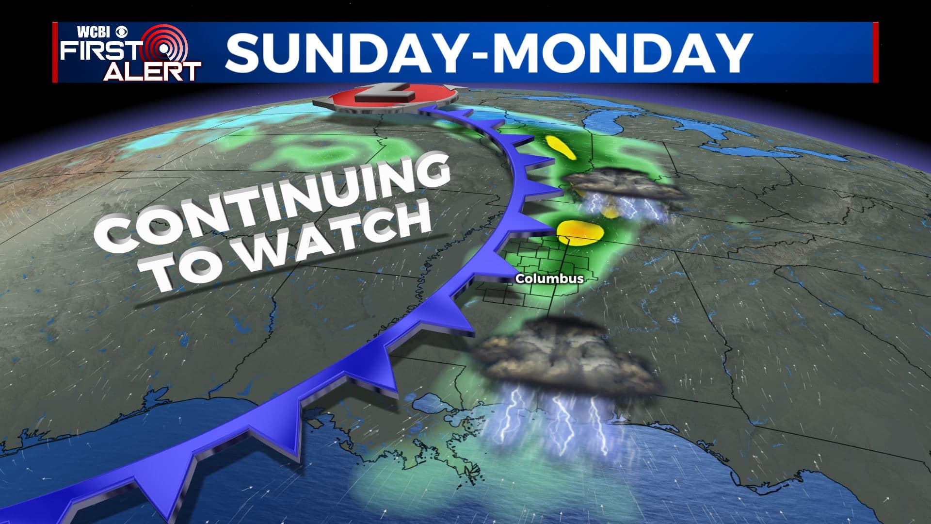
SUMMARY: The warm. above average temperatures will hang around through the weekend into early next week. It’ll remain breezy at times as well. While a shower is possible on Saturday, the next chance of any heavy rain or strong storm activity will wait until late Sunday or Monday. Still uncertain on the exact threats, but it’s something we’ll continue to watch. Stay tuned! Don’t forget to Spring Forward one hour late Saturday night/early Sunday morning. Daylight Saving Time begins 2 am Sunday.
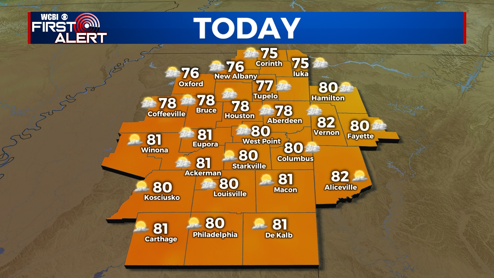
THURSDAY: A mix of clouds & sun once again. Highs in the upper 70s to even near 80 degrees by this afternoon. The breezy southerly winds will once again help with the big warm up with our temperatures at 10-20 mph with higher gusts possible.
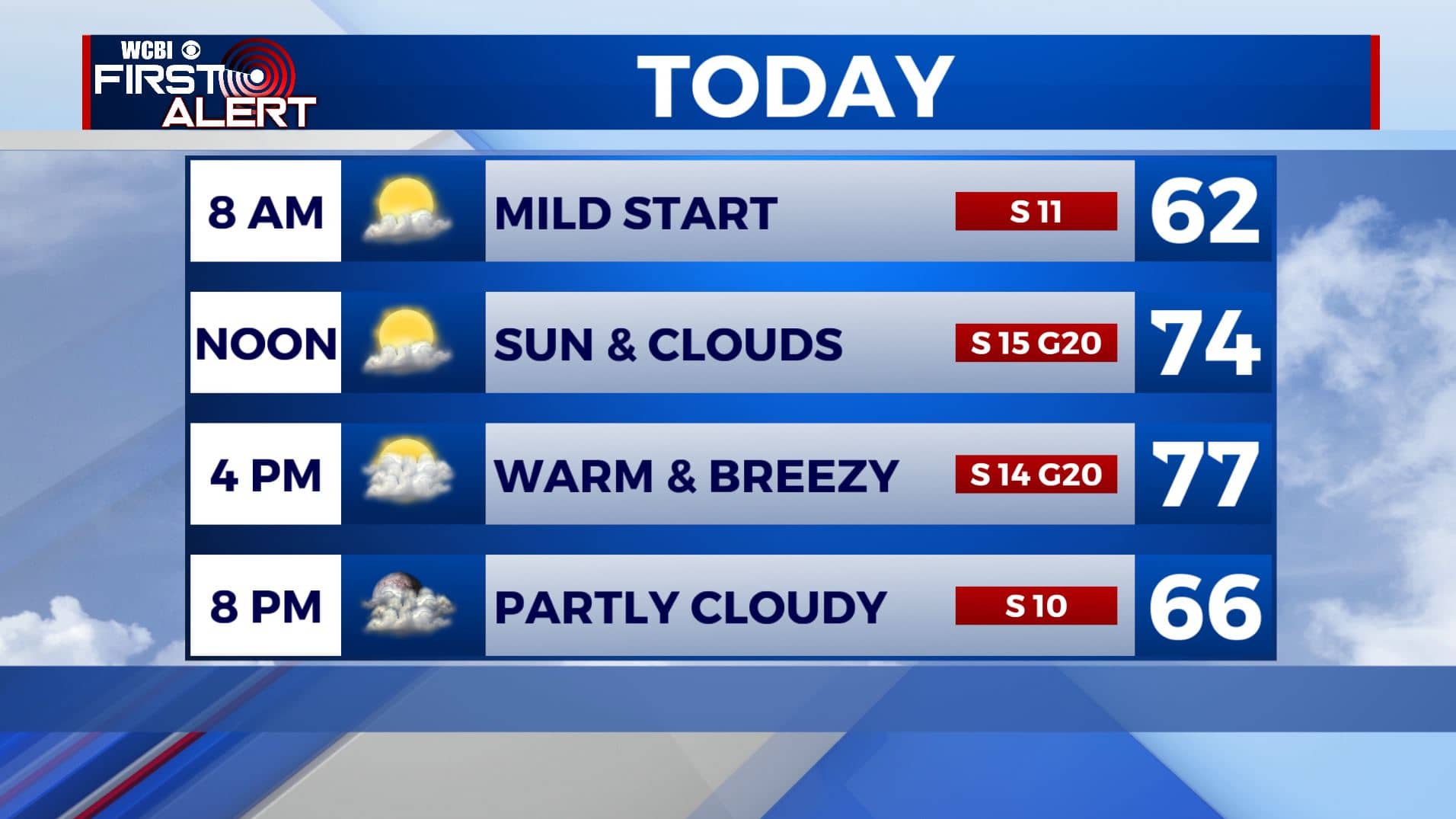
THURSDAY NIGHT: Clouds will increase. Mild overnight lows in the mid 50s. Winds will start dying down to the south at 5-10 mph.
FRIDAY: Cloudy skies for the end of the week on Friday with a few peeks of sunshine. Highs in the upper 70s to near 80 degrees once again. South winds 5-10 mph.
FRIDAY NIGHT: Mostly cloudy skies. Mild overnight lows continue in the upper 50s.
SATURDAY: Some showers are possible on Saturday with cloudy skies . Highs will be near 80 degrees with overnight lows in the 50s.
SUNDAY & MONDAY: An area of low pressure and cold front is expected to cross our area at some point. A batch of strong to severe storms is still possible but not a sure bet at this point. We’ll keep on watching how things evolve during the coming days. Highs in the mid to upper 70s with lows in the 50s.
MIDWEEK: We’ll have a mix of sun & clouds with a chance of a few isolated showers on Tuesday before we see better chances of showers & some storms again on Wednesday. Highs in the lower to mid 70s.
Stay connected with @WCBIWEATHER on Facebook, Twitter, Instagram, and the WCBI News App


Leave a Reply