A warm and sunny Thursday before rain chances return
SUMMARY: Who’s ready for the 70s? For early December, we’ll take this and the sunshine. Enjoy this while you can because rain chances will return for our Friday and into the weekend. It appears that we will be drier and cooler early next week.
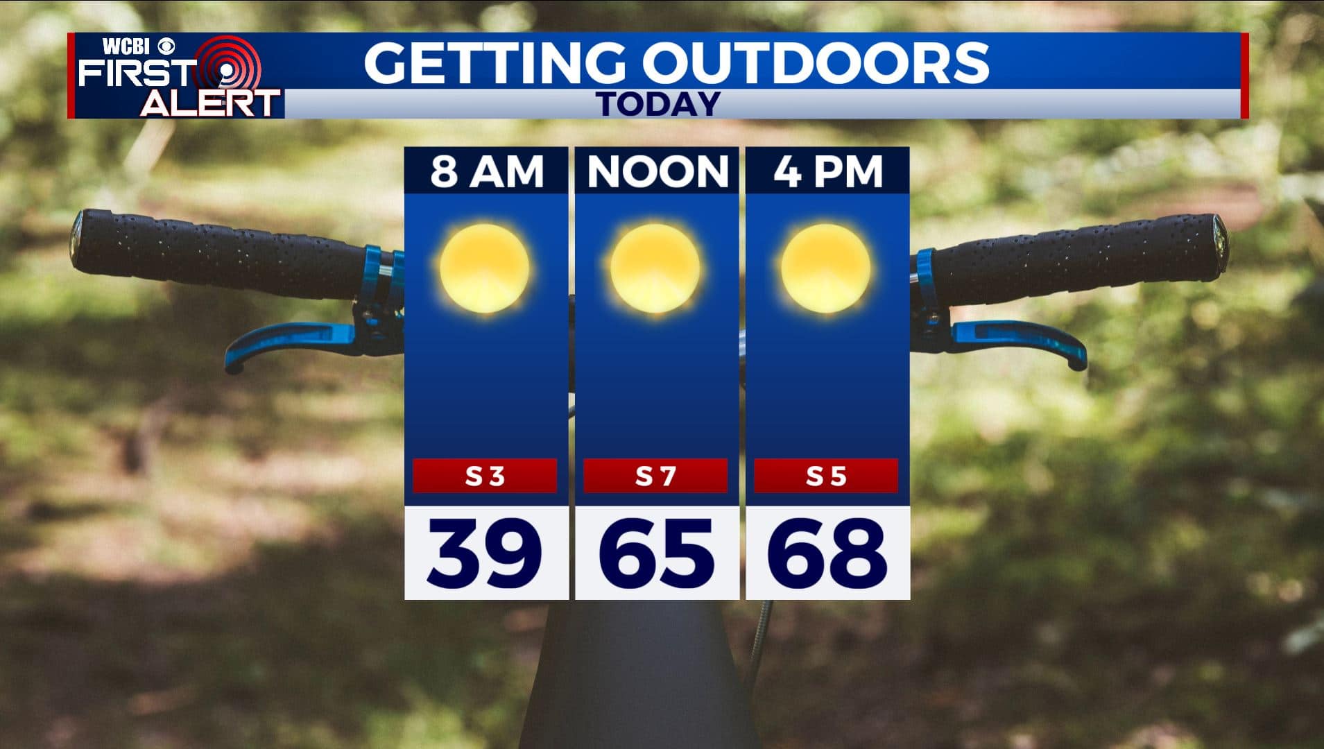
THURSDAY: We’re basically hitting the repeat button for our Thursday as the sunshine & clear blue skies continues. Temperatures will also continue to be warm & above average with highs in the upper 60s to even near 70 degrees. Get outside and enjoy the day!
THURSDAY NIGHT: Mostly clear skies and another calm night ahead. Overnight lows near 40.
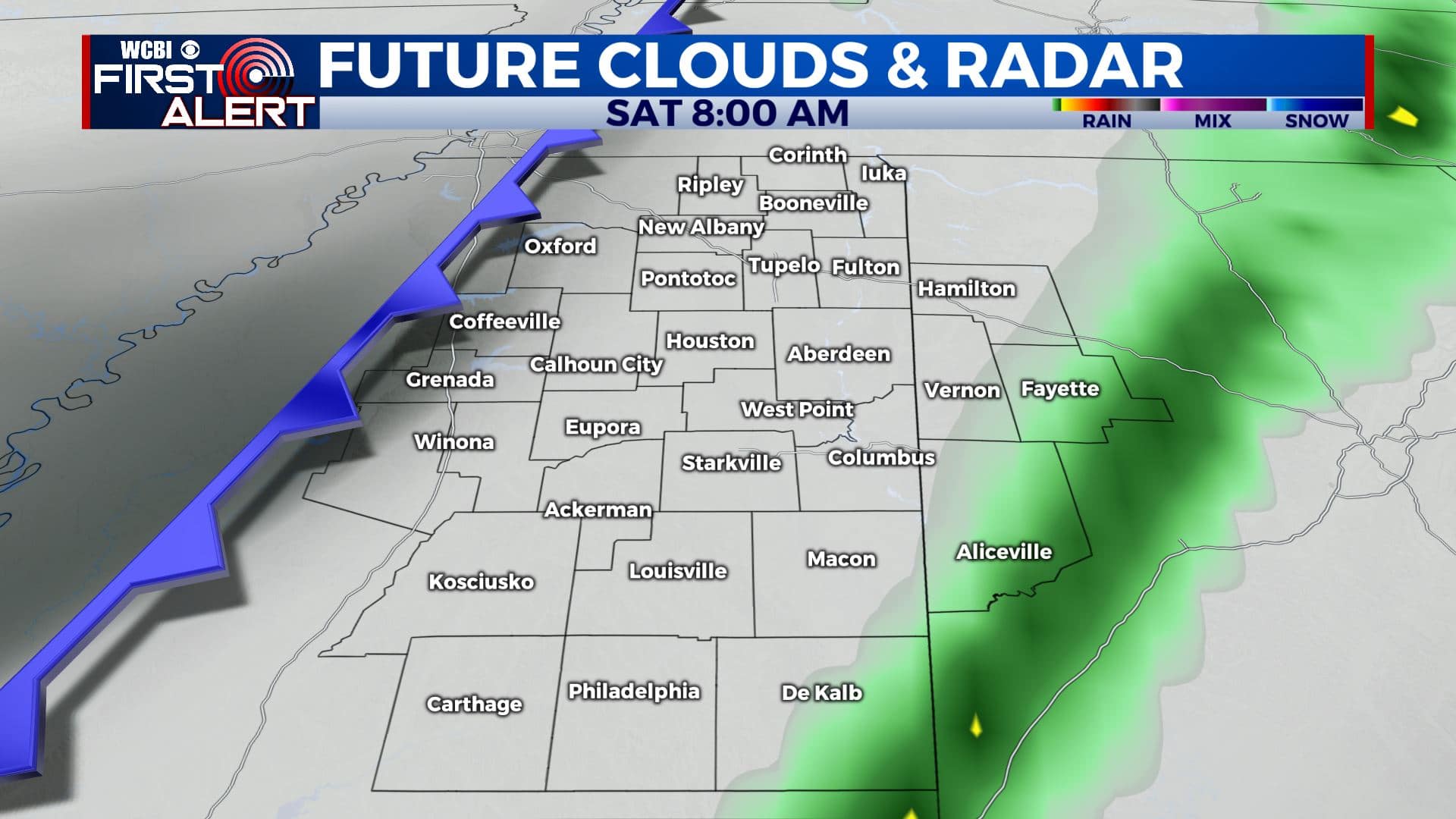
FRIDAY-SATURDAY: Cloudy skies and rain chances will return to the region by Friday and into the weekend as our next cold front approaches us. Most of the day Friday looks to remain dry with a mix of sun & clouds, but showers are possible after sunset into the overnight hours. We’ll likely see more rain chances into the first half of the day on Saturday. We aren’t expecting any severe weather, but rainfall amounts could approach a quarter of an inch in some locations. Highs will be in the mid to upper 60s with morning lows in the 40s and 50s.
SUNDAY: Cooler air will filter in on Sunday. Highs will be back down into the lower 50s with overnight lows in the 30s. There are some indications that we could see some isolated showers on Sunday, but we’ll see a mix of sun & clouds for the most part.
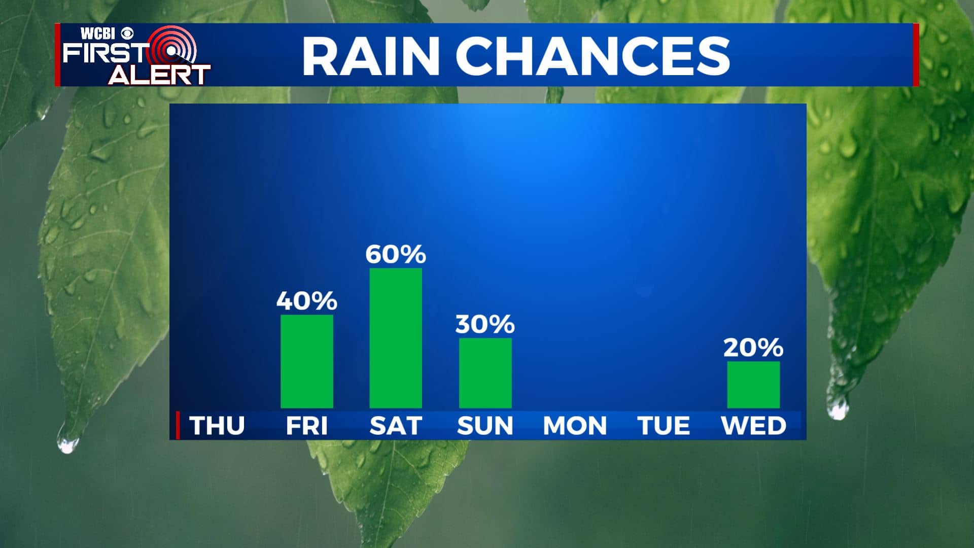
EARLY NEXT WEEK: We’ll see a few clouds on Monday before the sunny skies return on Tuesday. A shower or two is possible on Wednesday right now. We’ll continue to look at that. Staying cool with highs in the lower 50s. We could once again go down into the 20s for overnight lows Monday night into Tuesday morning.
Stay connected with @WCBIWEATHER on Facebook, Twitter, Instagram, and the WCBI News App


Leave a Reply