A warm & breezy next few days ahead
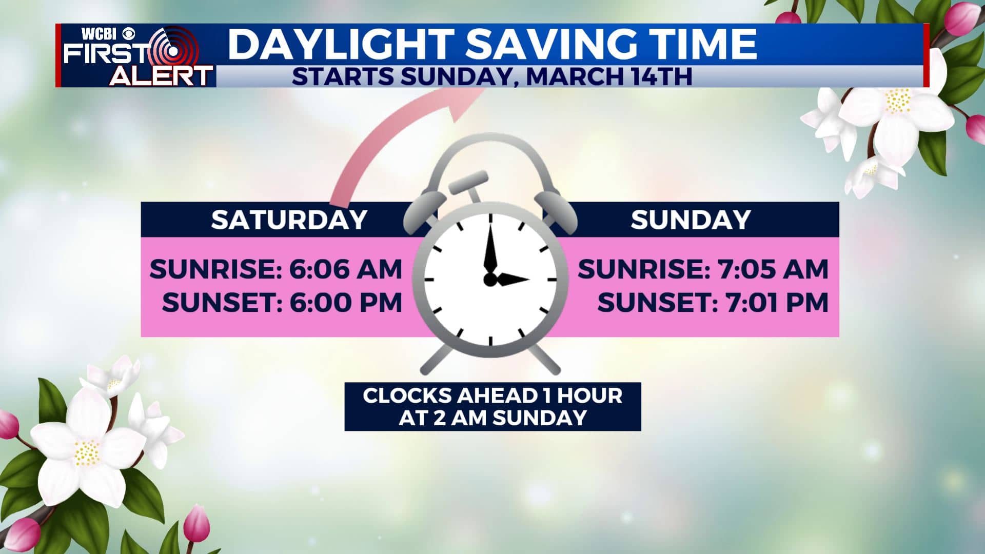
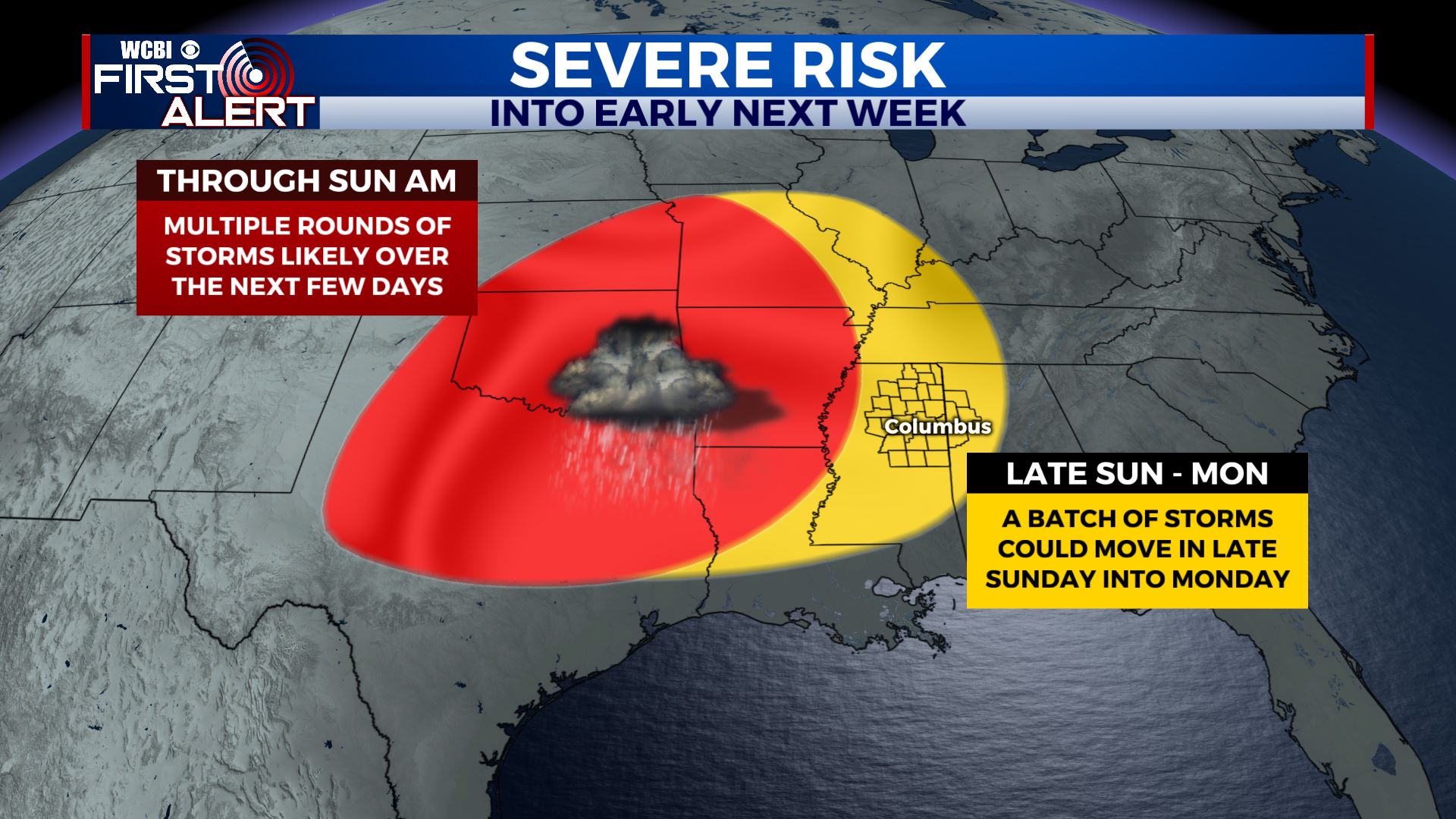
SUMMARY: Dry, warm & breezy conditions will continue for the next few days with a few showers becoming possible again by the start of the weekend. Any strong to severe storms or heavy rain still looks like it is going to hold off until late Sunday into Monday. Still uncertain on the exact threats or timing, but it’s something we’ll continue to watch. Stay tuned! Don’t forget to Spring Forward one hour late Saturday night/early Sunday morning. Daylight Saving Time begins 2 am Sunday.
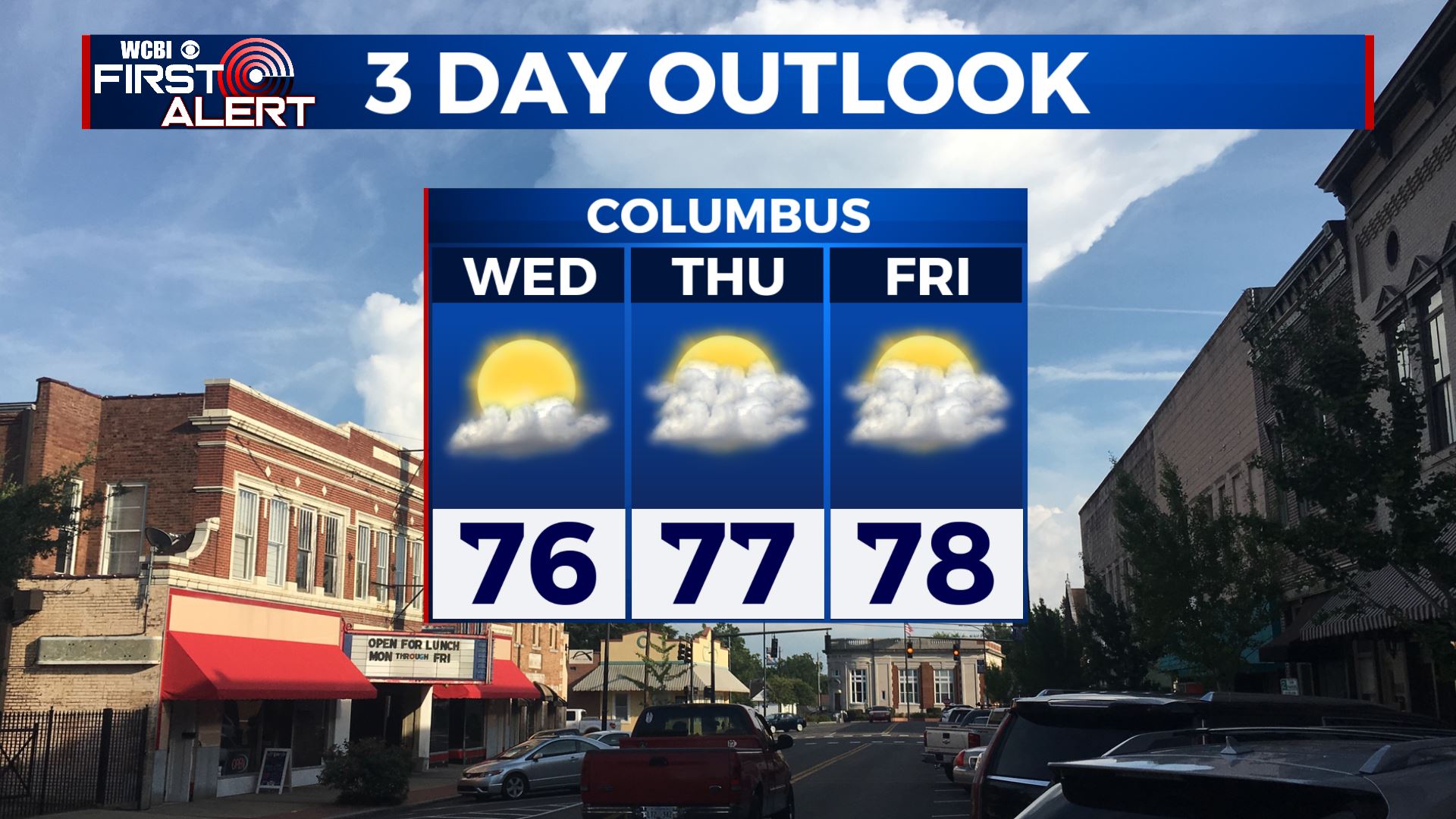
WEDNESDAY: A mix of sun & clouds. Breezy southerly winds 10-15 mph with gusts over 20 mph possible. Warm, above average highs in the mid 70s.
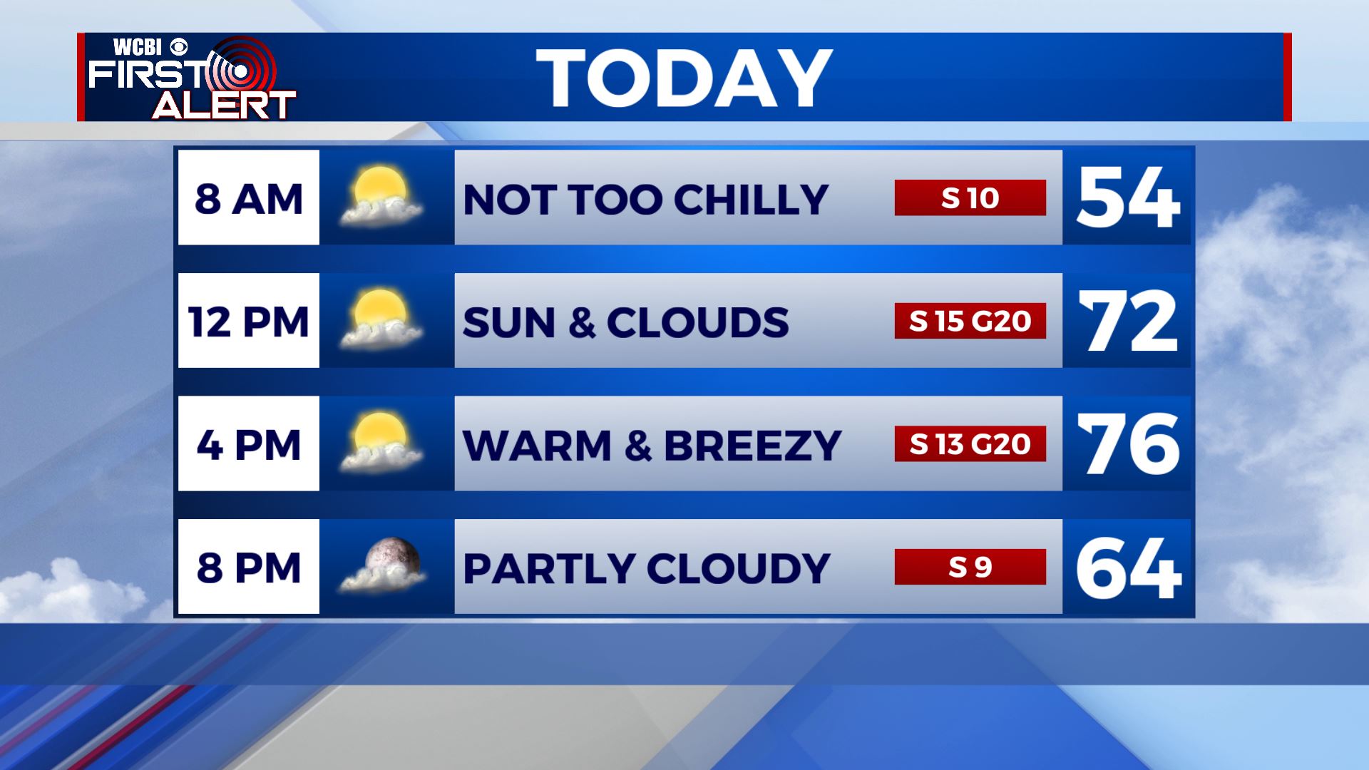
WEDNESDAY NIGHT: Partly cloudy skies. Mild overnight lows in the 50s.
THURSDAY: A mix of sun & clouds. Highs in the upper 70s. Breezy southerly winds 10-15 mph with higher gusts will continue.
THURSDAY NIGHT: Clouds will increase. Mild overnight lows in the mid 50s.
FRIDAY-SATURDAY: Cloudy skies for the end of the week on Friday with a few peeks of sunshine. Some showers are possible on Saturday. Highs will be in the upper 70s with overnight lows in the 50s.
SUNDAY INTO EARLY NEXT WEEK: We’re still watching out for the potential for some storms and heavy rain. It’s still early to pinpoint the exact timing or eventual threats but it’s definitely something we’ll keep watching since we are in the spring severe weather season. High temperatures will remain in the 70s.
Stay connected with @WCBIWEATHER on Facebook, Twitter, Instagram, and the WCBI News App


Leave a Reply