Active weather pattern continues through Saturday
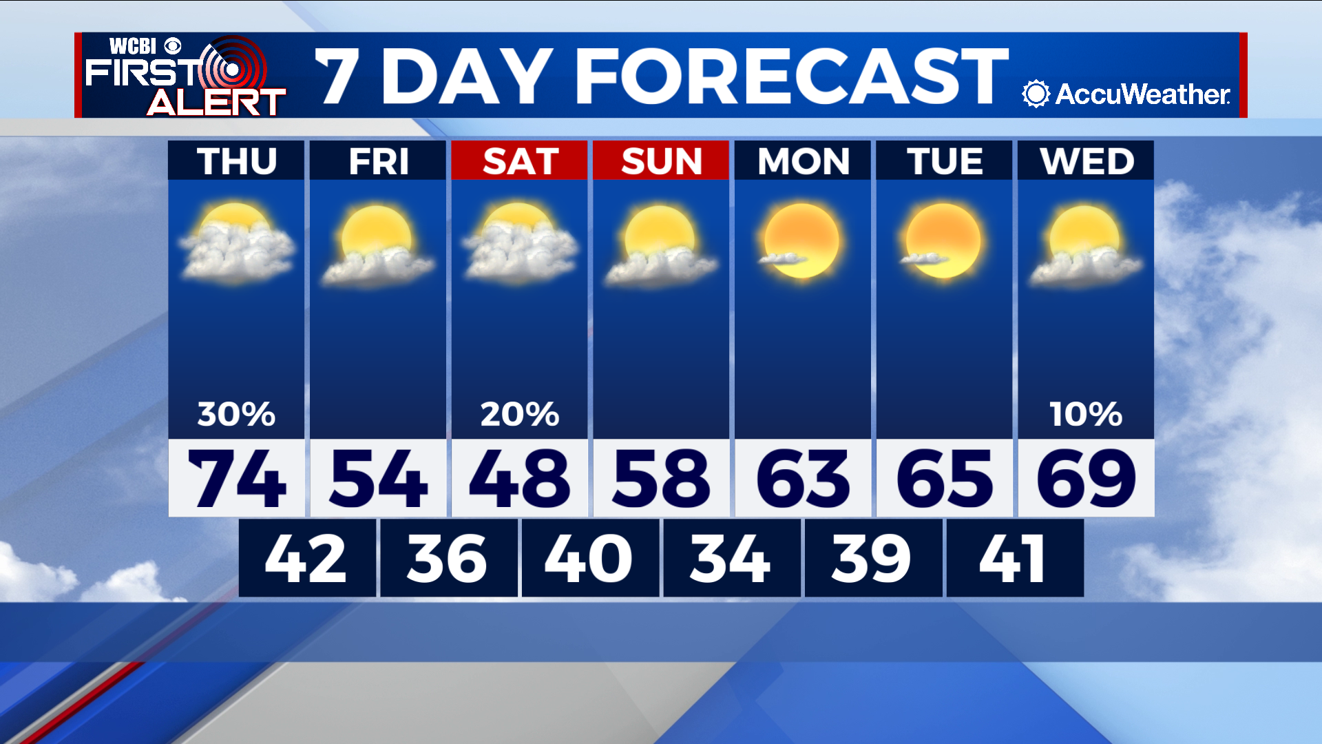
COLUMBUS, Mississippi (WCBI) – SUMMARY: After a brief warm-up Thursday, cooler temperatures return this weekend.
TONIGHT: Cloudy with a few isolated showers possible. Lows in the upper-40s. North wind, 5-10 mph. Chance of rain: 20%.
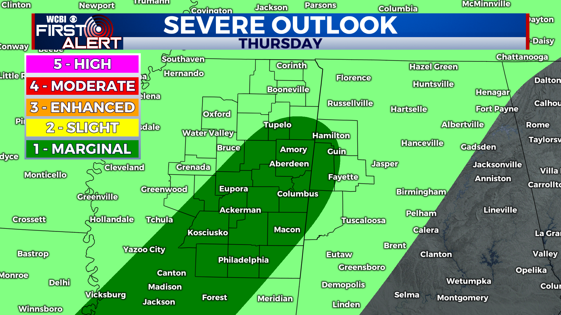
THURSDAY: Mostly cloudy with a few isolated thunderstorms. A few storms may be strong with damaging wind gusts and frequent lightning. Highs in the low-to-mid 70s. East wind around 5 mph. Chance of rain: 30%.
THURSDAY NIGHT: Showers likely before midnight, then showers and possibly a thunderstorm overnight. Overnight lows in the mid-40s. South wind 5-10 mph. Chance of rain: 90%.
EXTENDED FORECAST: This weekend will be cooler than average with highs in the mid-40s Saturday and upper-50s Sunday. Showers are likely Saturday night, but we will finally dry out Sunday afternoon. A gradual warming trend will commence as we begin next week with highs back into the upper-60s by Wednesday. The long-term forecast models call for dry conditions lasting through next week and temperatures returning to the upper-70s by the end of next week.


Leave a Reply