Active weather pattern continues with the possibility of strong storms tomorrow
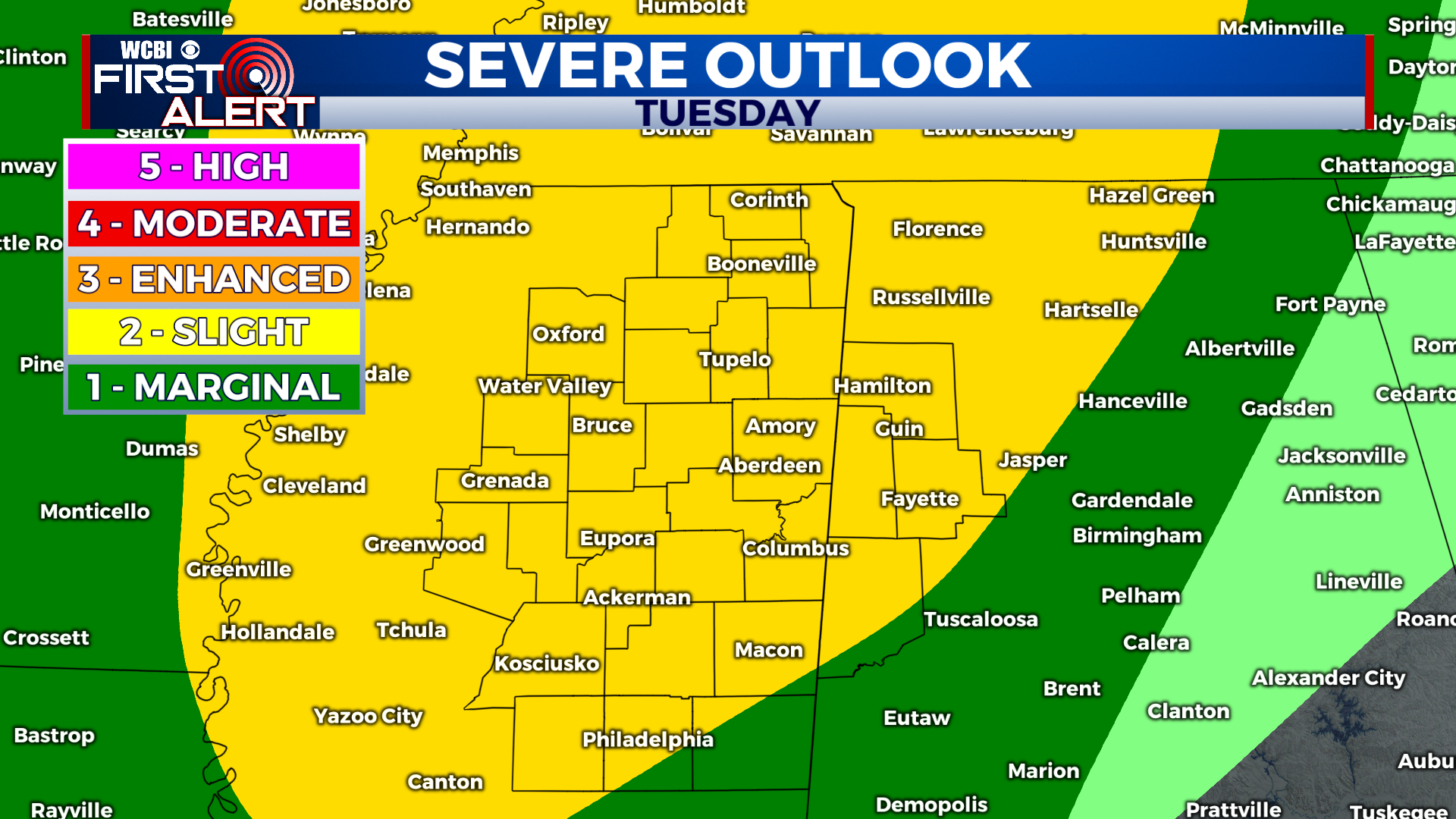
COLUMBUS, Mississippi (WCBI) – SUMMARY: This week will remain active through at least Thursday as a few systems move through the region. Severe storms will be possible tomorrow afternoon and evening.
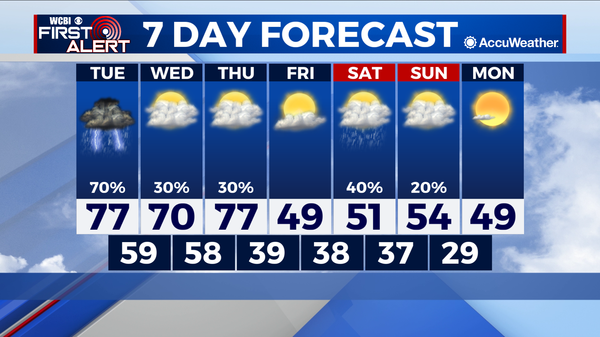
TONIGHT: Isolated showers and thunderstorms before midnight, then overcast. Lows in the mid-50s. South wind, 5-10 mph with gusts up to 20 mph. Chance of rain: 30%.
TUESDAY: Scattered afternoon showers and thunderstorms. Some storms may be severe. Warmer with highs in the upper-70s. South wind, 5-10 mph with gusts up to 25 mph. Chance of rain: 60%.
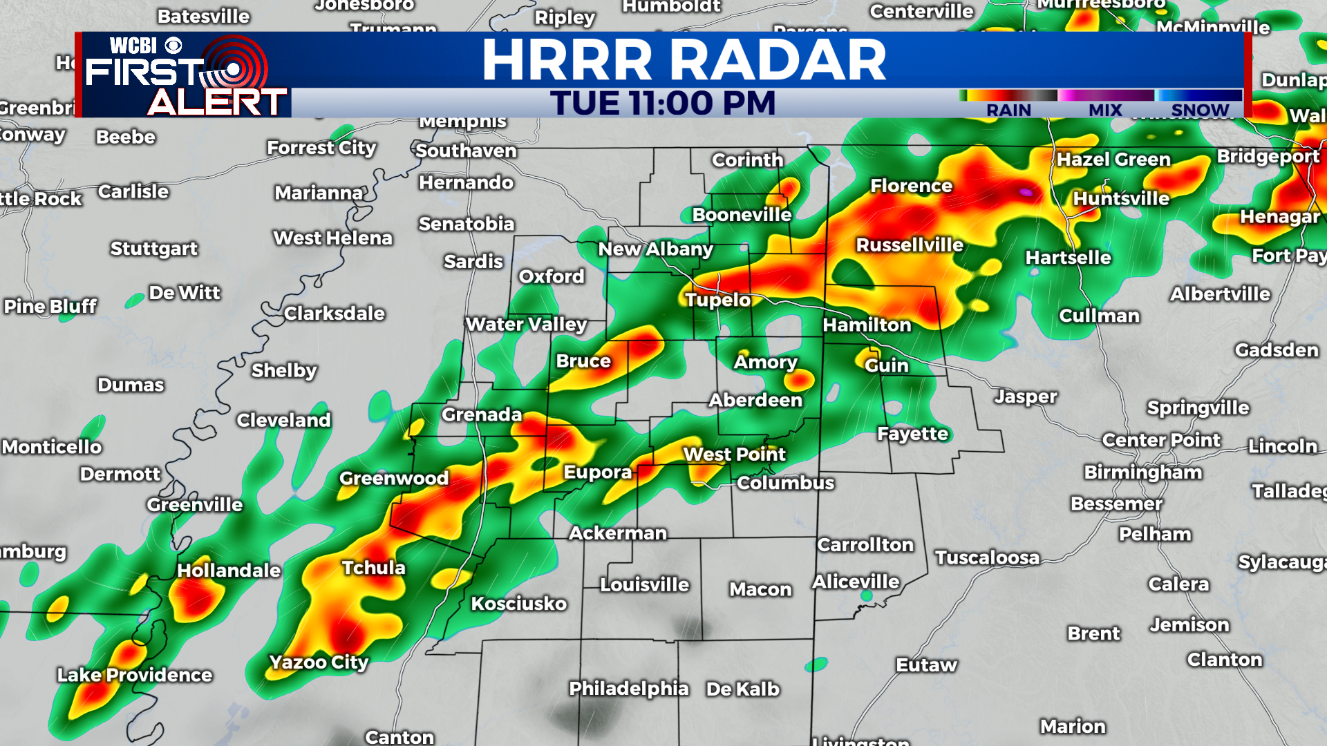
TUESDAY NIGHT: Scattered showers and thunderstorms. Overnight lows in the upper-50s. South wind, 5-10 mph with gusts up to 25 mph. Chance of rain: 80%.
EXTENDED FORECAST: A series of disturbances will progress through the region as we close out the second half of the week. Scattered showers and thunderstorms will remain in the forecast through Thursday, then cooler than average temperatures arrive this weekend with highs in the 50s Saturday and Sunday. Another plume of moisture will progress north through the weekend Saturday evening and overnight. Otherwise, expect cooler conditions with highs in the low-to-mid 50s.


Leave a Reply