An active weather pattern returns this workweek
SUMMARY: After a very quiet last week, our weather pattern will be picking up & become more active this upcoming week. An approaching cold front will be giving us better chances of showers & storms Monday into Tuesday. Afternoon high temperatures will remain warm & humid in the mid to upper 80s. Summer is here to stay for a while.
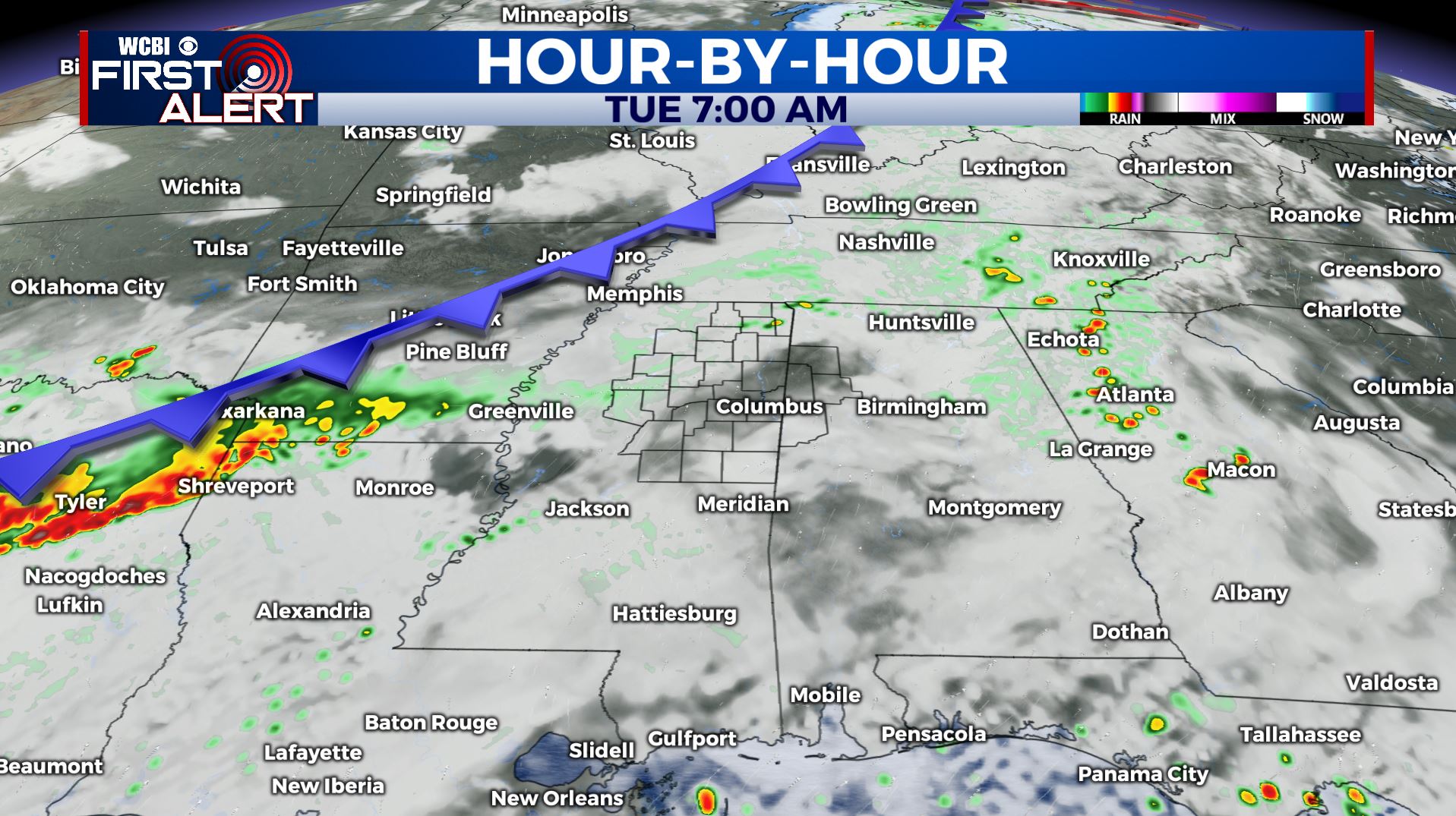
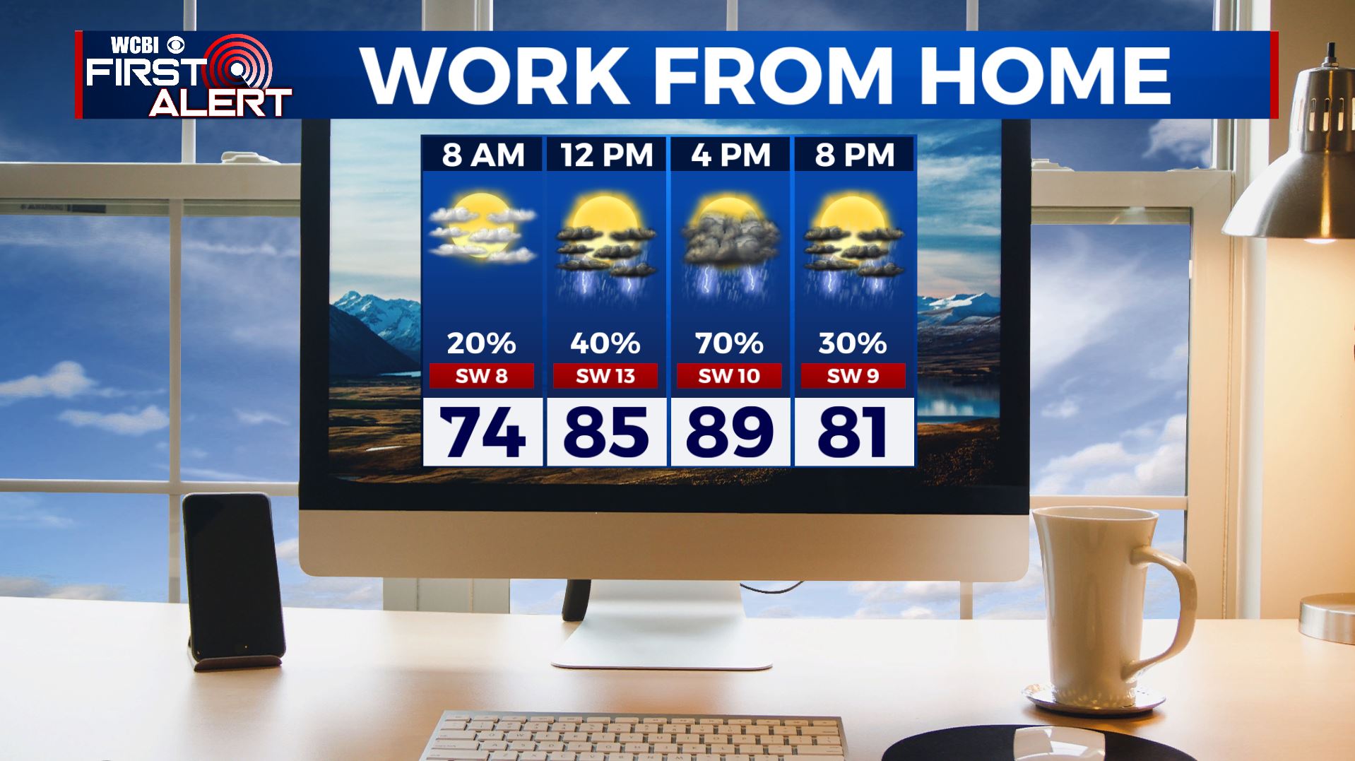
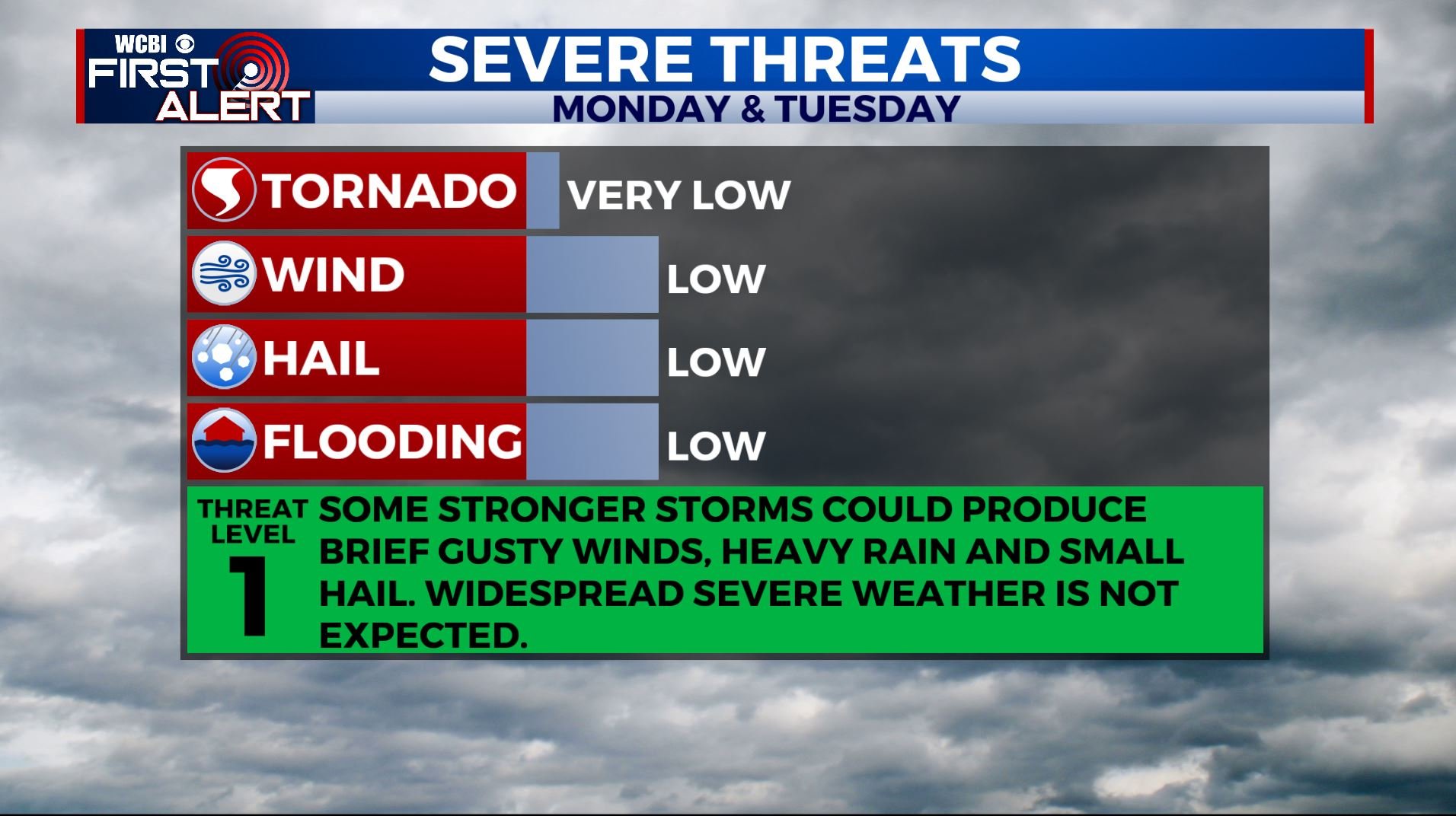
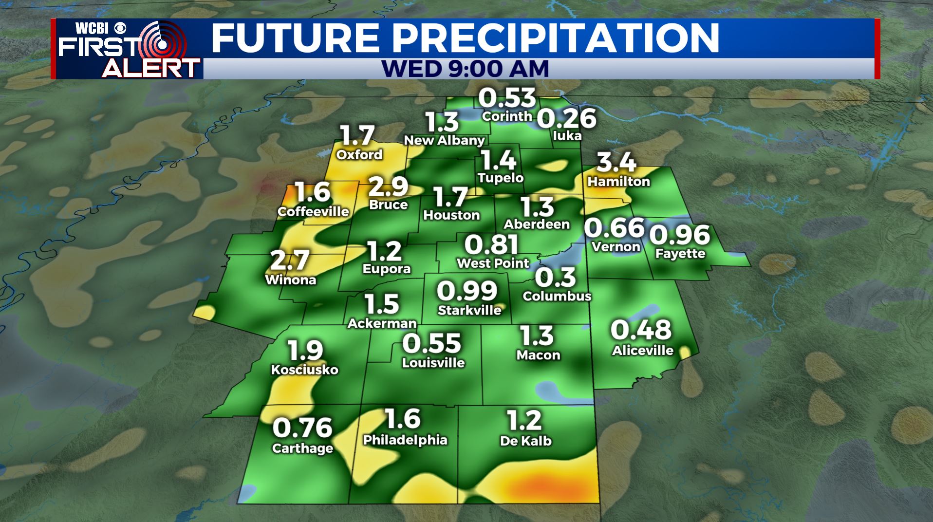
MONDAY: A new week & an active weather pattern returns. We’re waking up to a few clouds this Monday morning, but showers & storms will develop by the afternoon. Temperatures will climb to the upper 80s. Don’t forget that humidity thanks to that SW wind at 10-15 mph. No widespread severe weather is expected, but some stronger storms will be capable of producing gusty winds and small hail. Also expect heavy downpours at times as we could receive 1-2 inches of rain now through Wednesday morning.
MONDAY NIGHT: Mostly cloudy with a chance for a few showers & storms. Overnight lows near 70 degrees.
TUESDAY-WEDNESDAY: Rain and storm chances continue through the middle of the week, so keep the umbrella on standby. Highs will be in the mid 80s with overnight lows near 70.
THURSDAY-FRIDAY: While showers and storms won’t be as widespread by the end of the workweek, there will still be a chance for some afternoon pop-up storms. Highs will return to near 90 by Friday.
SATURDAY-SUNDAY: As of now, the weekend looks to be more on the dry side with just a slight chance of a stray afternoon shower or storm. Hot and humid weather will continue with highs into the lower 90s.
Stay connected with @WCBIWEATHER on Facebook, Twitter, Instagram, and the WCBI News App


Leave a Reply