Another chance of stormy weather for Tuesday
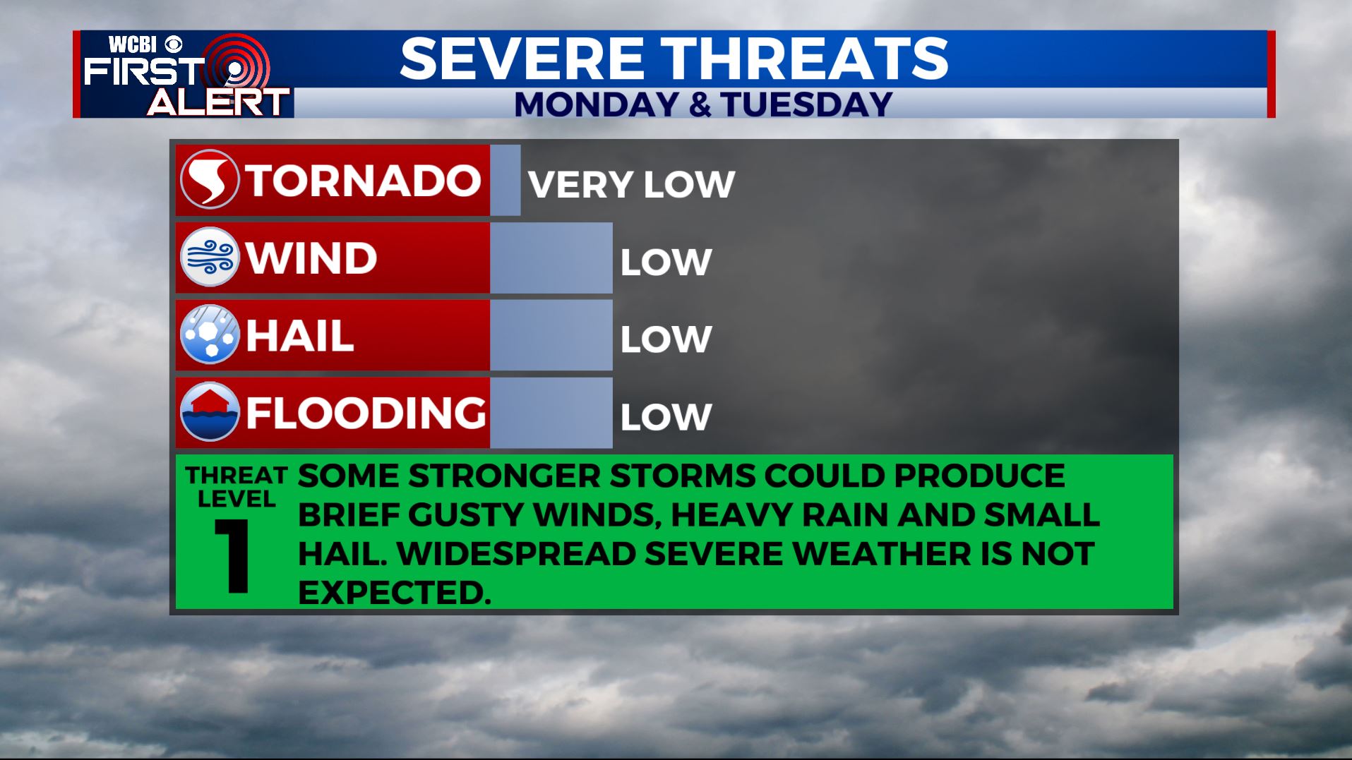
SUMMARY: Expect daily chances of showers and storms throughout the rest of the workweek. We’ll have better chances Tuesday into Wednesday as a cold front pushes through the region. Not expecting widespread severe weather, but any storms could become strong with gusty winds, small hail, heavy downpours, and frequent lightning. Temperatures will remain warm & humid with highs in the mid to upper 80s. Coverage of activity will lower going into the weekend as temperatures climb back up to around 90.
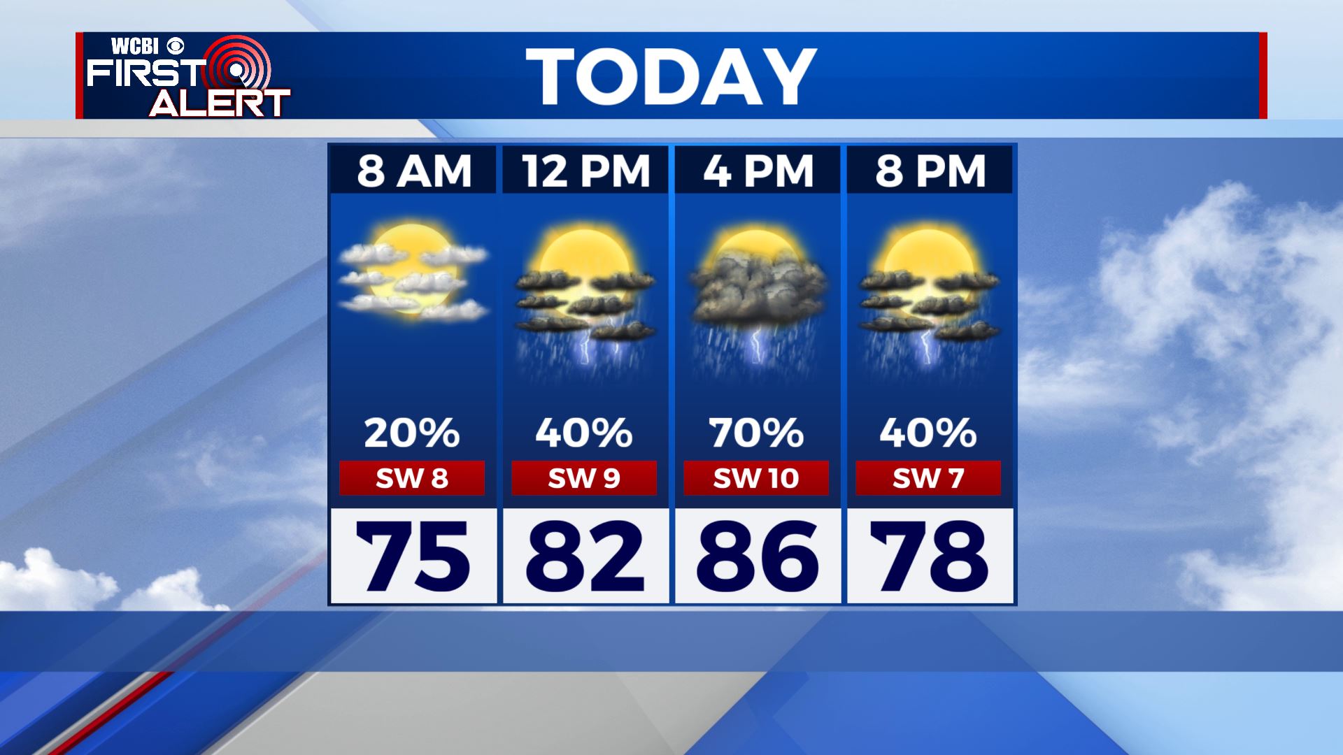
TUESDAY: An approaching cold front will be once again giving us better chances of showers & storms for our Tuesday. Some storms could be on the strong side with gusty winds, heavy rain and small hail. Highs will be in the mid 80s. Winds SW 5-10 mph.
TUESDAY NIGHT: Lingering showers and storms are possible. Overnight lows in the upper 60s. Calm winds.
WEDNESDAY: Mostly cloudy, warm, and humid. Another chance of showers and storms. Highs in the mid 80s.
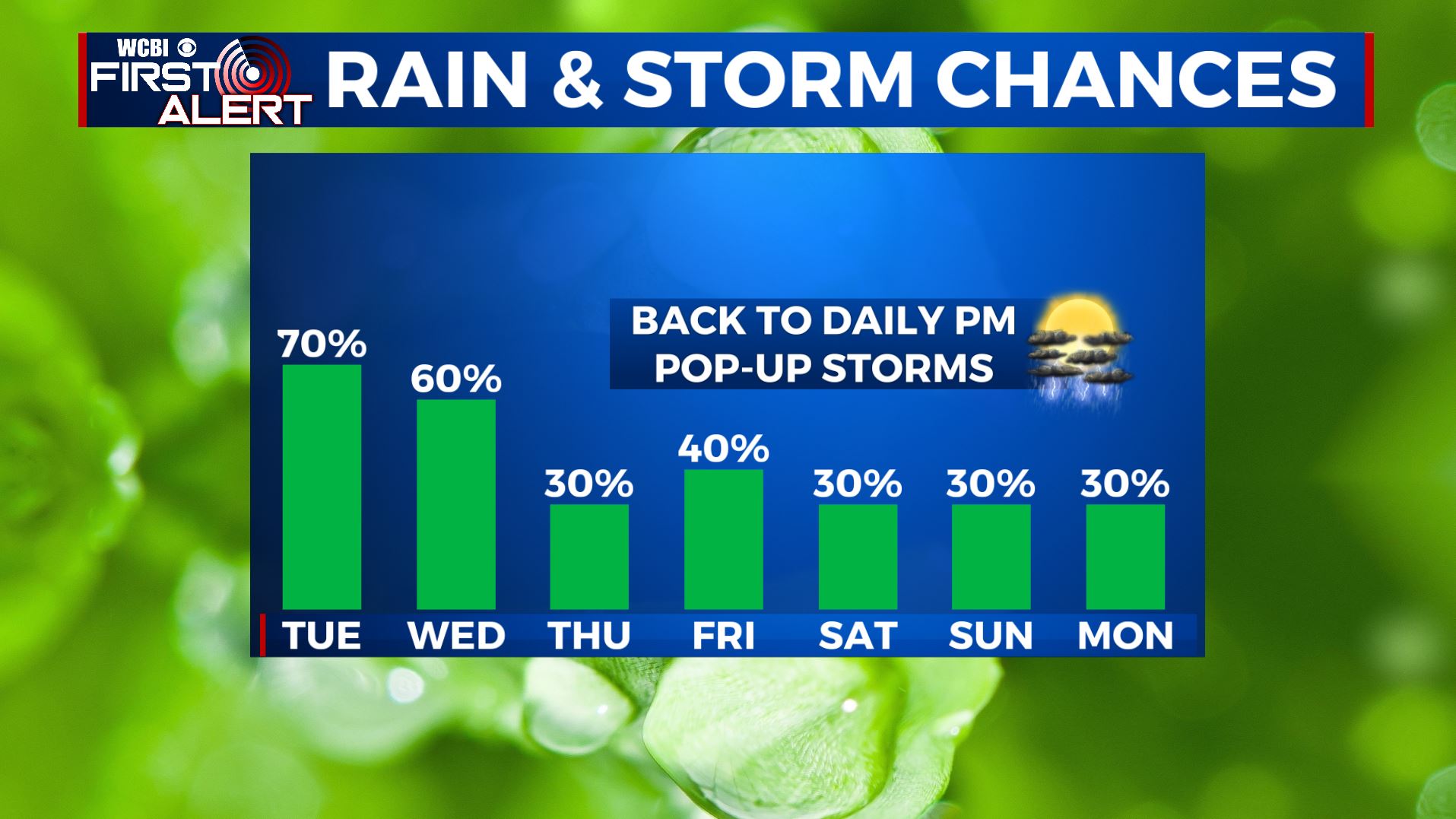
THURSDAY-FRIDAY: While showers and storms won’t be as widespread by the end of the workweek, there will still be a chance for some afternoon pop-up storms. Highs will return to near 90 by Friday.
WEEKEND-MONDAY: Isolated rain & storm chances continue, but not everyone will get a storm every day. Highs will climb back into the lower 90s with higher heat indices.
Stay connected with @WCBIWEATHER on Facebook, Twitter, Instagram, and the WCBI News App


Leave a Reply