Another chance of scattered storms for Tuesday
SUMMARY: A very typical summertime weather pattern will return to the region by midweek into the weekend along with warmer temperatures. Rain and storm chances will increase again next week.
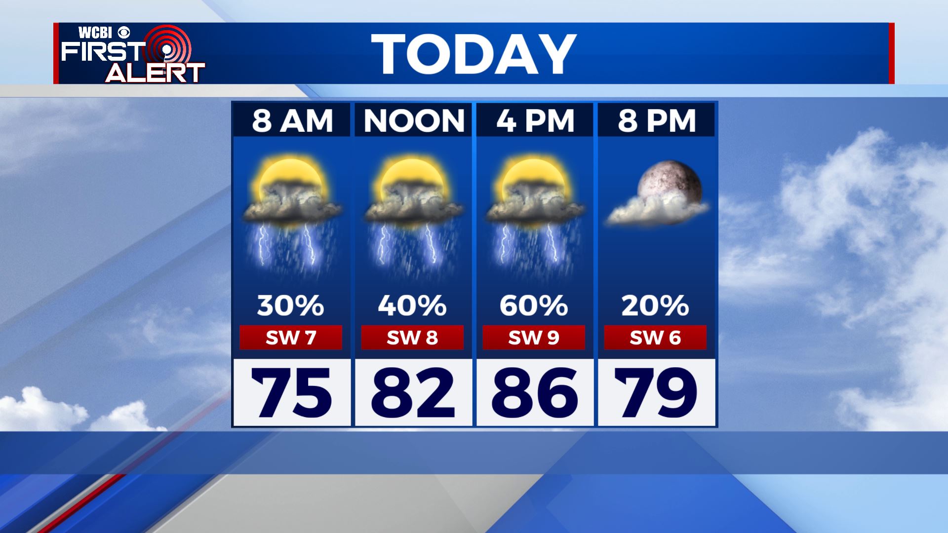
TUESDAY: Shower and storm chances remain high for our Tuesday. Skies will remain cloudy, which will once again keep those high temperatures below average in the mid 80s. Still warm & humid thanks to SW winds 10-15 mph.
TUESDAY NIGHT: Scattered afternoon showers and storms will die down early evening once we lose the heating of the day. Partly cloudy skies overnight. Lows near 70 degrees.
WEDNESDAY: Looking to be a bit drier with more of a mix of sun & clouds. Still can’t rule out the chance for afternoon isolated showers & storms. Staying warm & humid with highs in the upper 80s to lower 90s.
THURSDAY-FRIDAY: A mix of sun and clouds with highs back up to near average in the lower 90s. Some isolated to scattered afternoon showers and storms are possible.
SATURDAY: Chances of those afternoon summertime showers & storms stick around. Staying warm & humid overall with a mix of sun & clouds. Highs in the upper 80s to lower 90s. Overnight lows in the lower 70s.
SUNDAY-MONDAY: Rain and storm chances will be on the increase again Sunday as another cold front could stall out. Something we’ll continue to update you on as we fine tune the forecast. The cloud cover will keep those high temperatures a bit cooler in the mid to upper 80s.
Stay connected with @WCBIWEATHER on Facebook, Twitter, Instagram and the WCBI News App


Leave a Reply