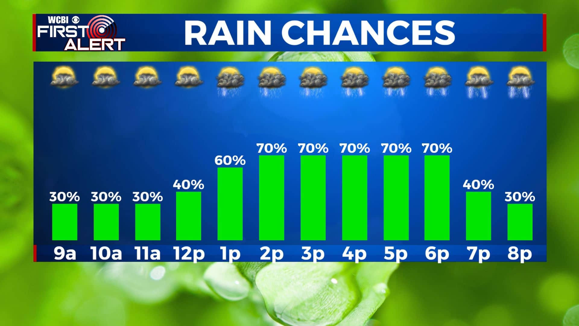
Another day of rain & storms for Tuesday
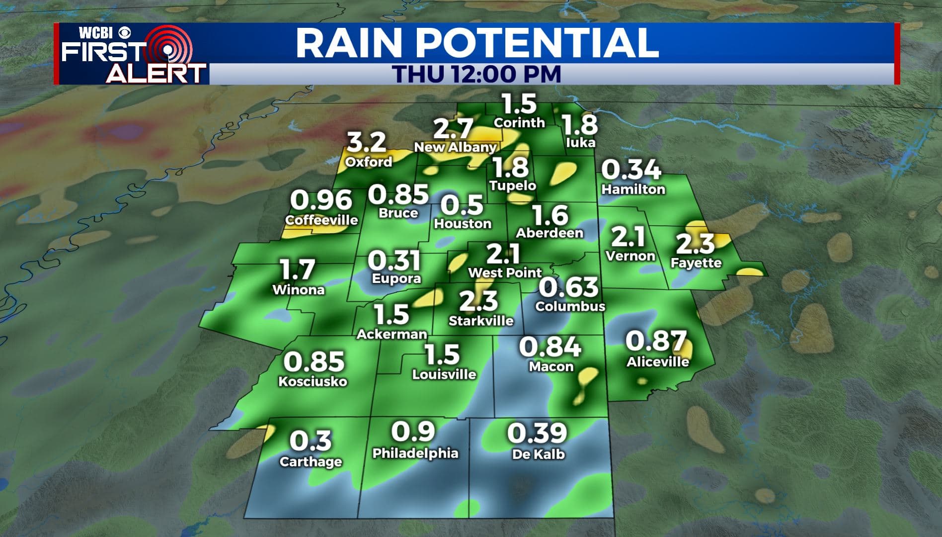
SUMMARY: Unsettled weather is here to stay for the rest of the workweek. Each day will present a chance of showers and storms, some of which may produce heavy rainfall, lightning and gusty winds. We’ve received anywhere between 1-4″ over the last 24 hours and an additional 1-2″ is in the forecast through Thursday. This could cause some flooding concerns, so keep that in mind if you live in a flood prone area. Temperatures will slowly warm back into the upper 80s by the end of the week.
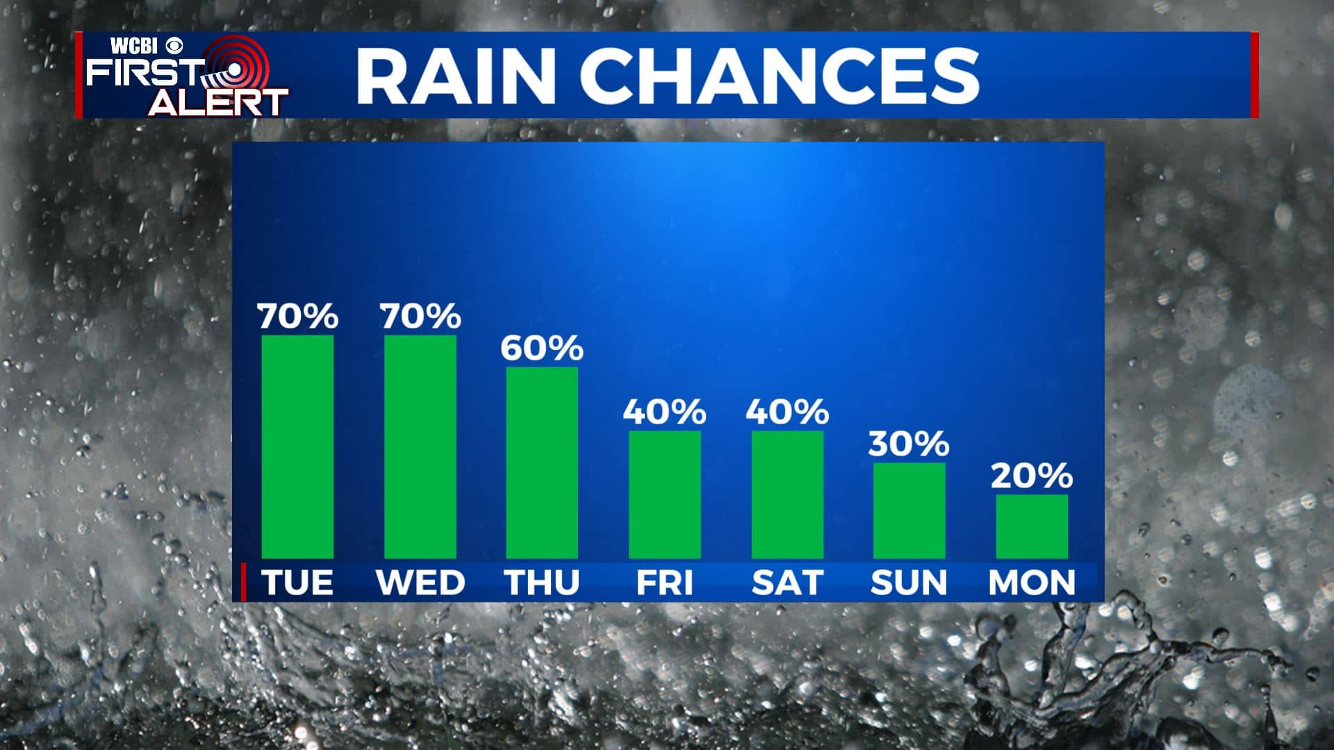
TUESDAY: Mostly cloudy with good chances of scattered showers and storms. Highs in the lower to middle 80s if there is enough sunshine. Winds SSE 5-15 mph.
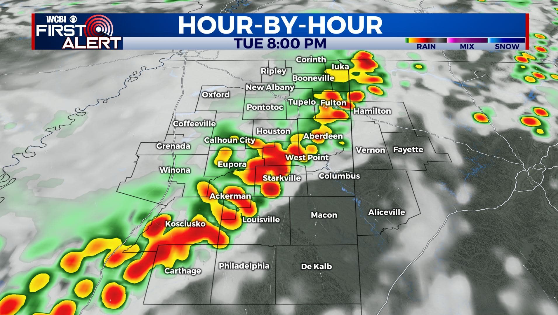
TUESDAY NIGHT: Lows around 70 again with a continuing chance of a shower or storm.
WEDNESDAY: Mostly cloudy. A chance of rain and storms. Highs in the middle 80s. Lows around 70 Wednesday night.
THURSDAY – FRIDAY: The chance of showers and storms will continue. Highs will rebound back into the upper 80s heading into the weekend. Lows in the lower 70s.
WEEKEND: Showers & storms remain possible both days. Otherwise a mix of sun & clouds with highs in the upper 80s and lows around 70.
MONDAY: A mix of sun & clouds. Just a very slight chance of a stray storm. Highs in the middle to upper 80s. Lows around 70.
Stay connected with @WCBIWEATHER on Facebook, Twitter, Instagram, and the WCBI News App.


Leave a Reply