Another warm & humid late summer day for Thursday
SUMMARY: Summer-like weather is set to continue as we end the workweek with highs in the lower 90s. It will stay humid with the heat index making it feel like over 100 degrees. A cold front will push through on Friday, helping to bring nicer & less humid weather for the Labor Day holiday weekend. Additional rain & storm storm are possible early next week.
THURSDAY: The summer heat & humidity has been the top weather story this week and expect it once again for your Thursday. We’ll have a mix of sun and clouds with a very slight chance of a stray shower Highs in the lower 90s with heat indices around 100°. SW winds 5-10 mph.
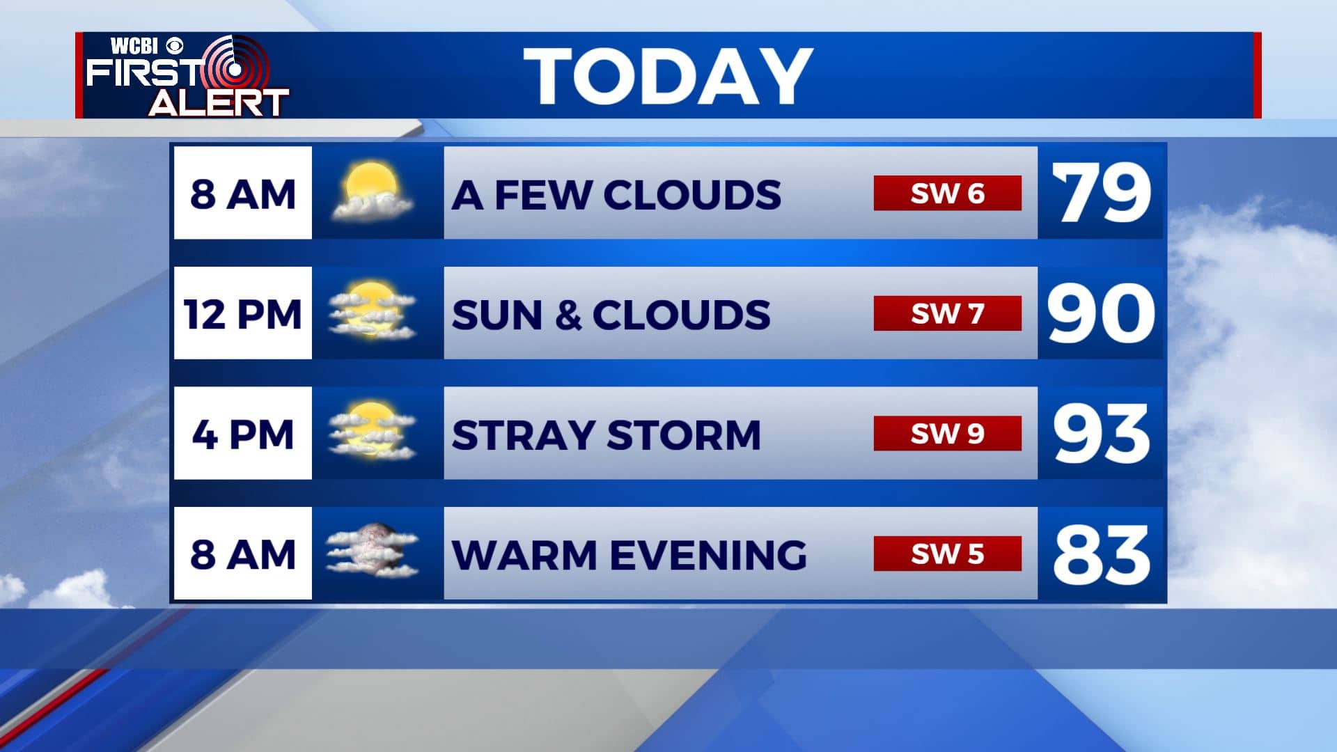
THURSDAY NIGHT: A few clouds but mostly clear. Mild & muggy overnight lows in the 70s.
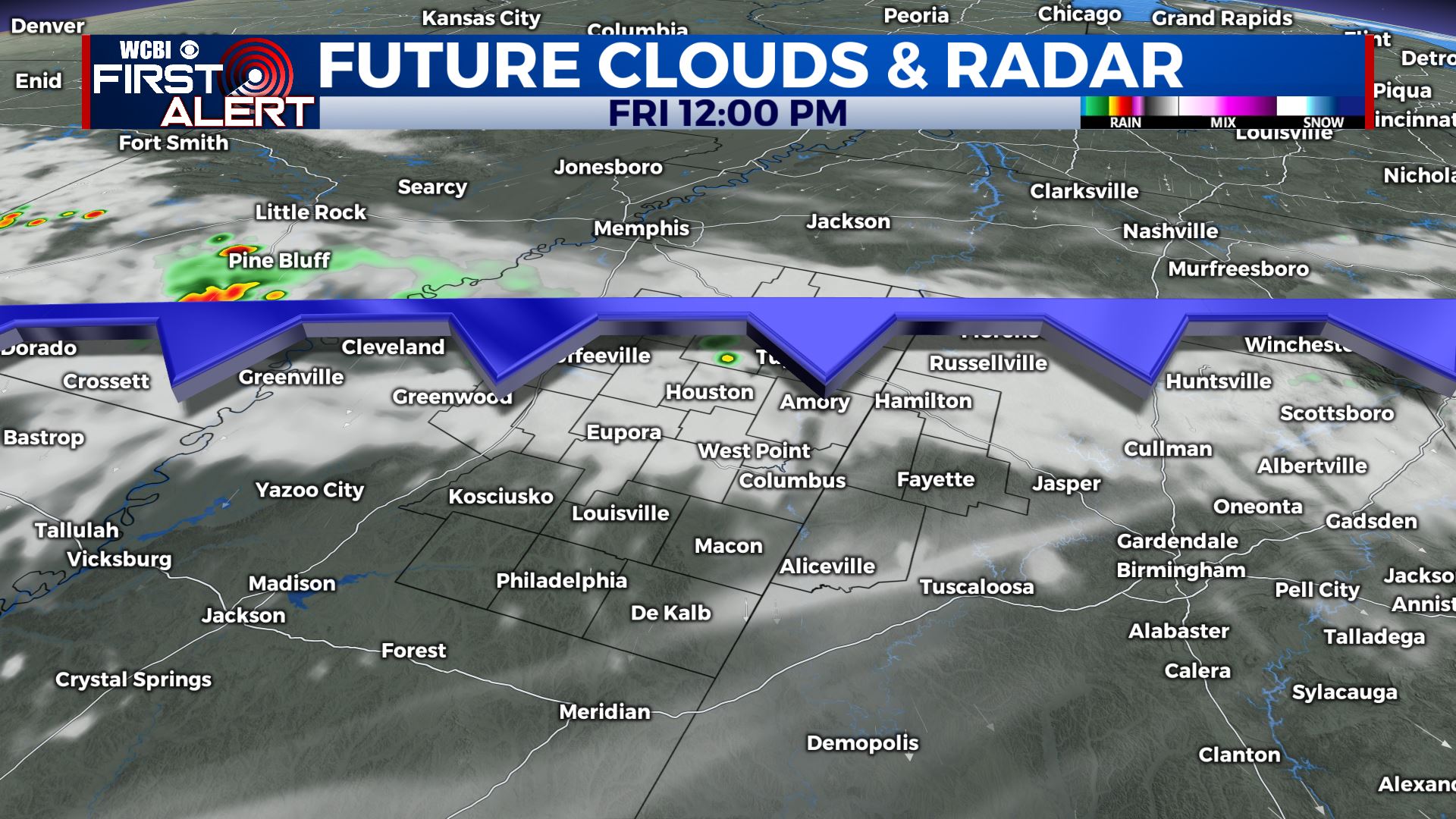
FRIDAY: Sun & clouds with a chance of a few showers and storms as a cold front pushes through. Highs near 80. Keep your fingers crossed that whatever pops up will start to fade away before high school football starts Friday evening.
FRIDAY NIGHT: Mostly clear and cooler. Overnight lows in the mid 60s.
SATURDAY-SUNDAY: More sunshine for the long holiday weekend. Maybe a few clouds with an isolated shower or two, but we’ll take it. Still warm but less humid. Highs in the upper 80s. Overnight lows dipping back into the mid to upper 60s.
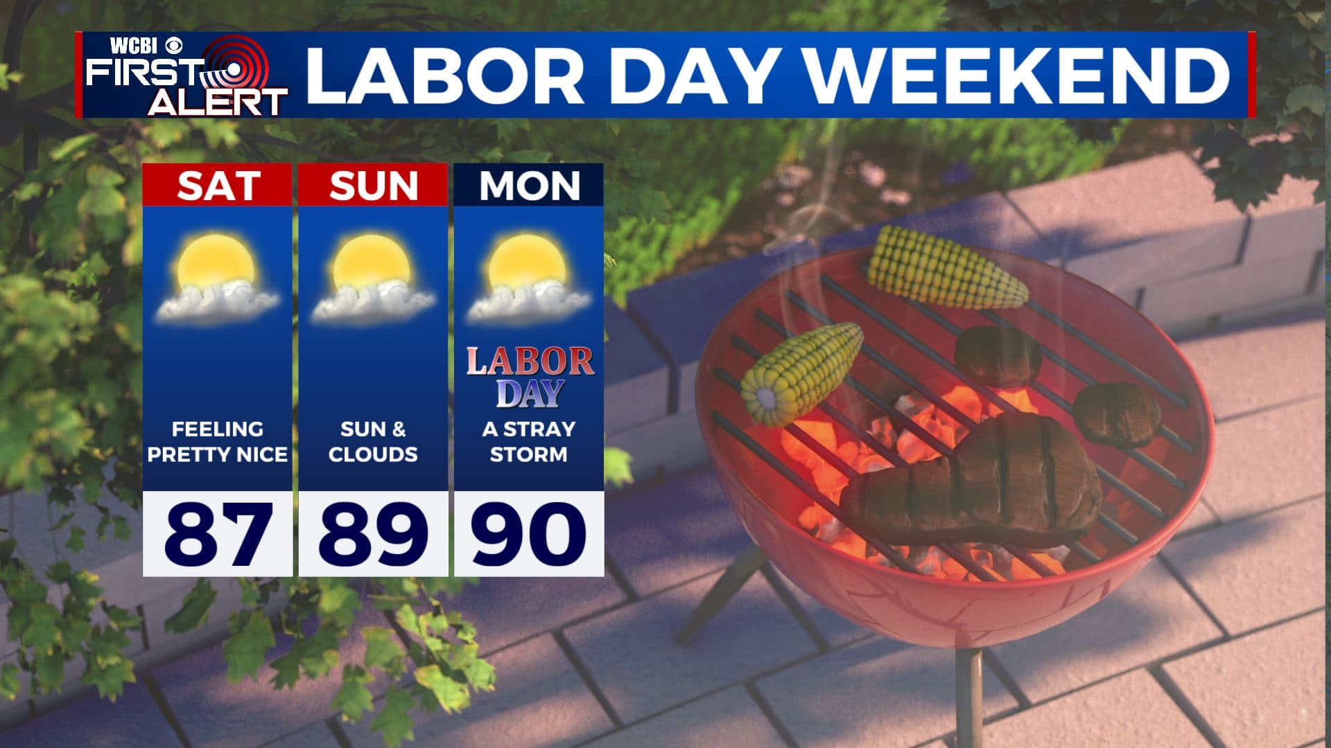
LABOR DAY: Partly sunny with an isolated chance of a shower and storm. High temperatures in the upper 80s to near 90.
EARLY NEXT WEEK: A few more scattered showers and storms likely. Highs in the 80s with overnight lows in the the 60s.
Stay connected with @WCBIWEATHER on Facebook, Twitter, Instagram, and the WCBI News App


Leave a Reply