Another winter storm heading our way for Wednesday
SUMMARY: Winter Storm Warnings and Winter Weather Advisories are in effect now as the second winter storm of the week will affect the area by late morning/midday Wednesday and continue into Thursday. The precipitation may start out as a mix of sleet, freezing rain, or snow then transition to a cold rain across our southeastern counties by late in the day as temperatures slowly warm. Wintry weather may continue across our northwestern counties Wednesday night and Thursday where temperatures stay a bit colder. We’ll continue to watch forecast trends throughout the day. Stay tuned!
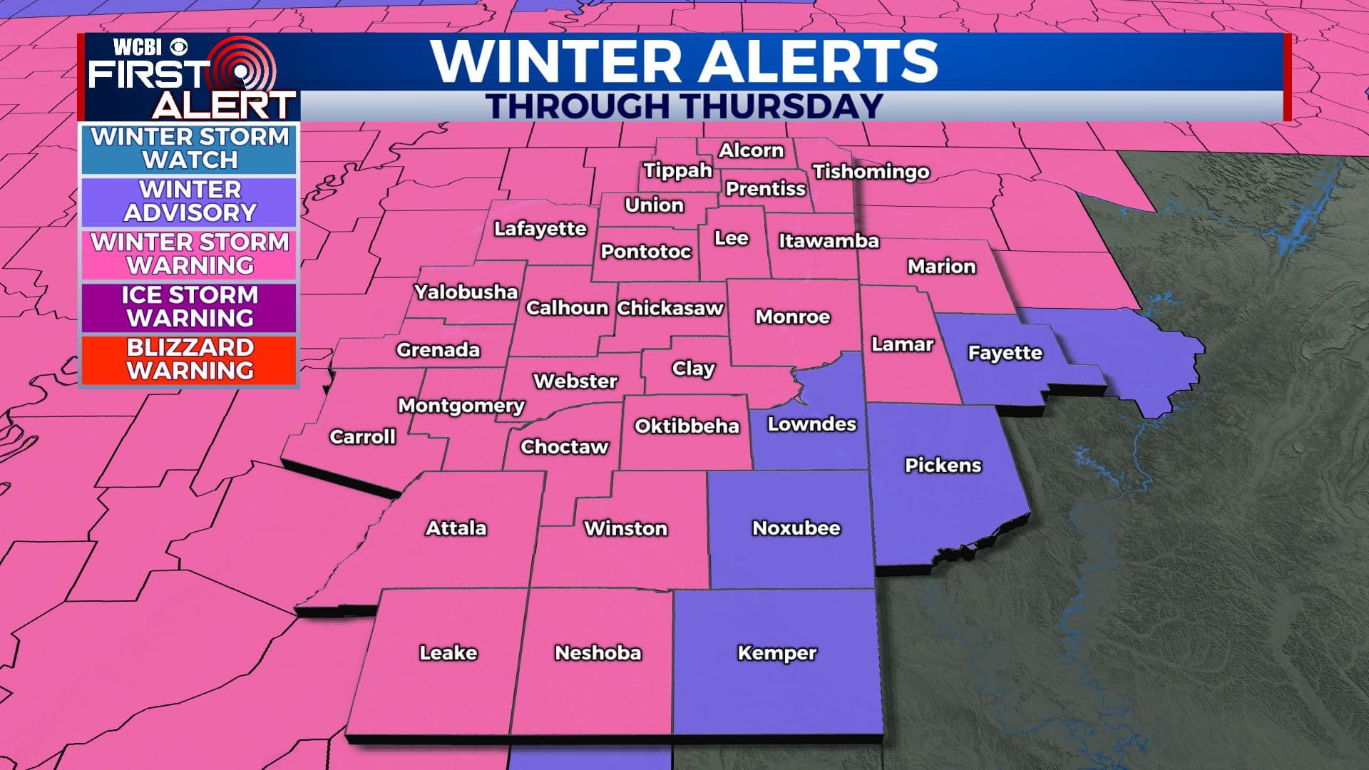
WEDNESDAY: Areas of sleet, freezing rain, and snow will build into our western counties by noon before spreading across the rest of the area during the afternoon. All depends where that freezing line sets up and how warm/above freezing we can get will determine what precipitation you will be seeing in your area. The latest forecast models are in and it looks like almost all of us will be seeing some type of winter weather by early afternoon, before that freezing line splits our SE counties to a cold all rain event to a winter wx event in our NW counties early evening. Stay tuned! Afternoon highs in the low to mid 30s. Winds NE 10-15 mph.
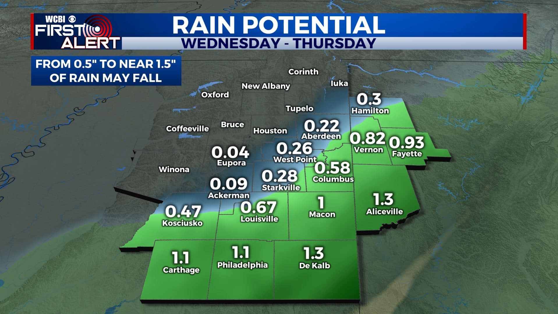
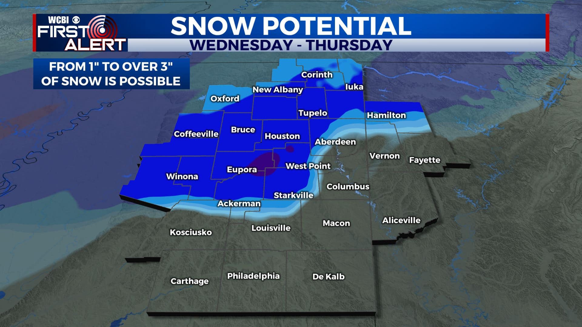
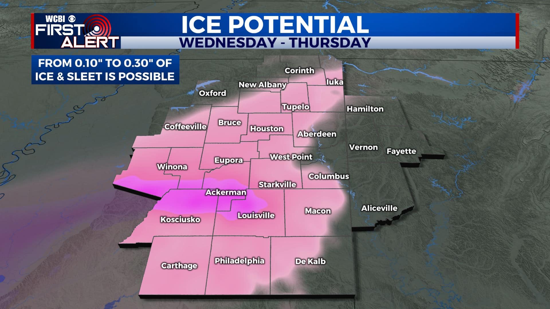
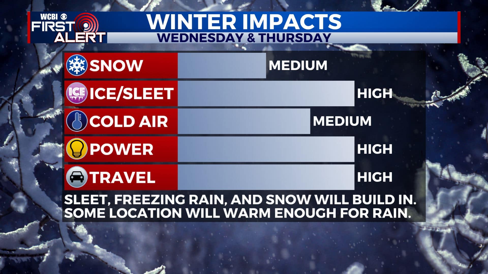
WEDNESDAY NIGHT: Areas of rain in our southeastern counties with a wintry mix of freezing rain, sleet, and snow more likely across our northwestern counties. Lows hovering in the low to mid 30s.
THURSDAY: Mostly cloudy with a light wintry mix still possible. Highs in the lower to mid 30s.
THURSDAY NIGHT: Cold. Lows in the lower 20s.
FRIDAY: A mix of sun & clouds. Chilly. Highs in the mid 30s. Overnight lows in the 20s.
SATURDAY: Mostly sunny skies. Getting warmer again with highs near 50. Overnight lows in the 30s Saturday night.
SUNDAY: Clouds increase with a few late showers possible. Mild with highs in the upper 50s.
MONDAY: Mostly cloudy skies with a chance of rain showers. Highs in the lower to mid 50s.
TUESDAY: Mostly sunny. Highs more spring-like again in the lower 60s.
Stay connected with @WCBIWEATHER on Facebook, Twitter, Instagram, and the WCBI News App


Leave a Reply