ARCTIC COLD LASTS FOR THE NEXT FEW DAYS
The cold air failed to move into our area quick enough, leaving most of us with a cold rain Monday night and Tuesday morning. The cold air is here now, and it’s going to last for the next 24 to 36 hours. This weekend is looking much warmer, but we may have to deal with some rain as we head into Monday.
TUESDAY NIGHT: Clouds will increase across the area tonight as a cold front swings in from the north. This will help our temperatures drop down into the lower 20s, and even the upper teens across northern portions of the area. This cold front will remain dry, so there is no need to worry about any wintry precipitation.
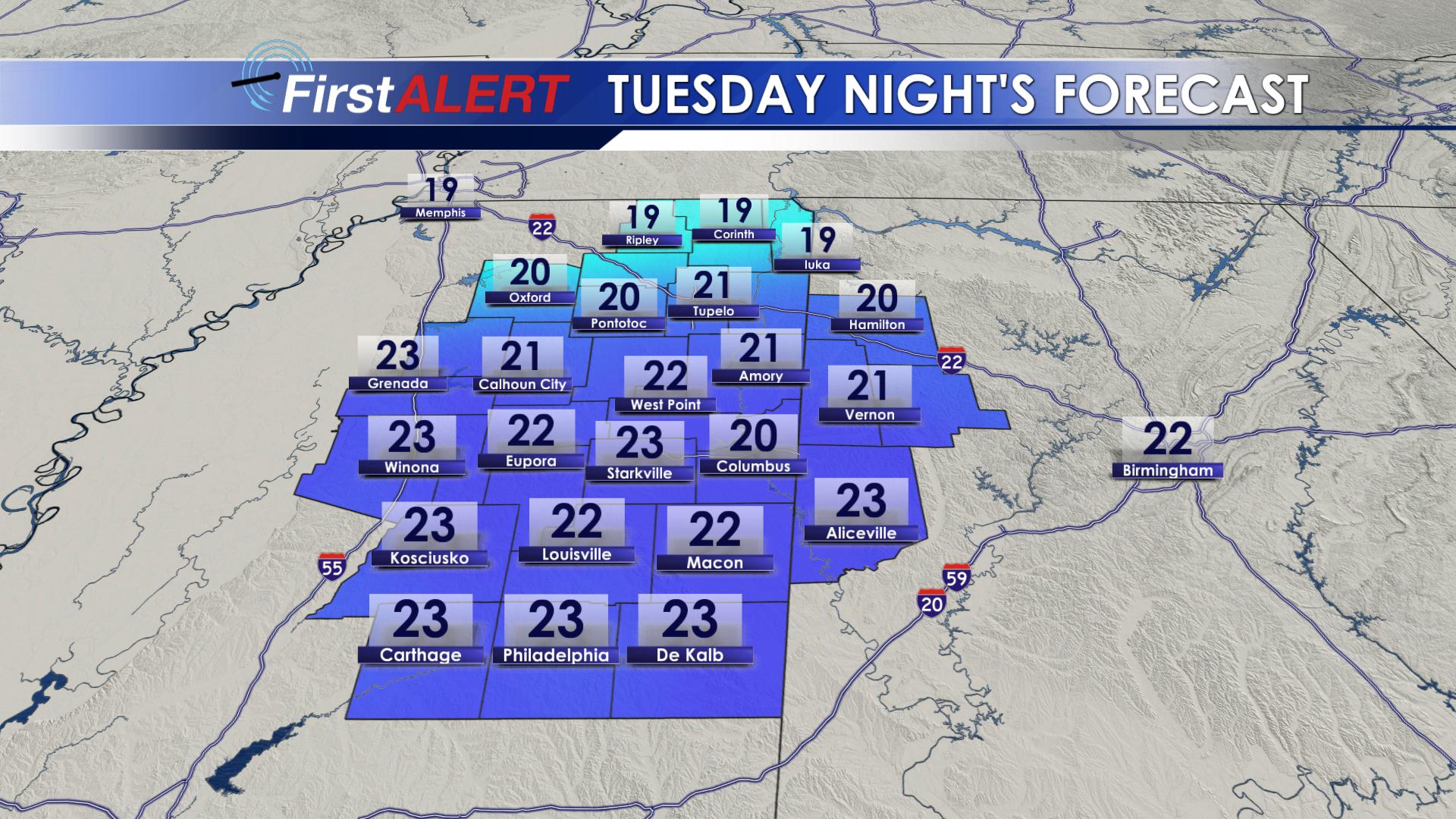
Overnight Lows
WEDNESDAY: You can thank the cold front moving through Tuesday night for the colder temperatures on Wednesday. Highs will struggle to make it into the lower and middle 40s across our area. As we go throughout the day, skies will begin to clear, giving way to partly cloudy skies in the evening. Temperatures will once again bottom out in the lower 20s Wednesday night, with skies remaining clear.
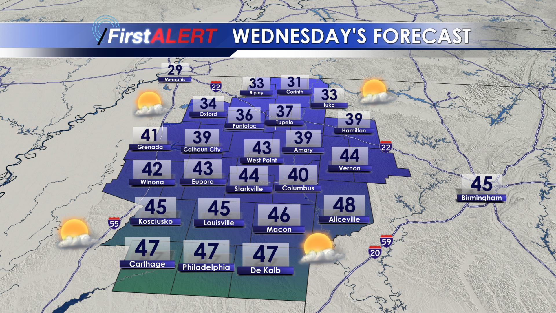
Wednesday’s Highs
THURSDAY: Thursday will be the first day of a much needed warming trend. Highs on Thursday will begin to make it back into the upper 40s and lower 50s! We will remain mostly clear on Thursday, with winds shifting out of the southeast. Thursday night will be about 10 degrees warmer than Wednesday night, but its still going to be cold. We will drop down into the middle 30s overnight.
FRIDAY: Clouds will be on the increase throughout the day on Friday, with winds bringing in more moisture out of the southeast. We could see a few isolated showers Friday afternoon, as highs climb into the middle and upper 50s. Our rain chances will die off overnight on Friday, as lows dip into the upper 30s and lower 40s.
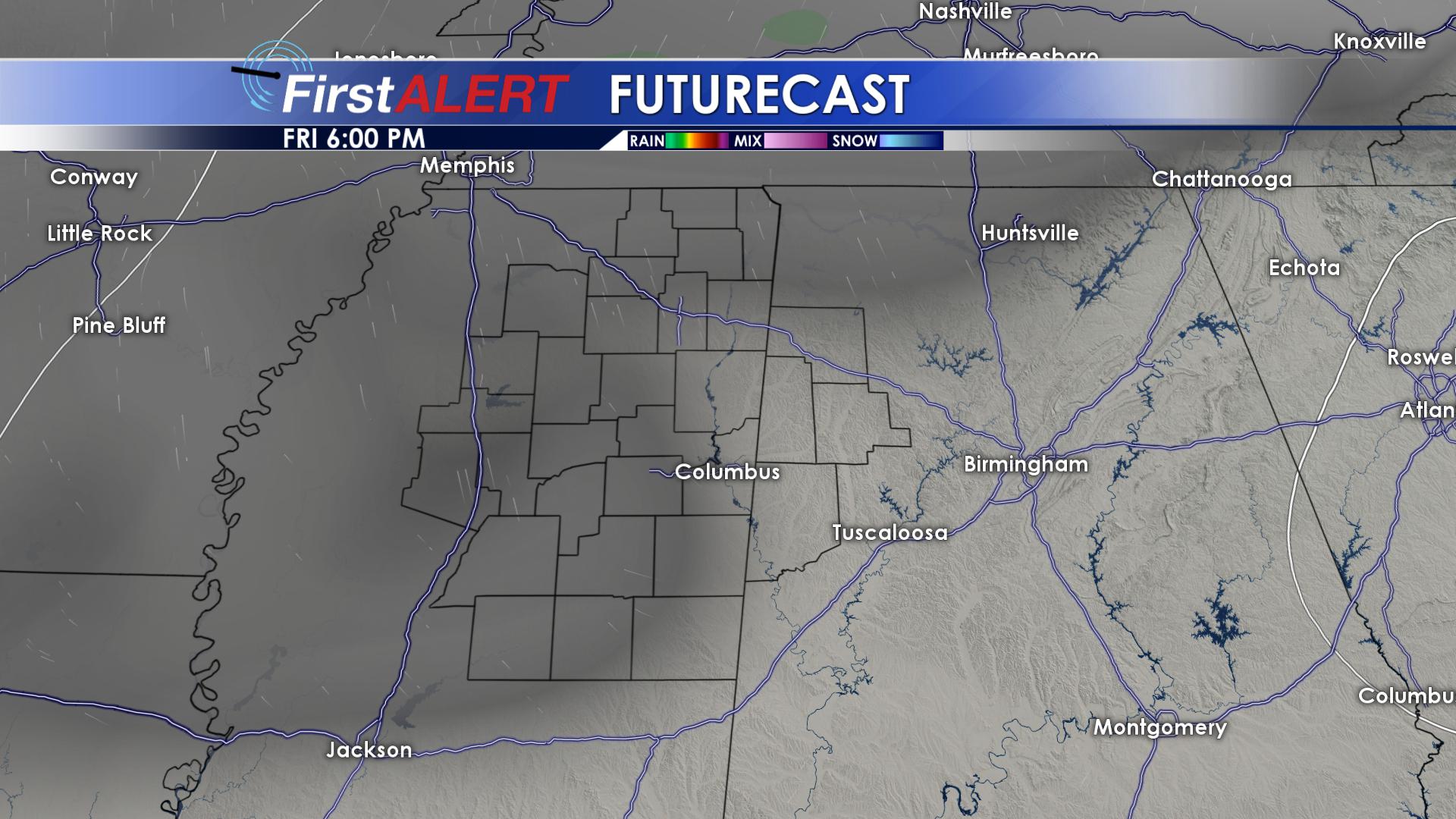
Increasing Clouds Friday
SATURDAY: Saturday will be another warm day! Clouds will increase throughout the day on Saturday, giving way to isolated showers during the afternoon. Highs on Saturday will top out in the lower 60s, with overnight lows in the middle to upper 40s.
SUNDAY: Highs on Sunday will warm into the middle 60s! Skies will remain mostly cloudy, with increasing rain chances throughout the day. Showers will become more scattered across our area, lasting into Sunday night. Overnight lows will be warm, only making it to the middle and upper 50s.
MONDAY: The warmth will continue on Monday, and so will our rain chances. Rain showers will become more scattered throughout the day on Monday, lingering into the overnight hours as temperatures drop into the middle and upper 50’s.
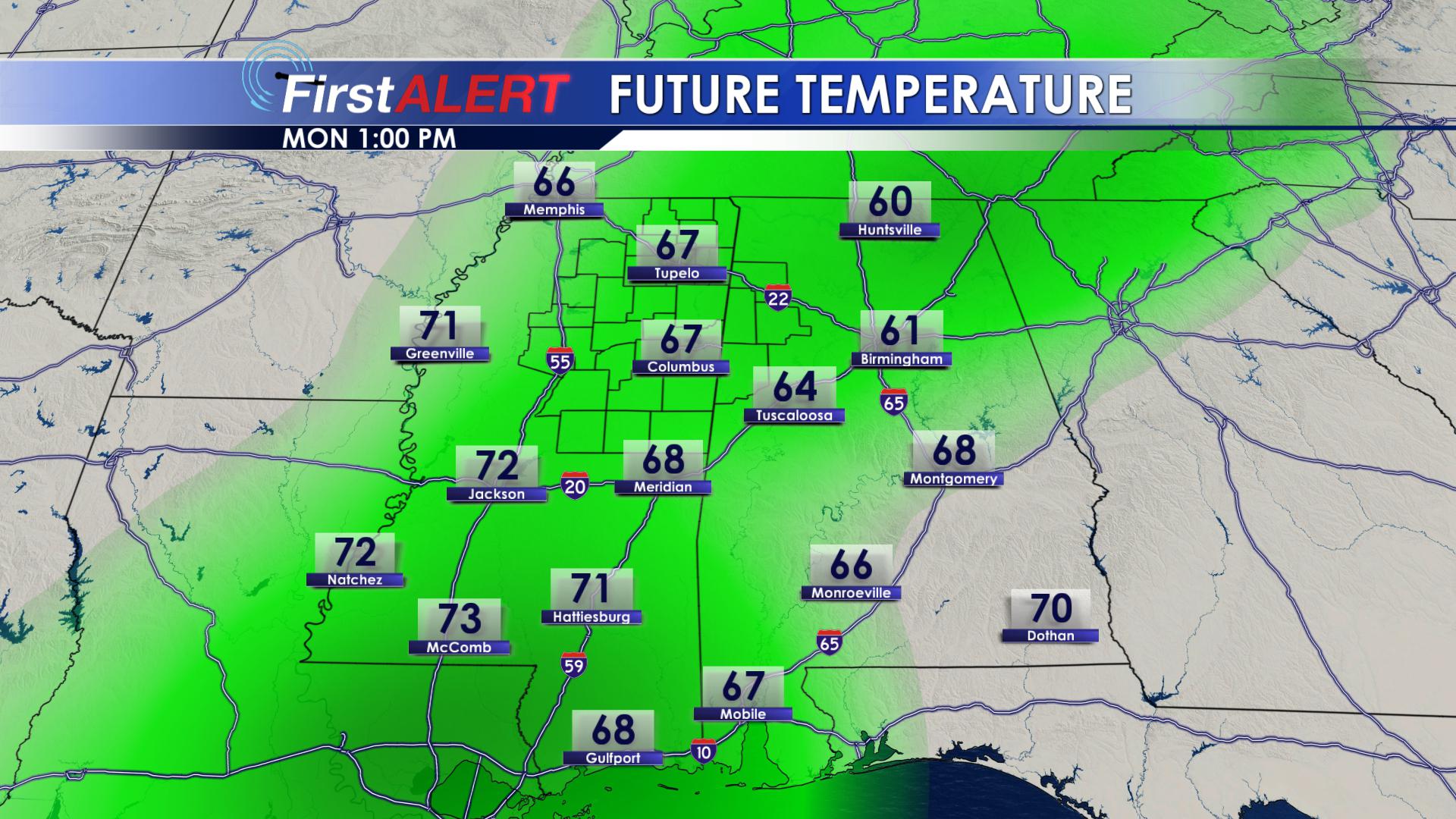
Warm and Moist Monday
TUESDAY: Showers and storms will become more widespread on Tuesday. Highs will be well above average, topping out in the lower 70’s.
BE SURE TO FOLLOW US ON Facebook, Twitter, Instagram and Snapchat @WCBIWEATHER


Leave a Reply