Are we done yet?
COLUMBUS, Mississippi (WCBI) – Many are asking, but the rain chances are holding through the end of the week. Getting drier by the weekend.
TUESDAY NIGHT: Mild and muggy. Humidity is staying high. Overnight lows drop into the middle 60s.
WEDNESDAY: Another day, another chance for showers and storms. Heavy clouds will maintain through a mostly dry morning, allowing highs to reach the lower 80s. As the cold front stalls out, showers and storms will move NE from our SW. These should stay below severe thresholds, but always stay aware.

THURSDAY: Here we go again, don’t put away the rain gear. More showers and storms will be likely throughout the afternoon and evening. There is a Level 1 – Marginal Risk for severe weather, with damaging wind and hail continuing to be the main concerns. Highs will be in the upper 70s to lower 80, with lows in the upper 60s.
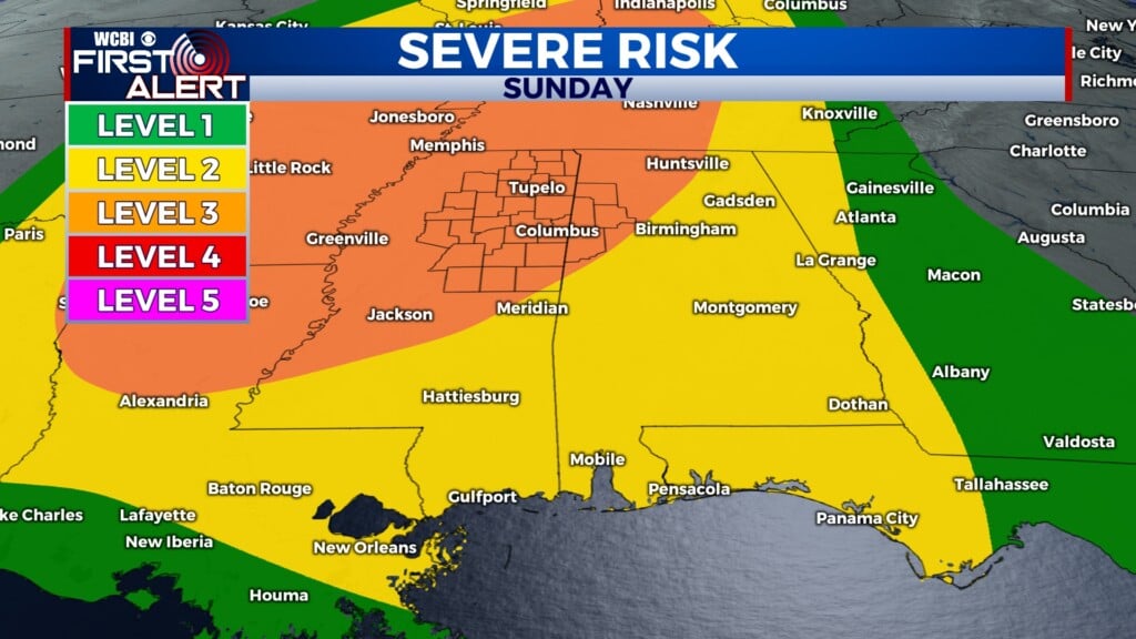
FRI-SUN: Hoping for drier air. Rain chances become much lighter as the week comes to a close and the weekend arrives. There will be a slight temperature dip on Friday before heading back to the lower 80s, thanks to our next passing cold front.