Back to typical summer weather for Fourth of July weekend
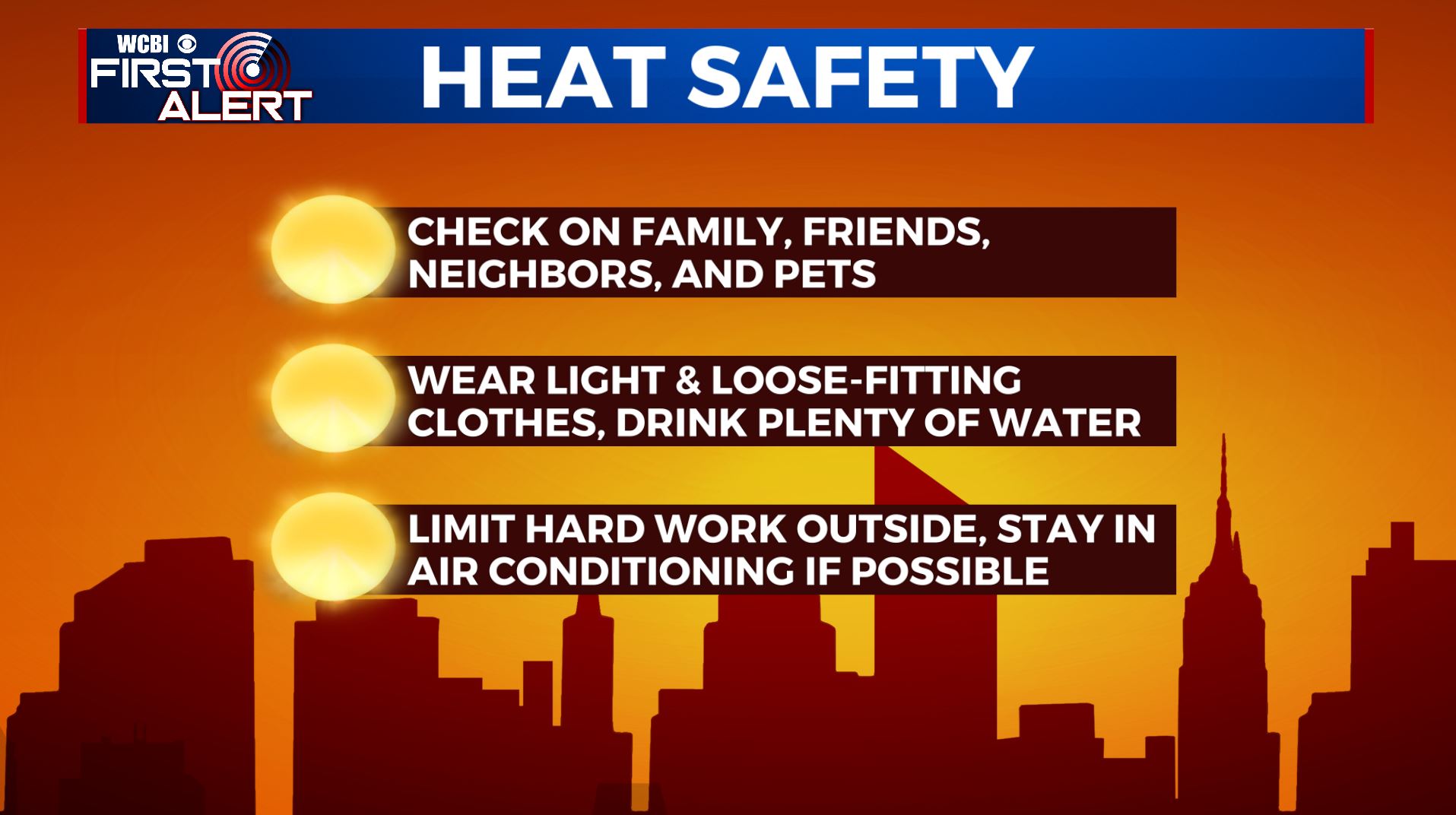
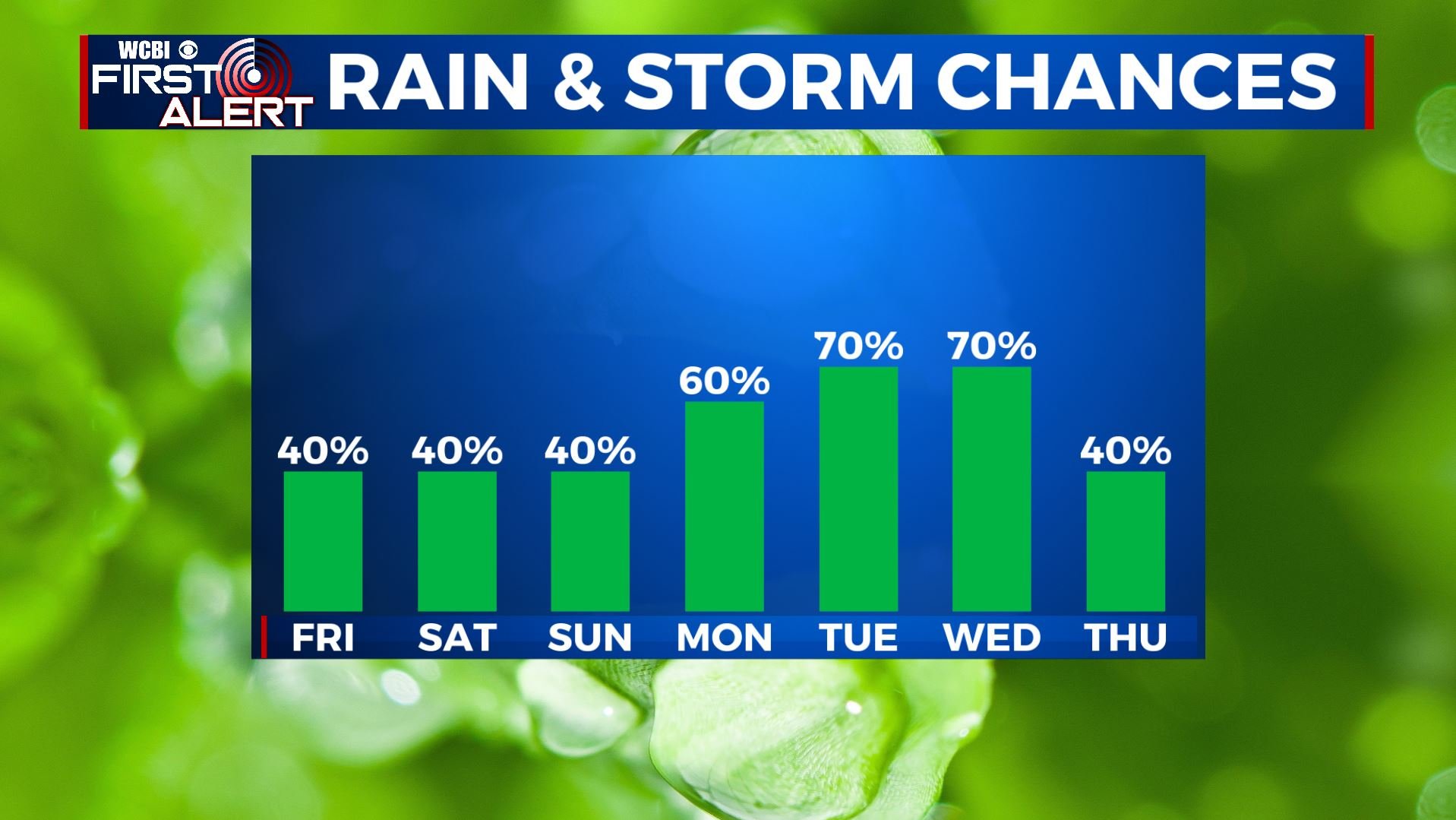
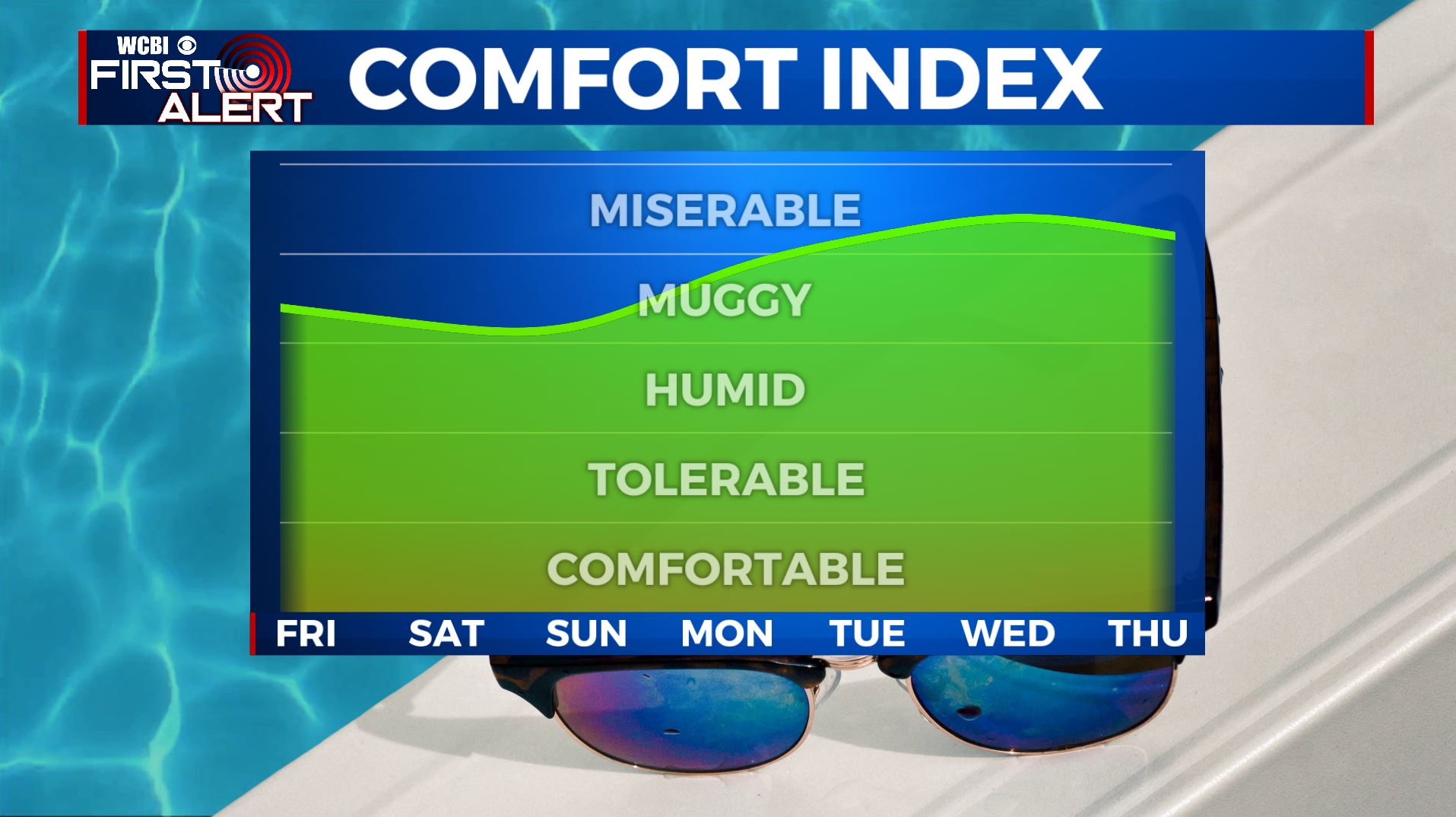
SUMMARY: After an active last few days, we’re back to a typical summer weather pattern heading into the Fourth of July holiday weekend. It will be hot & humid with highs in the lower 90s with the heat index making it feel like near 100 degrees so stay cool and hydrated. The holiday weekend is not looking to be a complete washout, but we’ll still have a few pop-up storms in the afternoon.
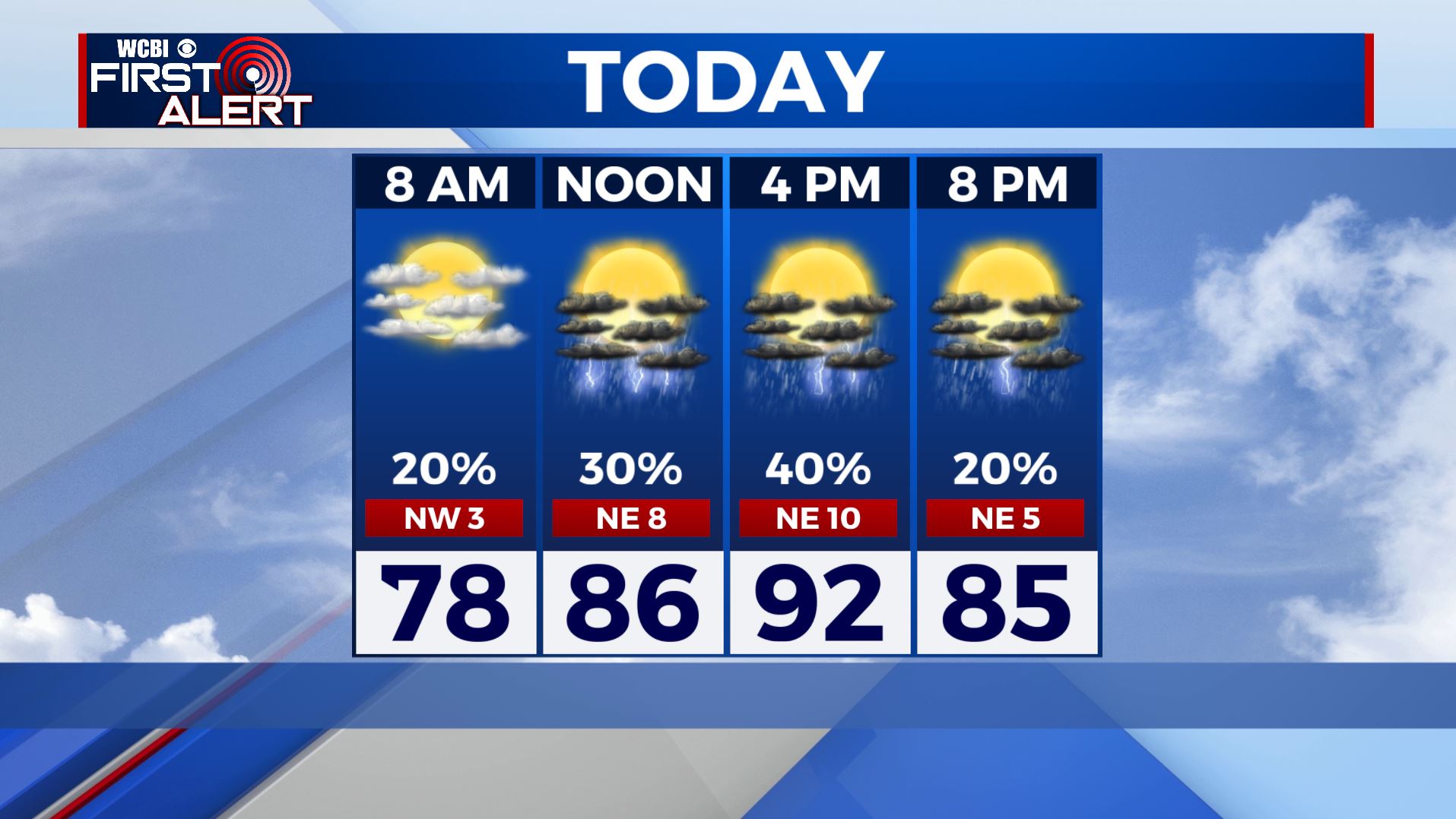
FRIDAY: It’s another mild & muggy start to our day on this Friday morning across with temperatures in the 70s with a mix of sun & clouds. We’ll have the usual pop-up scattered showers & storms in the afternoon. Hot and humid once again with highs in the lower 90s.
FRIDAY NIGHT: Partly cloudy skies. Muggy & mild overnight with lows in the 70s.
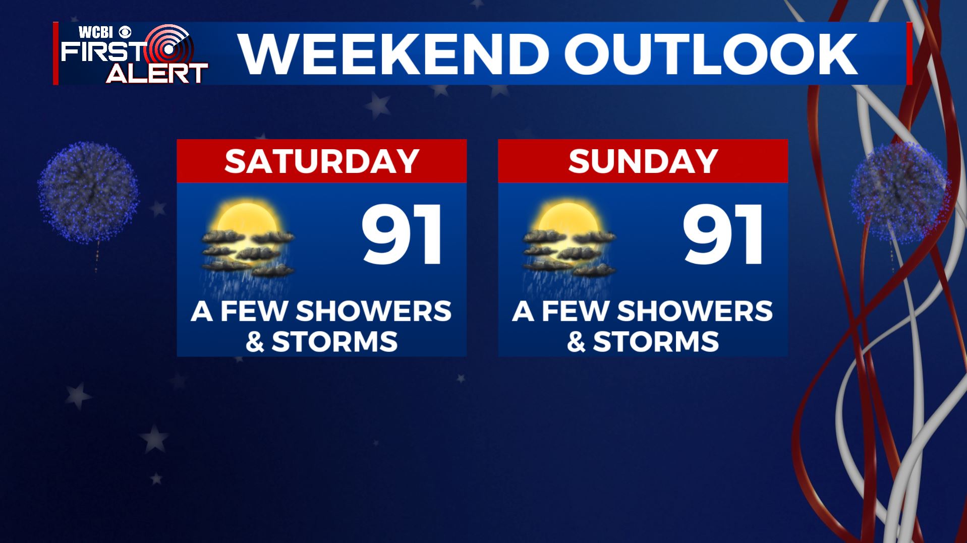
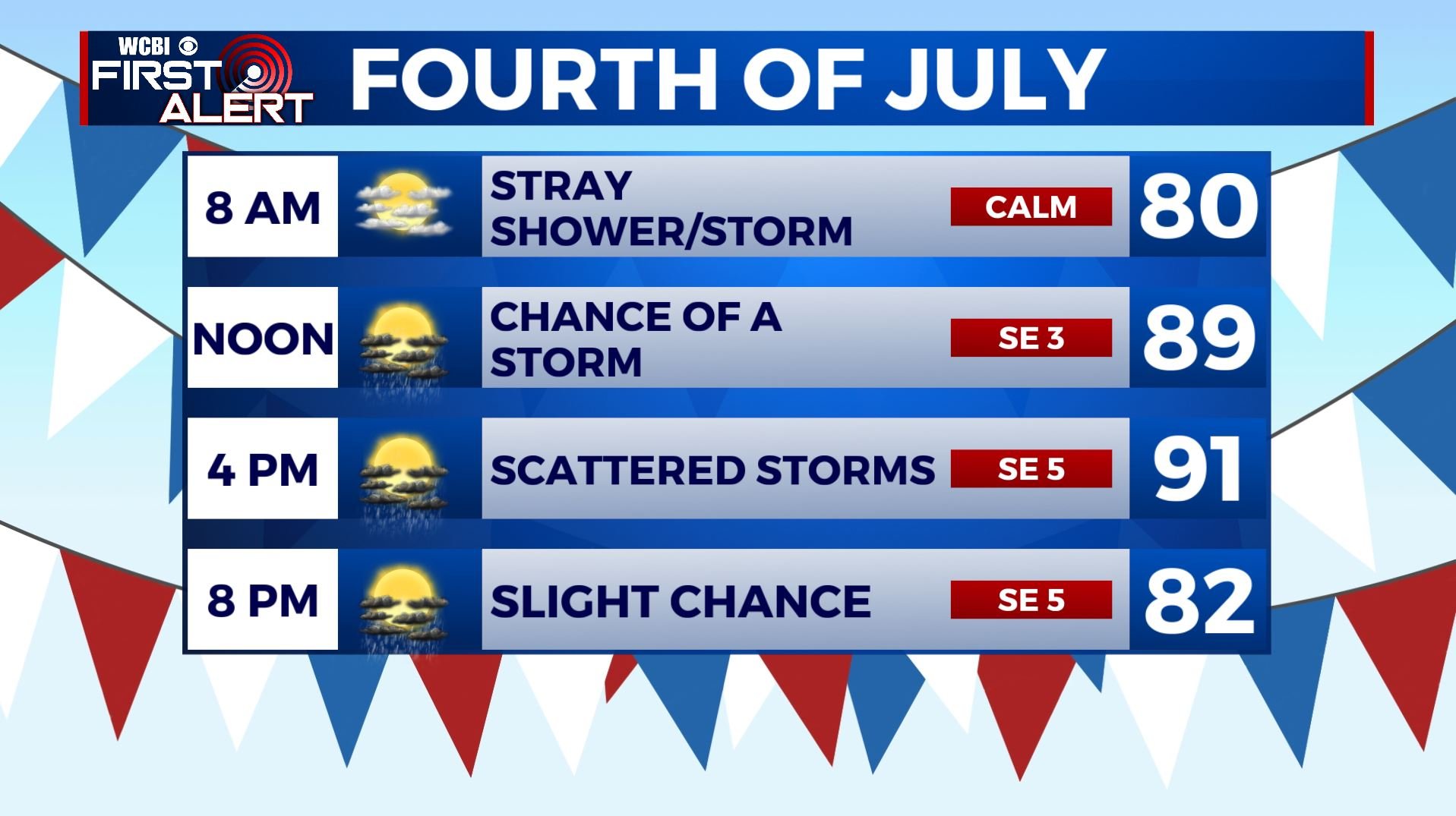
FOURTH OF JULY: The Fourth of July holiday on Saturday looks to feature typical summertime weather. Highs in the lower 90s with the heat index near 100. Chances of a pop-up shower or storm in the afternoon hours, but not looking to be a complete washout so any outdoor weekend plans or evening fireworks will be a go. But you may want to have a backup indoor plan just in case.
SATURDAY NIGHT: We’ll have a few clouds. It may be a bit misty and hazy overnight due to leftover smoke from fireworks. Overnight lows in the 70s.
SUNDAY: A mix of sun & clouds with scattered afternoon storms due to the daytime heating. Highs stay very warm & humid in the upper 80s to near 90 with overnight lows in the low 70s.
MONDAY-THURSDAY: A better chance of showers and storms next week as we return to an active/unsettled weather pattern. High temperatures in the upper 80s to lower 90s and staying muggy & humid.
Stay connected with @WCBIWEATHER on Facebook, Twitter, Instagram, and the WCBI News App


Leave a Reply