Beautiful weekend ahead, but rain and storms return to kick off the workweek
COLUMBUS, Mississippi (WCBI) – SUMMARY: A picture-perfect weekend is in store, but rain and storms return on Monday ahead of an active week.

TODAY: Abundant sunshine. Highs in the upper-50s with a calm wind. It will feel cooler in the shade, but that sun will help warm you up.
TONIGHT: Cold! Mostly clear skies with lows near freezing. Thankfully, winds will be calm so wind-chill is not a factor.
SUNDAY: Mostly sunny skies during the morning, then increasing clouds later in the afternoon. Highs in the mid-60s. Increasing southerly breeze, 5-10 mph.
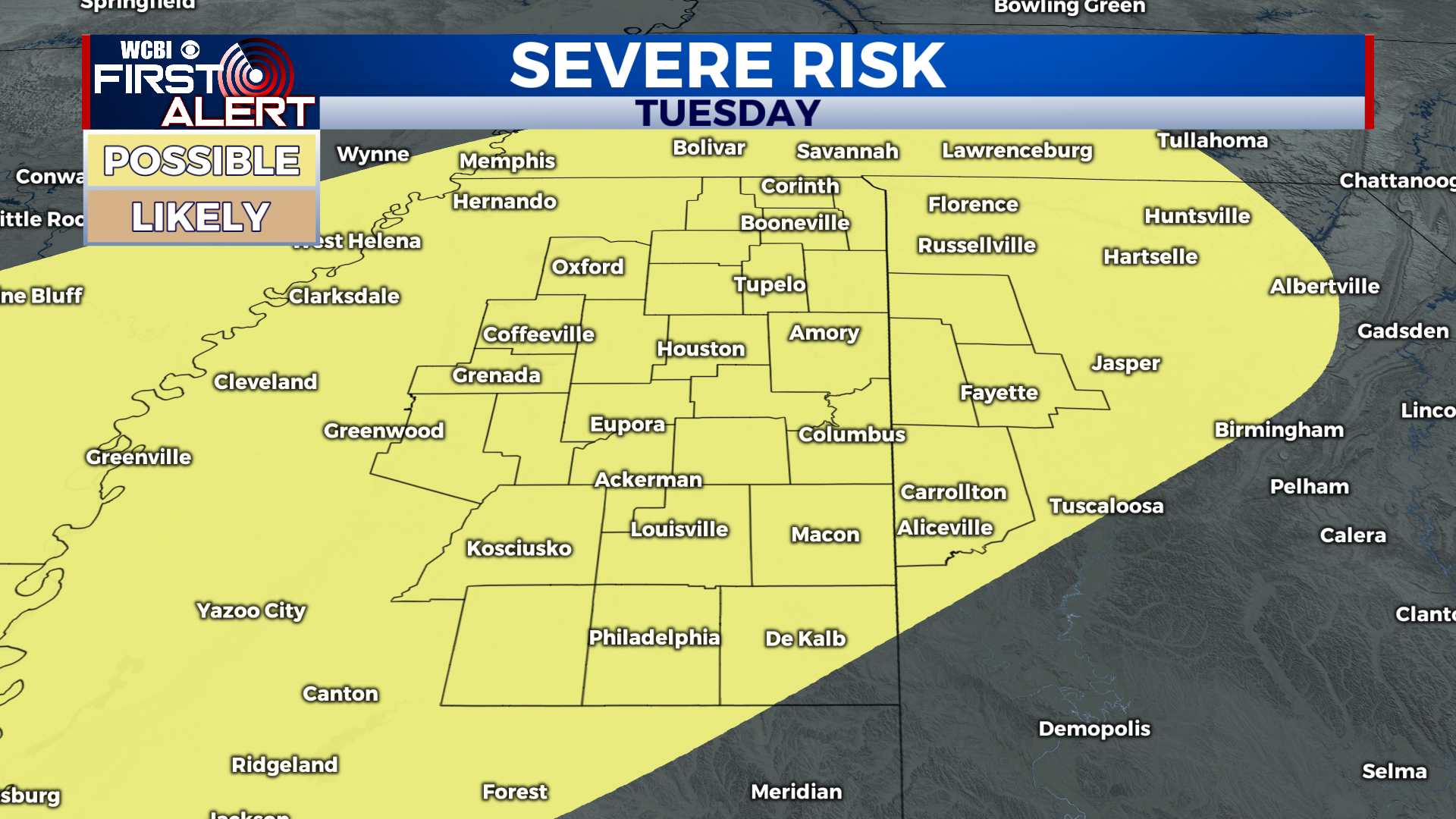
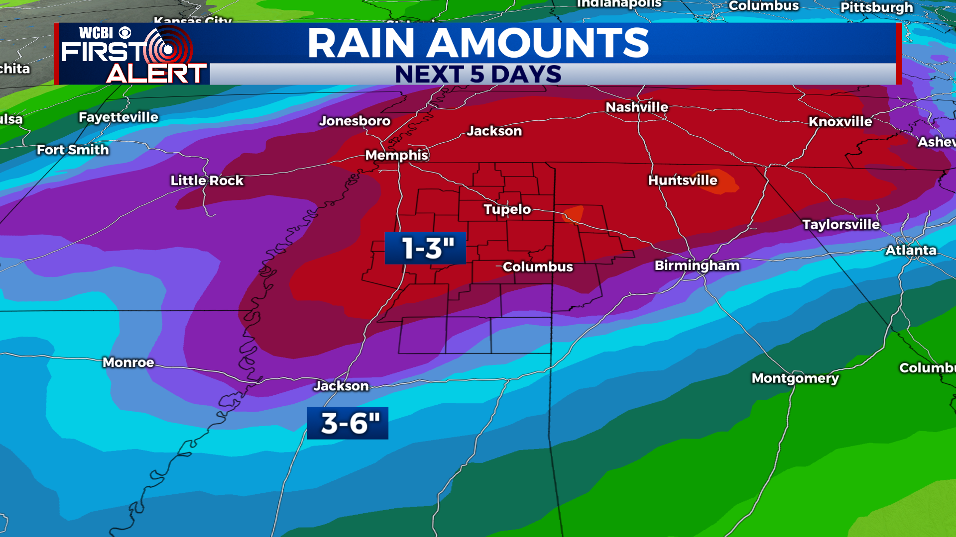
EXTENDED FORECAST: A warm front will lift northward through the region on Monday, which will allow warmer temperatures and plenty of Gulf moisture to surge into the area. Off-and-on scattered showers and thunderstorms are likely on Monday, lasting most of the day. Rain may be heavy at times. We’ll see a lull in precipitation on Monday night, but more showers and storms will move through the region on Tuesday. The Storm Prediction Center has outlined the entire viewing area in a “slight risk” (level 2 out of 5) for severe weather on Tuesday (as seen above). The main concern will be thunderstorms capable of producing damaging winds. We’ll continue to fine-tune the details this weekend. For now, just something to be aware of. Other than that, the main headline will be beneficial rainfall. Locations north of US-82 are likely to see the highest rainfall totals, ranging from 2-4+ inches between Monday and Thursday! Regardless, everyone will see decent rainfall next week.
With that, enjoy your weekend, enjoy some baseball, and we’ll continue to keep you updated on next week’s active weather!


Leave a Reply