BREEZY AND COLD START TO NEXT WEEK
Saturday has been down right miserable. Rain pushed through the area during the morning and early afternoon hours, dropping anywhere between 0.25″ and 0.75″ across the region. After this rain pushes out tonight, we should dry for at least the next few days. Next weekend looks to start off warm, before a strong arctic front moves through and causes our temperatures to nose dive.
SATURDAY NIGHT: Showers will come to an end late Saturday night. Overnight lows will drop down into the lower 40’s, with breezy winds shifting from the southwest to the west around 10-15 MPH.
SUNDAY: Highs on Sunday will occur in the early AM hours Sunday morning. Highs will be in the lower 50’s. As we go throughout the rest of the day on Sunday, a few peaks of sunshine will be possible. For the most part, clouds will continue to blanket the area. Winds will be gusty out of the northwest between 10 and 15 MPH, with gusts around 20 MPH at times. Temperatures will fall through the 40’s on Sunday. Sunday night, temperatures will fall into the middle 30’s.
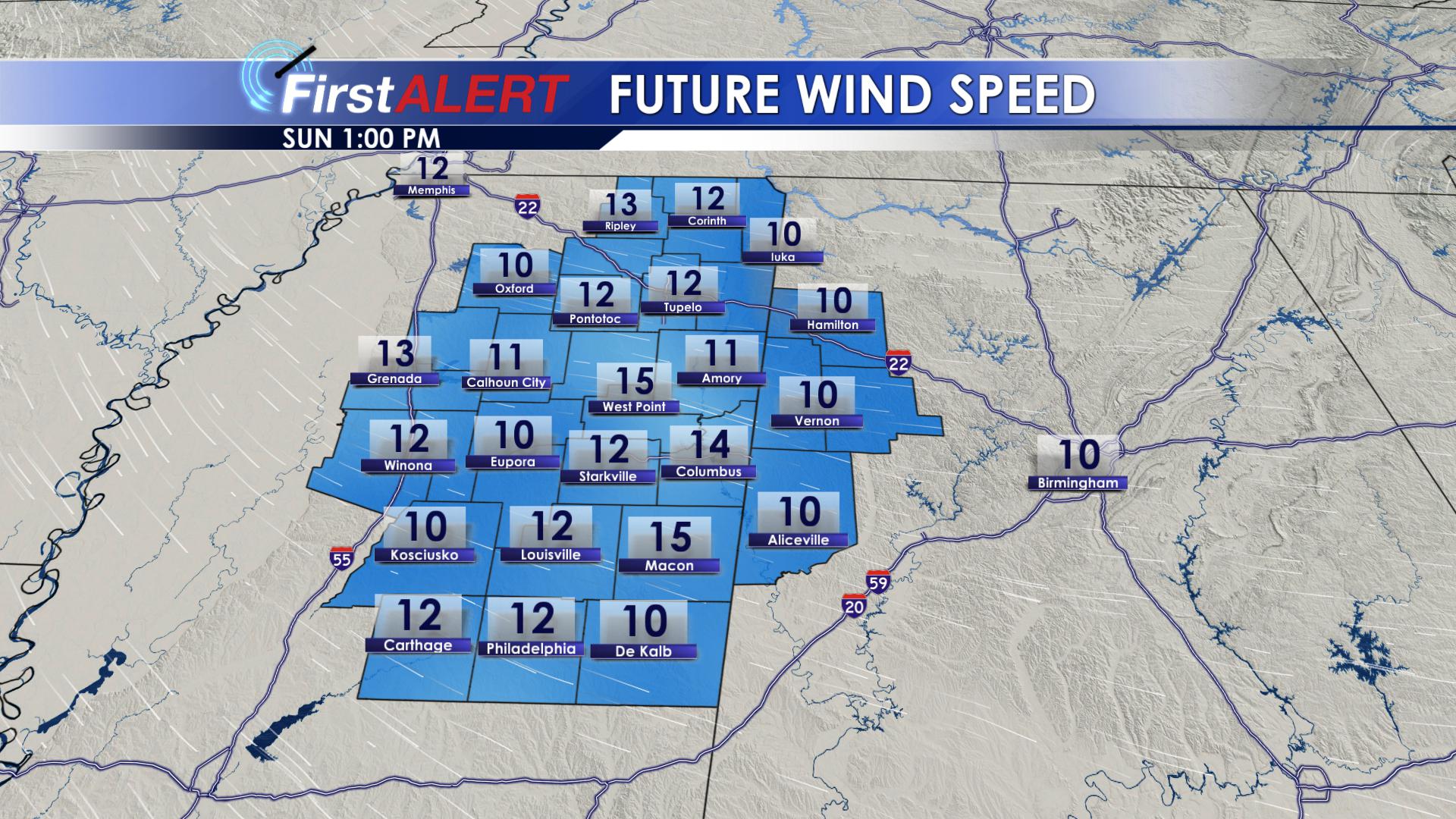
Winds on Sunday
MONDAY: Monday will be chilly, with highs in the middle 40’s. Wind will continue out of the northwest, ushering in colder air. Monday will remain mostly cloudy, with rain chances remaining at 0% for our area. Monday night, temperatures will drop below freezing for most locations, with lows in the upper 20’s and lower 30’s.
TUESDAY: Things will warm up just a tad on Tuesday. Highs will be in the lower 50’s, with partly cloudy skies. Things will remain dry, with a chilly north wind. Tuesday night will be cold, with lows dropping down into the lower and middle 30’s.
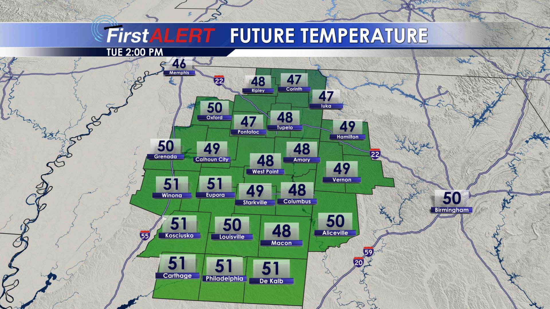
Warmer on Tuesday
WEDNESDAY: On Wednesday, winds will begin to shift to the southwest, bringing in some warmer air. Highs on Wednesday will top out in the upper 50’s, with overnight lows remaining mile in the middle 40’s.
THURSDAY: Clouds will begin to increase throughout the day on Thursday. Highs will be warm, topping out in the lower 60’s. Overnight Thursday, our rain chances will increase. Overnight lows will only lower into the lower 50’s.
FRIDAY: Rain showers will return to the area on Friday. It will remain warm, with highs in the middle 60’s. Rain chances will be around 40% for our area. Friday night will remain mild, with overnight lows in the lower 50’s.
SATURDAY: Saturday is shaping up to be a wild weather day. Models are showing us start out in the lower 60’s and upper 50’s around midnight. As we go throughout the day, temperatures will plummet! Rain chances will become more widespread on Saturday. It looks like this weekend will be just as nasty as the last.
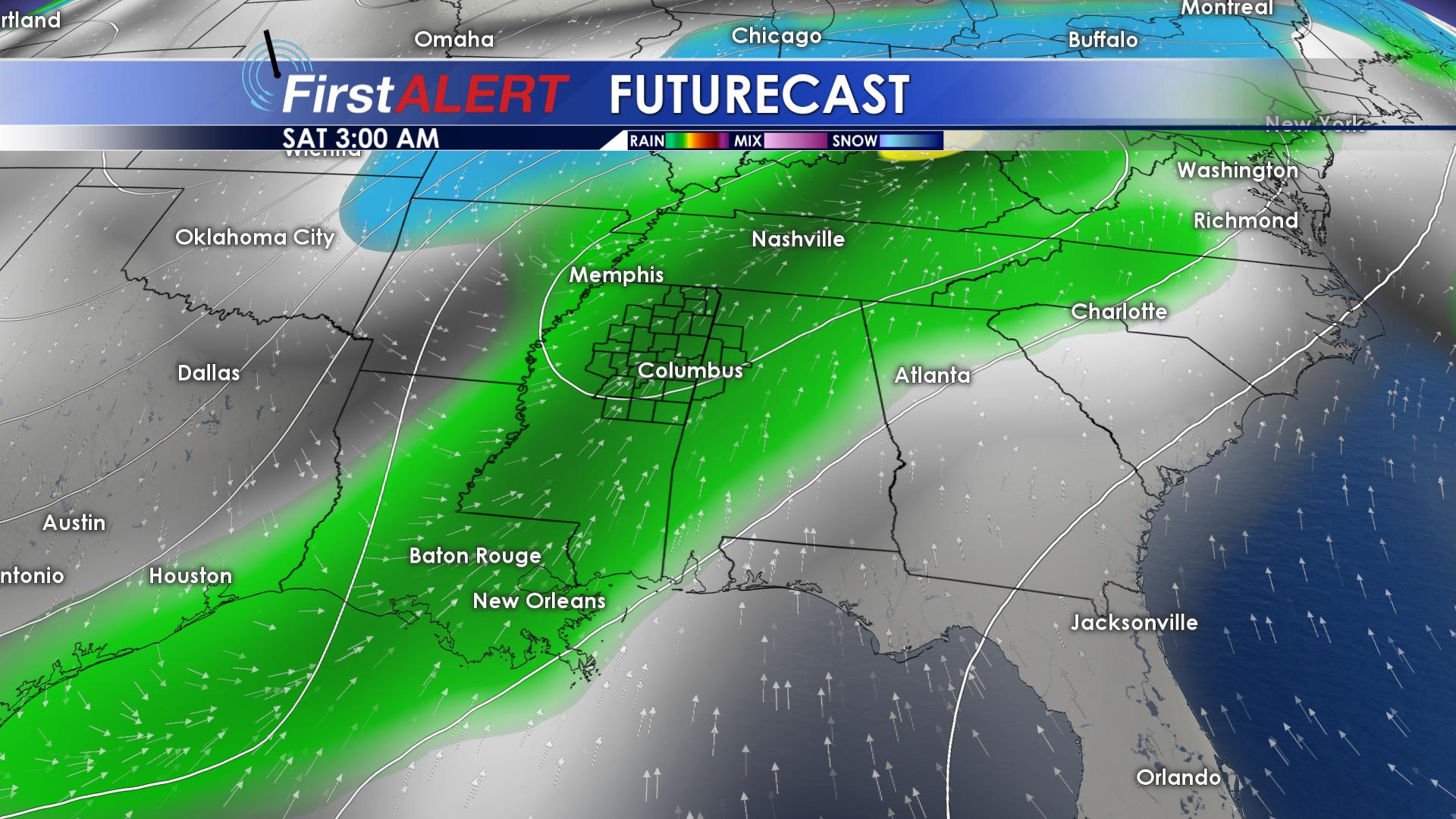
Rainy Saturday
Be sure to Follow Us on Facebook, Twitter, Instagram and Snapchat @WCBIWEATHER


Leave a Reply