Brief relief from the rain Wednesday before another round Thursday
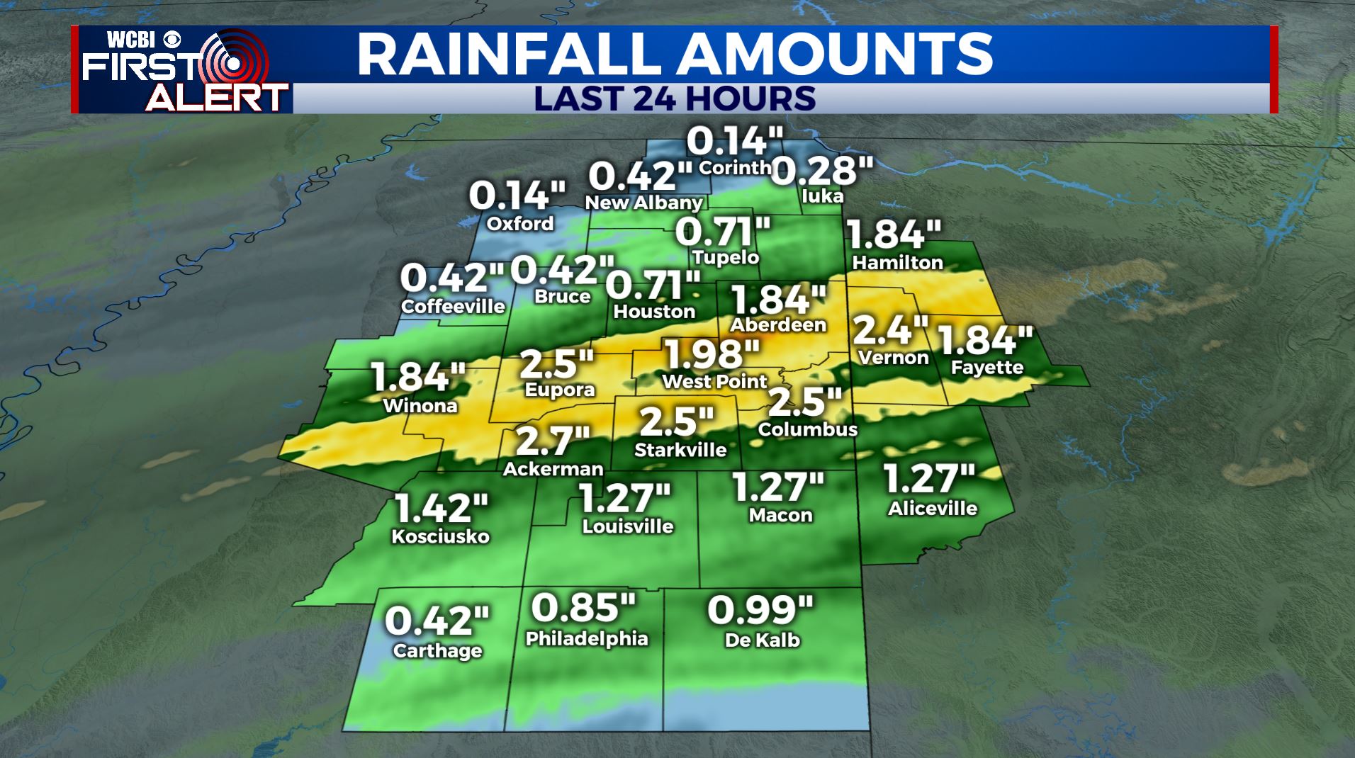
SUMMARY: We are waking up to some lingering showers this Wednesday morning. We received for the most part 1 to a little over 2 inches of rain yesterday. We’ll at least get a bit of relief today before more rain moves in tonight & Thursday. The heaviest rain with this next system will likely stay just to our south but anymore rain is unwelcome. Cooler and drier air settles in for the end of the work week and the start of the weekend. More rain chances do move back in Sunday into early next week.
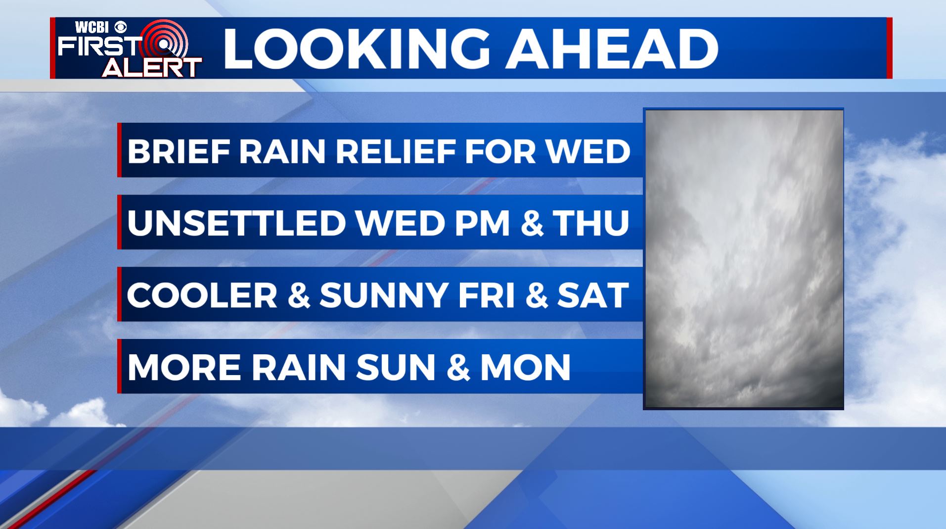
WEDNESDAY: Mostly cloudy and drier after some lingering morning showers. Cooler with highs in the lower to middle 50s. Northerly winds around 5-10 mph.
WEDNESDAY NIGHT: Mostly cloudy. Areas of rain developing late evening into the overnight hours. Lows in the lower 40s.
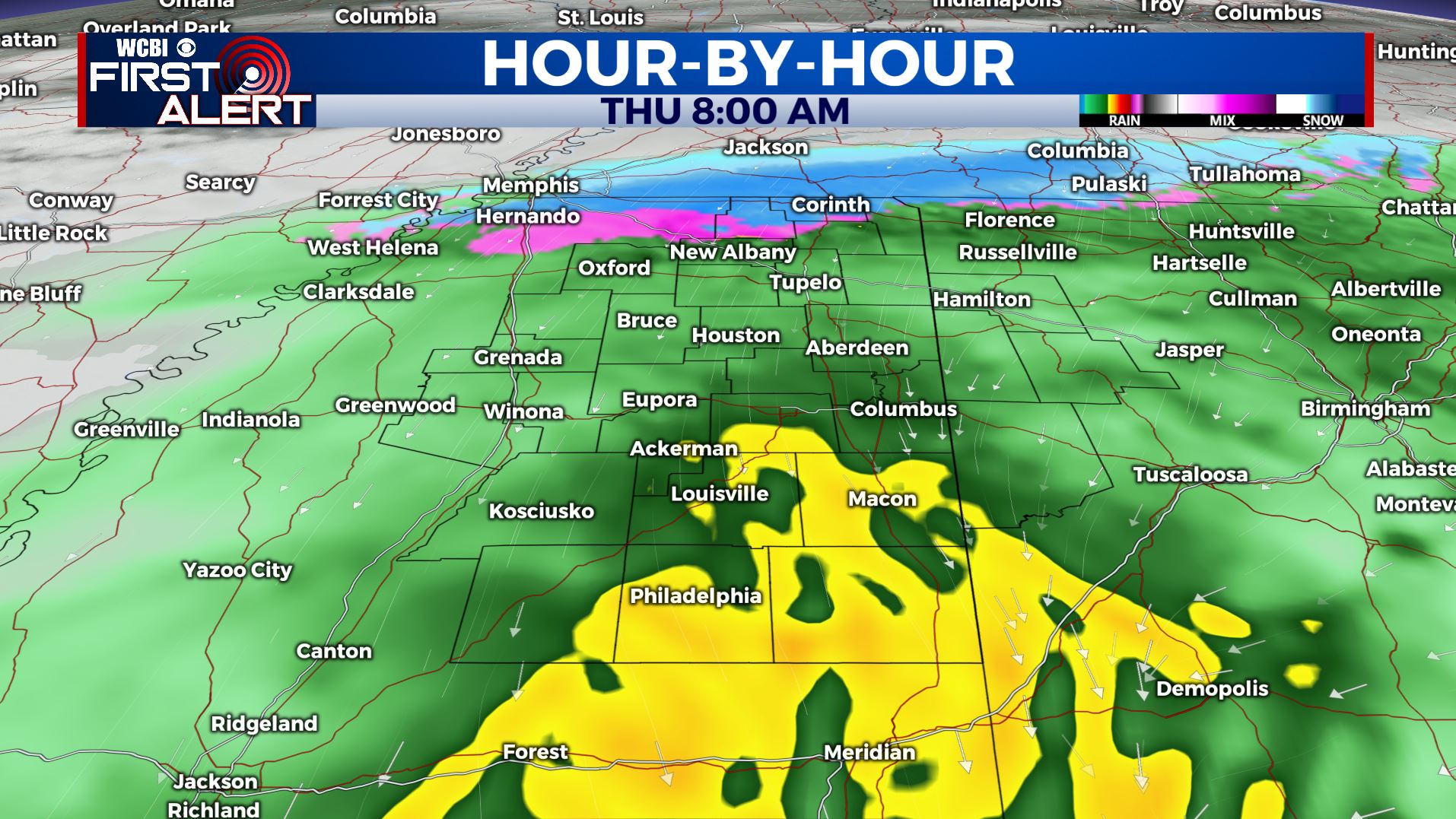
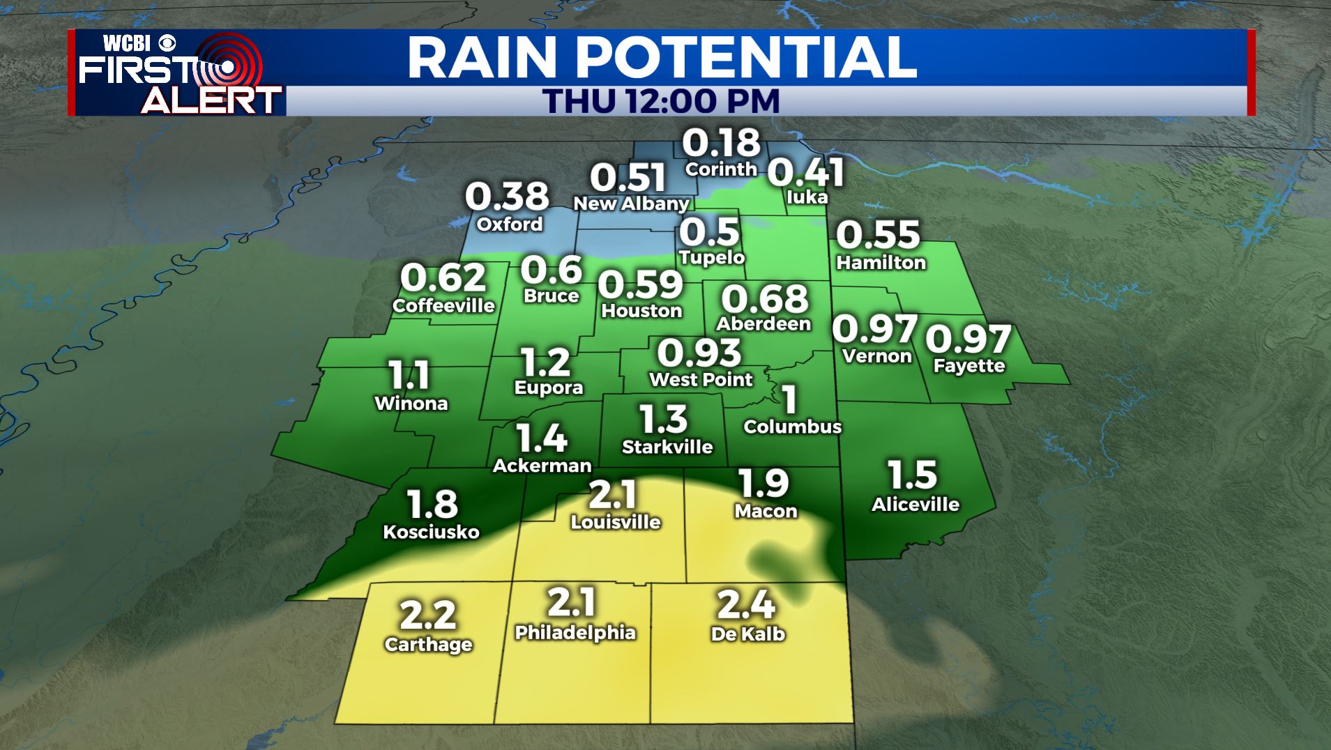
THURSDAY: Areas of rain. The heaviest activity is likely going to be along and south of the I-20 corridor. Some wintry precipitation can’t be totally ruled out across the TN/MS border area in the morning either. No impacts are expected with that, even if it were to happen. Look for highs mainly in the middle 40s with chilly northerly winds continuing at 10-20 mph. Skies will clear from north to south during the afternoon.
THURSDAY NIGHT: Clear and cold. Lows in the upper 20s.
FRIDAY: Sunny skies return. Highs in the upper 40s.
FRIDAY NIGHT: Clear and cold. Lows in the upper 20s.
SATURDAY: Mostly sunny. Highs in the low 50s.
SATURDAY NIGHT: Partly cloudy. Lows in the upper 30s.
SUNDAY: Increasing clouds as rain chances return. Highs in the lower 50s.
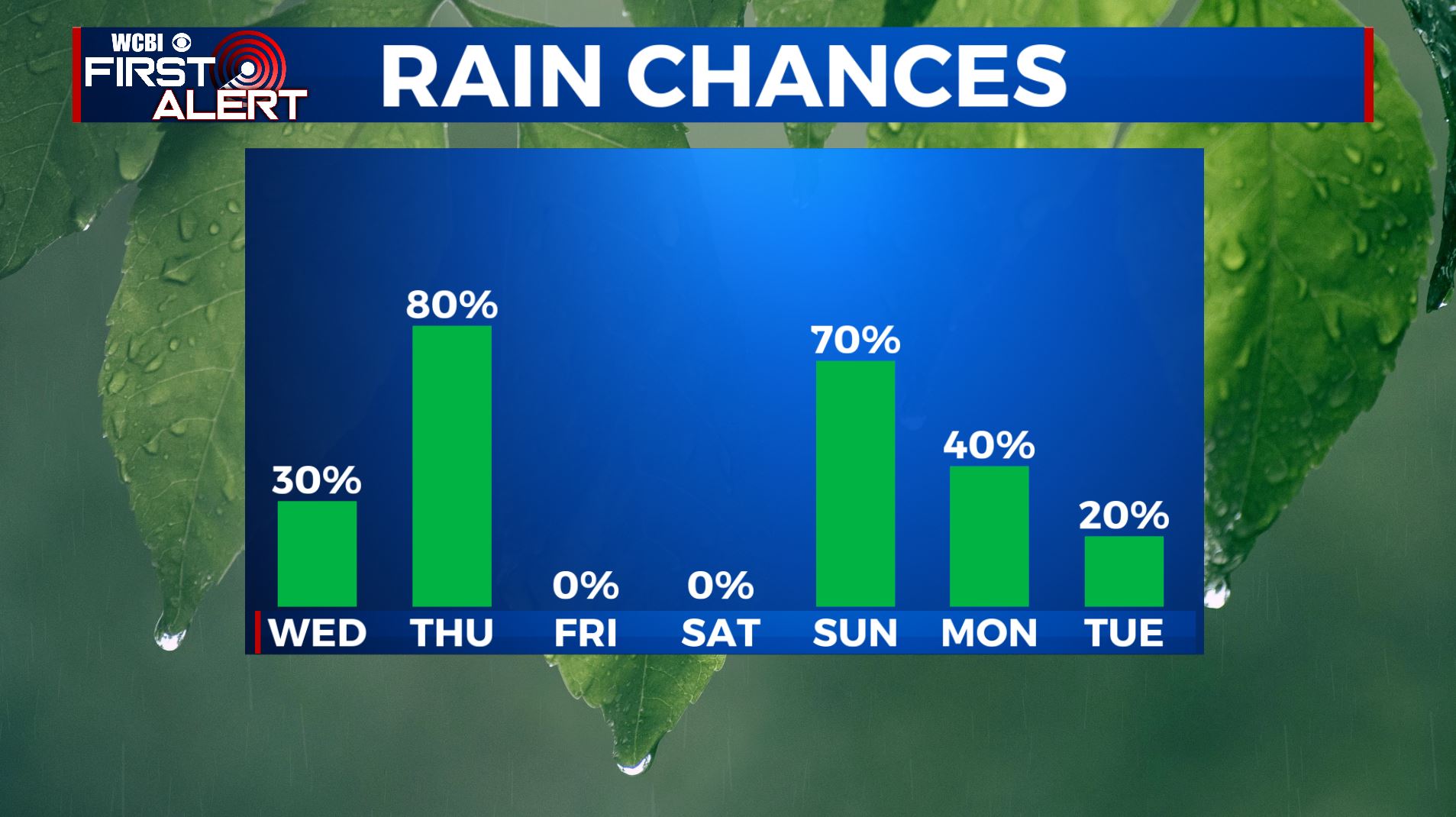
MONDAY: Areas of rain. Perhaps a storm. Highs in the lower 60s.
TUESDAY: A mix of sun and clouds. Highs in the lower 60s.
Follow @WCBIWEATHER on Facebook, Twitter, Instagram, and the WCBI News App


Leave a Reply