Christmas Forecast
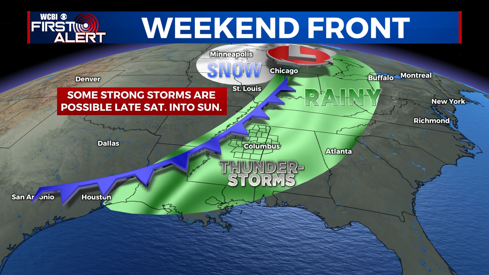
SUMMARY: We’ll be pushing 70 today on Christmas Day with a mix of sun and clouds. Our next best chance of rain will come Saturday into Sunday when another round of rain and storms roll through. There is at least the potential for a few strong to severe storms Saturday night into Sunday so stay tuned for additional details later this week. Total rain accumulation with the weekend storms may range from 1/2” to over 2” depending on how the system develops.
CHRISTMAS DAY: Sun & clouds. Very mild with highs in the upper 60s to around 70. Winds SE 5-10 mph.
WEDNESDAY NIGHT: Mostly cloudy and mild. Lows around 50.
THURSDAY: Mostly cloudy. Highs in the mid 60s.
THURSDAY NIGHT: Mostly cloudy. Lows in the low 50s.
FRIDAY: Mostly cloudy with a slight chance of a few showers. The chance of rain is 20% or less. Highs in the mid to upper 60s.
FRIDAY NIGHT: Mostly cloudy. Lows in the low to mid 50s.
SATURDAY: Mostly cloudy. A 40-50% chance of afternoon showers. Some evening rain and storms are also likely. Highs in the upper 60s.
SATURDAY NIGHT: Rain and storms. Temperatures holding steady in the 60s. Chance of rain is 90%.
SUNDAY: Areas of rain and storms. Chance of rain is 70%. Highs in the 60s.
EARLY NEXT WEEK: Cooler and drier air returns along with more sunshine. Highs fall back into the 50s with lows in the 20s and 30s.
Follow @WCBIWEATHER on Facebook, Twitter, Instagram, and the WCBI News app


Leave a Reply