Clouds move back in for Monday; Watching the return of showers & storms midweek
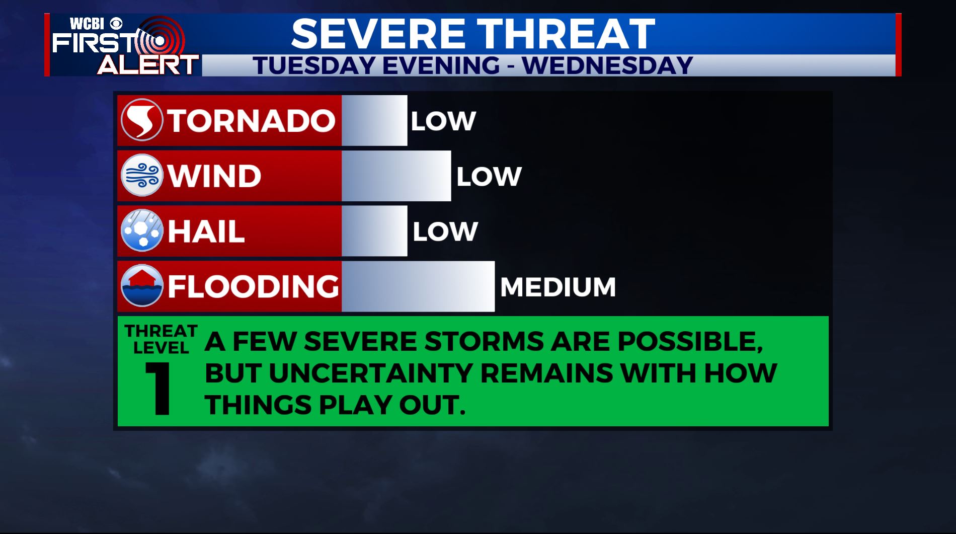
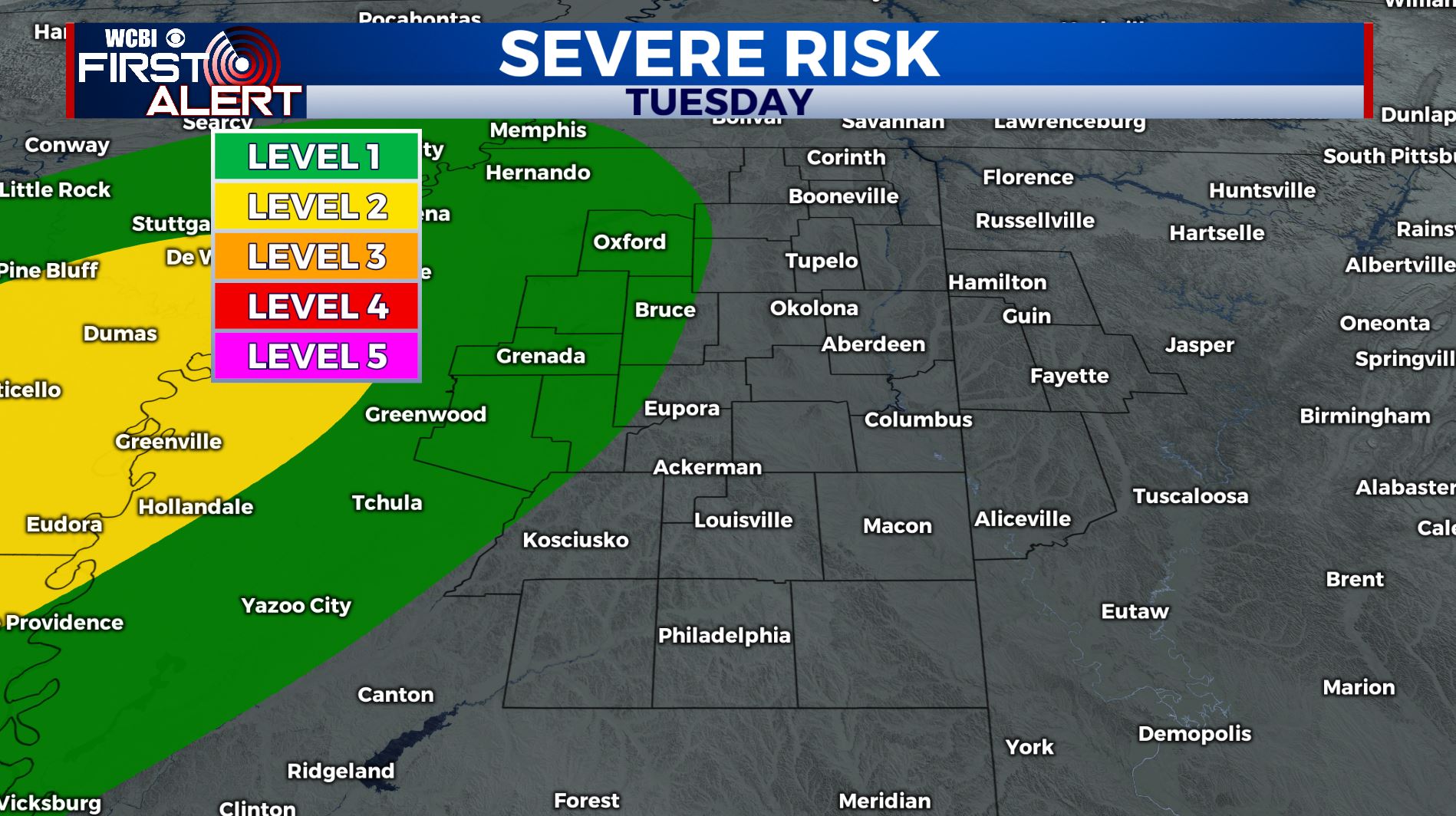
SUMMARY: After a beautiful & warm Super Sunday, we’ll be seeing clouds move back into the forecast for Monday. We’ll also see the return of showers & thunderstorms in the forecast by midweek. Some of those storms could be on the strong side with gusty winds and heavy rain with rainfall amounts of 1-2+ inches Tuesday through Thursday. Right now we’re in a Level 1 Risk for Tuesday night into Wednesday.
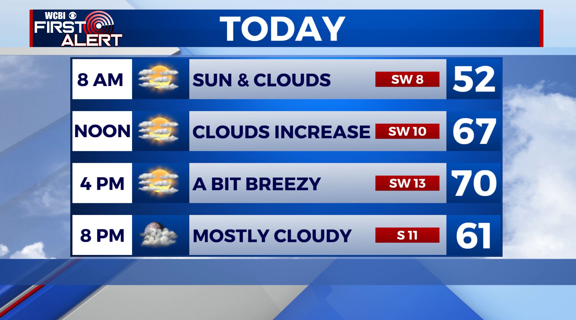
MONDAY: We’re back into the upper 60s and low 70s for highs on Monday. We will be seeing an increase in cloud cover mixed in with some sunshine. A bit breezy with SW winds 5-15 mph.
MONDAY NIGHT: Scattered showers are anticipated overnight with mostly cloudy skies. Overnight lows only in the middle 50s. Winds gusting up to the S at 20 mph.
TUESDAY: We’ll see the return of showers and storms to the region, with some heavy rain possible. Overall Tuesday, the main threat for strong to severe storms will be to the west, but a few strong storms capable of damaging winds can’t be ruled out locally, particularly Tuesday evening and Tuesday night. Highs Tuesday are in the upper 60s to near 70 with south winds 5-15 mph. Lows at night are only down into the low 60s with rain and storms likely.
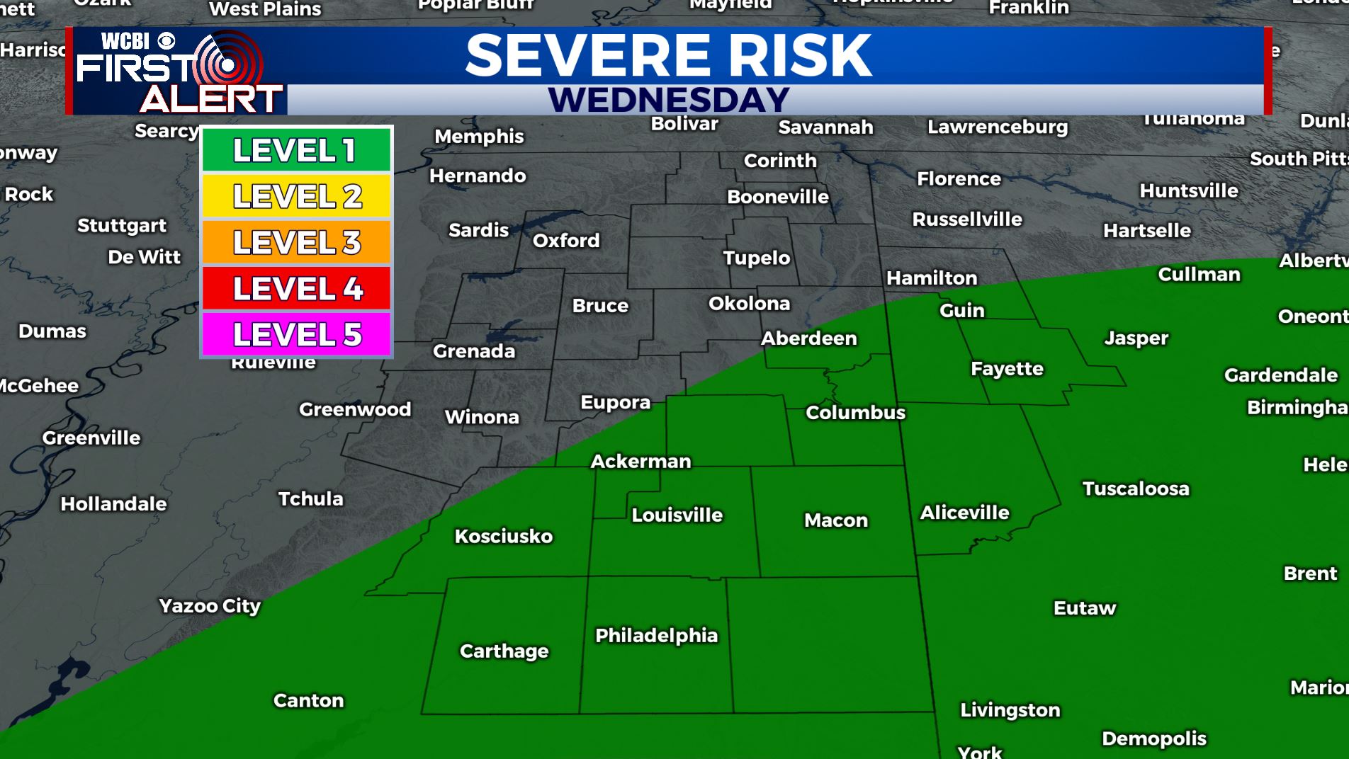
WEDNESDAY: Some uncertainty remains with how Wednesday plays out. There’s a chance for strong to severe storms again in parts of our area, but it all depends on how the track of an area of low pressure moves. A track further north means we’d be in play for severe weather, while a track to the south of us would keep us out of severe weather. Regardless of severe weather or not, we’ll anticipate it to be a wet day with rain and thunderstorms likely. Highs generally remain in the 60s with a few low 70s not out of the question. Rain and storms likely remain in the region Wednesday Night, but we anticipate any threat for severe weather to end by Wednesday Night. Lows fall into the upper 40s and low 50s as the front passes by.
THURSDAY: Currently, we anticipate the front to clear through at the latest by Wednesday Night or early Thursday Morning before sunrise. Some areas of rain are expected to remain behind the front at least through Midday. Thursday will bring falling temperatures and breezy northwest winds. By the afternoon, temperatures will be in the low 40s with lows Thursday Night dropping into the low 30s.
FRIDAY: Cooler air filters on in, with more seasonal highs in the 50s and lows in the 30s. Look mostly sunny skies.
NEXT WEEKEND: We’ll stay dry both on Saturday & Sunday with lots of sunshine. Very pleasant and seasonal highs in the upper 50s to lower 60s.
STAY CONNECTED WITH @WCBIWEATHER ON FACEBOOK, INSTAGRAM AND TWITTER AND THROUGH THE WCBI MOBILE APP.


Leave a Reply