Cold blast tonight & Tuesday
SUMMARY: A quick hitting jab of Arctic air will blast in tonight on the heels of a strong cold front. Dangerous wind chills are possible all day Tuesday along with record cold temperatures continuing into Tuesday night. Rain may mix with a little wintry precipitation late tonight before coming to an end but no widespread impacts are foreseen; however, there could be a few slippery spots on any elevated surfaces. Ground temperatures are too warm for any kind of accumulation.
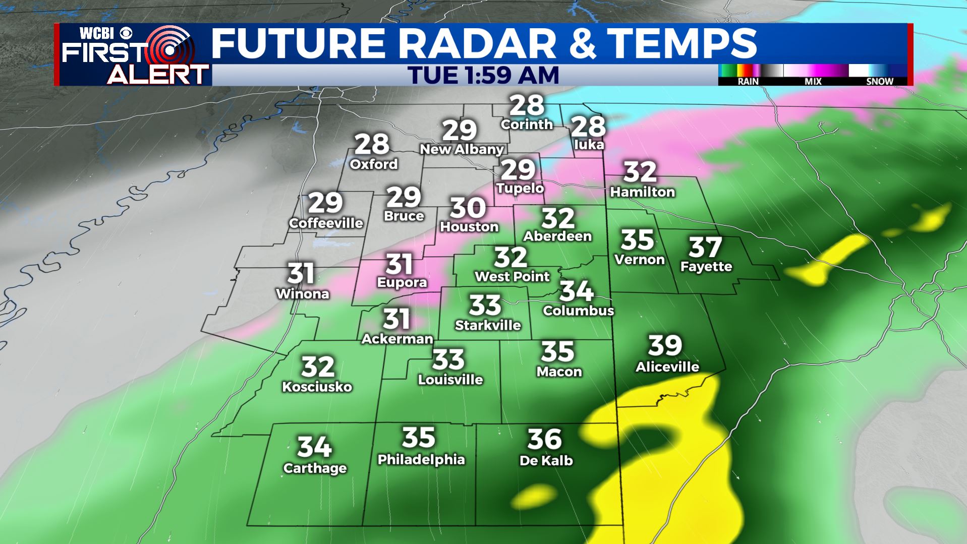
MONDAY NIGHT: Areas of rain with a chance of a light mix of sleet, freezing drizzle, snow late as cold air comes in. There will just be a short window of opportunity for frozen precipitation and any shot of it should end by sunrise. Northwesterly winds 15-25 mph develop with some gusts over 30 mph. Wind chill values by morning will be in the 20s and 10s in most spots. Temperatures will tumble all night long and they should be somewhere in the 20s to low 30s by the commute.
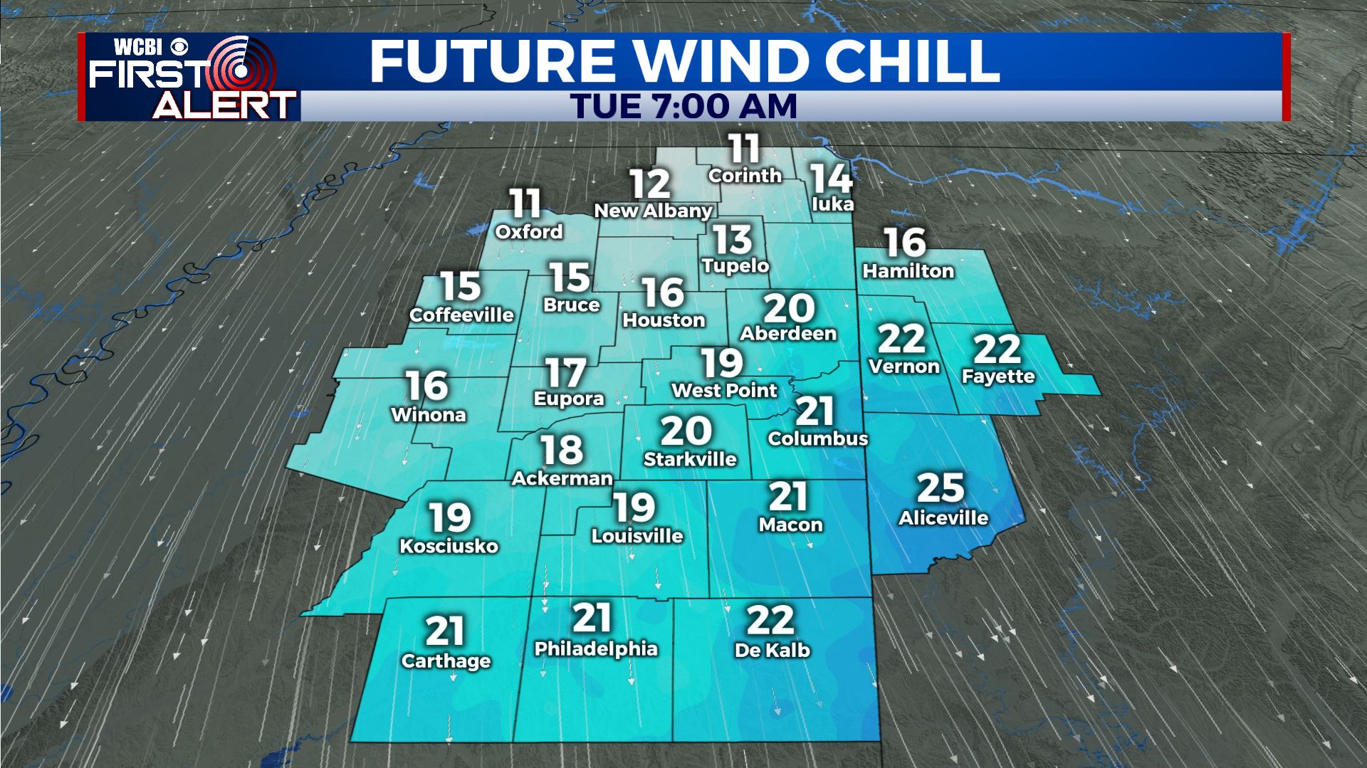
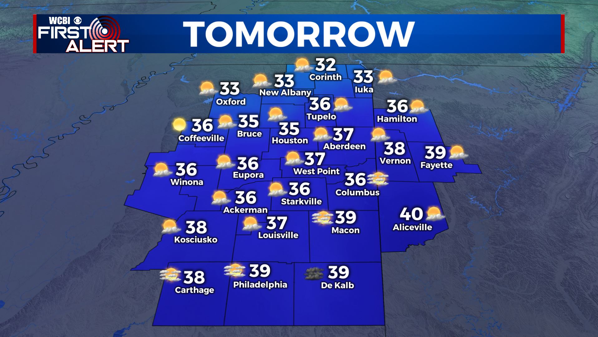
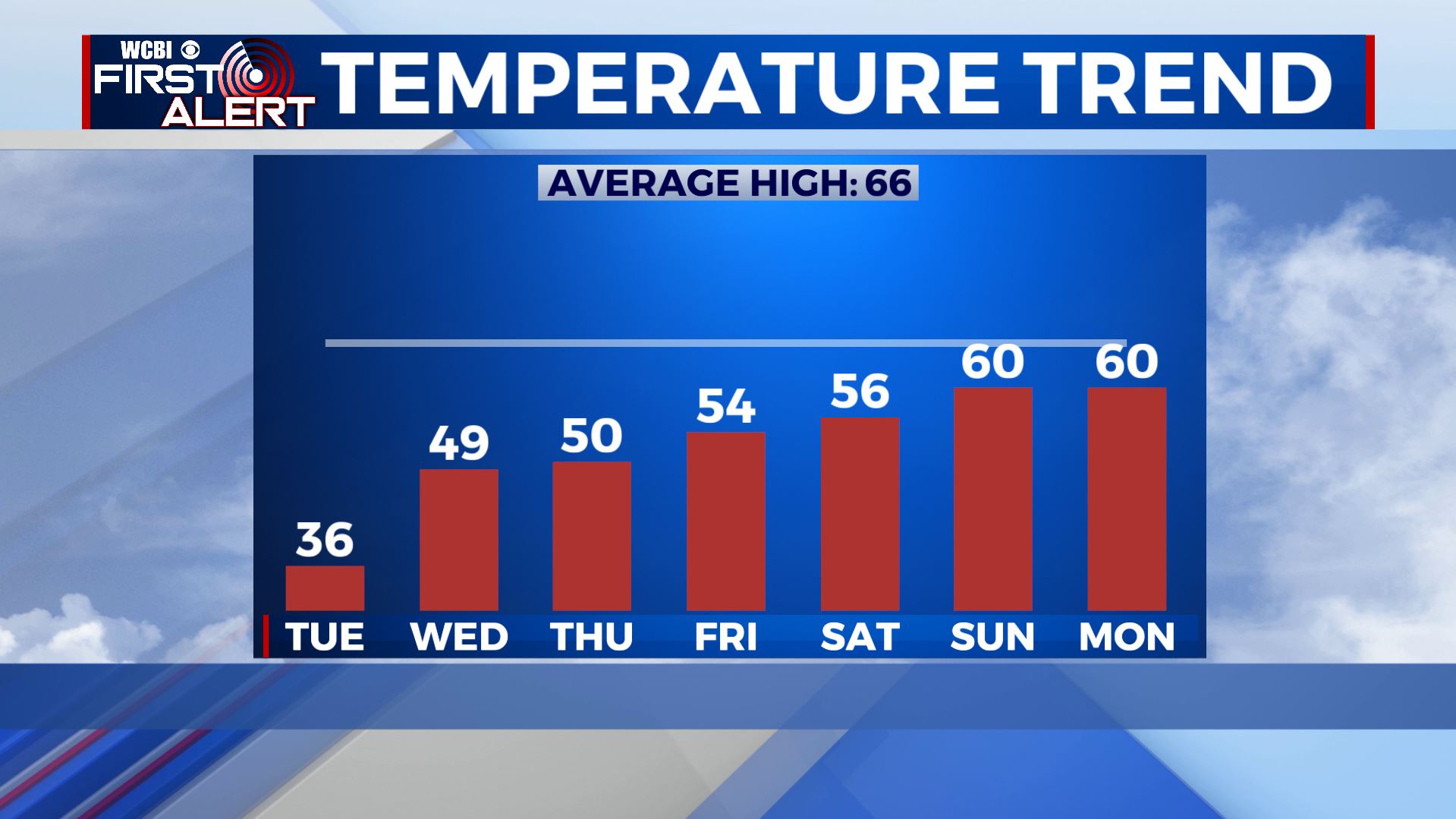
TUESDAY: Turning sunny but it will remain cold. Look for highs in the 30s. Northerly winds 10-25 mph continue creating numbing wind chill values mainly in the 20s all day long.
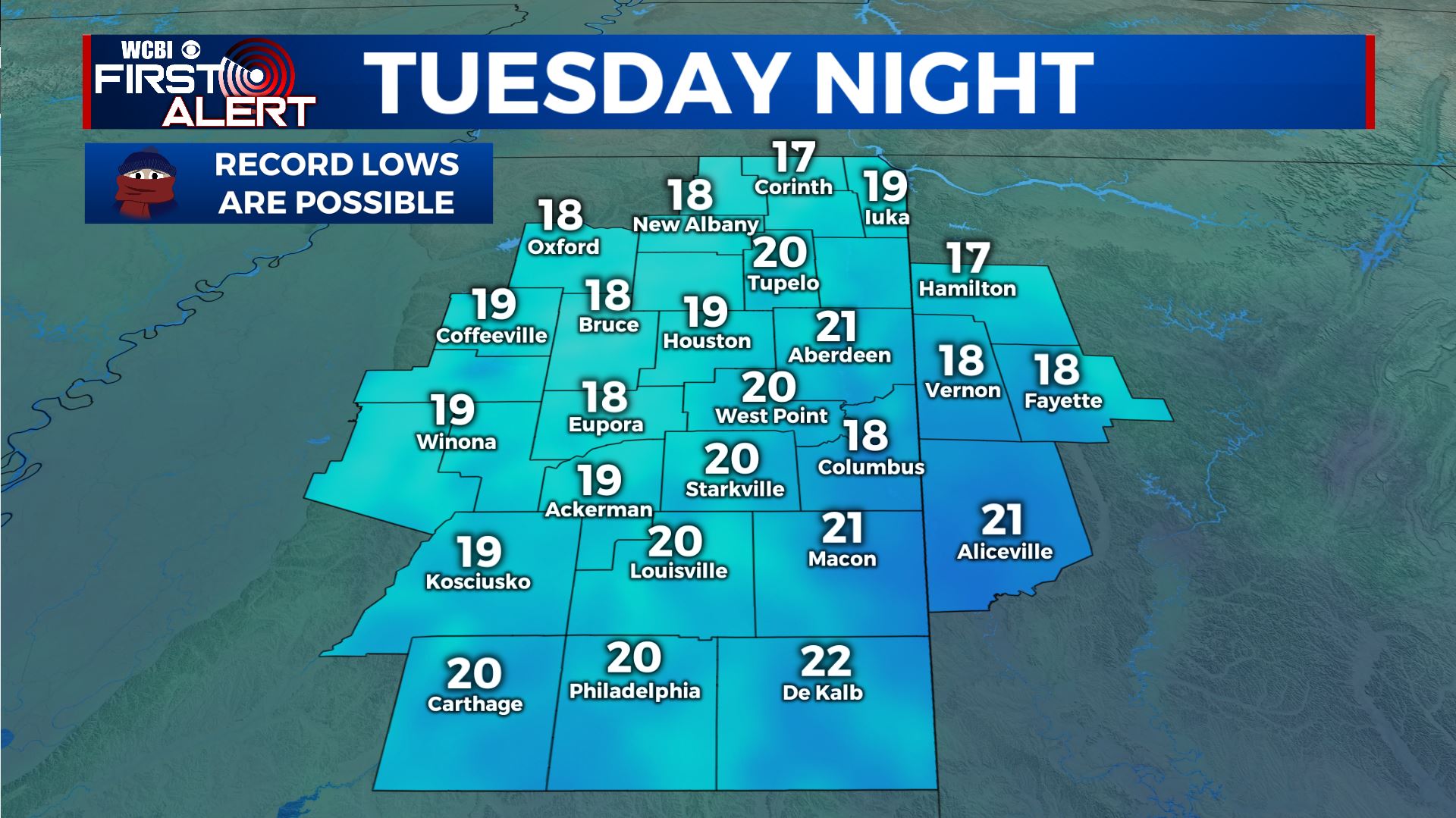
TUESDAY NIGHT: Clear and cold. Record setting lows in the upper teens are likely.
WEDNESDAY-SATURDAY: We’ll enjoy lots of sunshine with more seasonable temperatures. Highs will moderate back into the 50s with overnight lows getting back into the 30s.
Follow @WCBIWEATHER on Facebook, Twitter, Instagram, and the WCBI News app


Leave a Reply