Cold front bringing clouds, breezy & mild conditions then rain
SUMMARY: It will get cloudy, breezy, but also mild with highs into the lower 60s for your Thursday. Then here come those rain chances late afternoon into the evening as our next cold front pushes through the region. Temperatures will remain seasonable in the 50s heading into the weekend and early next week with some more rain chances. Much colder air could still invade the region by the middle to end of next week. It’s something we’ll keep watching.
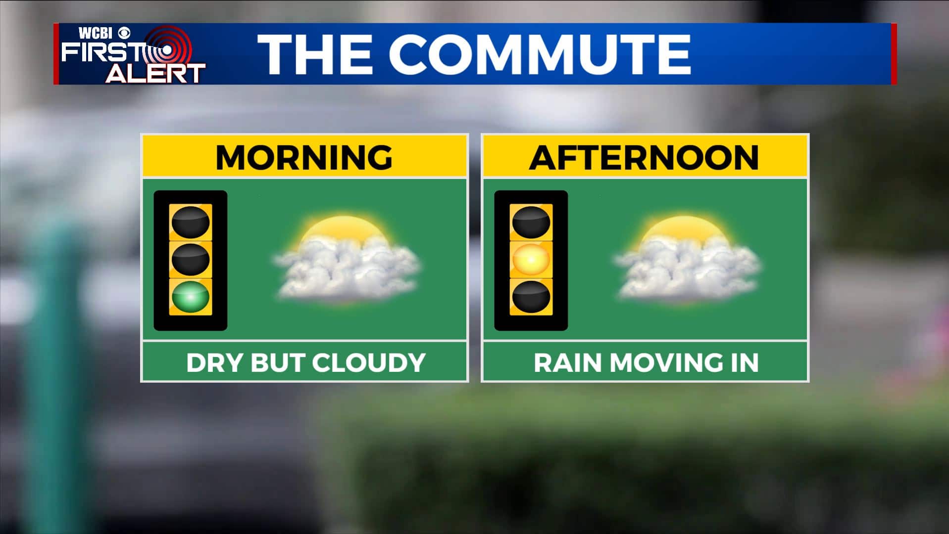
THURSDAY: Clouds are increasing this morning. Not expecting any issues as you head out the door to work and school, but grab the rain gear as rain chances will be moving in later on today. Not only are we expecting cloudy skies and rain chances for our Thursday, it will also be breezy out there. Winds will be picking up from the S at 10-20 mph sustained throughout the day. Wind gusts could get up to 30 mph at times. It will help temperatures be mild with highs into the lower 60s this afternoon. Then here come those rain chances late afternoon into the evening.
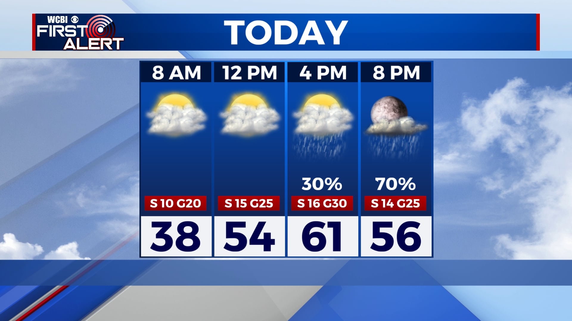

THURSDAY NIGHT: Cloudy with areas of rain. Most if not all of the rain will clear out of the area by sunrise Friday. Lows in the mid 30s. Total rainfall generally less than a quarter of an inch.
FRIDAY: Skies will be clearing out Friday morning, making way for a nice afternoon with sunshine. It will be cooling down a bit with highs in the lower 50s. Winds NW 5-10 mph.
FRIDAY NIGHT: Mostly clear and cold. Overnight lows in the upper 20s to near 30 degrees.
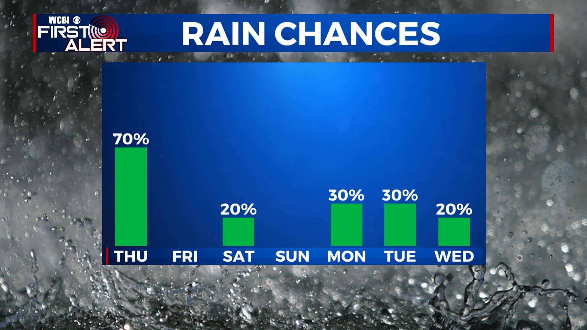
SATURDAY: A mix of sun & clouds. Highs in the mid 50s.
SATURDAY NIGHT: Mostly cloudy. A slight chance of a shower. Lows in the mid 30s.
SUNDAY: Mostly sunny skies. Seasonable temperatures mainly in the 50s.
SUNDAY NIGHT: Partly cloudy. Lows in the mid 30s.
MONDAY: Increasing clouds with showers possible. Mild highs in the low 60s.
MONDAY NIGHT: Mostly cloudy. Mild lows around 50. Some showers could linger.
TUESDAY: Mostly cloudy. Showers possible. Highs in the 50s. The Arctic air mass now appears to be delayed for our neck of the woods until the middle to end of next week at the earliest. We’ll keep watching.
Stay connected with @WCBIWEATHER on Facebook, Twitter, Instagram, and the WCBI News App


Leave a Reply