Cold front pushing through for our Thursday
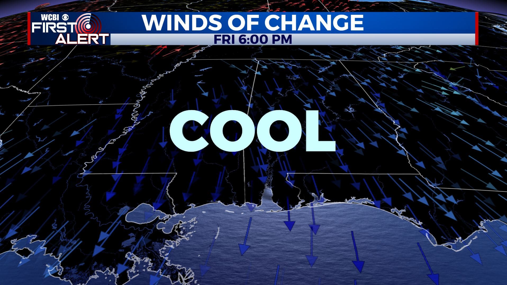
SUMMARY: Another cold front will push through north Mississippi and west Alabama late Thursday into early Friday and will deliver a short blast of cooler air for Friday and Saturday. After that, temperatures are expected to warm back to above normal next week. Chances for rain will also remain limited heading into next week.
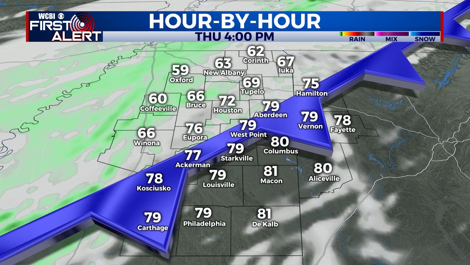
THURSDAY: After a clear & cool start, expect changes to move in for our Thursday. Expect sunny & warm conditions during the day. Highs in the lower 80s. Clouds will increase late in the day with an isolated chance of showers in the evening as our cold front approaches. SW winds will switch up to the NW 5-10 mph.
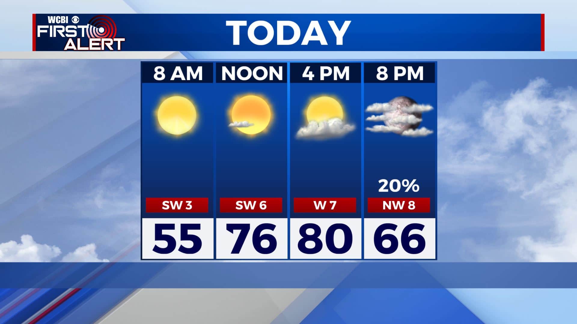
THURSDAY NIGHT: Mostly cloudy with a few showers possible. Overnight lows around 50. A bit breezy with winds N 5-15 mph.
FRIDAY: Morning clouds and isolated showers. More sunshine by the afternoon. Breezy N winds 10-15 mph with gusts to 20 mph behind the front will bring in a much cooler air mass into the region with highs below average in the low to mid 60s. Jackets are needed for high school football with temperatures dipping into the 50s and upper 40s during the games.
FRIDAY NIGHT: Clear skies and cold. Lows in the upper 30s. Some patchy frost can’t be ruled out at this point.
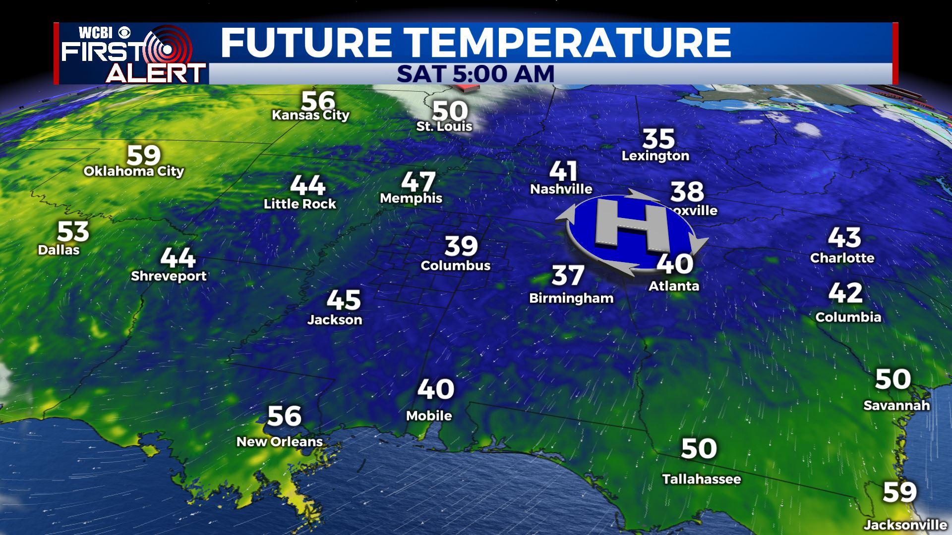
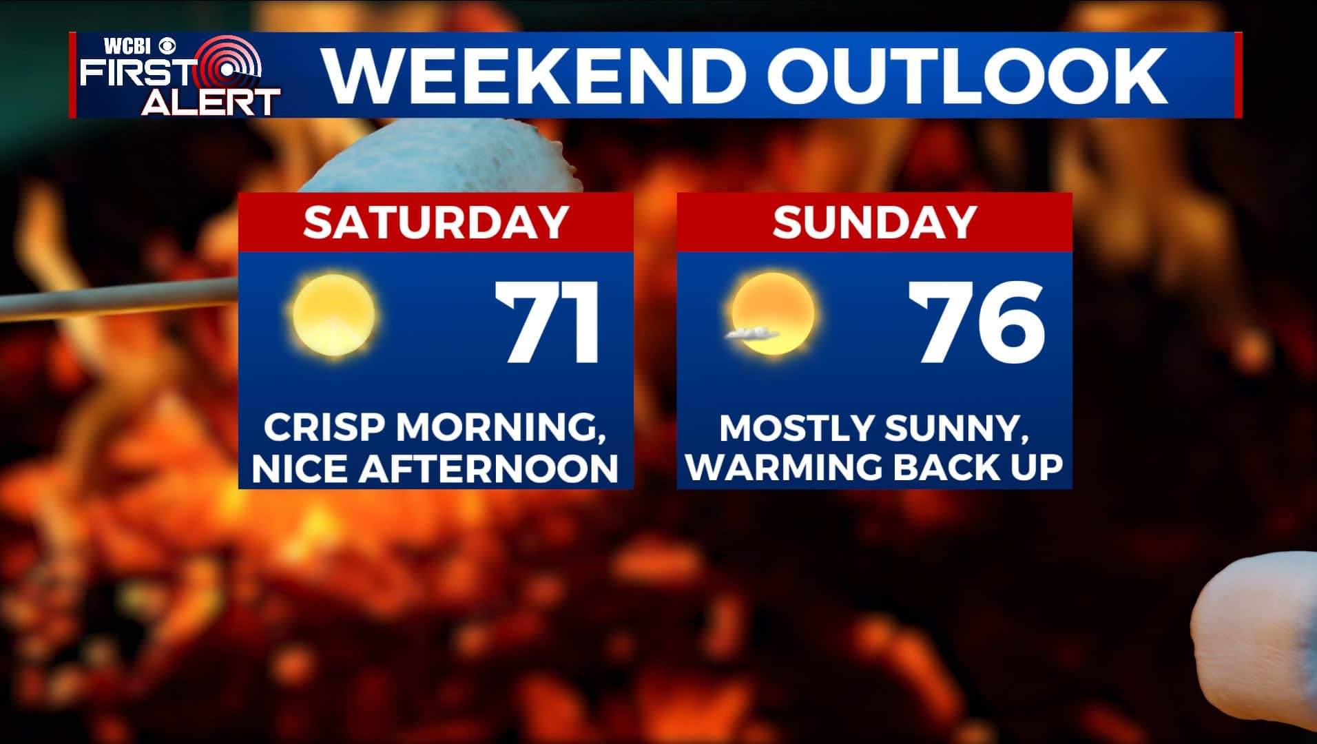
SATURDAY: An awesome weekend is ahead for us for any fall outdoor plans. A chilly start with morning temperatures possibly in the upper 30s. Afternoon highs in the upper 60s with lots of sunshine.
SUNDAY: Sunshine with a few clouds. Highs back up to near average into the mid 70s.
MONDAY-WEDNESDAY: A mix of clouds and sun each day for the first half of next week for now. Staying unseasonably warm with highs in the low 80s with overnight lows in the mid to upper 50s.
Stay connected with @WCBIWEATHER on Facebook, Twitter, Instagram, and the WCBI News App


Leave a Reply