Cold weekend ahead, possible snow Monday?
SUMMARY: Cold and mostly cloudy weather is here to stay into early next week. Another weather maker could produce snow in our region Monday. Stay tuned for updates over the coming days.
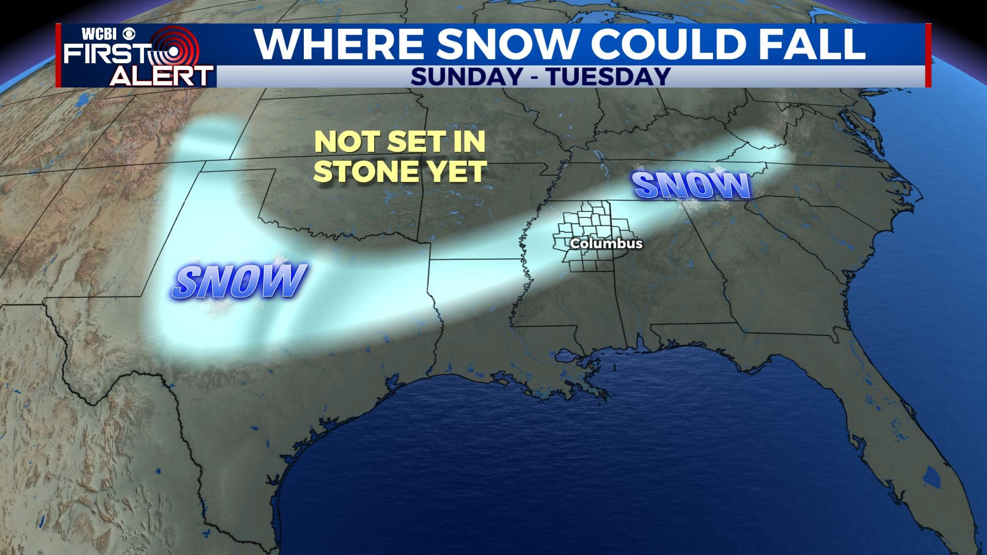
Possible snow track early next week
THURSDAY NIGHT: Cloudy with lingering rain and/or snow showers. No issues are anticipated even if a few flakes of snow can develop. Lows in the mid 30s. Winds NW 10-15 mph.
FRIDAY: Mostly cloudy and cool. Highs in the low 40s. Winds NW 10-20 mph.
FRIDAY NIGHT: Mostly cloudy and cold. Lows in the upper 20s.
SATURDAY: Partly to mostly cloudy. Highs in the low 40s. Lows in the upper 20s Saturday night.
SUNDAY: Mostly cloudy. Highs in the mid 40s.
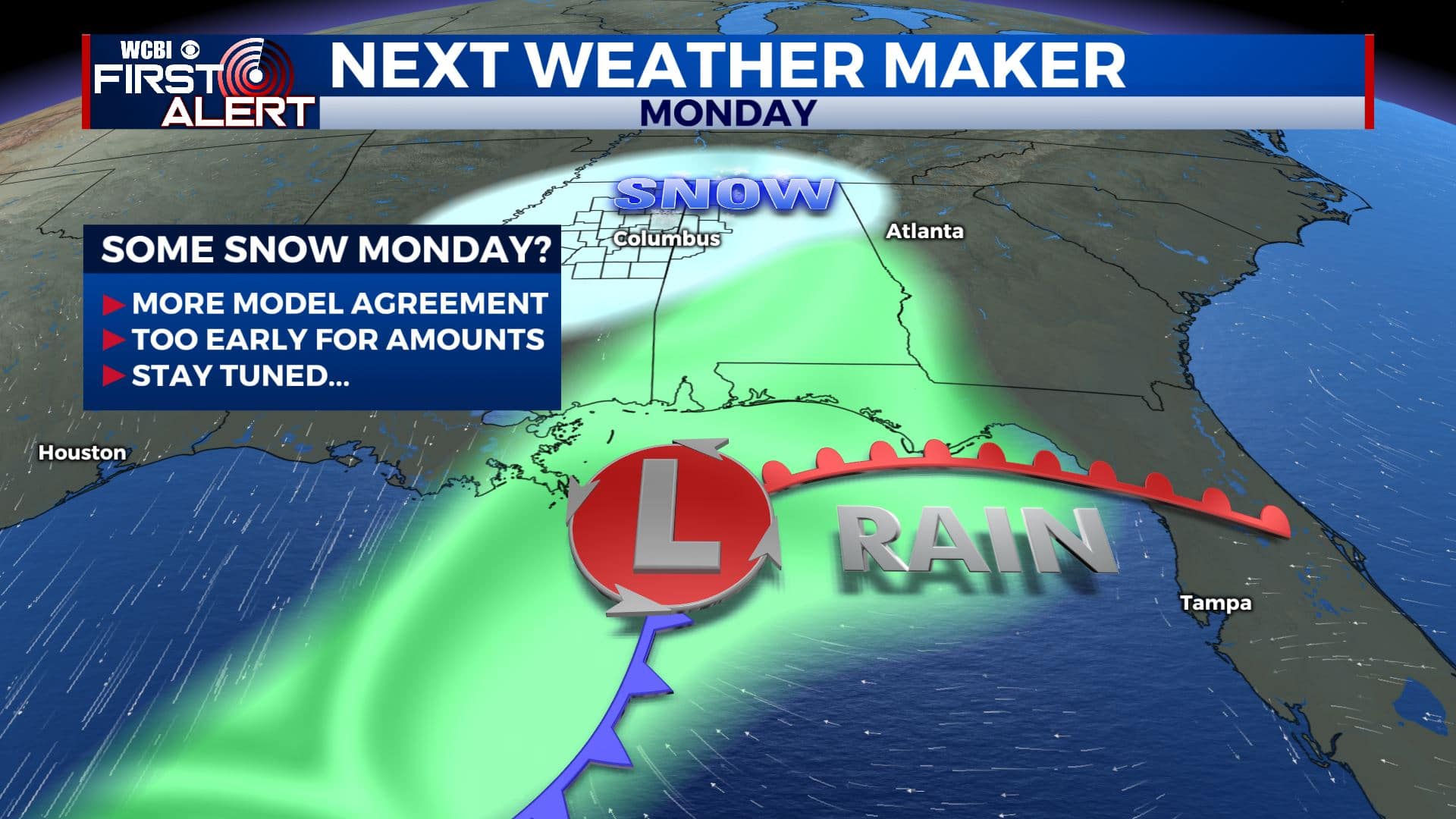
Snow possible Monday
SUNDAY NIGHT & MONDAY: An area of low pressure is forecast to move across the northern Gulf. It will team up with a cold pocket of air that could produce a swath of snow and wintry weather from Texas into the Deep South. It’s too early to pin down any possible snow amounts but at first glance the system has all the looks of a southern snow maker.
TUESDAY-THURDAY: Developing sunshine. Highs climbing back into the 50s by Wednesday.
Follow @WCBIWEATHER on Facebook, Twitter, Instagram, and the WCBI News App


Leave a Reply