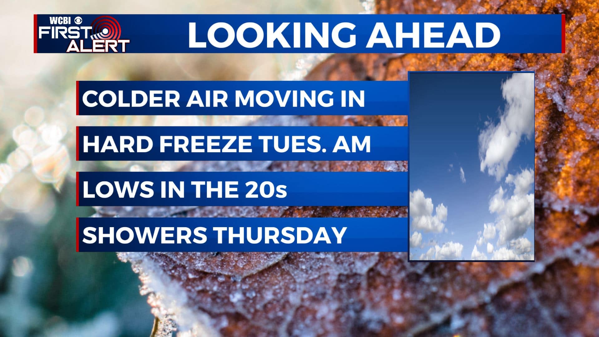
The coldest air of the season moving in this workweek
SUMMARY: After a dreary and rainy Sunday, drier weather is moving back in as we begin a new workweek. The coldest air of the season so far will be moving in on Monday and we could possibly be dealing with our first hard freeze of the season on Tuesday morning. Temperatures will remain below average this week with another chance for some showers on Thursday.
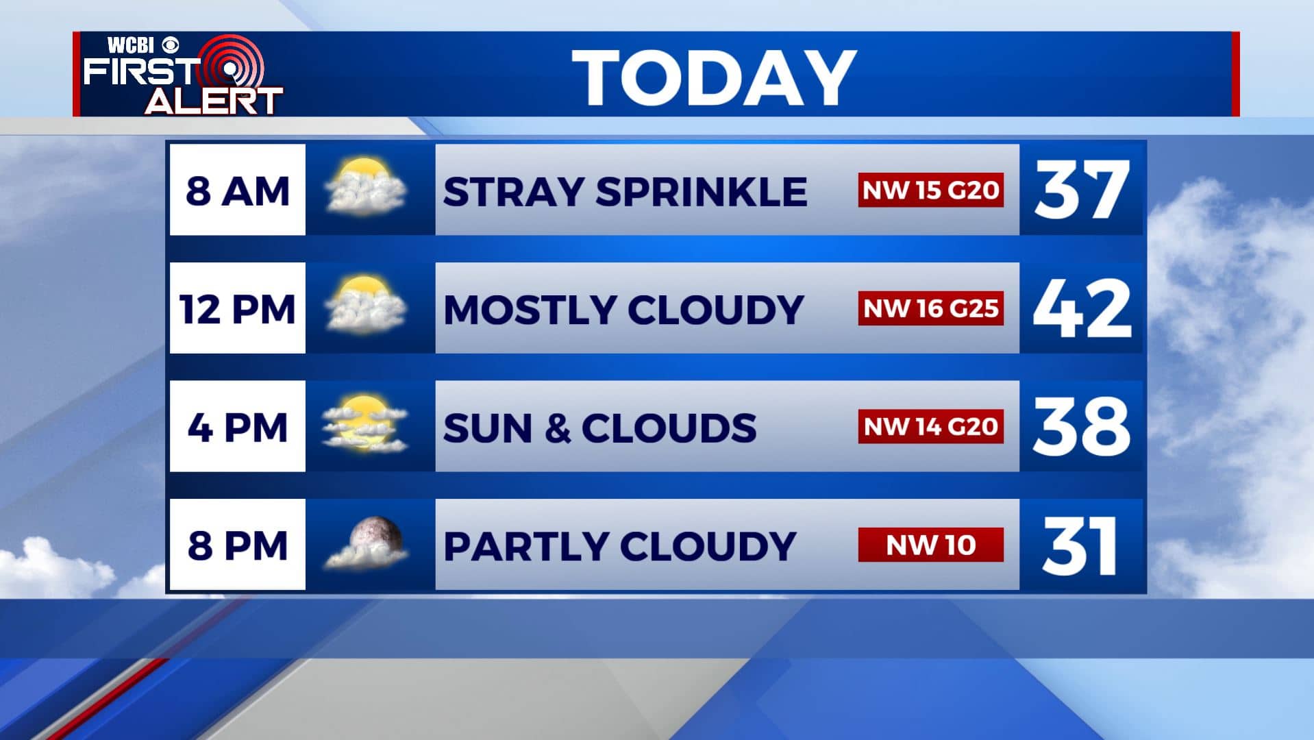
MONDAY: We’re waking up on this Monday to overcast cloudy skies with some light sprinkles. We’ll see skies clear up by this evening as colder air filters into the region. High temperatures will be in the lower 40s then falling into the 30s as a breezy NW wind picks up at 10-20 mph, gusting up to 25.
MONDAY NIGHT: Skies will finally clear up, making way for a cold night ahead. A hard freeze is expected as we wake up on Tuesday morning as much of the area will see overnight lows in the lower to mid 20s. Make sure you bring in or cover up sensitive plants. Also, make sure your pets, kids and elderly are staying warm.
TUESDAY: We’ll see sunny skies throughout the day, but temperatures will remain chilly with highs only in the mid to upper 40s.
WEDNESDAY-FRIDAY: Our next chance for showers will be late Wednesday night into Thursday, with a few morning showers on Friday. Wednesday morning will also be cold with temperatures in the low and mid 20s. Overnight lows will be in the 30s for Thursday and Friday with highs in the 40s and 50s.
WEEKEND: Temperatures will remain in the 50s for the weekend and, aside from a few clouds, we’ll generally remain mostly sunny.
Stay connected with @WCBIWEATHER on Facebook, Twitter, Instagram, and the WCBI News App


Leave a Reply