Cool days and chilly nights ahead heading into midweek
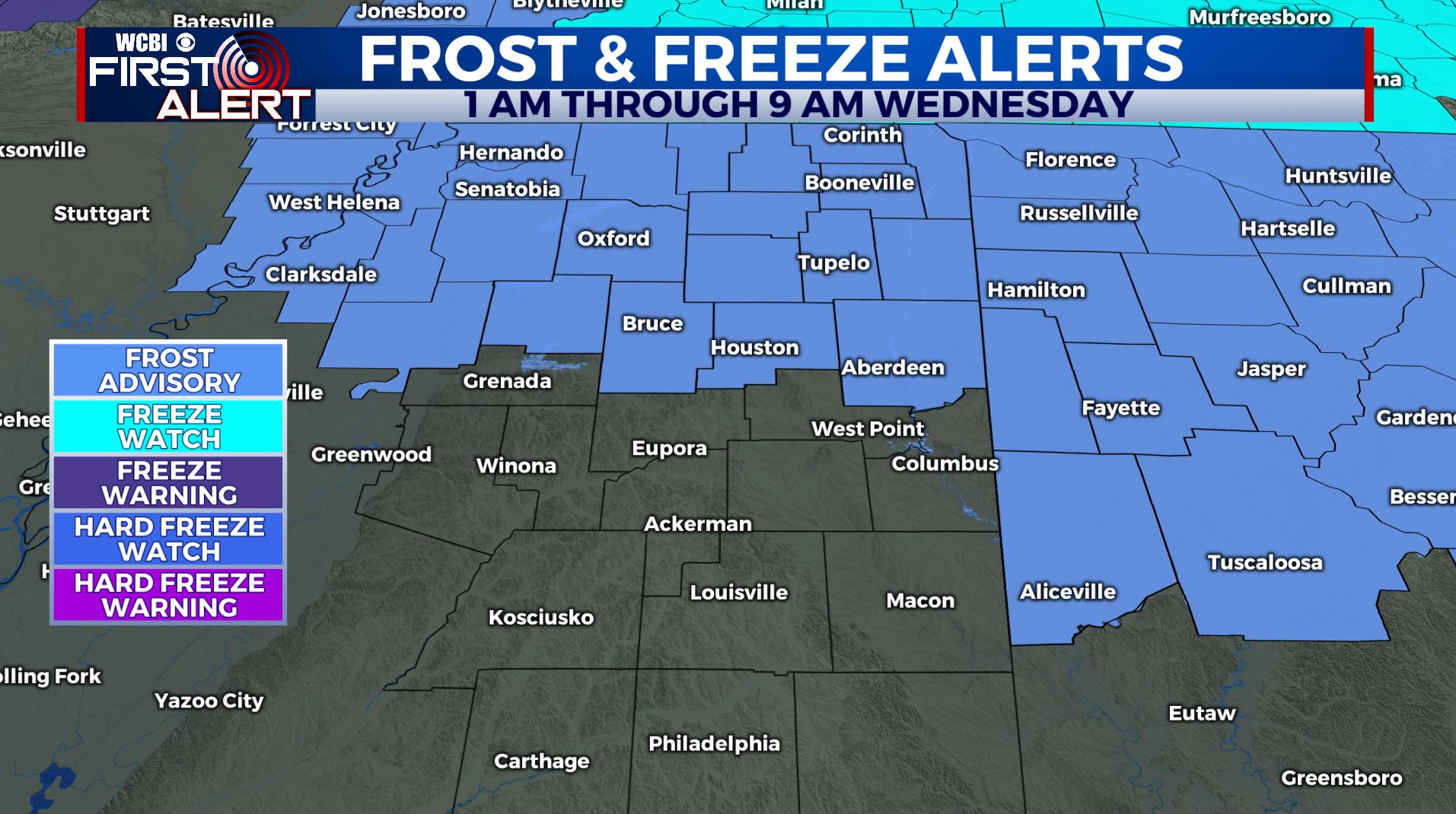
SUMMARY: Below average temperatures but quiet weather will remain the forecast for the rest of the week. Some frost is possible early Wednesday and Thursday. A Frost Advisory is right now in effect for Wednesday morning. Rain chances are possible for the weekend.
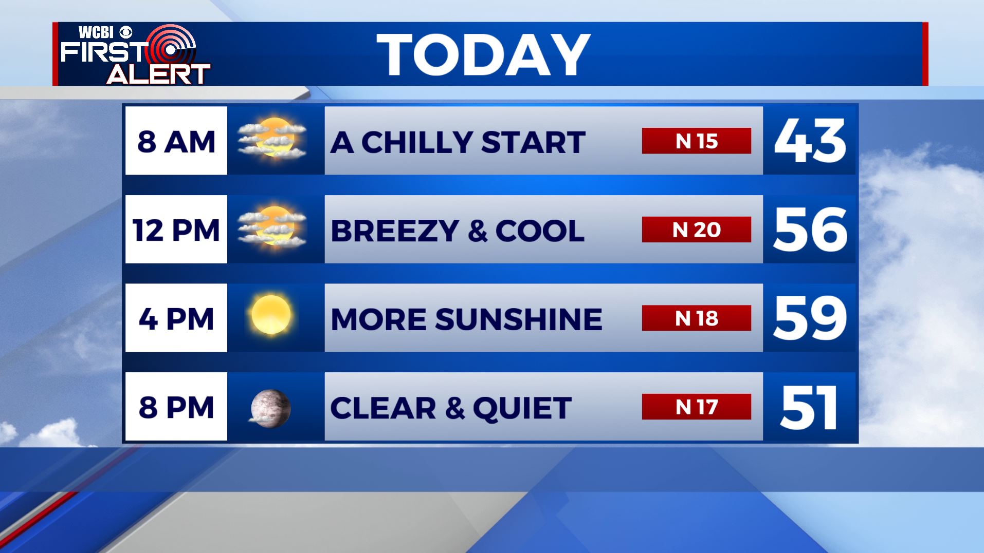
TUESDAY: Mainly clear and sunny. Chilly start in the upper 30s to lower 40s. Highs in the upper 50s to lower 60s. Breezy northerly winds continue between 15-20 mph.
TUESDAY NIGHT: Mostly clear and chilly. Lows in the mid 30s. Some frost is possible by early Wednesday morning so cover up or bring in that tender vegetation.
WEDNESDAY: Partly sunny to mostly sunny. Highs in the low 60s.
WEDNESDAY NIGHT: Mainly clear and chilly. Lows in the mid 30s. Areas of frost are possible.
THURSDAY: Partly sunny. Milder highs in the upper 60s to around 70.
THURSDAY NIGHT: Partly cloudy. Lows in the mid 40s.
FRIDAY: A mix of sun & clouds. Warm. Highs in the mid 70s.
WEEKEND: Data is all over the place regarding the forecast for Saturday and Sunday. We’re going to keep the chance of rain and a few storms going both days but it could go either way. There is still the outside chance for some strong storms in the region if things line up but that’s still up in the air Look for highs to range from the 60s to the 70s.
Stay connected with @WCBIWEATHER on Facebook, Twitter, Instagram, and the WCBI News App


Leave a Reply