Cool weather pattern set to begin
SUMMARY: A long stretch of below average conditions will begin Wednesday and continue through most of next week. Rain chances return for the next few days but there won’t be any severe weather in our area.
TUESDAY NIGHT: Increasing clouds with a chance of some rain and thunder by sunrise. Lows in the mid to upper 50s. Light and variable wind.
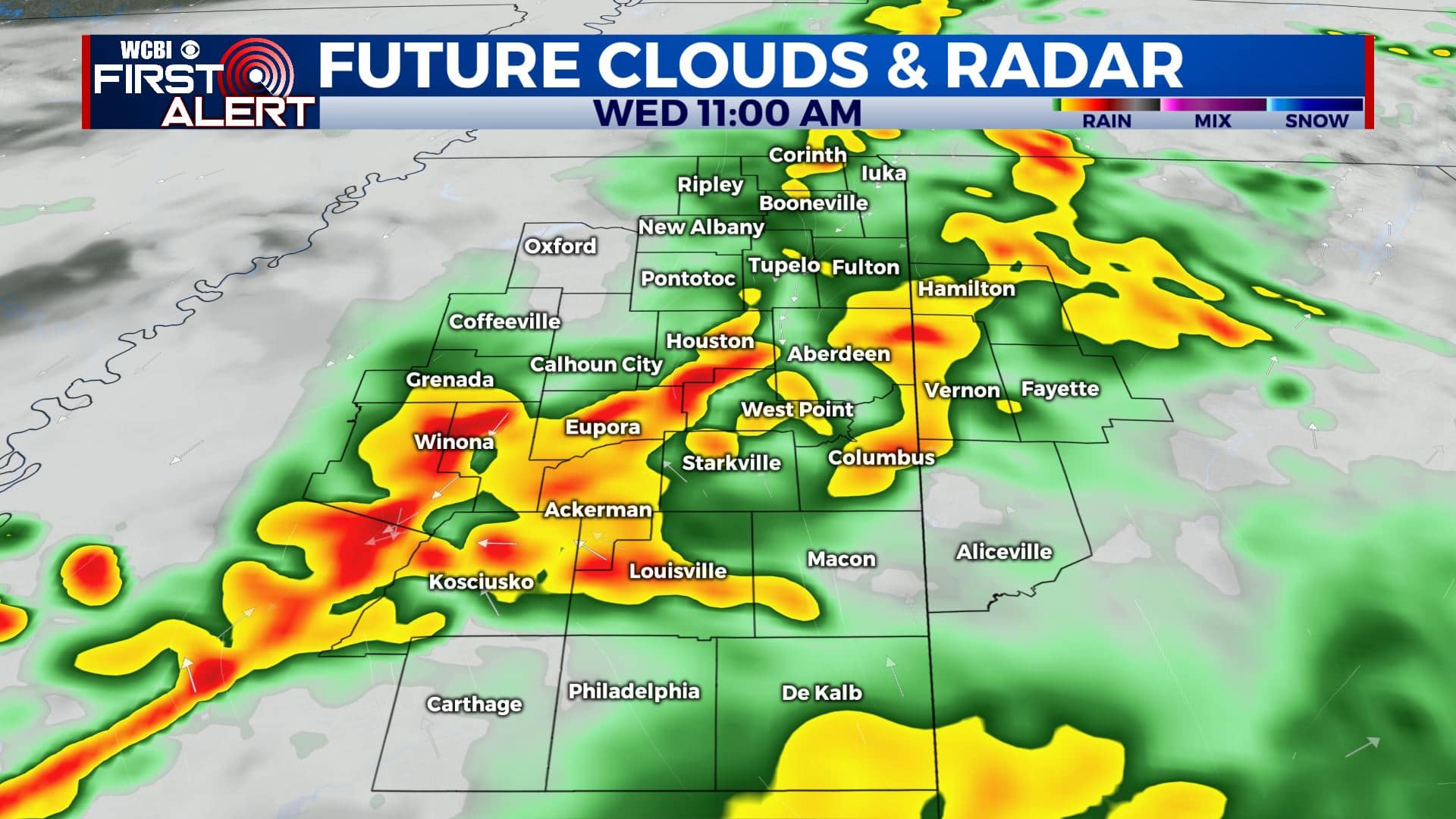
WEDNESDAY: Areas of rain and thunder, especially through early to mid afternoon. Highs mainly in the mid to upper 60s.
WEDNESDAY NIGHT: Mostly cloudy with some rain possible. Lows near 50.
THURSDAY: Mostly cloudy with morning showers possible across our southern counties. Turning mostly sunny during the day. Highs in the upper 60s to around 70.
THURSDAY NIGHT: Partly cloudy. Lows in the mid 40s.
FRIDAY: Partly to mostly cloudy. A chance of showers late in the day and during the evening. Highs in the mid 60s.
SATURDAY: Mostly cloudy with rain showers during the morning. Conditions should dry out a bit heading into the afternoon. Highs in the 60s.
SUNDAY: Clouds & sun. Highs in the 60s.
MONDAY & TUESDAY: Variably cloudy. Highs around 70.
Follow @WCBIWEATHER on Facebook, Twitter, Instagram, and the WCBI News App


Leave a Reply