Cooler air heading back
SUMMARY: Less active but cooler than average weather is slated for good chunk of the rest of the week. Areas of showers are possible Wednesday and a few little disturbances are possible as the weekend nears but no widespread heavy rain or severe weather is likely through next Monday.
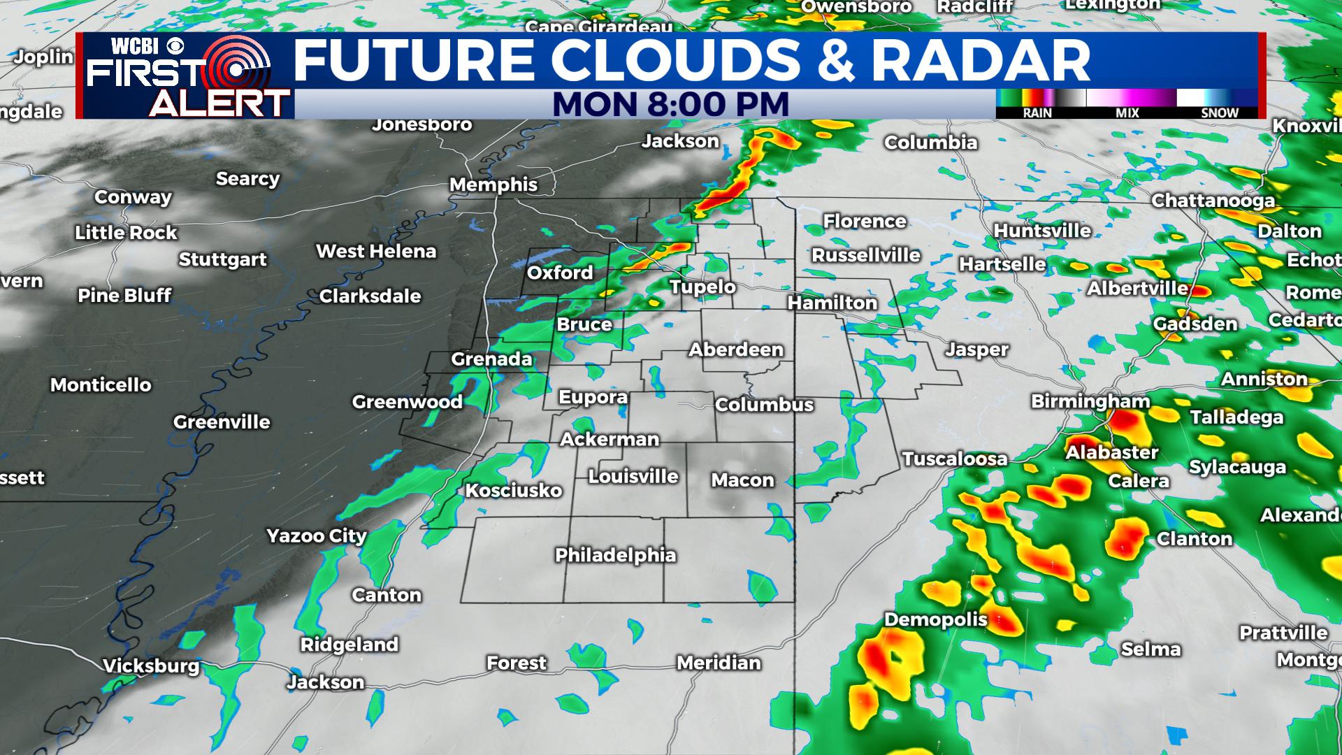
MONDAY NIGHT: Evening showers are possible then variably cloudy overnight. Lows in the mid to upper 40s. Winds SW 5-15 mph.
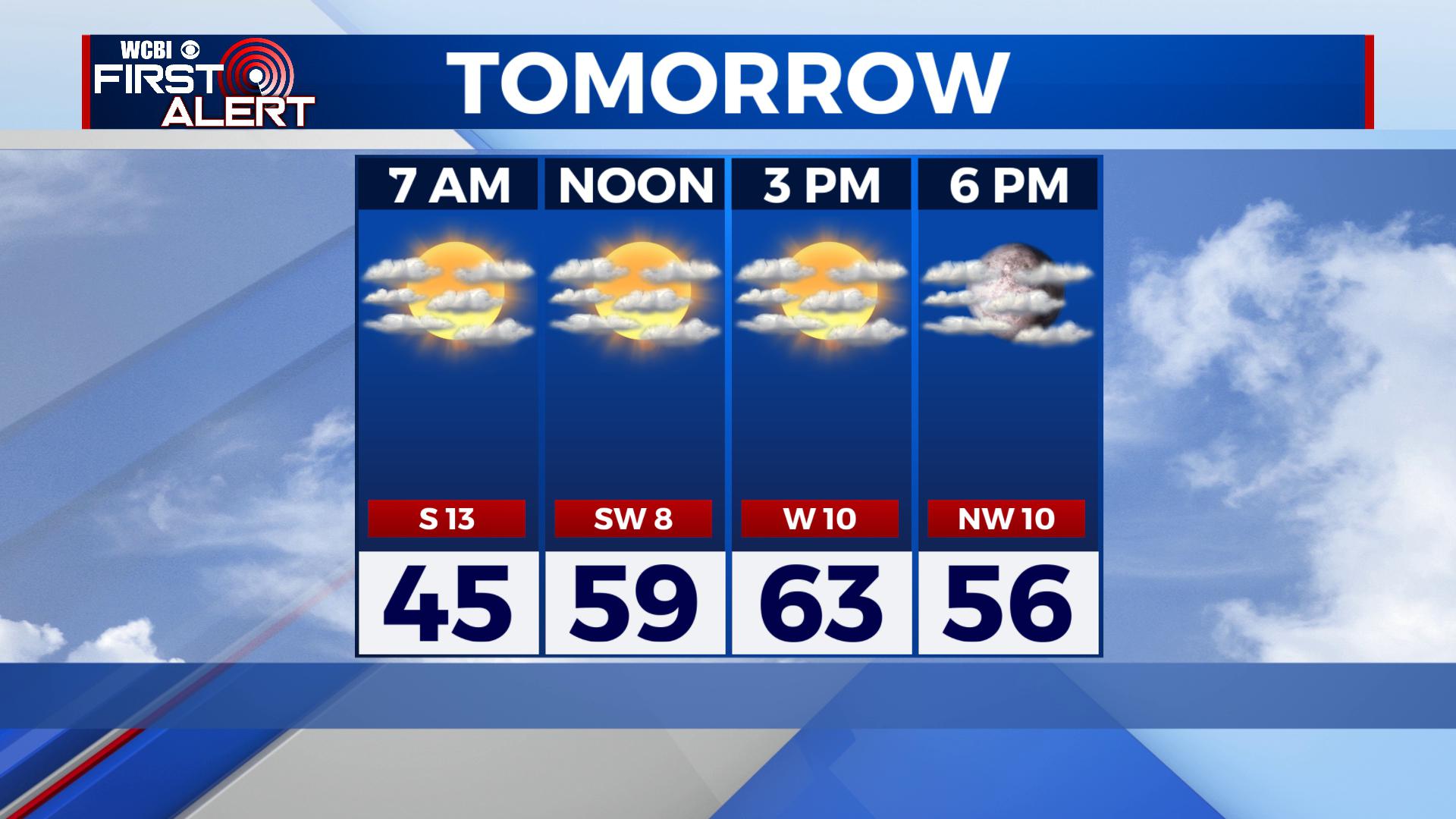
TUESDAY: A mix of clouds and sun. Highs in the 60s. Winds veer from SW to NW about 10 mph.
TUESDAY NIGHT: Mostly cloudy with some showers possible. Lows near 40.
WEDNESDAY: Mostly cloudy, breezy, and cool. A 40% chance of showers. Highs in the mid to upper 40s.
WEDNESDAY NIGHT: Gradual clearing. Much colder lows in the upper 20s to around 30.
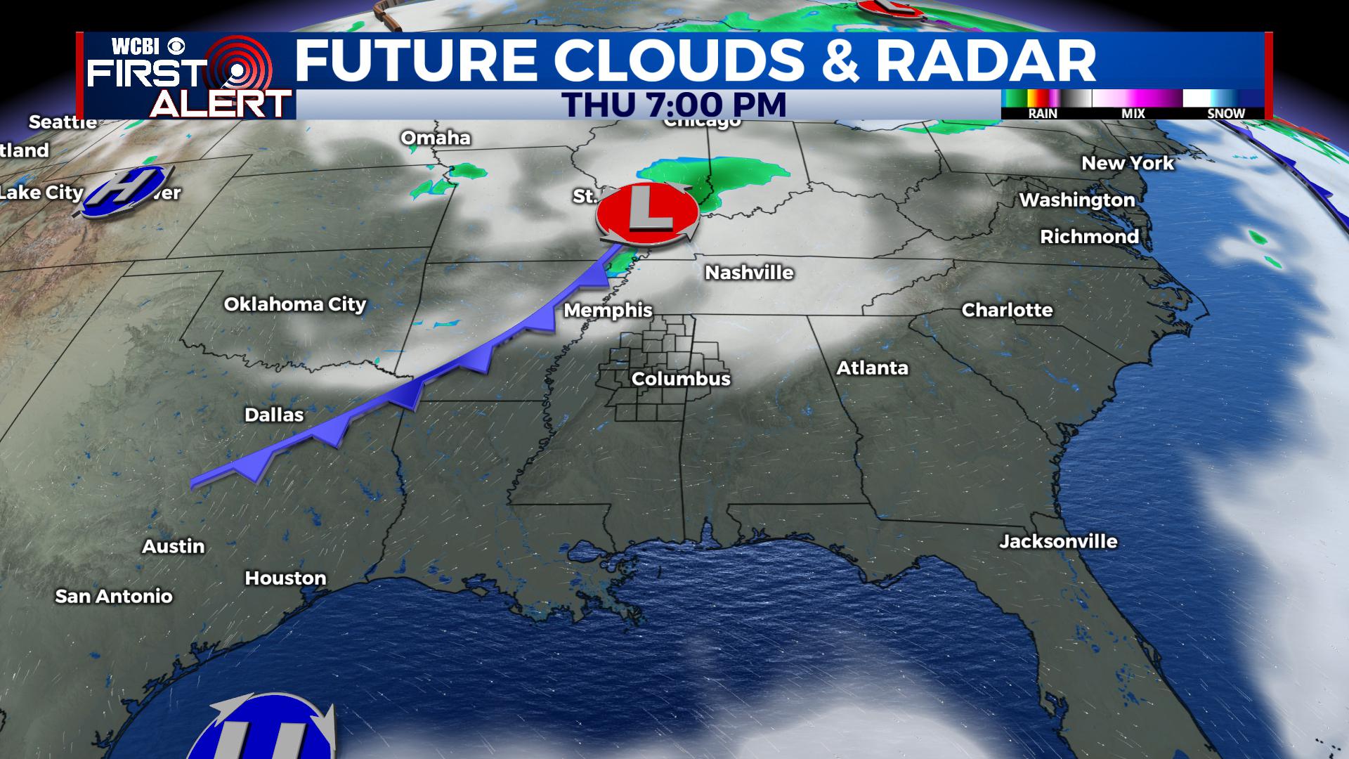
THURSDAY-FRIDAY: Sun & clouds. Highs in the upper 40s to lower 50s. Lows in the upper 20s to lower 30s. A weak system could produce some light rain mixed with some flakes Friday night so stay tuned for updates on that.
WEEKEND: Partly cloudy. Highs in the 50s and lows in the low 30s.
EARLY NEXT WEEK: Temperatures will moderate out ahead of the next system to come our way. Some showers may develop on Monday but better odds of rain and storms are likely to exist Tuesday into Wednesday. We’ll have to keep watching the potential for strong to severe storms along with more heavy rain.
Follow @WCBIWEATHER on Facebook, Twitter, Instagram, and the WCBI News App


Leave a Reply