Cooler summer temperatures but better rain chances are on the way
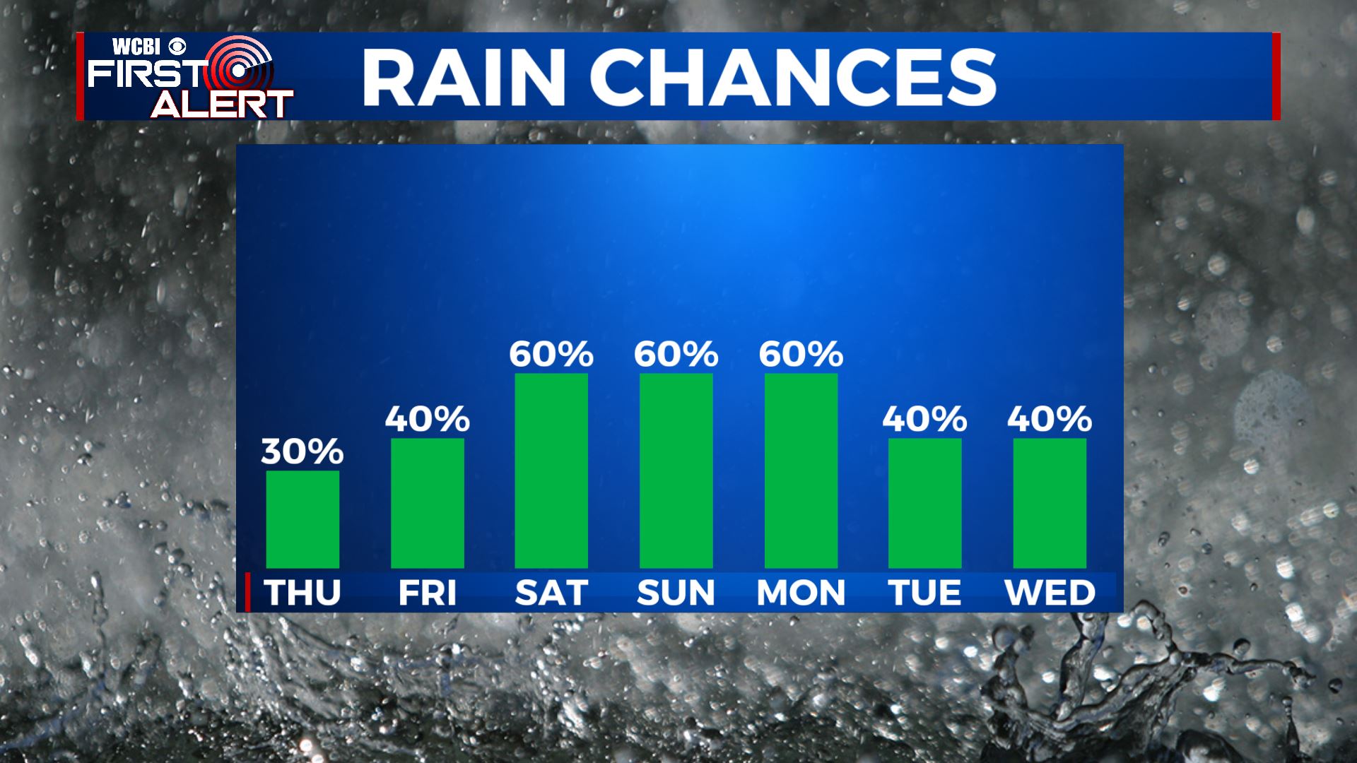
SUMMARY: We still have another hot & humid couple of days for us before temperatures start cooling back down into the 80s. The trade off will be rain chances increasing this weekend into early next week thanks to a cold front and moisture from Tropical Storm Fred. 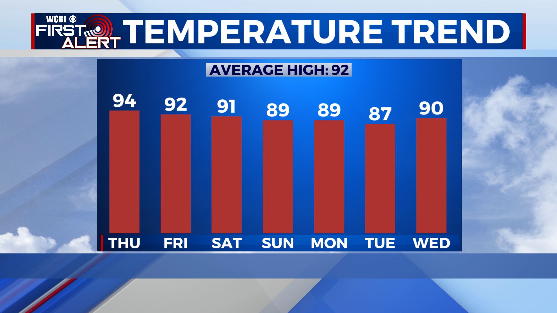
 TROPICS: A disorganized Tropical Depression Fred is moving back over the Caribbean after interacting with the high mountains of Hispaniola. It’s looking to still be an issue for Florida and make landfall over the Florida Panhandle late Sunday night/early Monday. Could bring us increased rain chances then. Stay tuned!
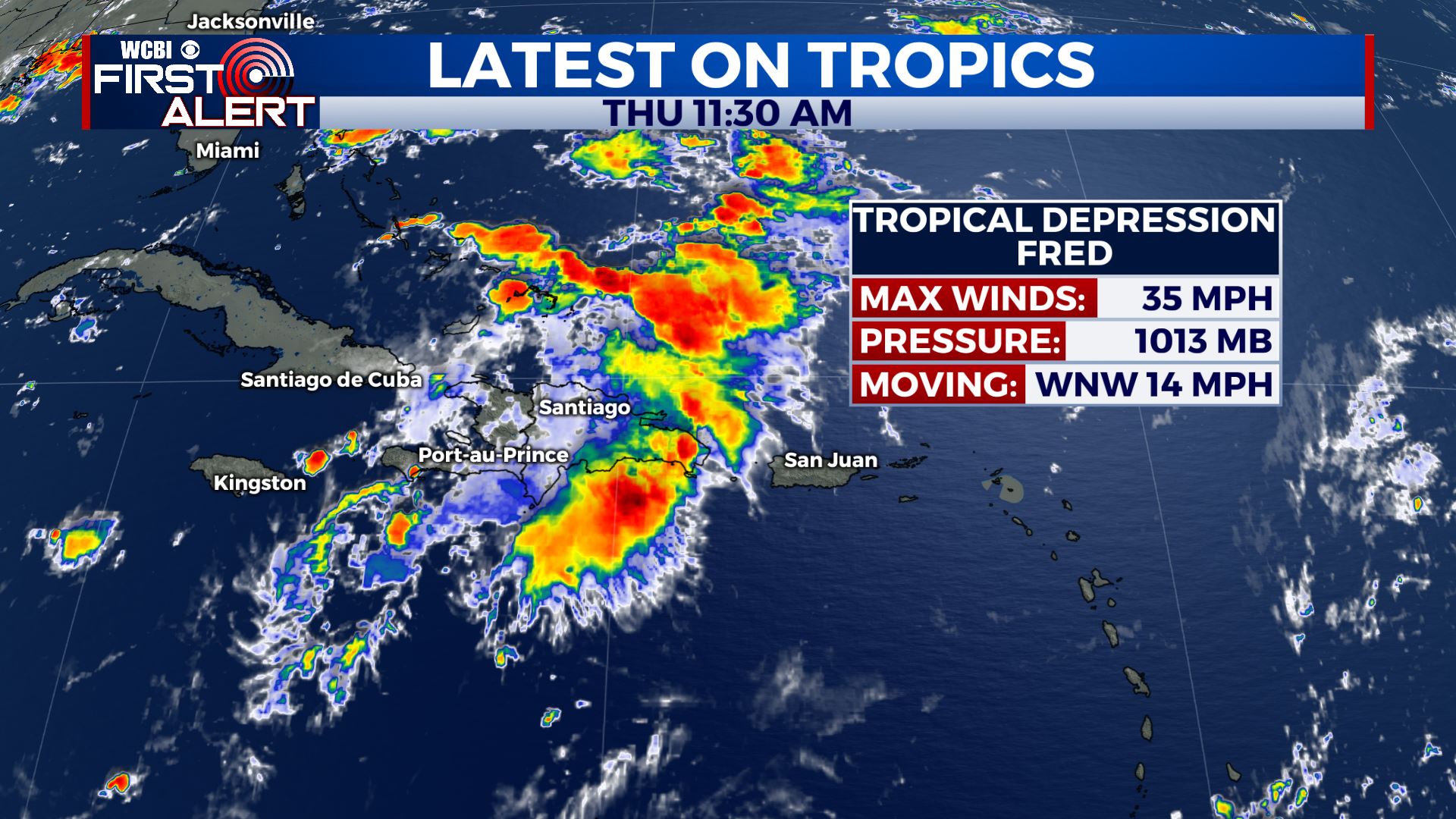
 THURSDAY: Another hot & humid summer day is ahead for our Thursday with highs in the mid 90s. Expect a mix of sun & clouds with isolated chances of showers & storms in the afternoon. A Heat Advisory is in effect as heat indices will make it feel like 100-105 degrees. Stay cool & hydrated once again. S winds 5-10 mph.
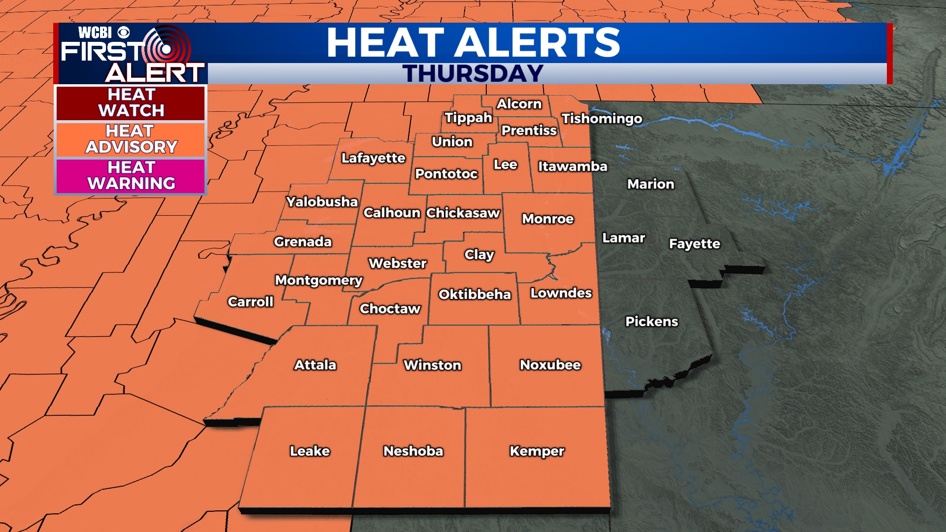
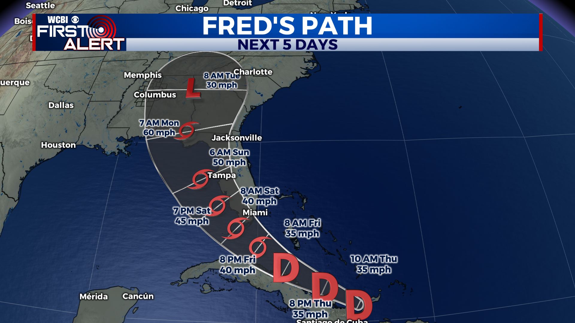
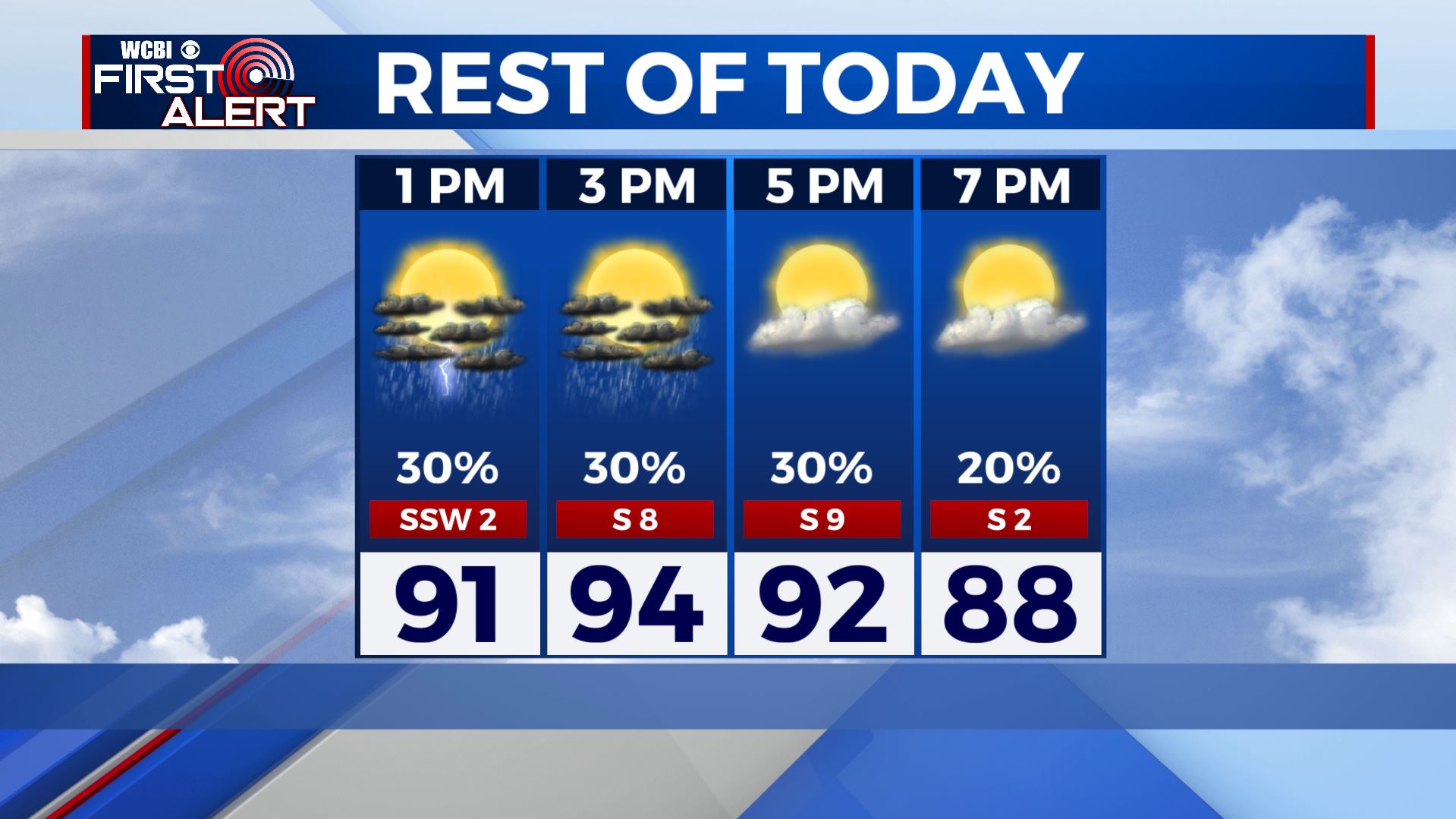 THURSDAY NIGHT: Rain and storms end early evening, making way for partly cloudy skies overnight. Staying mild & muggy with lows in the 70s. FRIDAY: One more hot & humid summer day with highs in the mid 90s, heat indices will make it feel like 100 degrees or more. A mix of sun & clouds with a few chances of showers & storms in the afternoon. WEEKEND: Better chances of showers & storms with mostly cloudy skies as a cold front pushes through Saturday. Chances could get higher by Sunday into Monday as Fred moves into the Gulf and affects Florida. We’ll keep you updated! Highs much cooler in the upper 80s to lower 90s. NEXT WEEK: Highs in the mid to upper 80s for the beginning of the new workweek. After dealing with some tropical moisture from Fred on Monday, we’ll be back to our usual summertime weather pattern of afternoon showers & storms by midweek. Stay tuned! Stay connected with @WCBIWEATHER on Facebook, Twitter, Instagram and the WCBI News App


Leave a Reply