Cooler temperatures but higher rain chances for the weekend
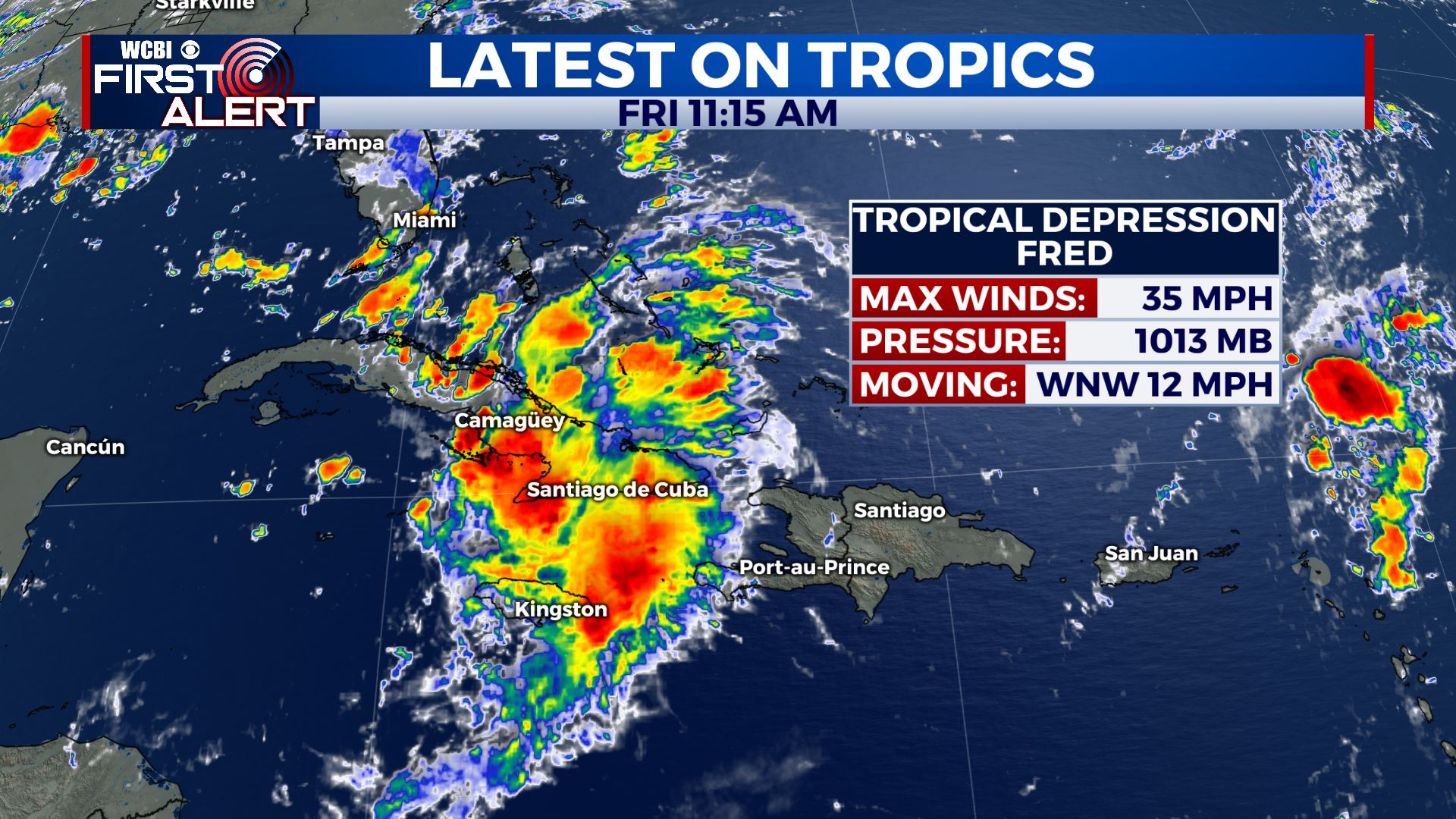
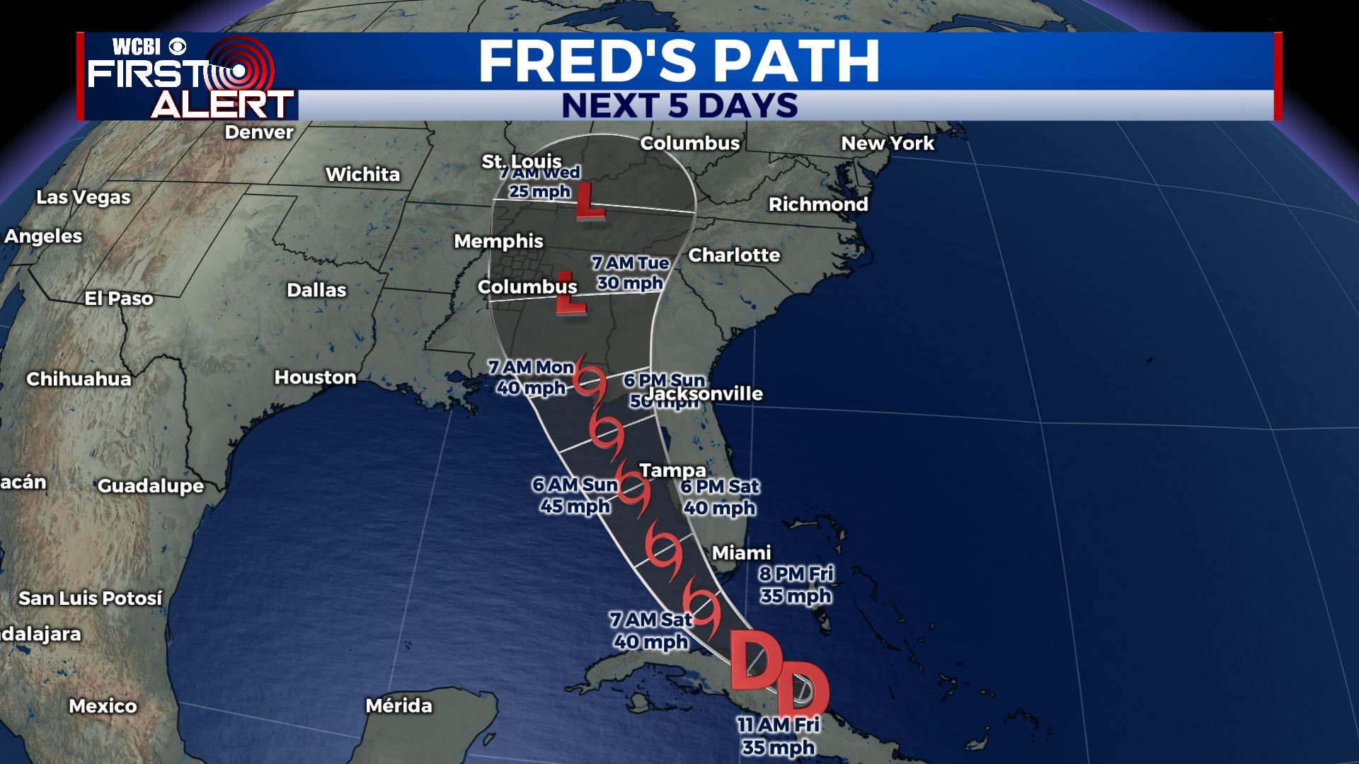
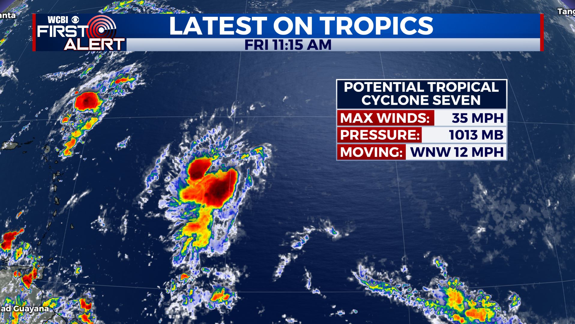
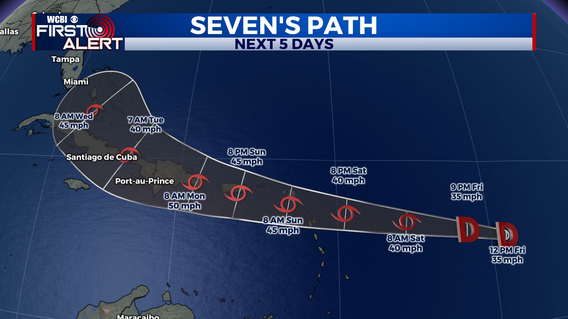
SUMMARY: After dealing with the brutal summer heat & humidity all week long, changes are moving in for the weekend. Cooler temperatures but higher rain chances are on the way. We’re continuing to watch the tropics. 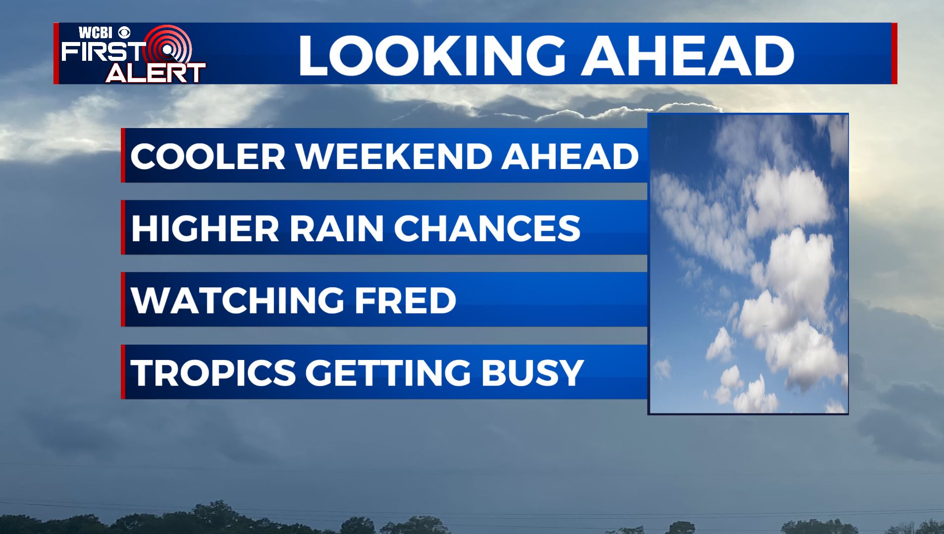 TROPICS: Tropical Depression Fred is just north of eastern Cuba this morning. Tropical Storm Watches & Warnings have been issued for SW Florida & the Keys. Potential impacts from Fred include flooding rains, gusty winds, and tornadoes for the area late Friday into this weekend. It’s looking to make landfall over the Florida Panhandle late Sunday night/early Monday. Will bring us increased rain chances for us early next week. As it will past to our east, we will be on the weaker side of the system, so impacts will be limited across the area. We not only have Fred in the Caribbean, but also now Potential Tropical Cyclone Seven in the Atlantic. This storm will most probably become Grace over the next 24 hours. We’ll continue to keep you updated! Stay tuned!
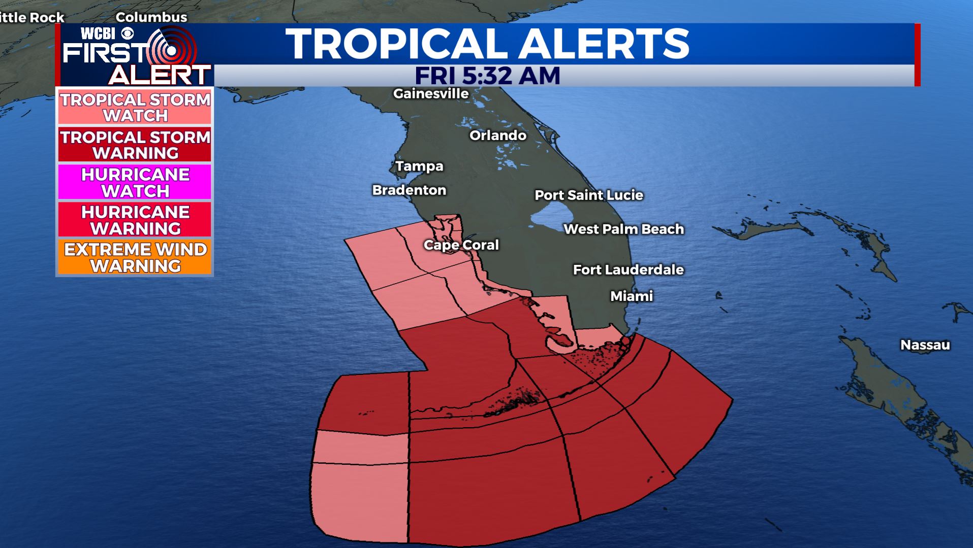
 FRIDAY: One more hot & humid summer day with highs in the lower 90s. Heat indices will make it feel like 100 degrees or more. Cloud increasing with a few chances of showers & storms in the afternoon.
 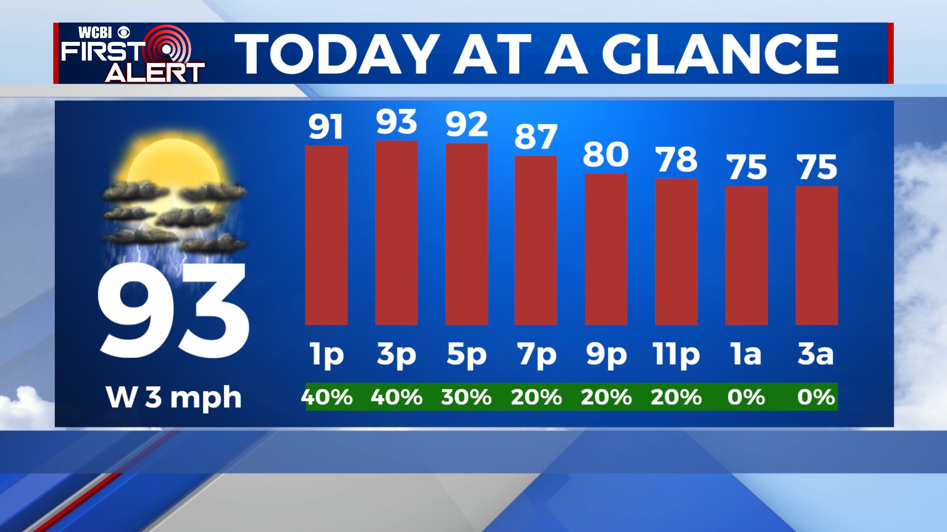 FRIDAY NIGHT: Partly to mostly cloudy skies expected. Maybe a few showers move in by daybreak ahead of our cold front. Mild & muggy with overnight lows in the low 70s. SATURDAY: Rain chances increase as cold front pushes through with scattered to numerous afternoon showers and storms. More rain and cloud cover in the area means slightly cooler temps. Highs will be around 90 degrees. SUNDAY: Rain chances continue to increase, more of us should see rain than not. Cooler, with highs in the upper 80s to near 90.
 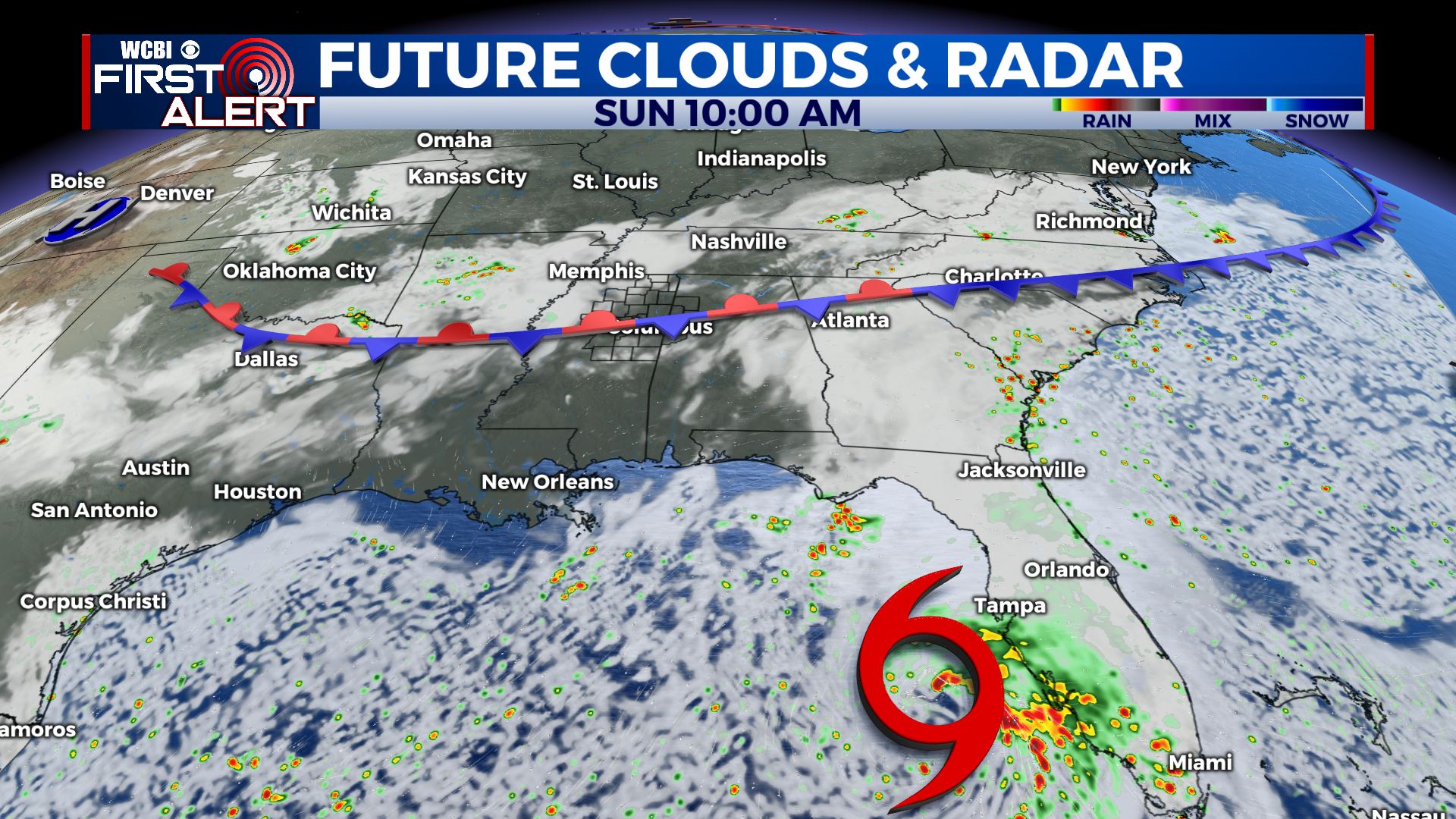 NEXT WEEK: Highs in the mid to upper 80s for the beginning of the new workweek. After dealing with some tropical moisture from Fred on Monday, we’ll be back to our usual summertime weather pattern of afternoon showers & storms by midweek. Temperatures then slowly rise as the week goes on, back to near 90 by Thursday. Stay connected with @WCBIWEATHER on Facebook, Twitter, Instagram and the WCBI News App


Leave a Reply