Cooler temperatures return for a new workweek
SUMMARY: Cooler temperatures returns for the new workweek with highs in the upper 40s to lower 50s. Monday and Tuesday will be dry. More rain chances are in the forecast for Wednesday and Saturday.
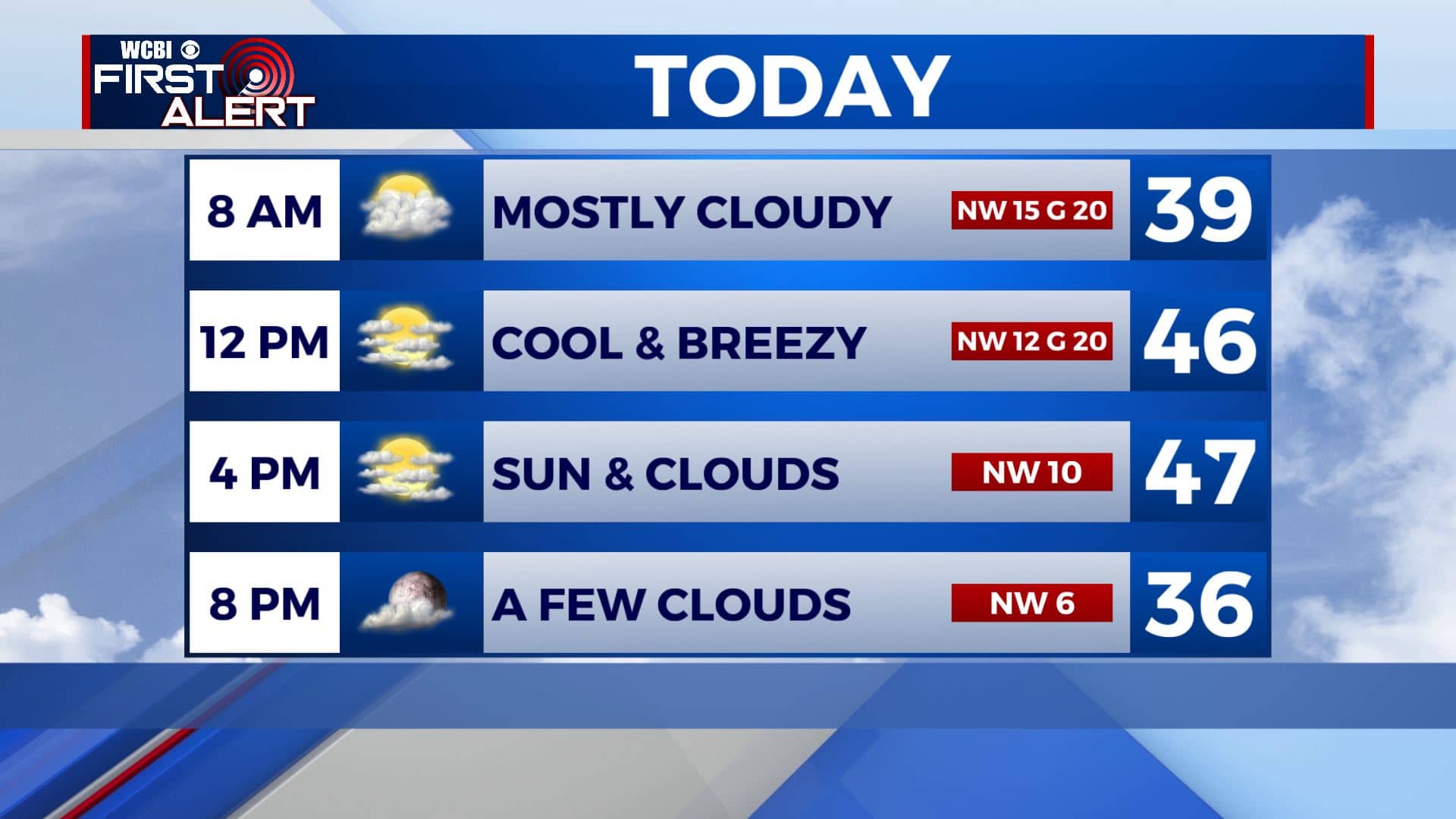
MONDAY: Skies will be overcast throughout the morning as the rain continues to push off to the east. We’ll probably see some peeks of sunshine as skies start clearing up in the afternoon. It will be breezy and cool out there with highs only in the mid to upper 40s. N to NW winds 5-15 with gusts up to 20.
MONDAY NIGHT: Mostly clear skies expected overnight with cold temperatures as lows fall into the mid to upper 20s. Light NE winds.
TUESDAY: We’ll see a mix of sun and clouds on Tuesday with temperatures staying cool. Highs in the mid 50s.
TUESDAY NIGHT: Rain chances will move in after sunset into the overnight hours. Lows in the 30s.
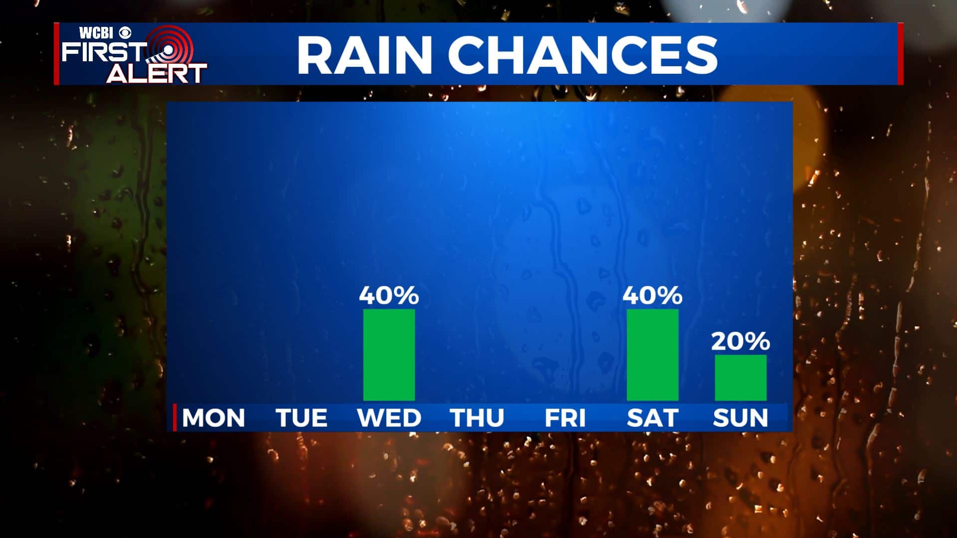
WEDNESDAY: Morning showers will give way to a mix of sun & clouds by the afternoon. High temperatures cooling back down into the 40s.
THURSDAY-FRIDAY: The end of the workweek looks to be drier with more sunshine returning to the forecast. Staying cool with highs in the upper 40s to lower 50s during the day. Chilly nights with overnight lows in the upper 20s into the 30s.
WEEKEND: Rain chances will yet again return to the area Saturday into Sunday. Highs will remain in the 50s for the weekend. Overnight lows in the 30s.
Stay connected with @WCBIWEATHER on Facebook, Twitter, Instagram, and the WCBI News App


Leave a Reply