Dangerous Heat Wave to Start the Week
WEATHER PATTERN OVERVIEW: A strong ridge of high pressure is situated over the southern US to start the week. This will lead to low rain chances and extreme heat. That ridge breaks down some by mid-week elevating our rain chances and leading to more seasonable temperatures. A seasonal pattern emerges through the second half of the week.
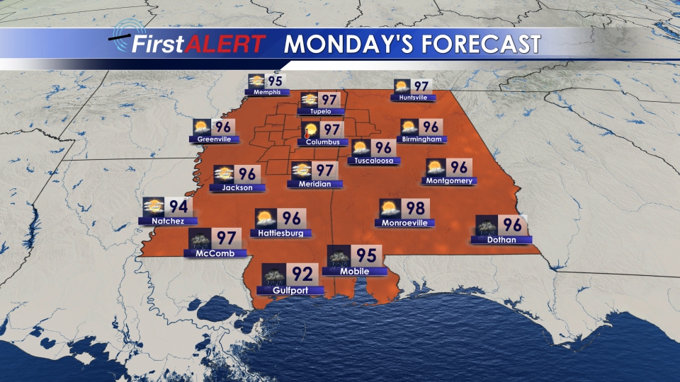
MONDAY/TUESDAY: The hottest weather so far this year kicks off this week. Temperatures will be in the upper 90s. We can’t totally rule out an isolated area hitting 100°. The heat index will be topping out between 107° and 115°. This kind of heat is dangerous, particularly to sensitive groups like the elderly and children, so be sure to monitor them and ensure they are staying cool and safe. Outdoor activity is discouraged, but for those who have to venture outside, be sure to avoid direct sun, drink plenty of water, and take breaks from the heat in air conditioning if at all possible. While a scattered shower or storm can’t be ruled out to start the week, most of us will stay dry. Overnight, lows only drop into the upper 70s and the mugginess will remain oppressive.
WEDNESDAY: We see the extreme heat end as showers and storms make a return to the forecast. Highs in the low 90s, with scattered showers and storms possible. Rain chance around 50%. Overnight, a lingering shower or storm possible with lows in the low 70s.
THURSDAY-SUNDAY: Relatively seasonable weather through the rest of the week with highs in the low 90s and a few pop up downpours possible each day.
FOLLOW US ON SOCIAL MEDIA @WCBIWEATHER ON FACEBOOK, TWITTER, AND INSTAGRAM


Leave a Reply